The best running trails in Südufer Des Simssees
4.3
(825)
17,222
runners
559
runs
Jogging in Südufer Des Simssees offers a diverse natural setting characterized by a gently undulating, hilly landscape with elevations typically under 200 meters. The region features a nature reserve with untouched reed and shoreline areas, as well as unique moor landscapes. The Simssee (Lake Sims) is a central feature, with the Sims River flowing out of it, and the area includes forests, wet meadows, and wooded moorland.
Best jogging routes in Südufer Des Simssees
- The most popular jogging route is…
Last updated: October 1, 2026
4.7
(13)
519
runners
Hard run. Very good fitness required. Mostly paved surfaces. Suitable for all skill levels.
4.8
(9)
127
runners
Moderate run. Good fitness required. Mostly paved surfaces. Suitable for all skill levels.

4.8
(13)
158
runners
Moderate run. Good fitness required. Mostly paved surfaces. Suitable for all skill levels.
4.8
(6)
54
runners
5.73km
00:37
50m
50m
Moderate run. Good fitness required. Mostly paved surfaces. Suitable for all skill levels.
5.0
(1)
23
runners
Moderate run. Good fitness required. Mostly paved surfaces. Suitable for all skill levels.
Get access to more routes and recommendations from other explorers.
Already have an account?
Our route recommendations are based on thousands of hikes, rides, and runs completed by other people on komoot.
Start today with a free account
Your next adventure awaits.
Tips from the Community


The original poultry farm on this site was founded in 1952 by Anton and Betty Rietz. Betty Rietz's dream of opening a small restaurant or café came true on August 1, 1955. She originally envisioned the name "Café am Weinberg." But thanks to the poultry farming and the fresh roosters from the farm's own rearing, guests named the restaurant "Gocklwirt." Anton Rietz wasn't shy and inscribed "Gocklwirt am Weinberg" on the building. This local idealist gave the place a special atmosphere with his passion for antiques and curiosities. It is open Thursdays from 5 p.m. to 10 p.m., and Fridays, Saturdays, and Sundays from noon to 10 p.m. Hot meals are served until 8:30 p.m.
11
0
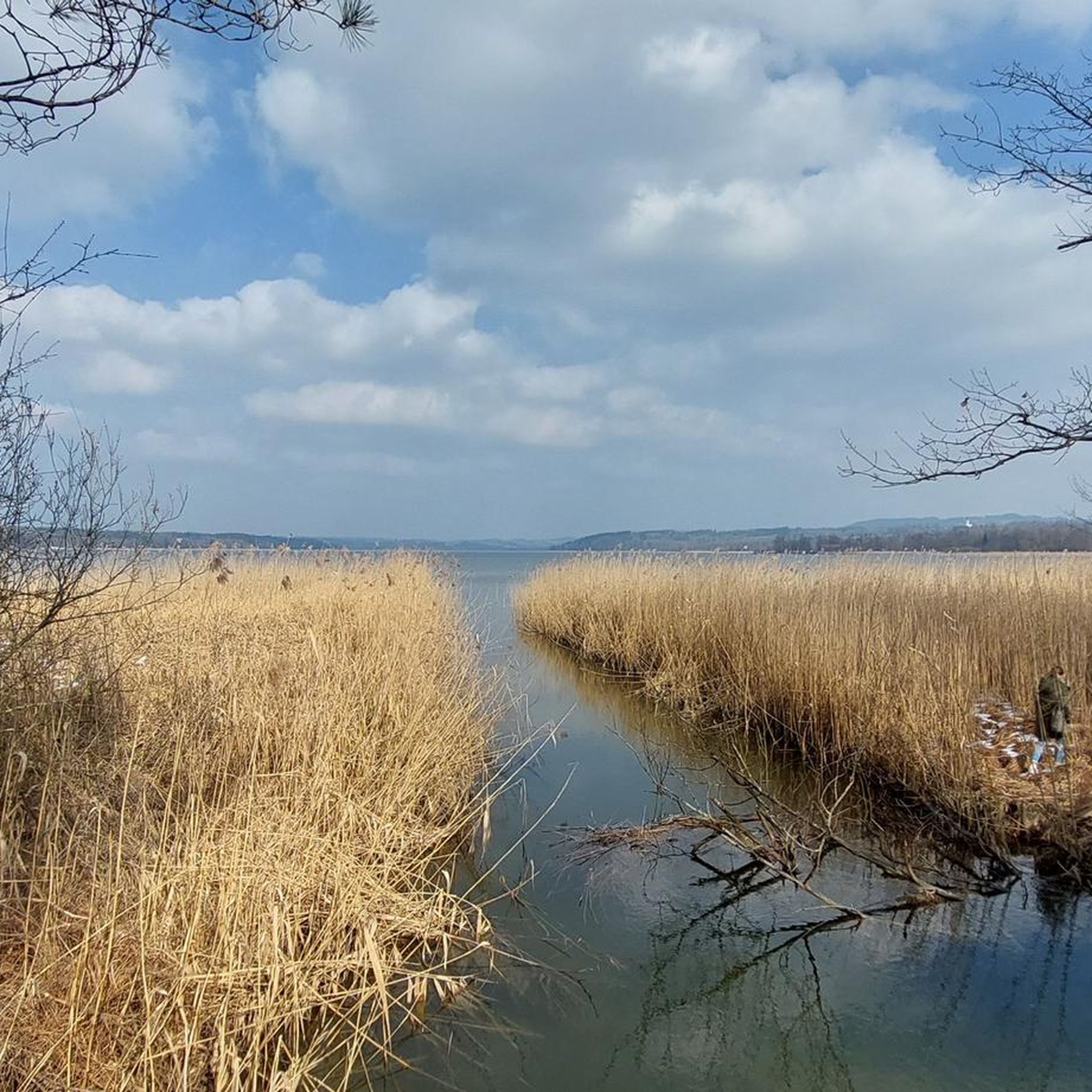
The Luisenbrücke bridge over the Neue Achen river at the outflow of Lake Simssee was rebuilt in spring 2025 for €224,000. Fifteen ten-meter-long oak piles were driven into the swampy ground for this environmentally friendly and sustainable wooden structure in the nature reserve. Fishing boats can pass unhindered under the bridge. The first Luisenbrücke bridge on this site was built in 1969 and renovated in 2001.
11
1
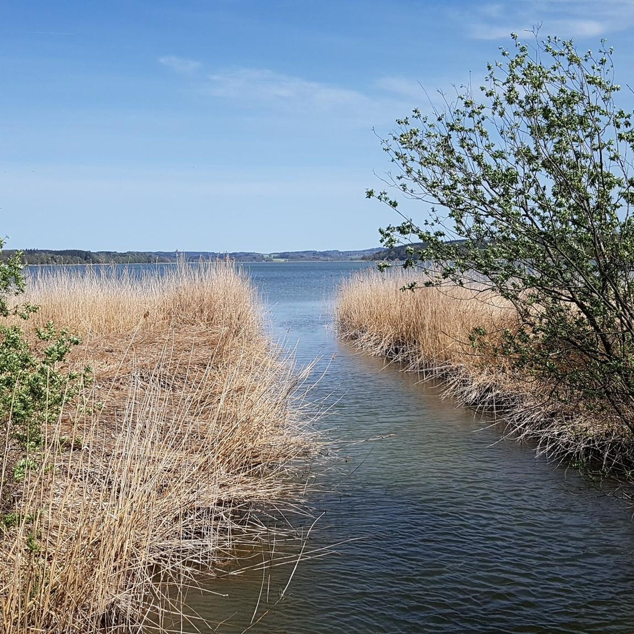
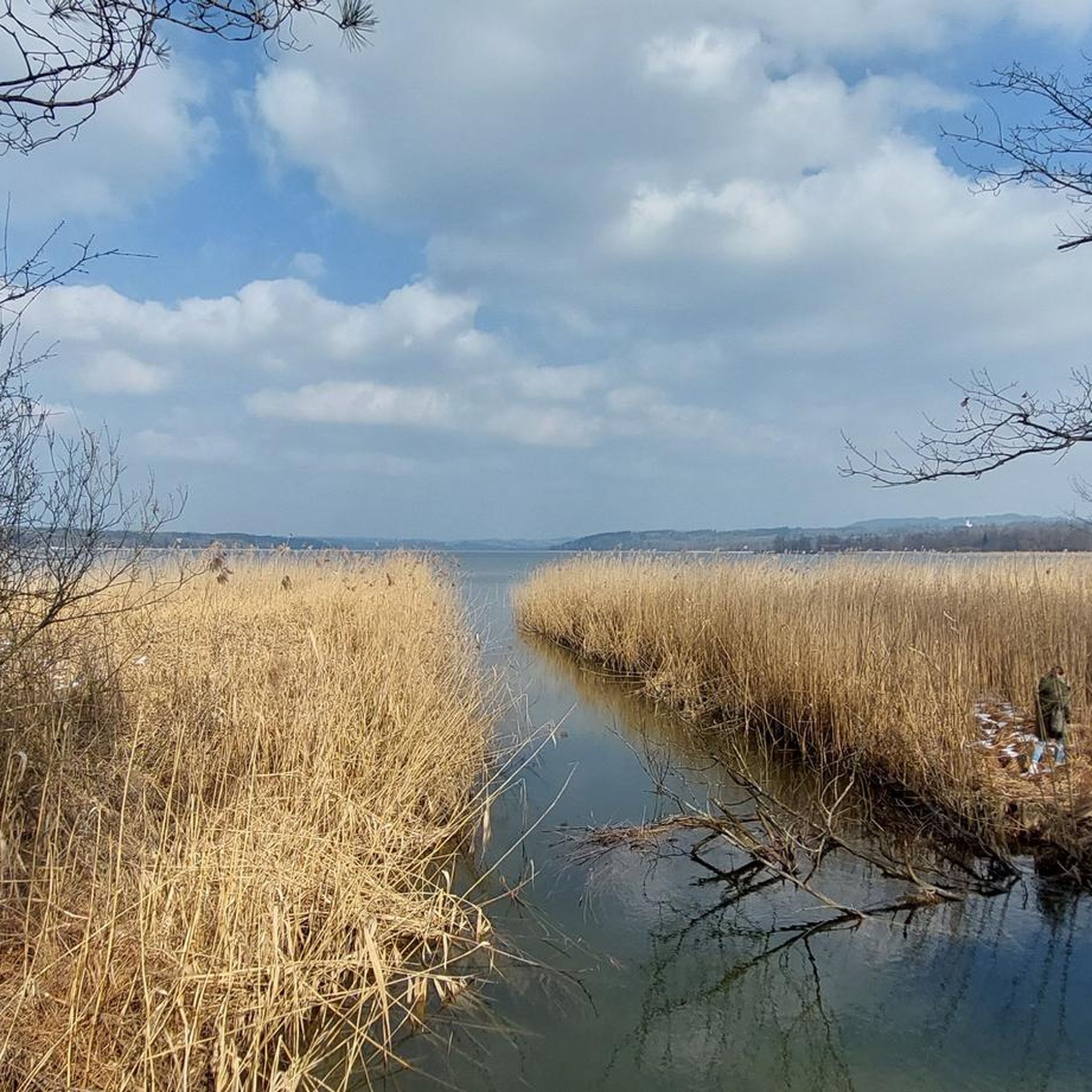
The path along the reed-covered shore leads through the "Southern Shore of Lake Simssee" nature reserve. Rest areas with benches are located right by the water every few hundred meters.
11
0
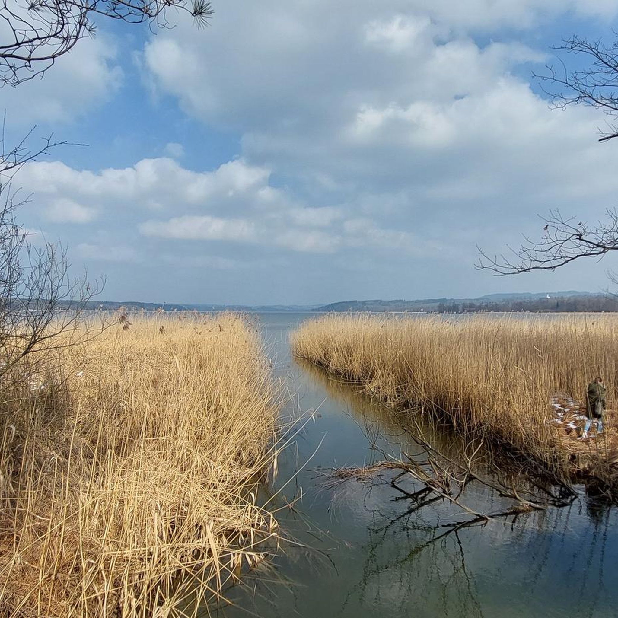
The Toni Rietz Trail crosses the Sims River over this wooden bridge shortly after it flows out of Lake Sims. The almost eight-kilometer-long watercourse was first mentioned in a document in 1522, and the village of the same name, known as "Sinsa," was already mentioned in 790. The name is possibly of Celtic origin and derives from Senja, which means marshland and reeds.
4
0

The bridge has been renewed and the path is open again.
1
1

There is no bridge at the moment, it won't be there again until April! The hike ends too early, the hike only takes half an hour!
1
1

Frequently Asked Questions
What kind of terrain can I expect on the running trails around Südufer des Simssees?
The region features a gently undulating, hilly landscape with elevations typically under 200 meters, offering varied terrain. You'll find a mix of paved paths, forest sections, and trails leading through wetlands and moorland areas. Some routes, like the South Shore of Lake Simssee – Gocklwirt at the Vineyard loop from Stephanskirchen, lead through varied terrain, while others, such as the South Shore of Lake Simssee loop from Riedering, are mostly on paved paths with minimal elevation gain.
Are there any easy or beginner-friendly jogging routes in Südufer des Simssees?
Yes, Südufer des Simssees offers a good selection of easy running routes. Out of over 540 available routes, 75 are classified as easy, making them suitable for beginners or those looking for a relaxed run. These often feature minimal elevation gain and are on well-maintained paths.
What natural features or attractions can I see while running in the Südufer des Simssees area?
The region is rich in natural beauty and points of interest. You can enjoy views of the Simssee and the distant Alpine chain, explore untouched reed and shoreline areas, and discover unique moor landscapes. Specific attractions include the Bird Interpretive Trail — South Shore of Lake Simssee, which provides information on local bird species, and the picturesque Bridge over the Sims River. The Reed Shore Path at the South Bank of Simssee also offers beautiful scenery.
Are there circular running routes available in Südufer des Simssees?
Yes, many of the running routes in Südufer des Simssees are circular, allowing you to start and end at the same point. Examples include the Simssee Lakeside Trail – View of the Simssee loop from Stephanskirchen, a longer option, or the moderate Sonnenholz – South Shore of Lake Simssee loop from Stephanskirchen.
How many jogging routes are available in Südufer des Simssees?
There are over 540 jogging routes available in Südufer des Simssees, catering to various fitness levels and preferences. This includes 75 easy routes, 397 moderate routes, and 68 difficult routes.
What do other runners say about the jogging experience in Südufer des Simssees?
The running routes in Südufer des Simssees are highly rated by the komoot community, with an average score of 4.2 stars from over 600 reviews. Runners often praise the diverse natural setting, the tranquil Simssee, and the varied terrain that offers options for different ability levels.
Are there any dog-friendly running routes in the area?
While specific routes aren't designated 'dog-friendly' in the data, the natural environment of Südufer des Simssees, with its forests, meadows, and lake shores, generally welcomes dogs. It's always advisable to keep dogs on a leash, especially in nature reserve areas or near wildlife, and to respect local regulations.
Are there options for food and drink near the running trails?
Yes, there are places to refuel. The traditional restaurant Gocklwirt at the Vineyard, known for its history and atmosphere, is located near some routes, such as the South Shore of Lake Simssee – Gocklwirt at the Vineyard loop from Stephanskirchen. There's also the Gocklwirt am Weinberg Beer Garden, Museum, and Minigolf for a more casual stop.
What is the best time of year for running in Südufer des Simssees?
Südufer des Simssees offers enjoyable running conditions throughout the year. Spring and autumn provide pleasant temperatures and beautiful scenery. Summer is great for lakeside runs, but be mindful of warmer temperatures. Even in winter, many trails remain accessible, offering a serene experience amidst the snowy landscape, though some paths might be icy or muddy.
Are there family-friendly running routes suitable for all ages?
Many of the easy and moderate routes with minimal elevation gain are suitable for families. The generally gently undulating landscape and well-maintained paths make it accessible for various fitness levels. Routes like the South Shore of Lake Simssee loop from Riedering are relatively short and have little elevation, making them good options for a family outing.
Is parking available near the jogging routes in Südufer des Simssees?
Yes, parking is generally available at various access points around the Südufer des Simssees. Many trailheads and popular starting points for routes will have designated parking areas, making it convenient to access the running trails.
What is the typical length and duration of running routes in this region?
The running routes in Südufer des Simssees vary significantly in length and duration. You can find shorter, moderate runs like the South Shore of Lake Simssee – Gocklwirt at the Vineyard loop from Stephanskirchen, which is about 6 km and takes around 37 minutes. Longer, more challenging options, such as the Simssee Lakeside Trail – View of the Simssee loop from Stephanskirchen, can be nearly 20 km and take over 2 hours.
Most popular routes in Südufer Des Simssees
Most popular attractions in Südufer Des Simssees

Get inspired with the komoot mobile app


Explore more
Browse the best Running Trails & Routes in other regions.
