The best MTB trails in Forst Bibra
4.7
(230)
990
riders
53
rides
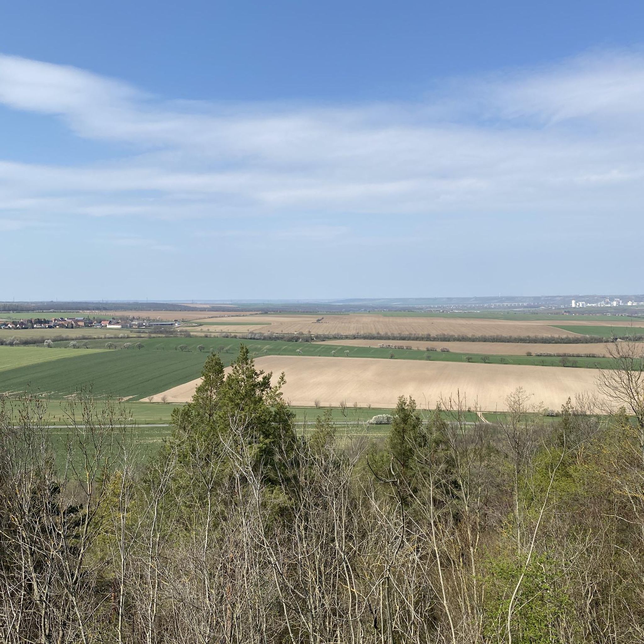
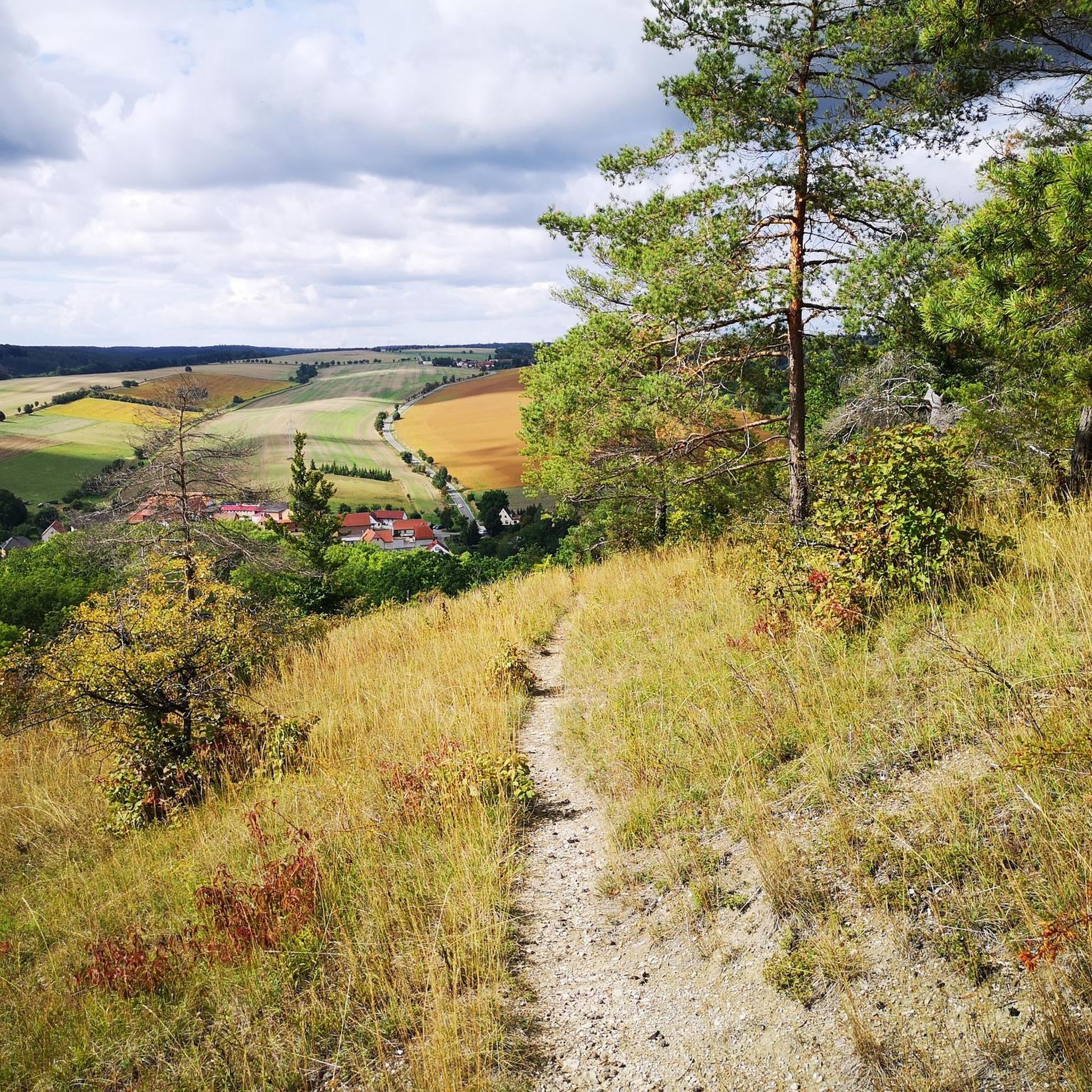
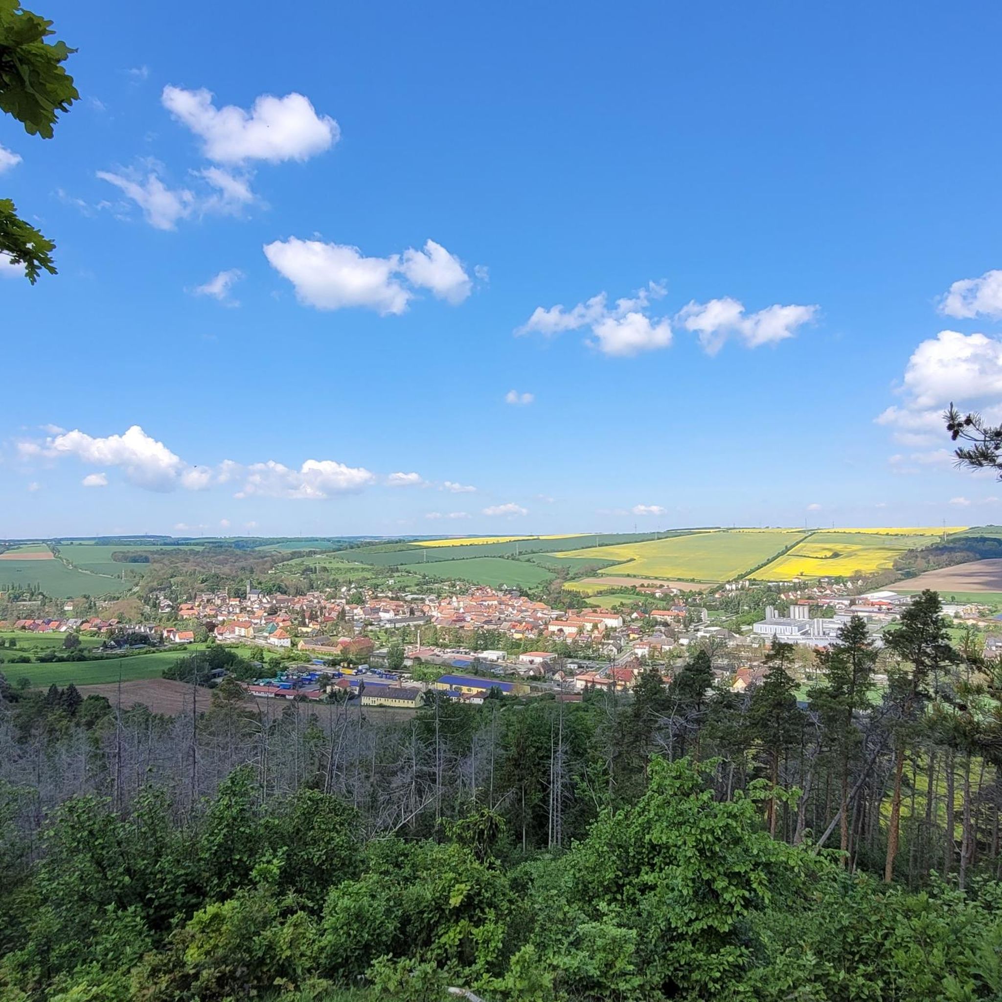
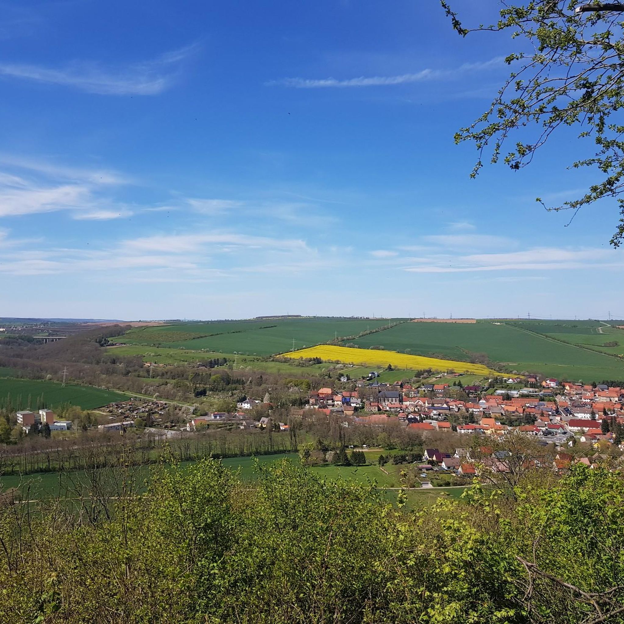
Mountain bike trails in Forst Bibra traverse a diverse landscape within the "Unstrut-Triasland" landscape protection area, featuring elevations from 160 to 288 meters above sea level. The region is characterized by significant mesophilic deciduous forests, valuable xerothermic grasslands, and a geological makeup including the Bibra-Plößnitz step slope. Dry valleys like Hornissental and Borntal add to the varied topography, offering a range of terrain for mountain biking.
Best mountain bike trails in Forst Bibra
- The most popular mountain bike trail is…
Last updated: July 8, 2026
4.7
(3)
5
riders
22.0km
01:17
160m
160m
Easy mountain bike ride. Great for any fitness level. Suitable for all skill levels.
3
riders
31.1km
02:02
270m
270m
Moderate mountain bike ride. Good fitness required. Suitable for all skill levels.

Sign up for free
5.0
(1)
3
riders
16.5km
01:05
180m
180m
Easy mountain bike ride. Great for any fitness level. Suitable for all skill levels.
4.7
(23)
83
riders
Moderate mountain bike ride. Good fitness required. Suitable for all skill levels.
4.6
(30)
98
riders
Moderate mountain bike ride. Good fitness required. Advanced riding skills necessary.
Get access to more routes and recommendations from other explorers.
Sign up for free
Already have an account?
Our route recommendations are based on thousands of hikes, rides, and runs completed by other people on komoot.
Start today with a free account
Your next adventure awaits.
Login or Signup
Tips from the Community

A beautiful mill on the Unstrutradweg near Freyburg.
0
0
The ferry is not in operation in winter, current ferry times: April 1st to November 1st, 2026 Monday to Thursday | 10:00-18:00 Friday and Saturday | 9:00-19:00 Sunday and public holidays | 9:00-18:00 October: Friday and Saturday | 9:00-18:00 Lunch break 13:00-13:30 every Friday, Saturday, Sunday and public holidays And if the ferryman is not visible, then call out loudly: "Ferryman, ferry over!" or knock with the ferry iron.
0
0
You should ride carefully here, especially with oncoming traffic
1
0

We got there too early, and the cable ferry wasn't operating yet...so we took a small detour to get to the other side. It wasn't a problem, and the path was beautiful 🥰
3
0

The cycle path is relatively narrow at this point, especially when there is oncoming traffic.
1
0

Here you can refresh yourself and relax in the shade. The bar looks like it's from around 1910, simply beautiful.
6
0
Here you can circumnavigate the weir by boat. From the bridge, you have a 😎view of the complex.
5
0

Open Church - Romanesque village church with origins in the 13th century
0
0
Frequently Asked Questions
How many mountain bike trails are available in Forst Bibra?
Forst Bibra offers a wide selection of mountain bike trails, with over 50 routes available on komoot. These range from easy paths to more challenging rides, catering to various skill levels.
What is the overall difficulty level of mountain biking in Forst Bibra?
The trails in Forst Bibra offer a diverse range of difficulties. You'll find 9 easy routes, 43 moderate routes, and 2 difficult routes, ensuring options for beginners and experienced riders alike.
What do other mountain bikers say about the trails in Forst Bibra?
The mountain bike trails in Forst Bibra are highly regarded by the komoot community, boasting an average rating of 4.7 stars from over 230 reviews. Riders frequently praise the varied terrain, scenic views, and the well-maintained paths through the forests and grasslands.
Are there mountain bike trails with good views in Forst Bibra?
Yes, Forst Bibra offers several trails with rewarding views. A notable spot is the Himmelsleiter (Heaven's Ladder), which leads to the Böselstein and provides magnificent panoramic views of the landscape towards Steinbach. Many routes traverse elevated sections, offering glimpses of the diverse natural surroundings.
What kind of terrain can I expect on mountain bike trails in Forst Bibra?
You can expect a varied terrain in Forst Bibra, characterized by significant mesophilic deciduous forests, valuable xerothermic grasslands, and a geological makeup including the Bibra-Plößnitz step slope. The region features elevations from 160 to 288 meters above sea level, with dry valleys like Hornissental and Borntal adding to the topographic interest and offering diverse riding surfaces.
Are there any specific natural features or landmarks to look out for while mountain biking?
Absolutely. Beyond the general beauty of the deciduous forests and grasslands, you can encounter specific natural features. The Himmelsleiter and the Böselstein Viewpoint and Memorial are prominent landmarks. The area also features dry valleys such as Hornissental and Borntal, which add unique elements to the landscape.
Are there any circular mountain bike routes in Forst Bibra?
Yes, many of the mountain bike trails in Forst Bibra are designed as circular routes, allowing you to start and end at the same point. For example, the Laucha Lock and Weir – Laucha Town Wall loop from Bad Bibra is a popular circular option.
Are there family-friendly mountain bike trails in Forst Bibra?
For families looking for easier rides, Forst Bibra offers several suitable options. The Burgscheidungen Village Church – Laucha Lock and Weir loop from Bad Bibra is an easy 13.6-mile (21.8 km) path that provides scenic views and is well-suited for a family outing.
Can I bring my dog on the mountain bike trails in Forst Bibra?
Forst Bibra is a nature reserve, and while many trails are generally accessible, it's always best to keep dogs on a leash to protect local wildlife and plant species, especially in areas with sensitive xerothermic grasslands. Always be mindful of other trail users and local regulations.
Where can I find parking for mountain biking in Forst Bibra?
Parking is generally available in and around the towns bordering Forst Bibra, such as Bad Bibra. Specific starting points for routes often have designated parking areas, though it's advisable to check the route details on komoot for the most convenient options.
What is the best time of year to go mountain biking in Forst Bibra?
The mesophilic deciduous forests and xerothermic grasslands of Forst Bibra are beautiful throughout the warmer months. Spring and autumn offer pleasant temperatures and vibrant scenery, with fewer crowds than peak summer. Always check local weather conditions before heading out.
Are there any cafes or pubs near the mountain bike trails in Forst Bibra?
While Forst Bibra itself is a nature reserve, the surrounding towns like Bad Bibra and Laucha (Unstrut) offer various amenities, including cafes and pubs where you can refuel after your ride. It's a good idea to plan your route to pass through or near these towns if you're looking for refreshments.
Are there any easy mountain bike routes for beginners in Forst Bibra?
Yes, beginners can find several easy mountain bike routes in Forst Bibra. An excellent choice is the Heilandsbrunnen – Kirstmühle loop from Bad Bibra, which is 10.3 miles (16.5 km) long and offers a gentle introduction to the region's trails.
Most popular routes in Forst Bibra
Most popular attractions in Forst Bibra

Get inspired with the komoot mobile app


Explore more
Browse the best MTB trails in other regions.
