The best MTB trails in Bülter See Und Randmoore
4.2
(7)
24
riders
11
rides
Mountain bike trails in Bülter See Und Randmoore traverse a landscape characterized by extensive high moors, interspersed with birch and pine forests. The region features flat to slightly hilly geest landscapes, offering varied terrain for cross-country and touring mountain biking. The central Bülter See, a nutrient-poor high moor lake, is a prominent natural feature, with paths often leading along its edges and through surrounding woodlands.
Best mountain bike trails in Bülter See Und Randmoore
- The most popular mountain bike trail is Apeler Lake – Forest Trail with Wooden Ramps loop from Schiffdorf, a 13.9 miles (22.3 km) easy route that takes about 1 hour 12 minutes to complete. This path leads through forest sections and past the Apeler Lake.
- Another top favourite among local mountain bikers is Charlemagne Monument in Rechtenfleth – Lune Sluice and Pumping Station loop from Loxstedt, a moderate 29.9 miles (48.2 km) path. This route offers varied scenery, including historical landmarks and river sluices.
- Local mountain bikers also love the Monsilienburg Earthworks – E loop from Lunestedt, a 18.1 miles (29.1 km) trail leading through diverse landscapes, often completed in about 1 hour 57 minutes.
- Mountain biking in Bülter See Und Randmoore is defined by high moorlands, mixed forests, and flat geest landscapes. The network offers options for different ability levels, from easy paths to moderate routes.
- The routes in Bülter See Und Randmoore are highly rated by the komoot community with an average score of 4.6 stars from several reviews. More than 20 mountain bikers have used komoot to explore Bülter See Und Randmoore's varied terrain.
Last updated: July 15, 2026
1
riders
29.1km
01:51
90m
90m
Moderate mountain bike ride. Great for any fitness level. Advanced riding skills necessary.
8
riders
35.5km
02:20
70m
70m
Moderate mountain bike ride. Good fitness required. Suitable for all skill levels.

Sign up for free
5.0
(1)
3
riders
Moderate mountain bike ride. Good fitness required. Advanced riding skills necessary.
5.0
(1)
2
riders
36.7km
02:38
80m
80m
Moderate mountain bike ride. Good fitness required. Suitable for all skill levels.
3.0
(2)
2
riders
21.6km
01:10
50m
50m
Easy mountain bike ride. Great for any fitness level. Suitable for all skill levels.
Get access to more routes and recommendations from other explorers.
Sign up for free
Already have an account?
Our route recommendations are based on thousands of hikes, rides, and runs completed by other people on komoot.
Start today with a free account
Your next adventure awaits.
Login or Signup
Tips from the Community

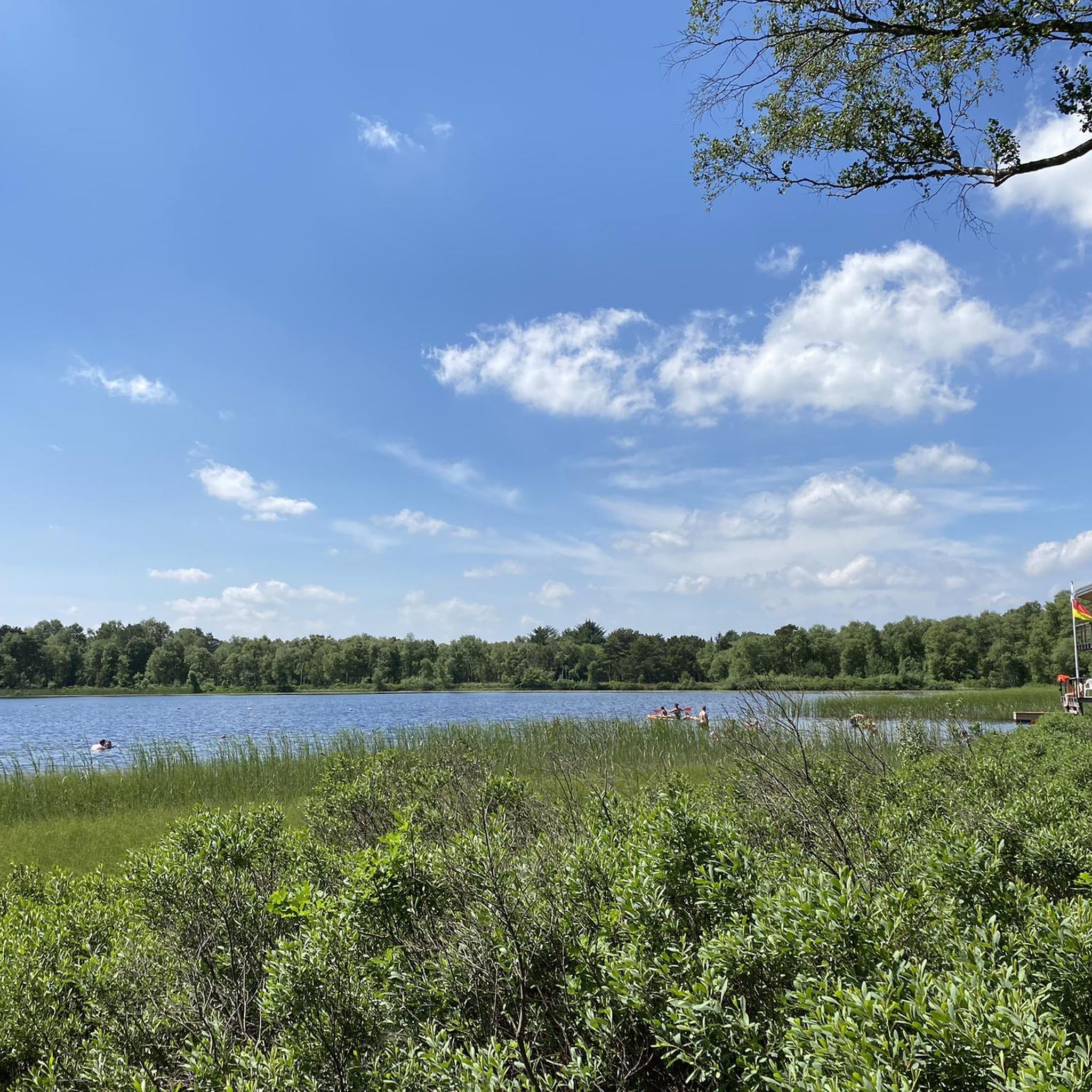
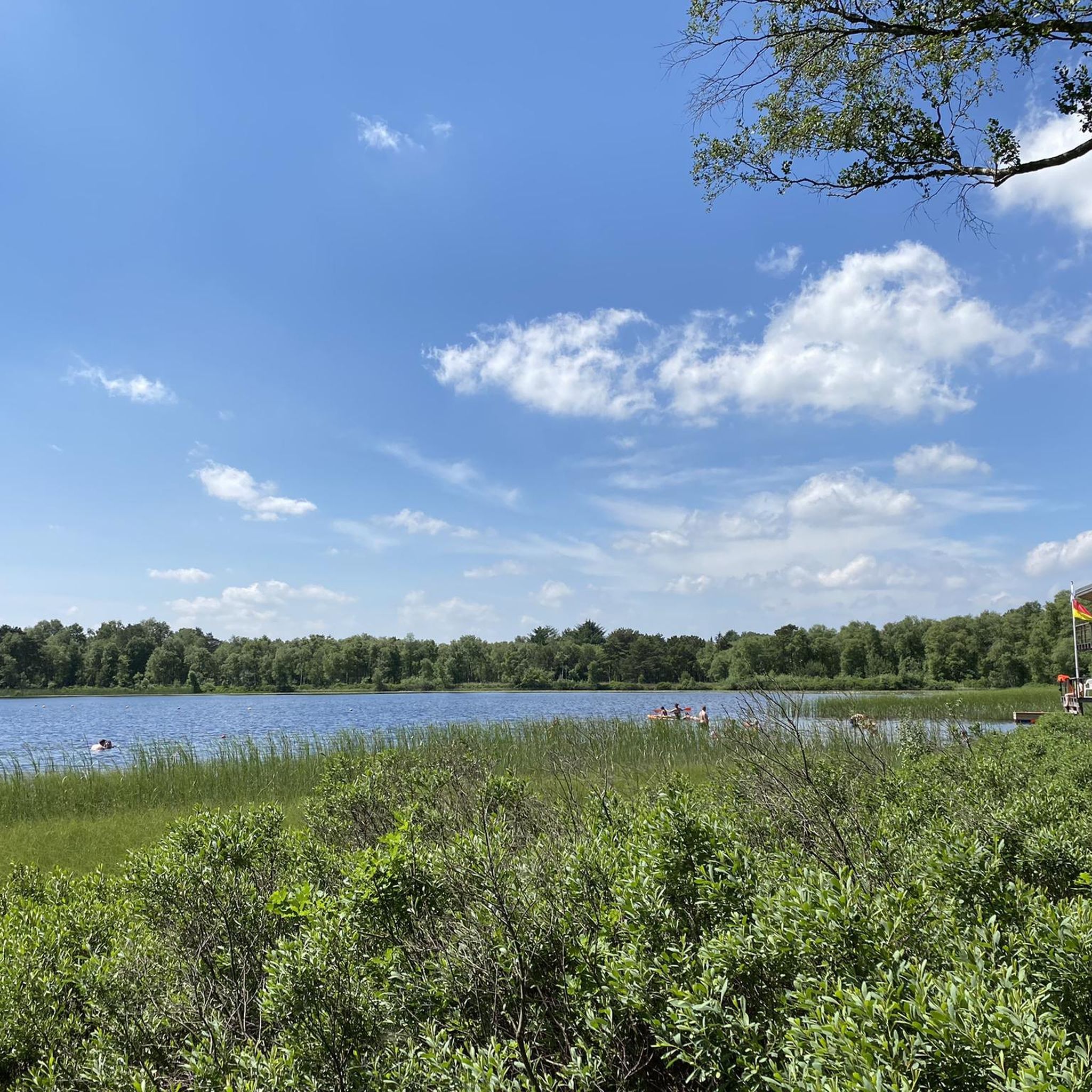
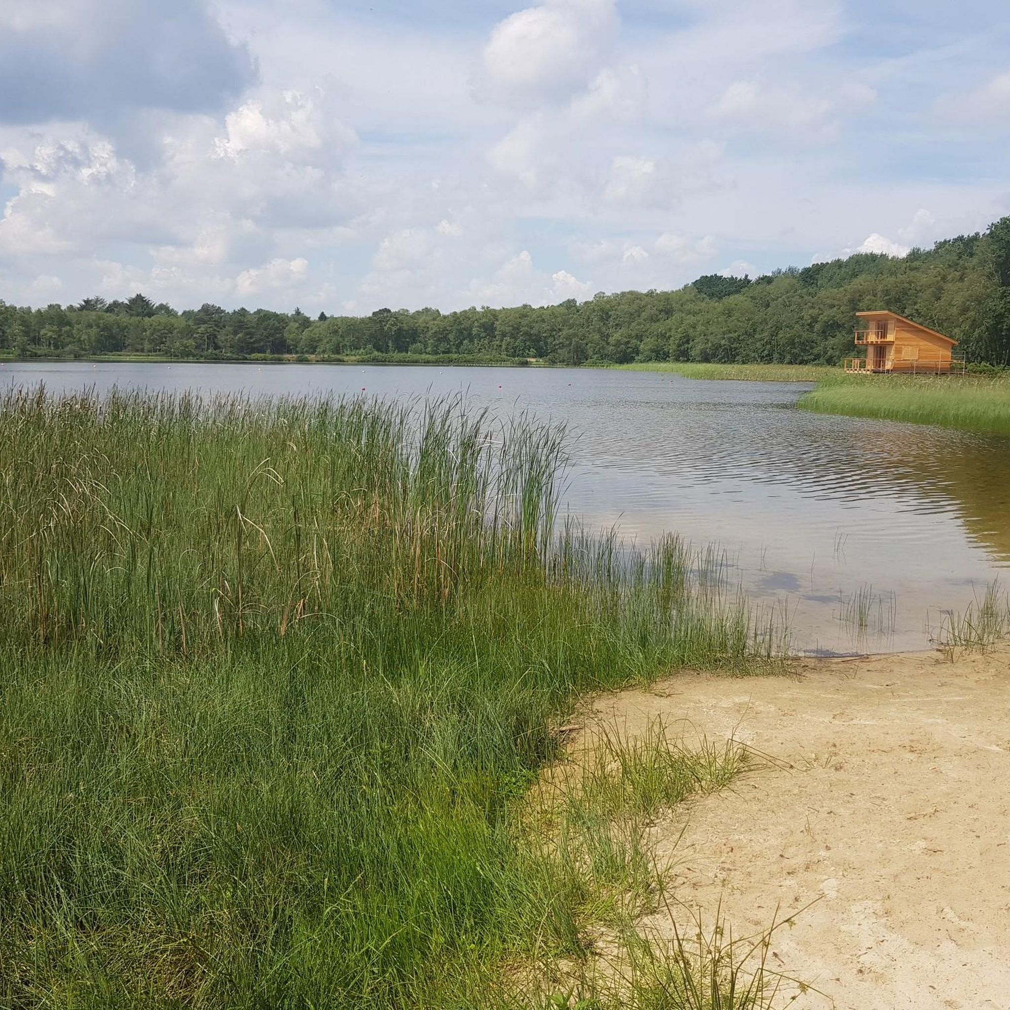
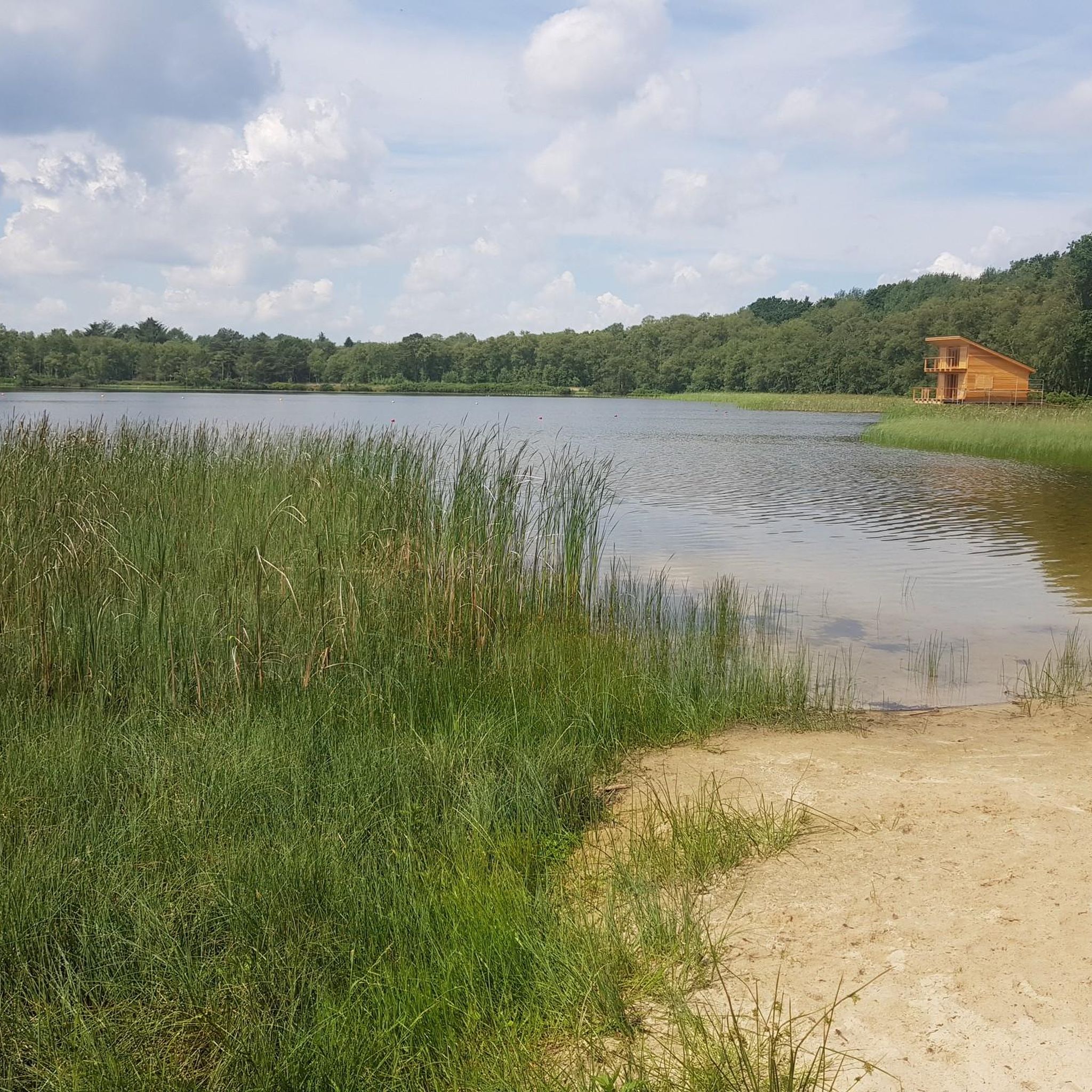
There are also fishing areas, camper parking spaces, and a hotel with a restaurant. The lake is also the starting point of its own hiking trail. A recreational area in the south of the lake was developed infrastructurally, but not built and completed due to the marshy subsoil. In the course of the construction of the Weser tunnel and the federal road 437, the lake was to be partially designated as a nature reserve and a second lake was to be created to the north, but this was rejected for the construction of the Loxpark commercial area. In the village of Stotel, the streets "Am Stoteler See" and "Zum See" were named after the body of water. See: https://de.wikipedia.org/wiki/Stoteler_See
1
0
The Stoteler See is an artificial bathing and recreational lake in the municipality of Loxstedt in Lower Saxony. It lies within the nature reserve „Teichfledermausgewässer“. The lake was named after the nearby village of Stotel and was created during the construction of the A27 federal motorway to the west. It is approximately 1 km long in a west-east direction, covers 30 hectares, and is up to 14.5 m deep. The surroundings are characterized by the Geest in the north and the Stoteler Moor in the south. Excess water from precipitation is diverted through the Hahnenknoop-Hetthorner Moor Canal into an old arm of the Lune river. The lake is home to fish species such as eel, perch, pike, carp, roach, rudd, tench, and zander. In addition, the surroundings offer a habitat for waterfowl such as mallard, garganey, greylag goose, water rail, and coot. Bathing activities are monitored by the DLRG (German Life Saving Association) local group Samtgemeinde Hagen, for which a watch station is available.
2
0


After persistent rain, part of the route can only be covered with waterproof shoes
0
0

The reconstruction shows very clearly how the old sluice structures were constructed and how small they were in comparison to today's ones.
2
0

Can also be muddy at times
0
0

Great bike route along the Weser...
2
0
Frequently Asked Questions
What kind of terrain can I expect on mountain bike trails in Bülter See Und Randmoore?
The region offers a diverse landscape characterized by extensive high moors, interspersed with birch and pine forests. You'll find paths leading along the edges of the Bülter See and through surrounding woodlands, as well as flat to slightly hilly geest landscapes. This mix provides varied terrain suitable for cross-country and touring mountain biking.
How many mountain bike trails are available in Bülter See Und Randmoore?
There are 11 mountain bike routes available in Bülter See Und Randmoore. These include 5 easy routes and 6 moderate routes, catering to different fitness levels and preferences.
Are there any family-friendly mountain bike routes in Bülter See Und Randmoore?
Yes, Bülter See Und Randmoore offers 5 easy mountain bike routes that are generally suitable for families. These paths often have minimal elevation gain and are easily accessible, allowing for a relaxed cycling experience amidst nature.
What are some of the longer mountain bike routes for more experienced riders?
For those seeking a longer ride, routes like the Charlemagne Monument in Rechtenfleth – Lune Sluice and Pumping Station loop from Loxstedt cover nearly 30 miles (48.2 km). Another option is the Gravel and sand track – Scenic Forest Path loop from Loxstedt, which is over 21 miles (35.1 km) long.
Are there any circular mountain bike routes in the Bülter See Und Randmoore area?
Yes, many of the mountain bike routes in Bülter See Und Randmoore are designed as loops, allowing you to start and finish at the same point. Examples include the Monsilienburg Earthworks – E loop from Lunestedt and the Apeler Lake – Forest Trail with Wooden Ramps loop from Schiffdorf.
What natural features or landmarks can I see while mountain biking in Bülter See Und Randmoore?
The routes often lead through the distinctive high moor landscapes, past the central Bülter See, and through surrounding birch and pine forests. You might also encounter the unique moor vegetation. The nearby Silbersee, with its sandy beach and recreational facilities, is also a popular destination.
What do other mountain bikers enjoy most about the trails in Bülter See Und Randmoore?
The mountain bike trails in Bülter See Und Randmoore are highly rated by the komoot community, with an average score of 4.6 stars. Riders often praise the varied natural scenery, including the tranquil moorlands, picturesque lakes, and mixed forest environments, which create a rewarding experience for cross-country and touring rides.
Are dogs allowed on the mountain bike trails in Bülter See Und Randmoore?
While specific regulations for dogs can vary, generally, dogs are welcome on trails in nature reserves like Bülter See Und Randmoore, provided they are kept on a leash to protect wildlife and other visitors. It's always a good idea to check local signage for any specific restrictions.
What is the best time of year for mountain biking in Bülter See Und Randmoore?
The spring, summer, and autumn months generally offer the most pleasant conditions for mountain biking in Bülter See Und Randmoore. During these seasons, the weather is typically milder, and the natural landscapes are at their most vibrant. Winter riding is possible, but conditions can be wet or icy, especially in the moor areas.
Are there any routes that offer historical landmarks or unique points of interest?
Yes, some routes offer more than just natural beauty. For example, the Charlemagne Monument in Rechtenfleth – Lune Sluice and Pumping Station loop from Loxstedt provides varied scenery, including historical landmarks and river sluices, adding an extra dimension to your ride.
What is the general difficulty level of mountain bike trails in Bülter See Und Randmoore?
The trails in Bülter See Und Randmoore are categorized as either easy or moderate. There are no technically difficult or extreme downhill trails. Easy routes are suitable for all skill levels, while moderate routes require good fitness and sure-footedness, but generally remain on accessible paths.
Most popular routes in Bülter See Und Randmoore

Get inspired with the komoot mobile app


Explore more
Browse the best MTB trails in other regions.
