Dreiherrenstein-Eschenberg-Kreutzerberg
Dreiherrenstein-Eschenberg-Kreutzerberg
The best walks and hikes in Dreiherrenstein-Eschenberg-Kreutzerberg
4.7
(4291)
13,401
hikers
505
hikes
Hiking in Dreiherrenstein-Eschenberg-Kreutzerberg offers diverse landscapes with varied terrain and gentle inclines. The region features routes through rich flora and fauna, often alongside the Werra valley. It encompasses nature reserves like Mertelstal, preserving its natural beauty. Prominent features include the Heldrastein, a significant viewpoint rising 325 meters above the Werra River.
Best hiking trails in Dreiherrenstein-Eschenberg-Kreutzerberg
- The most popular hiking route is Dreiherrenstein Viewpoint – View of the Heldrastein loop from Graburg, a 6.9 miles (11.1 km) trail that…
Last updated: October 2, 2026
4.9
(18)
52
hikers
11.1km
02:54
80m
80m
Moderate hike. Good fitness required. Easily-accessible paths. Suitable for all skill levels.
4.7
(10)
44
hikers
Moderate hike. Good fitness required. Easily-accessible paths. Suitable for all skill levels.

4.5
(6)
10
hikers
Moderate hike. Good fitness required. Easily-accessible paths. Suitable for all skill levels.
5.0
(2)
10
hikers
7.65km
02:01
70m
70m
Moderate hike. Good fitness required. Easily-accessible paths. Suitable for all skill levels.
4.4
(5)
8
hikers
8.22km
02:08
50m
50m
Moderate hike. Good fitness required. Easily-accessible paths. Suitable for all skill levels.
Get access to more routes and recommendations from other explorers.
Already have an account?
Our route recommendations are based on thousands of hikes, rides, and runs completed by other people on komoot.
Start today with a free account
Your next adventure awaits.
Popular around Dreiherrenstein-Eschenberg-Kreutzerberg

Tips from the Community

This colorful drum stands right by the wayside. It is designed by Karin Lina Adam and belongs to Ars Natura - Art on the Hiking Trail.
0
0
The wooden sculpture pair "Die Architekten" is by Jochen Guinand and belongs to Ars Natura - Kunst am Wanderweg.
1
0
A work of art in the forest, part of the Ars Natura art project.
1
0
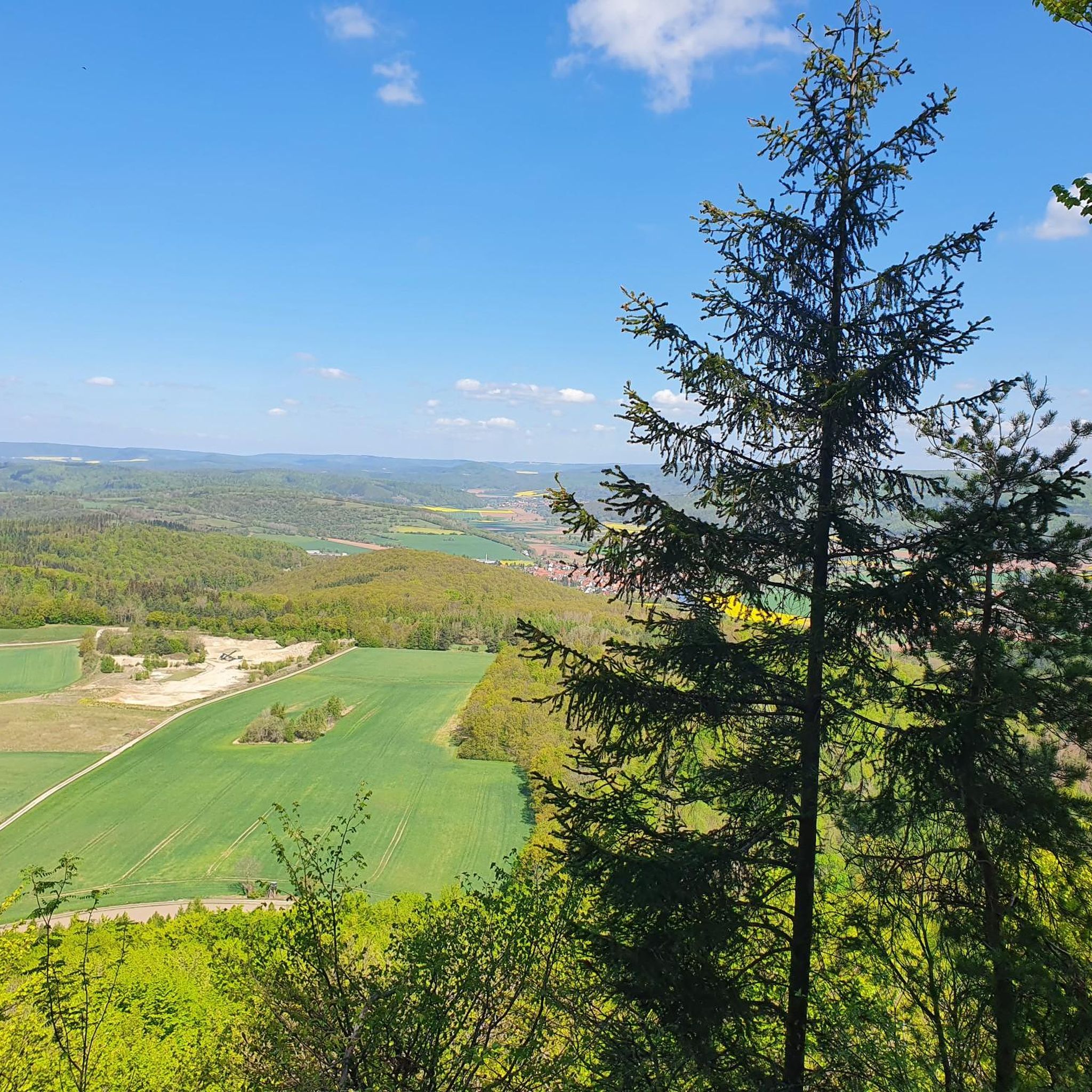
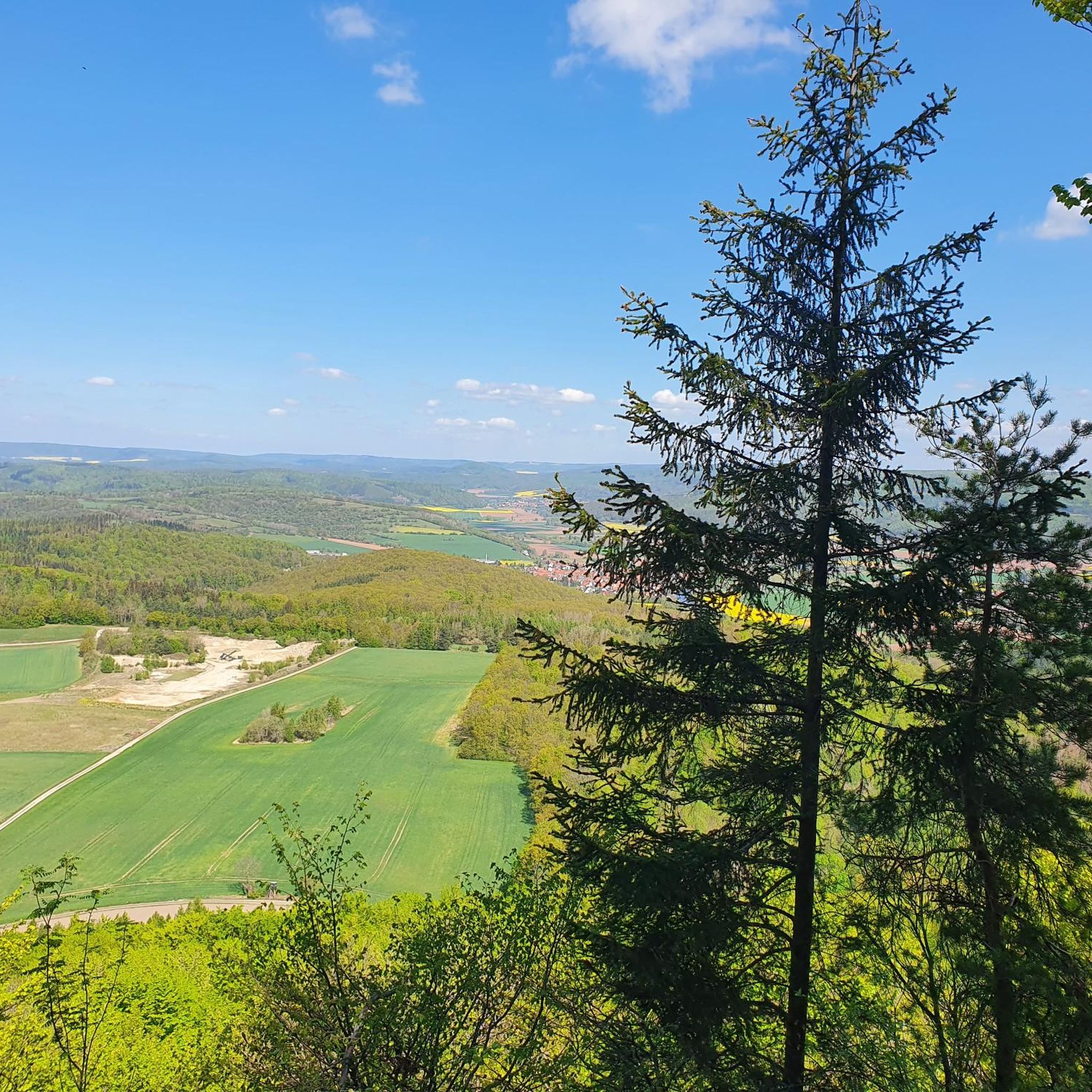
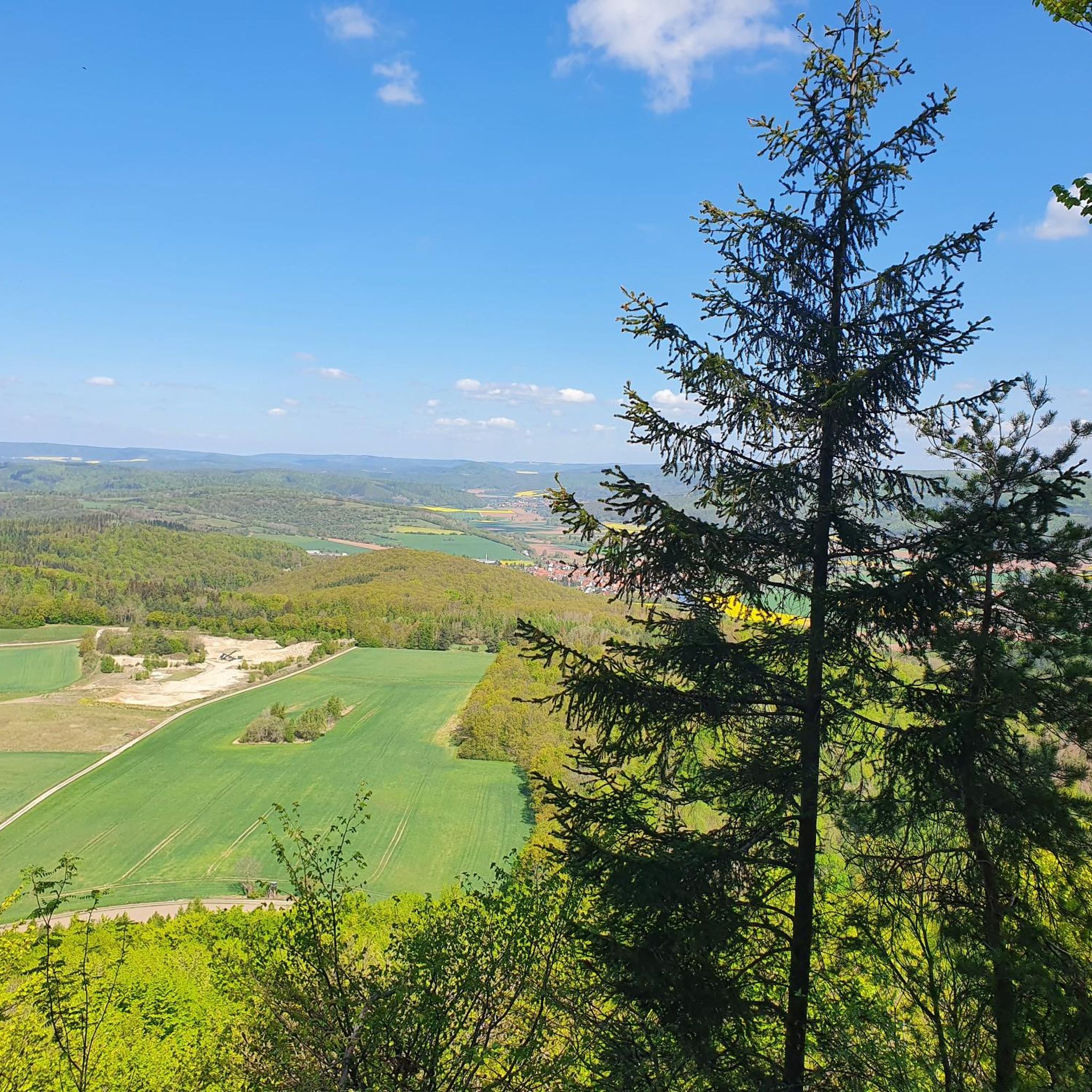
The mountain hut is a perfect place for a break. From the benches at the steep cliff edge, you look directly into the landscape and at the village of Weißenborn.
2
0
From the Rabenkuppe you have a wonderful view of the landscape.
0
0

The Graburg is neither a castle nor a castle ruin, but rather a mountain massif of shell limestone, lying on a base of red clay. Natural limestone beech forests, rocks, and landslides characterize the area. Due to its "scenic beauty and uniqueness," as well as its importance as a habitat for rare and endangered animal and plant species, the Graburg was declared a natural monument in 1915 and, starting in May 1965, a nature reserve.
3
0

The Graburg is a large nature reserve with rockfalls. Here, you can experience the forest in its fullest, featuring several ARS NATURA artworks. Some of the cliffs offer wonderful views.
1
0
By the way, there is a wonderful view not only of Weißenborn, but you can also easily follow the Green Belt all the way to the rear ridge, where you can also see from right to left: Treffurt with Normannstein Castle, then further to the left the Hülfensberg and in front of it Wanfried in the Werra Valley, further to the left the mountain with Greifenstein Castle and on the far left the Hessian Switzerland near Bad Sooden-Allendorf.
3
0
Frequently Asked Questions
How many hiking trails are available in Dreiherrenstein-Eschenberg-Kreutzerberg?
The Dreiherrenstein-Eschenberg-Kreutzerberg region offers a wide selection of routes, with over 500 hiking trails to explore. This includes a good mix of easy, moderate, and some more challenging options.
Are there easy or beginner-friendly hiking routes in the area?
Yes, the region is known for its varied terrain and gentle inclines, making it suitable for less experienced walkers. There are approximately 250 easy routes available. An example of an easy route is the Ringgau District Stone Circle – View from the Rabenkuppe loop from Graburg, which is about 7.6 km long.
What kind of viewpoints can I expect to find along the trails?
The Dreiherrenstein-Eschenberg-Kreutzerberg area is rich in panoramic views. A prominent feature is the Heldrastein, often called the 'king of the Werra valley,' which rises 325 meters above the river and offers fantastic vistas. You can visit the Dreiherrenstein Viewpoint for excellent views. Many trails, such as the Dreiherrenstein Viewpoint – View of the Heldrastein loop from Graburg, specifically highlight these scenic spots.
Are there any circular walks in Dreiherrenstein-Eschenberg-Kreutzerberg?
Yes, circular routes are very popular in this region. A particularly well-liked option leads from Eschenberger Wald to Kreutzerberg, offering diverse scenery and manageable gradients. Many of the featured routes, like the View of the Heldrastein – Dreiherrenstein Viewpoint loop from Dreiherrenstein-Eschenberg-Kreutzerberg, are designed as loops.
What attractions or landmarks can I see while hiking?
Beyond the natural beauty, the region offers several interesting points. You can explore the Dreiherrenstein Viewpoint, discover art installations like the Zaunvolk – Ars Natura Sculpture by Georg Janthur, or see the Lebensspur by Michaela Biet. Some paths also traverse parts of the former inner-German border, adding a historical dimension to your walk.
Are the hiking trails in Dreiherrenstein-Eschenberg-Kreutzerberg suitable for families?
Absolutely. The region provides many family-friendly routes with varied landscapes and gentle inclines. The circular route from Eschenberger Wald to Kreutzerberg is particularly recommended for families due to its diverse scenery and manageable gradients. Informative boards along the trails also enhance the experience for all ages.
Can I bring my dog on the hiking trails?
While specific dog-friendly regulations can vary by nature reserve, generally, dogs are welcome on most hiking trails in the Dreiherrenstein-Eschenberg-Kreutzerberg region, provided they are kept on a leash. Always check local signage, especially within designated nature reserves like Mertelstal, to ensure compliance.
What is the best time of year to go hiking in this region?
The Dreiherrenstein-Eschenberg-Kreutzerberg area is beautiful year-round. Spring and autumn offer pleasant temperatures and vibrant colors, while summer provides lush greenery. Even in winter, the trails can be enjoyed, though conditions may require appropriate gear. The varied terrain and well-maintained paths make it accessible in most seasons.
Are there challenging hikes for experienced hikers?
While many routes feature gentle inclines, the region does offer options for more experienced hikers. There are 27 difficult routes available. For example, the View of the Heldrastein – Dreiherrenstein Viewpoint loop from Dreiherrenstein-Eschenberg-Kreutzerberg is a 15 km trail with significant elevation gain, often taking around 4 hours 30 minutes to complete.
What do other hikers say about the trails in Dreiherrenstein-Eschenberg-Kreutzerberg?
The area is highly rated by the komoot community, with an average score of 4.7 stars from over 3700 reviews. Hikers often praise the diverse landscapes, the prominent viewpoints like Heldrastein, and the well-maintained routes through natural reserves. Many appreciate the options for different ability levels, from easy walks to moderate climbs.
Is there parking available near the trailheads?
The Dreiherrenstein-Eschenberg-Kreutzerberg region is generally well-equipped for hikers, and you can expect to find parking facilities near popular trailheads and starting points for many routes. Specific parking information is often available on individual route descriptions on komoot.
Are there places to rest or have a picnic along the trails?
Yes, hikers will find numerous small rest areas equipped with benches throughout the Dreiherrenstein-Eschenberg-Kreutzerberg region. These spots provide ideal opportunities to relax, enjoy the surroundings, and have a picnic amidst nature.
Most popular routes in Dreiherrenstein-Eschenberg-Kreutzerberg
Most popular attractions in Dreiherrenstein-Eschenberg-Kreutzerberg

Get inspired with the komoot mobile app


Explore more
Browse the best Hikes in other regions.
