The best walks and hikes in Röhnberg
4.6
(4515)
17,134
hikers
34
hikes
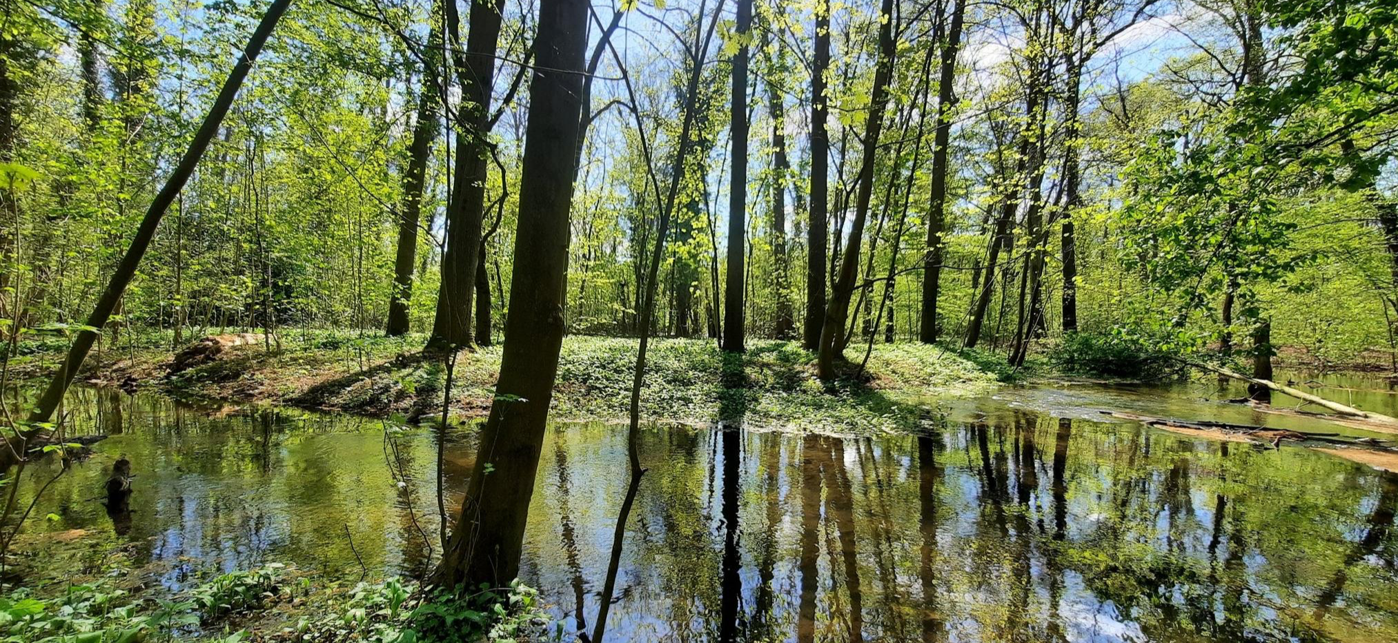
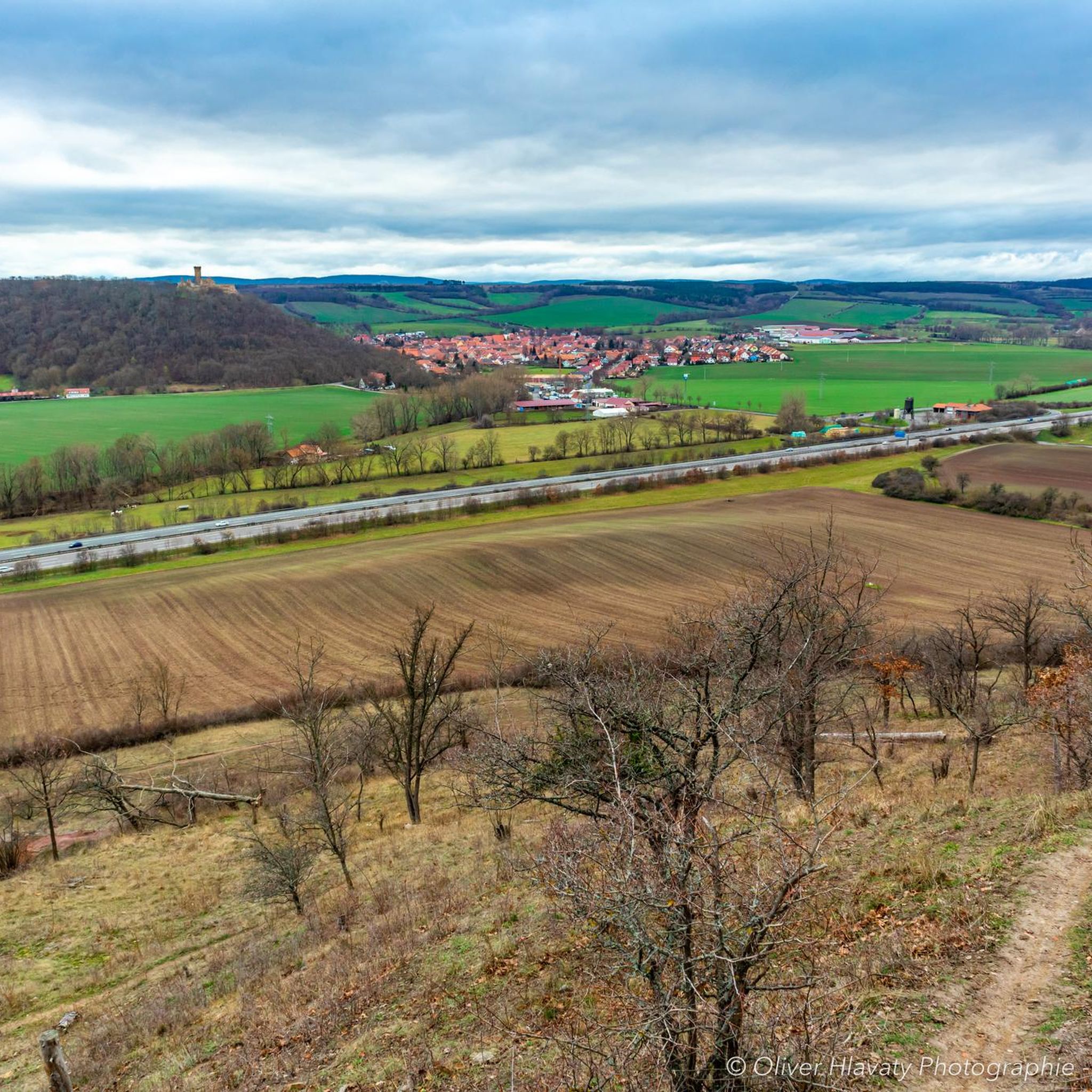
Hiking in Röhnberg offers diverse terrain characterized by unique geological formations and historical landmarks. The region features "Badlands" with exposed subsoil displaying striking red, gray, and green hues, a result of millions of years of alternating floods and dry spells. This environment supports specialized plant and insect life. Hikers can explore areas including the Röhnberg Gorge and enjoy views of the Wechmar Reservoir.
Best hiking trails in Röhnberg
- The most popular hiking route is Gleichen Castle – Röhnberg Gorge loop…
Last updated: July 10, 2026
4.6
(43)
172
hikers
9.43km
02:47
260m
260m
Moderate hike. Good fitness required. Mostly accessible paths. Sure-footedness required.
4.8
(25)
61
hikers
3.64km
01:07
130m
130m
Easy hike. Great for any fitness level. Easily-accessible paths. Suitable for all skill levels.

Sign up for free
4.7
(7)
39
hikers
8.23km
02:27
230m
230m
Moderate hike. Good fitness required. Mostly accessible paths. Sure-footedness required.
4.8
(33)
117
hikers
6.99km
02:02
180m
180m
Moderate hike. Good fitness required. Easily-accessible paths. Suitable for all skill levels.
4.9
(29)
74
hikers
8.62km
02:26
180m
180m
Moderate hike. Good fitness required. Easily-accessible paths. Suitable for all skill levels.
Get access to more routes and recommendations from other explorers.
Sign up for free
Already have an account?
Our route recommendations are based on thousands of hikes, rides, and runs completed by other people on komoot.
Start today with a free account
Your next adventure awaits.
Login or Signup
Other adventures in Röhnberg

Tips from the Community

Very nice corner with many trails in the area.
0
0

At dusk, Gleichen Castle is illuminated from all sides, creating a particularly beautiful atmosphere.
0
0

On the Gustav-Freytag-Weg and on the northern edge of the Schloßleite forest, there are approximately 60 such sovereign stones of the Electorate of Mainz. They are marked with the Mainz wheel and the number 1777, as well as the consecutive number.
9
0

wonderful path. It's a lot of fun to walk it
0
0

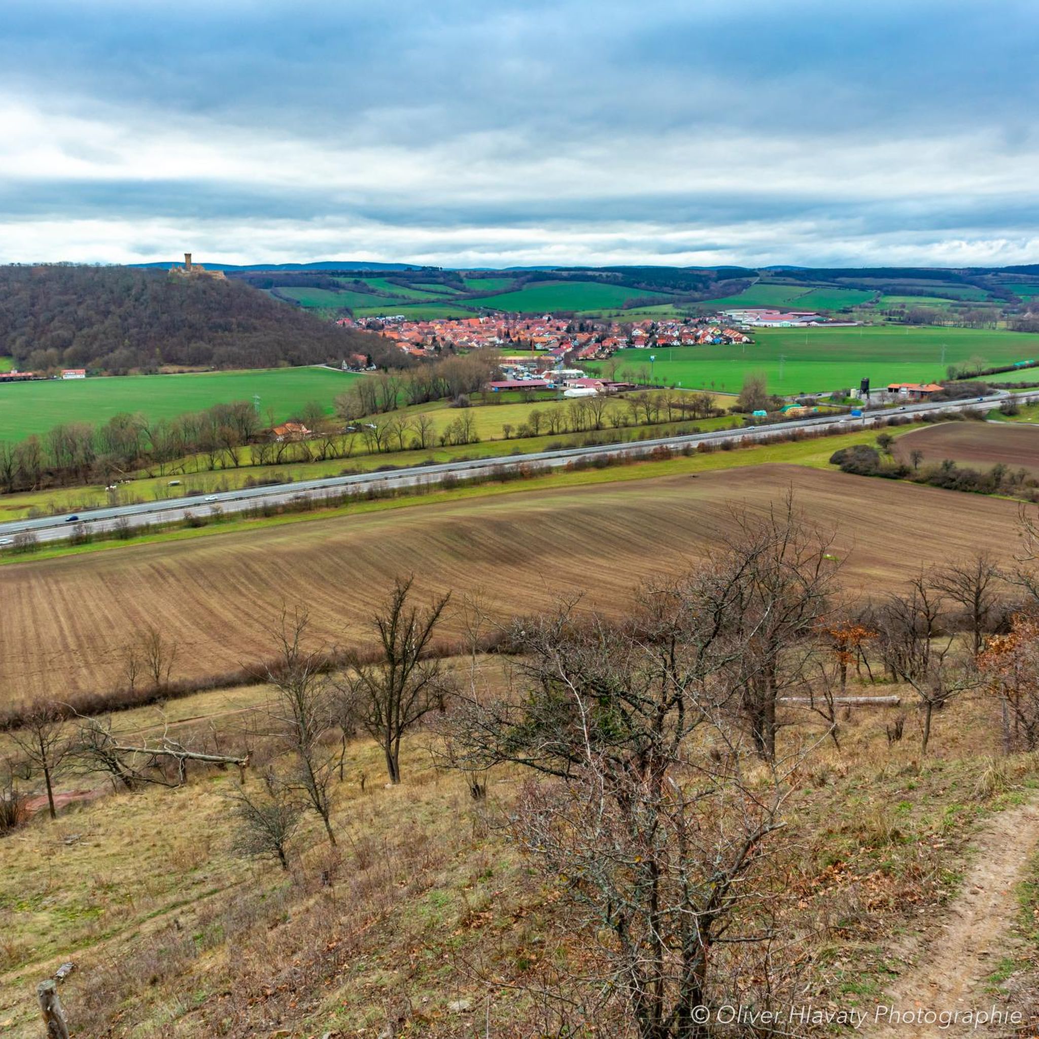
The castle ruins are easy to reach and can be seen from far away from the motorway.
0
0
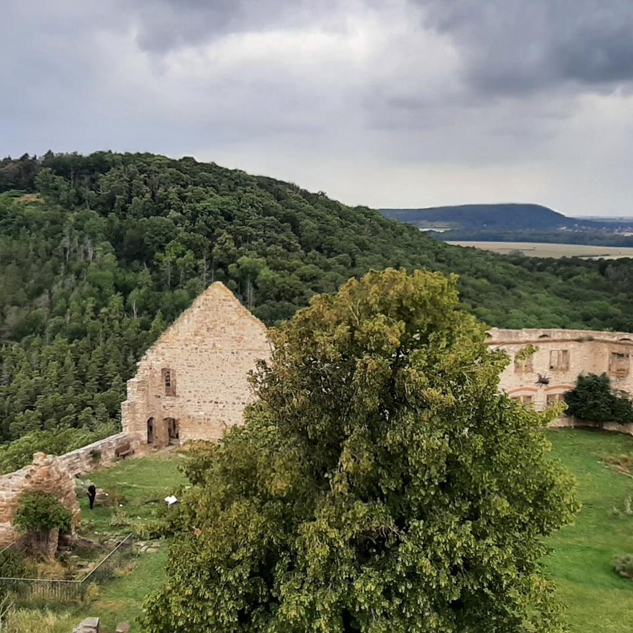
Very beautifully preserved castle ruins.
0
0
The castle ruins on the edge of the highway.
0
0

Nice for hikers uphill - downhill with the MTB is certainly more fun ;-)
0
0
Frequently Asked Questions
How many hiking trails are there in Röhnberg, and what are their difficulty levels?
Röhnberg offers a diverse network of over 30 hiking trails. You'll find a balanced mix, with 17 easy routes perfect for a relaxed stroll and 17 moderate trails for those seeking a bit more challenge. There are no difficult trails listed, making the area accessible for most hikers.
What unique natural features can I expect to see while hiking in Röhnberg?
Röhnberg is renowned for its distinctive 'Badlands,' a geological formation where exposed subsoil reveals striking red, gray, and green hues. These ancient landscapes, formed over millions of years, provide a habitat for rare plants and specialized insects. You can explore these areas directly or view them from paths leading to the castle. Don't miss the Badlands of Röhnberg or the Canyon in the Röhnberg.
Are there any historical landmarks to explore along the hiking routes?
Absolutely. A prominent historical landmark is the ruined Gleichen Castle, part of Germany's famous 'Drei Gleichen' ensemble. Many trails incorporate views of or lead directly to this significant cultural site, adding a rich historical dimension to your hike. For example, the Gleichen Castle – Röhnberg Gorge loop from Wandersleben offers excellent views.
Are there any family-friendly hiking options in Röhnberg?
Yes, Röhnberg has several routes suitable for families. Many of the 17 easy trails are ideal for hikers of all ages. For instance, the Gleichen Castle – Mühlberg Aqueduct loop from Wandersleben is an easy 4.2-mile path that combines historical sights with varied terrain, perfect for a family outing.
Can I bring my dog on the hiking trails in Röhnberg?
Most hiking trails in Röhnberg are dog-friendly, allowing you to enjoy the natural beauty with your canine companion. However, it's always recommended to keep your dog on a leash, especially in areas with wildlife or near historical sites like Gleichen Castle, and to check for any specific local regulations on individual routes.
Are there circular hiking routes available in Röhnberg?
Yes, Röhnberg features numerous circular hiking routes, which are very popular among visitors. These loops allow you to start and end your hike at the same point, offering convenience and varied scenery without retracing your steps. Examples include the Gleichen Castle – Röhnberg Gorge loop from Wandersleben and the View of Wechmar Reservoir – View of Wechmarer Talsperre loop from Wandersleben.
What do other hikers enjoy most about hiking in Röhnberg?
The Röhnberg area is highly rated by the komoot community, with an average score of 4.7 stars from over 250 reviews. Hikers frequently praise the unique geological 'Badlands,' the historical significance of Gleichen Castle, and the varied terrain that includes gorges and reservoirs. The well-maintained paths and diverse landscapes are often highlighted as key attractions.
Are there any viewpoints or scenic spots along the trails?
Röhnberg offers several scenic viewpoints that provide stunning panoramas of the unique landscape. The Hasenwinkel Dinosaur Fossil Site and Viewpoint is a notable spot, offering both historical interest and expansive views. Many trails also provide excellent vantage points over the Badlands and towards the castles.
What is the best time of year to go hiking in Röhnberg?
The Röhnberg region is beautiful year-round, but spring and autumn are particularly popular for hiking. In spring, the landscape comes alive with greenery and wildflowers, including the Snowdrop Meadows at Kaffberg. Autumn offers vibrant foliage and comfortable temperatures. Summer is also suitable, though it can be warmer, while winter hikes can provide a serene, snow-covered experience.
Are there places to eat or amenities near the hiking trails?
Yes, you can find amenities and places to eat in the vicinity of Röhnberg's hiking trails. For example, Gasthaus Freudenthal is a local option where you can refuel after your hike. It's always a good idea to check opening hours in advance, especially for smaller establishments.
Is there parking available at the trailheads in Röhnberg?
Many of the popular trailheads in Röhnberg, especially those starting from villages like Wandersleben or Günthersleben-Wechmar, offer designated parking areas. While specific parking details vary by route, you'll generally find convenient options to begin your hike. It's advisable to check the starting point of your chosen route for precise parking information.
Can I reach the Röhnberg hiking trails using public transport?
While Röhnberg is primarily accessed by car, some starting points for hikes may be reachable via local public transport, particularly from larger nearby towns. For the most accurate and up-to-date information on bus or train connections to specific trailheads, it's best to consult local transport schedules or regional tourism websites.
Most popular routes in Röhnberg
Most popular attractions in Röhnberg

Get inspired with the komoot mobile app


Explore more
Browse the best Hikes in other regions.
