The best running trails in Saarsteilhänge/ Lutwinuswald
4.5
(403)
6,558
runners
328
runs
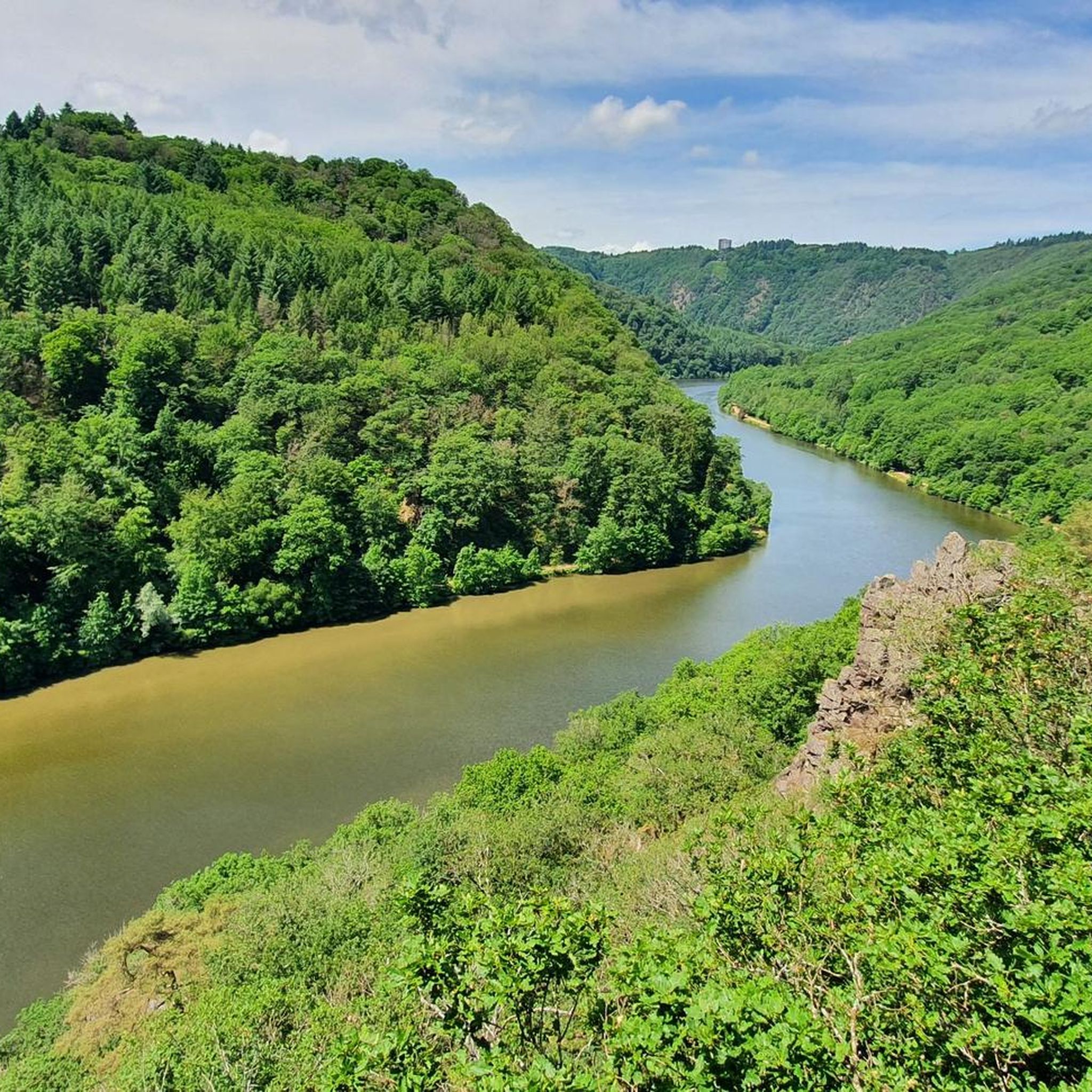
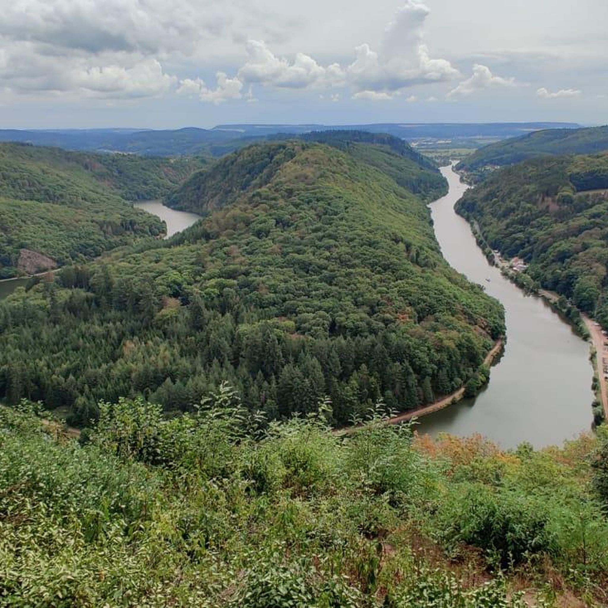
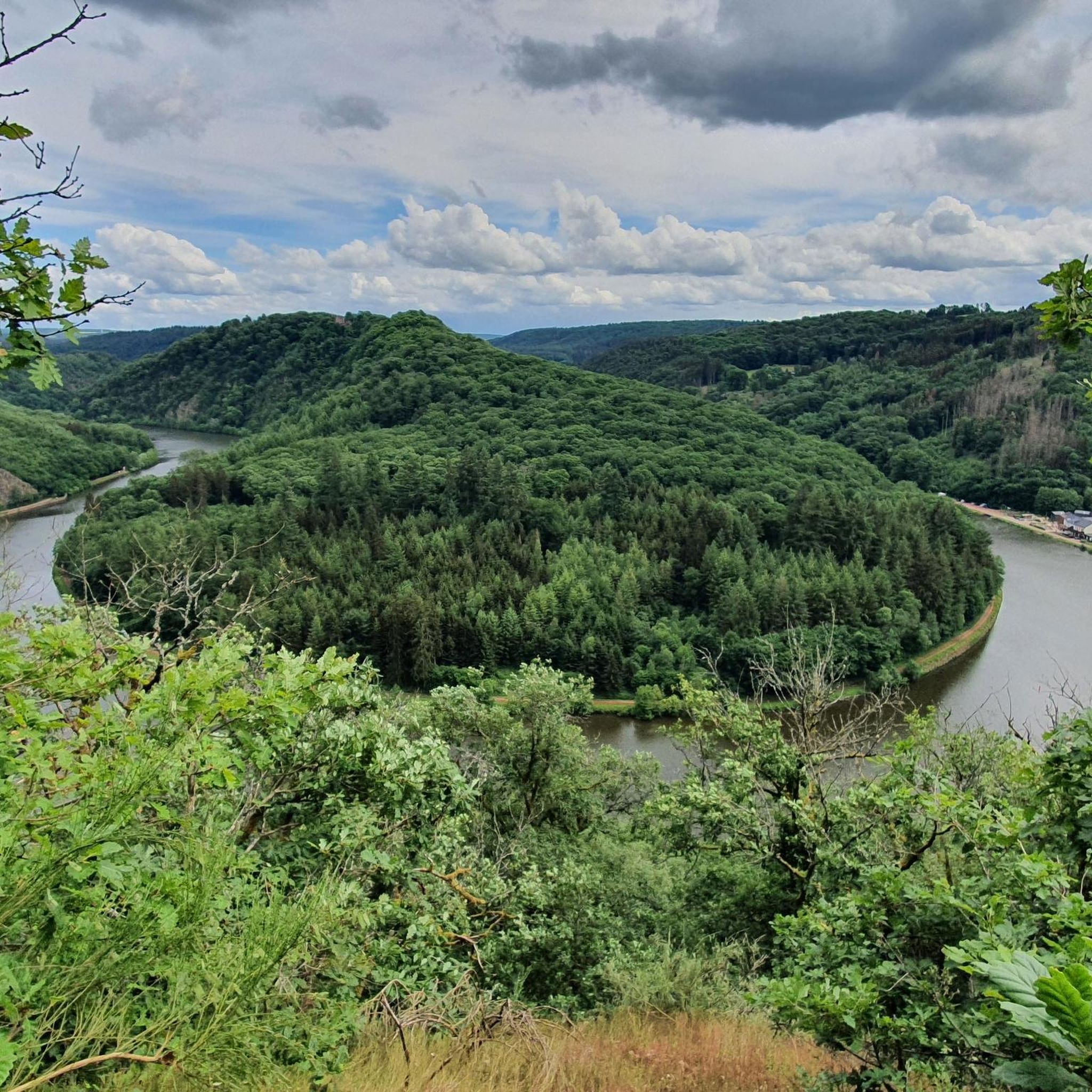
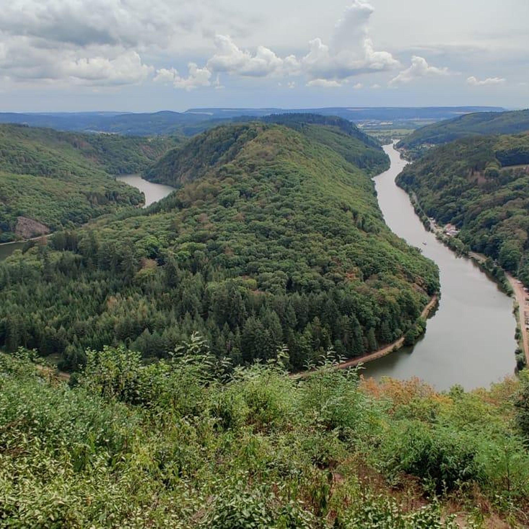
Jogging routes in Saarsteilhänge/ Lutwinuswald traverse a landscape defined by the dramatic Saarschleife, where the Saar River carves a deep meander through forested steep slopes. The region features varied terrain, from river valleys to elevated points like Vogelscheid Rock and Eisenkopf. This topography creates diverse running experiences, allowing for exploration of natural features and cultural attractions.
Best jogging routes in Saarsteilhänge/ Lutwinuswald
- The most popular jogging route is Saar Loop – View of the Saar River loop from Mettlach,…
Last updated: July 6, 2026
4.8
(5)
212
runners
10.3km
01:07
160m
160m
Moderate run. Good fitness required. Mostly paved surfaces. Suitable for all skill levels.
4.6
(5)
198
runners
9.26km
00:59
120m
120m
Moderate run. Good fitness required. Mostly paved surfaces. Suitable for all skill levels.

Sign up for free
5.0
(10)
216
runners
19.8km
02:08
270m
270m
Hard run. Very good fitness required. Mostly paved surfaces. Suitable for all skill levels.
101
runners
17.6km
02:08
430m
430m
Hard run. Very good fitness required. Mostly paved surfaces. Suitable for all skill levels.
4.3
(3)
40
runners
36.3km
03:50
330m
330m
Hard run. Very good fitness required. Mostly paved surfaces. Suitable for all skill levels.
Get access to more routes and recommendations from other explorers.
Sign up for free
Already have an account?
Our route recommendations are based on thousands of hikes, rides, and runs completed by other people on komoot.
Start today with a free account
Your next adventure awaits.
Login or Signup
Popular around Saarsteilhänge/ Lutwinuswald

Other adventures in Saarsteilhänge/ Lutwinuswald

Tips from the Community

Many years ago we were up there before. In the meantime, the treetop path costs 14 euros for adults - quite steep.
0
0
The Cloef path winds under the treetop path at the end.
0
0

The only ferry in Saarland across the Saar river. The crossing takes only a few minutes (approx. 250 m route distance).
1
0


with several houses also tree houses already interesting
4
0

From the hiking trail or cycle path over the bridge and you have hourly train connections towards Trier and Homburg via Saarbrücken with the RB.
0
0

The ferry ride was really funny.
1
0
Frequently Asked Questions
What types of running routes can I find in Saarsteilhänge/Lutwinuswald?
Saarsteilhänge/Lutwinuswald offers a diverse range of running routes, from easy paths suitable for beginners to challenging trails with significant elevation gain. You'll find routes traversing forested steep slopes, river valleys, and paths leading to panoramic viewpoints. There are over 300 routes in total, with options for all fitness levels.
Are there any easy or family-friendly jogging routes in the region?
Yes, the region provides 36 easy running routes, perfect for families or those looking for a less strenuous run. These trails often follow the Saar valley, offering gentle gradients and scenic views without demanding climbs. While specific family-friendly routes aren't highlighted by name here, many of the easy trails are suitable.
What are some notable viewpoints or attractions I can see while running in Saarsteilhänge/Lutwinuswald?
The region is rich in natural beauty and cultural landmarks. Many routes offer stunning views of the iconic Saar Loop, especially from viewpoints like Cloef. You might also encounter the Treetop Walk Saar-Hunsrück, historic Montclair Castle, or the peaceful Lutwinus Chapel along your run.
Can I find circular running routes in Saarsteilhänge/Lutwinuswald?
Yes, many of the running trails in Saarsteilhänge/Lutwinuswald are designed as circular routes, allowing you to start and finish at the same point. For example, the moderate route Saarschleife Lodge – Cloef Atrium loop from Weiten is an excellent circular option, covering 8.2 km with beautiful scenery.
What do other runners say about the trails in Saarsteilhänge/Lutwinuswald?
The running routes in Saarsteilhänge/Lutwinuswald are highly regarded by the komoot community, boasting an average rating of 4.5 stars from over 300 reviews. Runners frequently praise the stunning views of the Saarschleife, the well-maintained paths through forested areas, and the variety of terrain that caters to different fitness levels.
Are there any longer, more challenging running routes for experienced runners?
Absolutely. For those seeking a greater challenge, the region offers 49 difficult routes. An example is the Welles Ferry (Saar Loop) – Saar Loop loop from Saarhölzbach, a demanding 36.2 km trail with significant elevation changes, perfect for long-distance training or an endurance run.
What is the typical terrain or surface type for jogging in this area?
The terrain in Saarsteilhänge/Lutwinuswald is quite varied. You'll encounter a mix of natural forest paths, gravel trails, and some paved sections, especially closer to villages or along the river. The forested steep slopes mean many trails will be unpaved and can be uneven, offering a natural running experience.
Is there public transport access to the trailheads in Saarsteilhänge/Lutwinuswald?
While specific public transport details for every trailhead are not provided, the region is generally accessible. Major towns like Mettlach and Orscholz, which are common starting points for routes, typically have bus connections. It's advisable to check local bus schedules for routes serving the specific trailheads you plan to visit.
Are there places to park near the running routes?
Yes, parking is generally available at popular starting points for trails, especially near attractions like Cloef Atrium in Orscholz or in the towns of Mettlach and Saarhölzbach. Look for designated parking areas near trail entrances, though some may require a small fee.
Are dogs allowed on the running trails in Saarsteilhänge/Lutwinuswald?
Many outdoor trails in the Saarsteilhänge/Lutwinuswald region are dog-friendly, allowing you to enjoy a run with your canine companion. However, it's always recommended to keep dogs on a leash, especially in nature reserves or areas with wildlife, and to be mindful of other trail users. Specific restrictions might apply to certain protected areas or attractions.
What is a good time of year to go running in Saarsteilhänge/Lutwinuswald?
The region is beautiful for running throughout much of the year. Spring and autumn offer pleasant temperatures and vibrant scenery, with blooming flowers or colorful foliage. Summer is also popular, though it's best to run in the mornings or evenings to avoid the midday heat. Winter running is possible, but some trails might be slippery or muddy, and conditions can vary.
Most popular routes in Saarsteilhänge/ Lutwinuswald
Most popular attractions in Saarsteilhänge/ Lutwinuswald

Get inspired with the komoot mobile app


Explore more
Browse the best Running Trails & Routes in other regions.
