Wildruhefläche Gaistal
Wildruhefläche Gaistal
The best mountain hikes in Wildruhefläche Gaistal
4.8
(641)
5,772
hikers
125
hikes
Mountaineering routes in Wildruhefläche Gaistal traverse a high alpine landscape characterized by prominent summits, deep valleys, and protected natural areas. The region features challenging ascents to peaks like Hochwanner and Karkopf, alongside routes connecting mountain huts such as Steinernes Hüttl and Neue Alplhütte. These trails often involve significant elevation gain through varied terrain, offering expansive views of the surrounding mountains.
Best mountaineering routes in Wildruhefläche Gaistal
- The most popular mountaineering route is Upper Bridge Over the Kotbach – Steinernes Hüttl (1925 m) loop from Gaistal, a 7.4 miles (11.9 km) trail that takes 5 hours 27 minutes to complete, leading to a notable mountain hut.
- Another top favourite among local mountaineers is Steinernes Hüttl (1925 m) – Hochwanner Summit (2,744 m) loop from Gaistal, a difficult 7.8 miles (12.6 km) path. This route offers a demanding ascent to a high alpine summit, providing panoramic mountain vistas.
- Local mountaineers also love the Judenköpfe Summit – Neue Alplhütte loop from Wildruhefläche Kuatrög, a 4.2 miles (6.8 km) trail leading through high mountain terrain to a summit and an alpine hut, often completed in about 3 hours 25 minutes.
- Mountaineering in Wildruhefläche Gaistal is defined by alpine summits, mountain huts, and protected natural landscapes. The network offers options for both moderate and difficult ability levels, with more than 40 moderate and 90 difficult routes available.
- The routes in Wildruhefläche Gaistal are highly rated by the komoot community with an average score of 4.8 stars from over 700 reviews. More than 6,000 mountaineers have used komoot to explore Wildruhefläche Gaistal's varied terrain.
Last updated: July 22, 2026
4
hikers
12.0km
05:30
760m
760m
Hard mountaineering route. Very good fitness required. Mostly accessible paths. Sure-footedness required.
5.0
(1)
3
hikers
12.5km
07:48
1,280m
1,280m
Hard mountaineering route. Very good fitness required. Sure-footedness, sturdy shoes and alpine experience required.

Sign up for free
5
hikers
6.99km
03:29
550m
550m
Moderate mountaineering route. Good fitness required. Mostly accessible paths. Sure-footedness required.
7
hikers
6.66km
05:11
900m
900m
Hard mountaineering route. Very good fitness required. Sure-footedness, sturdy shoes and alpine experience required.
6
hikers
8.55km
06:42
950m
950m
Hard mountaineering route. Very good fitness required. Sure-footedness, sturdy shoes and alpine experience required.
Get access to more routes and recommendations from other explorers.
Sign up for free
Already have an account?
Our route recommendations are based on thousands of hikes, rides, and runs completed by other people on komoot.
Start today with a free account
Your next adventure awaits.
Login or Signup
Tips from the Community

Very warm staff and lovingly prepared, very delicious food. Absolutely recommended.
0
0


A very simple hut, but a welcome stop for a break below Predigtstein and Hochwanner. Drinks are available in the cold spring water (Spezi, apple spritzer €4, wheat beer €5 – all must be flown in by helicopter). Crossing to the Rotmoosalm or towards Gatterl. The ascent from the Gaistal takes about 1.5 hours.
2
0

The Neue Alplhütte rises on the Mieminger Plateau above the Inn Valley at a height of 1,504 meters. Behind it, the mighty rock faces of the Mieminger chain rise up. The climb to the hut can also be mastered with children. Opening times in summer: mid-July to mid-November. You can find more information at http://www.alplhuette.com/.
1
1

A cute hut for up to 8 hikers. You sleep under the roof in the mattress dormitory. The mattresses are wide enough to sleep comfortably. In the early morning you can enjoy herds of chamois and marmots. A beautiful, varied and breathtaking route that is highly recommended.
1
0


Every now and then cows cross the path here, be careful when descending.
11
1
Frequently Asked Questions
What are the typical difficulty levels for mountaineering routes in Wildruhefläche Gaistal?
Wildruhefläche Gaistal offers a range of mountaineering challenges. You'll find over 40 moderate routes, which are suitable for those with some experience, and more than 90 difficult routes, designed for experienced mountaineers seeking significant ascents and demanding terrain.
How long do mountaineering routes in Wildruhefläche Gaistal usually take to complete?
The duration of routes varies significantly based on difficulty and distance. For example, a moderate route like the Judenköpfe Summit – Neue Alplhütte loop from Wildruhefläche Kuatrög can be completed in about 3 hours 25 minutes. More challenging routes, such as the Steinernes Hüttl (1925 m) – Hochwanner Summit (2,744 m) loop from Gaistal, can take upwards of 7 hours 50 minutes due to significant elevation gain.
Are there any circular mountaineering routes in Wildruhefläche Gaistal?
Yes, many mountaineering routes in Wildruhefläche Gaistal are designed as loops, allowing you to start and end at the same point. An example is the Steinernes Hüttl (1925 m) – Upper Bridge Over the Kotbach loop from Parkplatz Gaistal Salzbach, which offers a comprehensive experience of the area.
What natural sights can I explore while mountaineering in Wildruhefläche Gaistal?
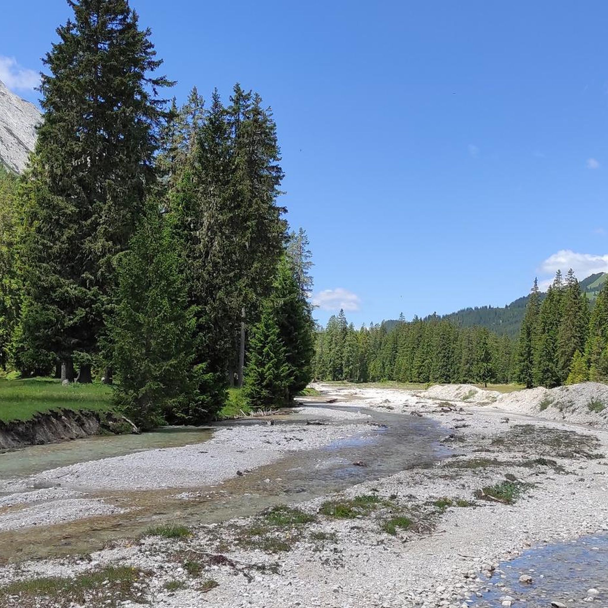
Beyond the impressive summits, you can encounter beautiful natural features. Highlights include the serene Leutasch Stream and the picturesque Leutascher Ache in the Gaistal. The Descent Through Gaistal Meadows also offers scenic views.
When is the best time of year for mountaineering in Wildruhefläche Gaistal?
The prime season for mountaineering in Wildruhefläche Gaistal is typically from late spring through early autumn (June to September). During these months, trails are generally free of snow, and weather conditions are more stable, offering the best experience for high alpine routes.
Are there mountain huts or places to stop for refreshments along the routes?
Yes, several routes connect to or pass by mountain huts where you can rest and refuel. Notable huts include the Steinernes Hüttl (1925 m) and the Neue Alplhütte, which are often featured as destinations or waypoints on tours like the Neue Alplhütte – Karkopf Summit loop from Wildruheflache Kuatrög.
Is winter mountaineering possible in Wildruhefläche Gaistal?
While the region is stunning in winter, mountaineering during this season requires significant experience, specialized equipment (such as crampons, ice axe, and avalanche safety gear), and a thorough understanding of alpine conditions. Many routes become considerably more challenging and hazardous due to snow and ice.
Where can I find parking for mountaineering routes in Wildruhefläche Gaistal?
Parking is available at various access points to the Gaistal. For instance, routes like the Steinernes Hüttl (1925 m) – Upper Bridge Over the Kotbach loop start from Parkplatz Gaistal Salzbach, providing convenient access to the trails.
What do other mountaineers enjoy most about Wildruhefläche Gaistal?
The area is highly rated by the komoot community, with an average score of 4.8 stars from over 700 reviews. Mountaineers often praise the expansive views of the surrounding mountains, the challenging ascents to prominent summits like Hochwanner, and the well-maintained trails connecting various mountain huts.
Are there any specific permits required for mountaineering in Wildruhefläche Gaistal?
Wildruhefläche Gaistal is a protected natural area. While general hiking permits are not typically required for standard trails, it's always advisable to respect local regulations regarding wildlife protection zones and any potential restrictions, especially during sensitive breeding seasons. Always stay on marked paths.
Are the mountaineering routes in Wildruhefläche Gaistal suitable for beginners?
Given the high alpine character of Wildruhefläche Gaistal, most mountaineering routes are classified as moderate to difficult. There are no 'easy' routes listed. Beginners with good physical condition and some prior hiking experience might consider the moderate routes, but should be prepared for significant elevation gain and varied terrain. It's recommended to gain experience on easier alpine hikes before tackling these routes.
Most popular routes in Wildruhefläche Gaistal
Most popular attractions in Wildruhefläche Gaistal

Get inspired with the komoot mobile app


Explore more
Browse the best Mountain Hikes & Routes in other regions.
