The best running trails in Prairies Inondables Du Val De Saône
4.6
(211)
9,575
runners
925
runs
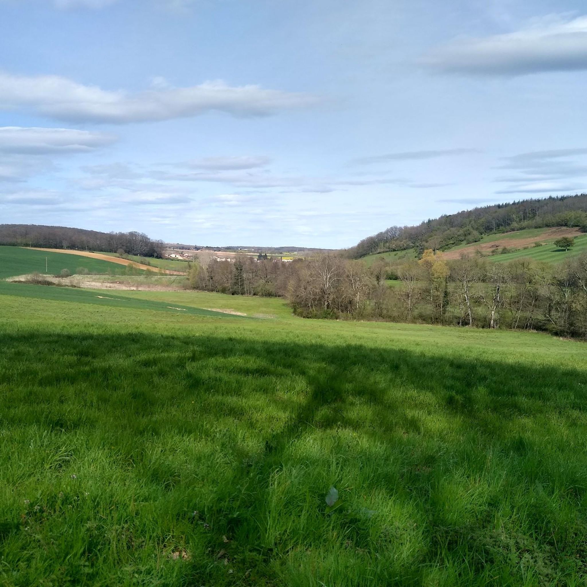
Jogging in Prairies Inondables Du Val De Saône offers routes across expansive, flat floodplains shaped by the Saône River. This region is characterized by its unique "prairies inondables" (flood meadows), which are ecologically significant and provide open, grassy areas for running. The landscape features a dynamic interplay of land and water, including "lônes" (old river arms), islands, ponds, and alluvial woodlands. These natural features create varied scenery, moving from open fields to shaded paths along waterways.
Best jogging routes in…
Last updated: July 15, 2026
5.0
(1)
40
runners
9.61km
01:01
20m
20m
Moderate run. Good fitness required. Mostly paved surfaces. Suitable for all skill levels.
13
runners
9.89km
01:01
10m
10m
Moderate run. Good fitness required. Mostly paved surfaces. Suitable for all skill levels.

Sign up for free
15
runners
13.9km
01:26
20m
20m
Moderate run. Good fitness required. Mostly paved surfaces. Suitable for all skill levels.
7
runners
5.07km
00:32
30m
30m
Moderate run. Good fitness required. Mostly paved surfaces. Suitable for all skill levels.
14
runners
Moderate run. Good fitness required. Mostly paved surfaces. Suitable for all skill levels.
Get access to more routes and recommendations from other explorers.
Sign up for free
Already have an account?
Our route recommendations are based on thousands of hikes, rides, and runs completed by other people on komoot.
Start today with a free account
Your next adventure awaits.
Login or Signup
Popular around Prairies Inondables Du Val De Saône

Tips from the Community

An idyllic, paved cycle path directly on the riverbank. It is a section of the well-known French long-distance cycle route „La Voie Bleue - Moselle-Saône Radweg" (Route V50) along the Saône. The entire long-distance cycle route covers around 700 kilometers from the Luxembourg border town of Apach (near the tripoint) to Lyon. The Saône section follows the natural meanders of the Saône, passing meadows, historic villages, and well-known wine-growing regions such as Mâcon. The route is mostly flat on former towpaths.
0
0
An idyllic, asphalted cycle path right on the riverbank. This is a section of the well-known French long-distance cycle route "La Voie Bleue - Moselle-Saône Radweg" (Route V50) along the Saône. The entire long-distance cycle route runs for around 700 kilometers from the French border town of Apach (near the tripoint) to Lyon. The Saône section follows the natural meanders of the Saône, passing meadows, historic villages, and well-known wine-growing regions such as Mâcon. The route runs mostly flat on former towpaths.
0
0

Along the Saône runs the unfortunately often unpaved, patchy Voie Bleu ("Blue Way"). Incidentally, there is only one Voie Bleu, unlike the Voies Vertes. From Wikivoyage.
1
0

Very flat, easy, although a little monotonous...
2
0

Watching the locks is always interesting.
3
0

From this passage of the Voie Bleue, we have a lovely view of the Saône. Depending on the weather, the color of the water alternates between blue and green.
3
0
At this point on the Voie Bleue, the Mouge flows into the Saône. The low water level favors vegetation and the places are known to fishermen for their fish-rich waters. It is a pleasant site for a break with a beautiful view of the river.
3
0

A beautiful view of the Saône as well as a nice picnic area in the shade of the tree (there are no benches however).
3
0
Frequently Asked Questions
How many running routes are available in Prairies Inondables Du Val De Saône?
There are over 900 running routes available in the Prairies Inondables Du Val De Saône region. These routes cater to various skill levels, with a significant number of moderate trails, as well as options for easy and difficult runs.
What kind of terrain can I expect on the jogging trails in Prairies Inondables Du Val De Saône?
The region is characterized by its vast, flat natural floodplains, shaped by the Saône River. You'll find open, grassy areas ideal for running, along with a dynamic interplay of land and water, including 'lônes' (old river arms), islands, ponds, and alluvial woodlands. This creates varied scenery, moving from open fields to shaded paths along waterways.
Are there any easy running routes suitable for beginners or a relaxed jog?
Yes, the Prairies Inondables Du Val De Saône offers 54 easy running routes. While specific easy routes are not highlighted in the intro, many trails traverse the flat floodplains, making them generally accessible. For a moderate option that's not too long, consider the Canal de Pont-de-Vaux loop from Fleurville, which is 3.8 miles (6.1 km) and takes about 38 minutes.
What are some longer or more challenging running routes in the area?
For a more challenging run, the region features 144 difficult routes. A notable option is the Between Mãcon and Fleurville – Between Tournus and Mâcon loop from Saint-Albain, a difficult 10.8 miles (17.4 km) path that explores the wider river landscape and surrounding meadows.
Can I find circular running routes in Prairies Inondables Du Val De Saône?
Yes, many of the running routes in the Prairies Inondables Du Val De Saône are designed as loops, offering a convenient way to start and finish at the same point. Examples include the Canal de Pont-de-Vaux loop from Fleurville and the Lac de Cormoranche loop from Moulin de la Tour.
What natural attractions or wildlife might I encounter while running?
The Prairies Inondables Du Val De Saône is a protected natural site, rich in biodiversity. You might spot diverse flora like the Fritillary and Gratiola officinalis, and abundant fauna, especially birds such as Corn Crakes, Curlews, Black-tailed Godwits, and Common Cranes. The area is also home to various insects, amphibians like the Great Crested Newt, and butterflies. Interpretation panels along nature trails can enhance your understanding of the local ecosystem.
What do other runners say about the trails in Prairies Inondables Du Val De Saône?
The running routes in Prairies Inondables Du Val De Saône are highly rated by the komoot community, with an average score of 4.5 stars from over 180 reviews. More than 8,500 runners have used komoot to explore the varied terrain, often praising the open views, tranquil natural environment, and diverse scenery from open fields to shaded paths along waterways.
Are there any specific trails that offer river views?
Given the region's characterization by the Saône River and its floodplains, many routes offer river views or run alongside waterways. The Canal de Pont-de-Vaux loop from Fleurville, for instance, offers direct views along the canal and through the flat floodplains.
When is the best time of year to go running in Prairies Inondables Du Val De Saône?
The Prairies Inondables Du Val De Saône is shaped by the Saône River and experiences natural flooding. While this enriches the soil, it's important to consider flood seasons. Generally, spring and summer offer pleasant conditions for running, with lush landscapes and abundant wildlife. Autumn can also be beautiful. It's advisable to check local conditions, especially during periods of heavy rain, as some areas might be temporarily inaccessible due to flooding.
Are there any trails near Lac de Cormoranche?
Yes, the Lac de Cormoranche loop from Moulin de la Tour is an 8.5 miles (13.7 km) trail that leads through the lake surroundings and varied terrain, making it a popular choice for runners.
Where can I find more information about the natural heritage of the Val de Saône region?
For more details on the unique natural heritage, including the ecological significance of the flood meadows, you can visit the official tourism website for the Val de Saône: tourisme-val-de-saone.fr.
Most popular routes in Prairies Inondables Du Val De Saône

Get inspired with the komoot mobile app


Explore more
Browse the best Running Trails & Routes in other regions.
