The best cycling routes in Gruzza Di Veppo
4.1
(29)
256
riders
13
rides
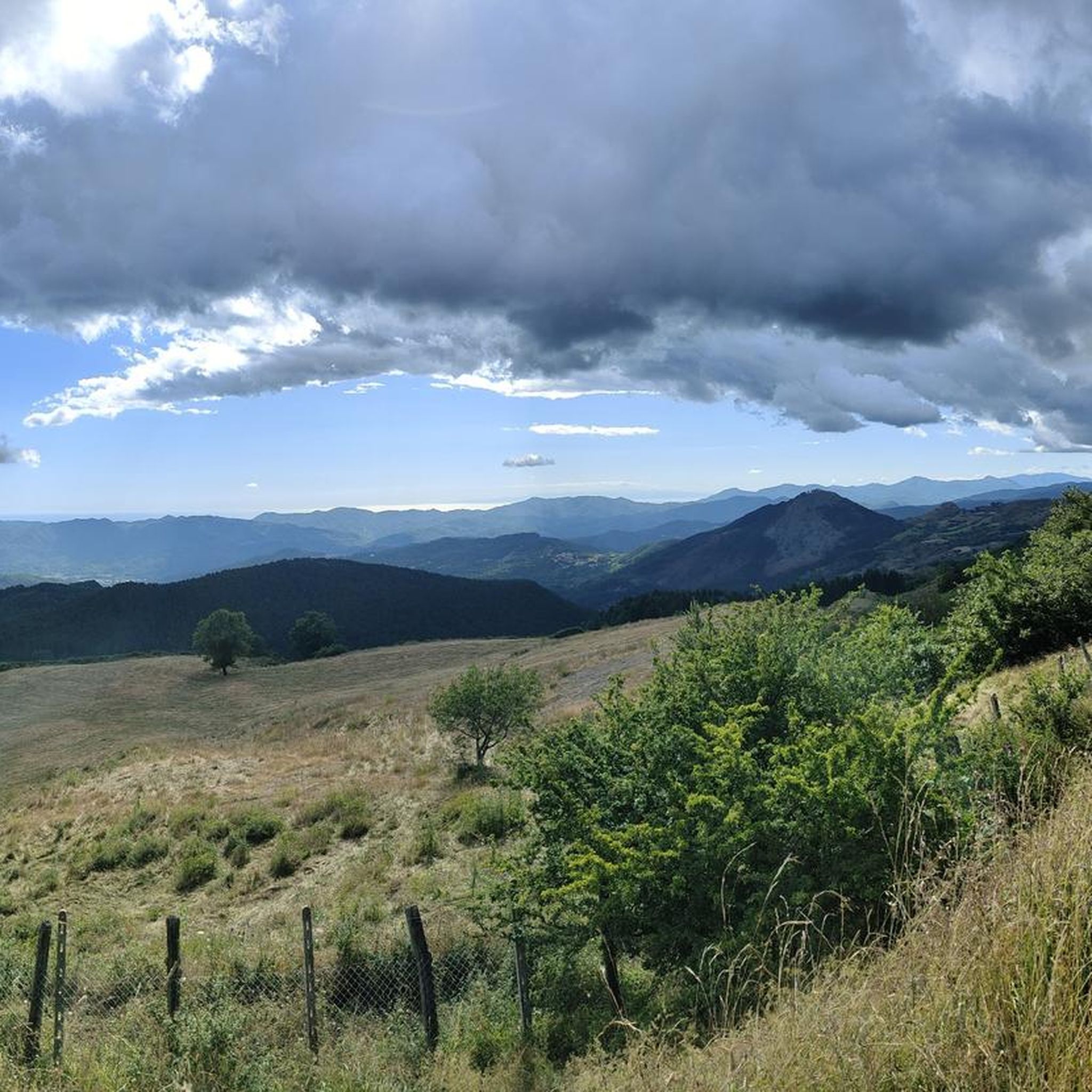
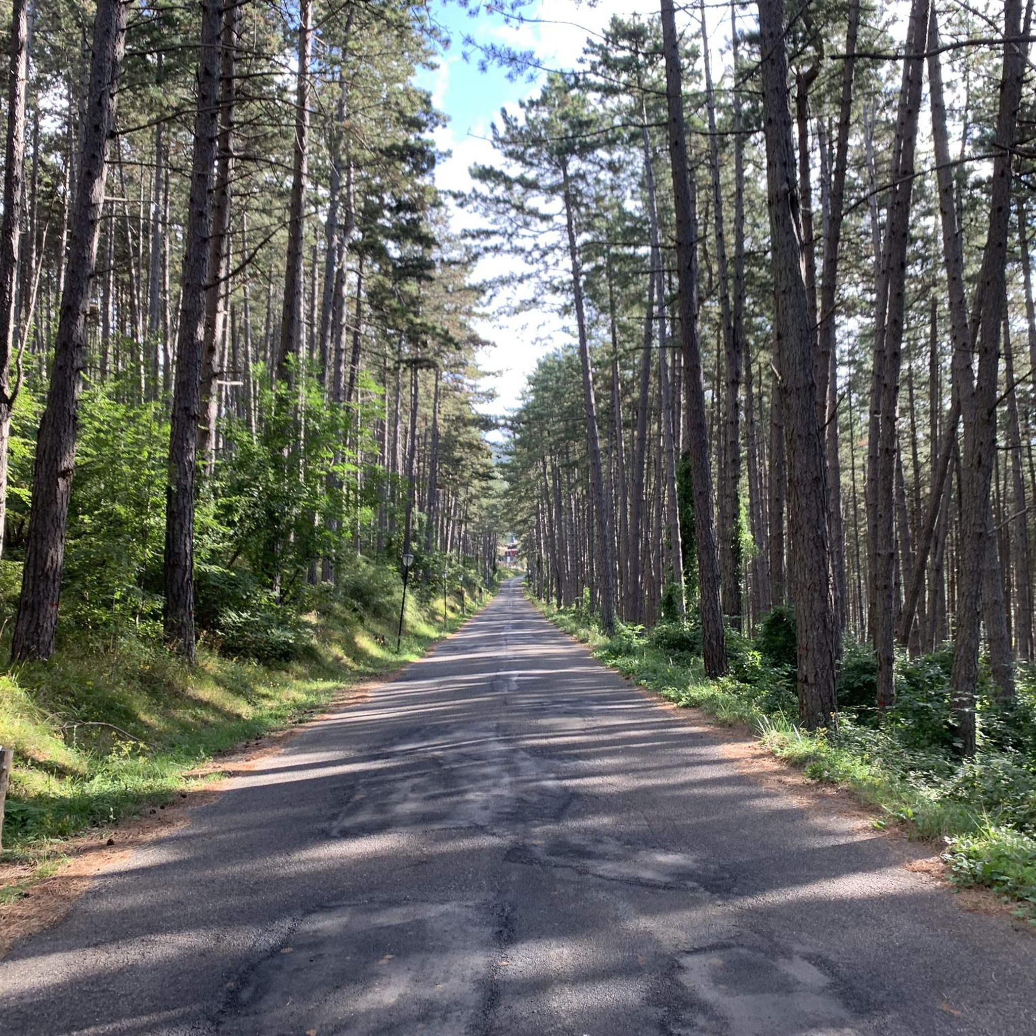
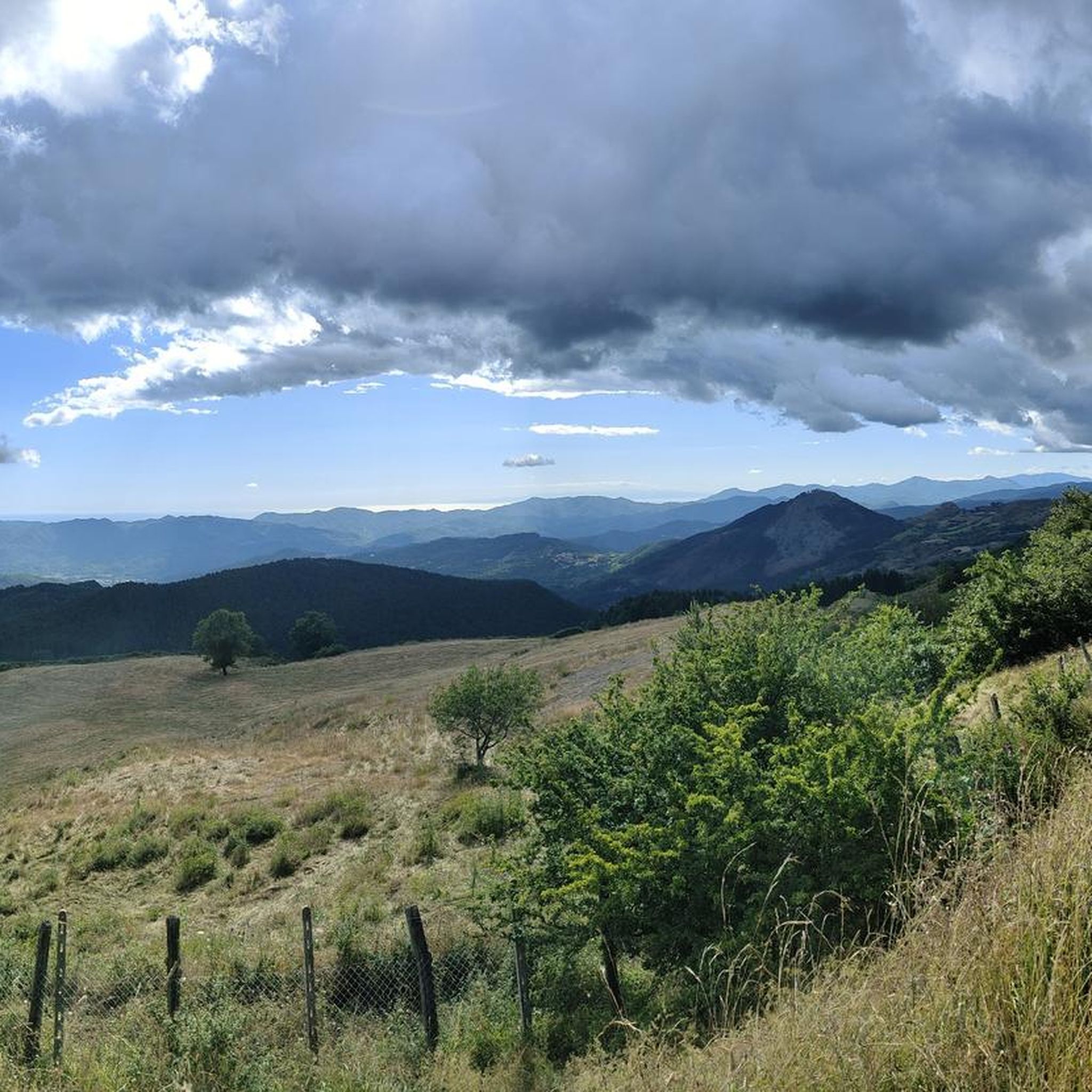
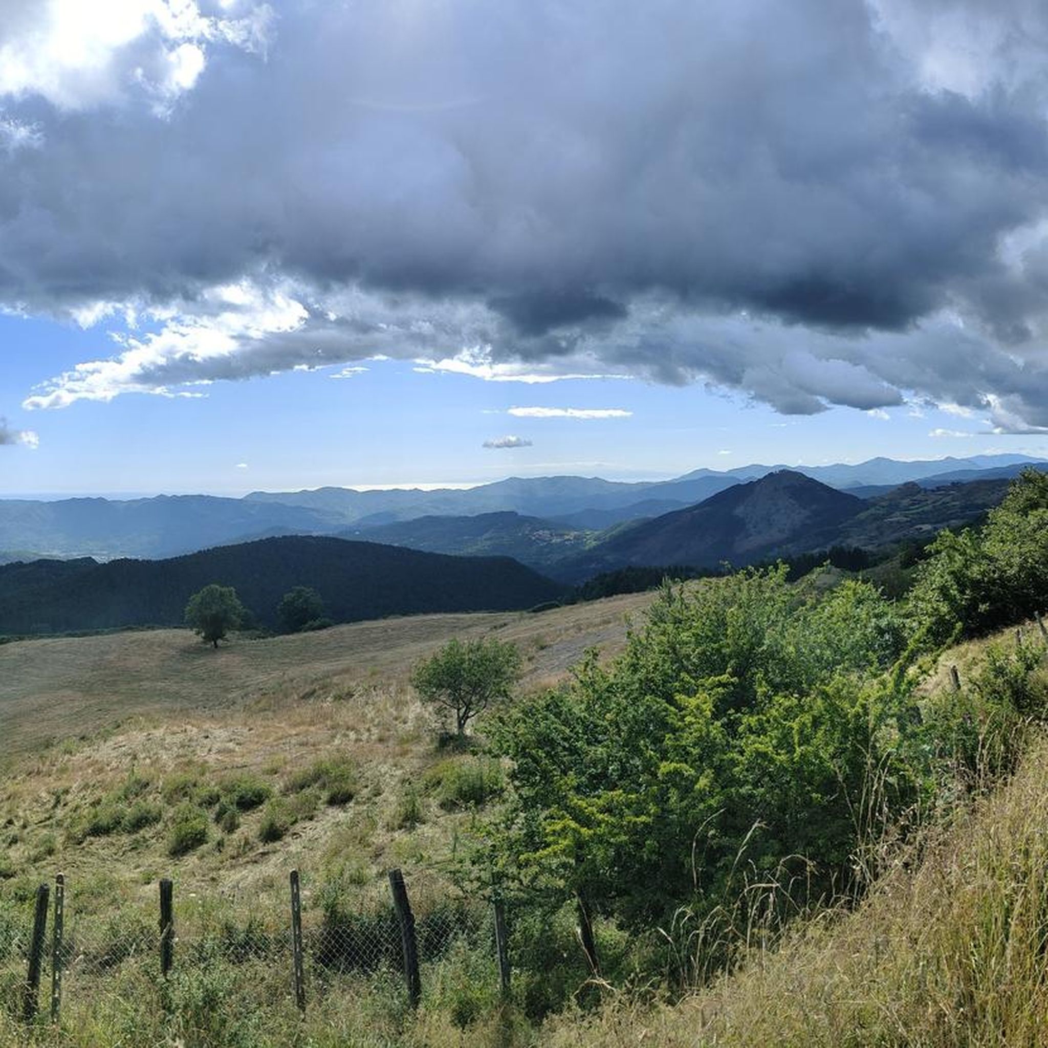
Touring cycling in Gruzza Di Veppo, located within a natural park in La Spezia, Italy, offers diverse terrain for cyclists. The region features rolling hills, extensive pine forests, and a mix of paved and unpaved surfaces. From higher elevations, distant sea glimpses are possible, contributing to varied and engaging rides. This area is also integrated with sections of the Alta Via dei Monti Liguri, providing access to longer routes that traverse between the sea and mountains.
Best touring cycling routes…
Last updated: July 13, 2026
5.0
(1)
14
riders
44.4km
04:37
1,240m
1,240m
Hard bike ride. Very good fitness required. Mostly paved surfaces. Suitable for all skill levels.
23
riders
40.5km
03:09
1,040m
1,040m
Hard bike ride. Very good fitness required. Mostly paved surfaces. Suitable for all skill levels.

Sign up for free
11
riders
35.2km
03:23
870m
870m
Hard bike ride. Very good fitness required. Mostly paved surfaces. Suitable for all skill levels.
1.0
(1)
11
riders
35.7km
02:24
570m
570m
Hard bike ride. Very good fitness required. Mostly paved surfaces. Suitable for all skill levels.
4.3
(3)
11
riders
27.7km
02:02
630m
630m
Hard bike ride. Very good fitness required. Mostly paved surfaces. Suitable for all skill levels.
Get access to more routes and recommendations from other explorers.
Sign up for free
Already have an account?
Our route recommendations are based on thousands of hikes, rides, and runs completed by other people on komoot.
Start today with a free account
Your next adventure awaits.
Login or Signup
Tips from the Community

small village but very suggestive and picturesque to pass by bicycle
0
0

The name Calice al Cornoviglio combines two distinctive elements of the village: "Calice," of uncertain origin but perhaps derived from the Latin calix (cup), referring to the site's concave shape, and "Cornoviglio," the mountain (561 m) that overlooks the village and lends its name to the entire ridge. This toponym appears in medieval documents and recalls the village's ancient connection with the surrounding Apennine territory. Calice was long ruled by the Malaspina dello Spino Secco family, who built a strategic castle there, documented since the 11th century and modified several times over the centuries. Today, the fortress houses the Diocesan Museum of Sacred Art and the Chestnut Documentation Center, two testimonies to the profound intertwining of history, spirituality, and the territory's resources. A short distance away is the parish church of Santa Maria Lauretana, an elegant 18th-century Baroque building with exquisite decorations and a polychrome marble high altar. The village comes alive throughout the year with traditional events such as the Feast of Our Lady of Loreto (September), the Chestnut Festival (October) and various summer festivals, which highlight the historical and cultural roots of the place.
0
0
During the Second World War, the Pra Bon area, located in the mountainous territory of the Municipality of Zeri (Massa-Carrara), played a strategic role in the supply network organized by the Allies for the partisan formations active in the Ligurian-Tuscan-Emilian Apennines. The location, a high grassy expanse located near the Foce di Prabono, was used as a launch field for materials intended for the liberation struggle. Due to its isolated position, difficult to access by land but visible from the sky and large enough to receive airdrops, Pra Bon was ideal for this purpose. Allied aircraft — generally taking off from southern Italy or from bases in Corsica — carried out night airdrops of weapons, ammunition, food, medicines and radio equipment intended for the partisan detachments operating in the area. The materials were parachuted and collected on site by the partisan brigades, who then took care of their distribution and protection. The operations were not without risks. The area was subject to continuous roundups by Nazi-Fascist forces, aware of the logistical importance of those places. In particular, on August 3, 1944, near the nearby Monte Picchiara, a violent clash took place between partisan forces and German troops during one of these roundups. The toponym "Pra Bon" or "Pra Bono", which means "good meadow" in the local dialect, still evokes the memory of that period: from a place of transhumance and summer pasture, it was transformed for a few crucial months into a clandestine hub of the Resistance, a meeting point between the mountains of Lunigiana and the liberated skies.
0
0

Village historically linked to the tradition of transhumance The ancient village of Noce is one of the first villages you encounter when entering the Zeri Valleys. In ancient times, the village of Noce was completely rural, historically linked to the work of shepherds and with them to the beautiful tradition of transhumance towards the town of Formentara. This took place through the ancient road called "Trianara", recently restored. During the Second World War, the village of Noce suffered a terrible roundup, during which almost the entire village was burned down. Today, the current village is very different from the original, which in ancient times was built almost entirely of stone arches and vaults.
0
0
Here the dirt road runs along the ridge of the mountains between the Vara Valley and the Magra Valley
0
0

Pignone. This village is really worth getting off the main road. Quiet and picturesque with narrow alleys and nice views
0
0
small picturesque village, really worth getting off the main road. very nice alleys with flowers and vistas
0
0
The Ponte della Cresa is a stone bridge built in the 14th century and despite the frequent flooding of the Verde river, it has maintained its original structure to this day. The bridge connects the new neighborhoods with the historic center. The bridge is located along the Verde river near Porta San Francesco. Under the arch of this bridge, on January 31, the characteristic fire of San Geminiano takes place. The Ponte della Cresa is considered by many to be the true symbol of the city of Pontremoli. It is also interesting to note that the name Pontremoli derives from the Latin 'Pons Tremulus', which means 'unsafe bridge'. This was a term used to describe the original conurbation of the city.
0
0
Frequently Asked Questions
How many touring cycling routes are available in Gruzza Di Veppo?
Gruzza Di Veppo offers a selection of 14 touring cycling routes. While most are considered difficult, there are also a couple of moderate options for those seeking a less strenuous ride.
What kind of terrain can I expect when touring cycling in Gruzza Di Veppo?
You can expect a diverse range of terrain, including rolling hills, extensive pine forests, and a mix of paved and unpaved surfaces. From higher elevations, you might even catch distant glimpses of the sea, making for visually engaging rides.
What is the overall difficulty level for touring cycling in Gruzza Di Veppo?
The majority of touring cycling routes in Gruzza Di Veppo are considered difficult, with 12 out of 14 routes falling into this category. There are also 2 moderate routes available. This suggests a challenging yet rewarding experience, often involving significant elevation gains.
What do other cyclists say about touring cycling in Gruzza Di Veppo?
The touring cycling routes in Gruzza Di Veppo are highly rated by the komoot community, with an average score of 4.7 stars from over 20 reviews. More than 200 touring cyclists have used komoot to explore the varied terrain here, often praising the scenic views and challenging climbs.
Are there any circular touring cycling routes in Gruzza Di Veppo?
Yes, many of the routes in Gruzza Di Veppo are designed as loops. For example, you can try the Poppy Flower Near Alpicella – Strada del Poggio Termine loop from Calice al Cornoviglio, which offers scenic views along ridge roads, or the Ponte della Cresa – Historic Center of Pontremoli loop from Zeri, connecting a historic center with a bridge.
Are there any routes suitable for beginner touring cyclists?
While most routes are difficult, there are two moderate touring cycling routes available in Gruzza Di Veppo. These might be more suitable for beginners or those looking for a less strenuous ride, though they still offer a good challenge.
What are some notable natural features I might encounter on a touring cycling route?
As Gruzza Di Veppo is located within a natural park, you'll encounter tranquil and unspoiled settings. Notable features include extensive pine forests, such as the "Pineta di Suvero," and varied flora and fauna characteristic of the Ligurian landscape. Many routes also offer stunning mountain and distant sea views.
Can I access the Alta Via dei Monti Liguri from Gruzza Di Veppo?
Yes, Gruzza Di Veppo is integrated with sections of the Alta Via dei Monti Liguri. This extensive trail, spanning the Liguria region, has parts adapted for cycling, offering a medium difficulty level. It features mule tracks and paths winding between the sea and mountains, accessible year-round. You can find more information about the Alta Via dei Monti Liguri on Italia.it.
Are there any touring cycling routes that pass through mountain passes?
Yes, some routes in the area include mountain passes. For instance, the Strada del Poggio Termine – Rastrello Pass loop from Zeri leads through ridge roads and mountain passes, offering a challenging and scenic experience.
What is the best time of year for touring cycling in Gruzza Di Veppo?
The Alta Via dei Monti Liguri, which has sections accessible from Gruzza Di Veppo, is generally cyclable year-round. However, for optimal conditions, spring and autumn offer pleasant temperatures and beautiful scenery, avoiding the peak heat of summer or potential winter snow at higher elevations.
Are there any routes that connect villages or historic centers?
Yes, some routes offer connections to local villages and historic sites. The Ponte della Cresa – Historic Center of Pontremoli loop from Zeri is a great example, linking a historic center with a bridge and varied landscapes.
What is the longest touring cycling route available in Gruzza Di Veppo?
The longest route listed is the Poppy Flower Near Alpicella – Strada del Poggio Termine loop from Calice al Cornoviglio, which spans approximately 42 kilometers (26.1 miles) and typically takes around 4 hours and 23 minutes to complete.
Most popular routes in Gruzza Di Veppo

Get inspired with the komoot mobile app


Explore more
Browse the best Cycling routes in other regions.
