The best road cycling routes in Weaselhead Flats
4.3
(82)
2,510
riders
59
rides
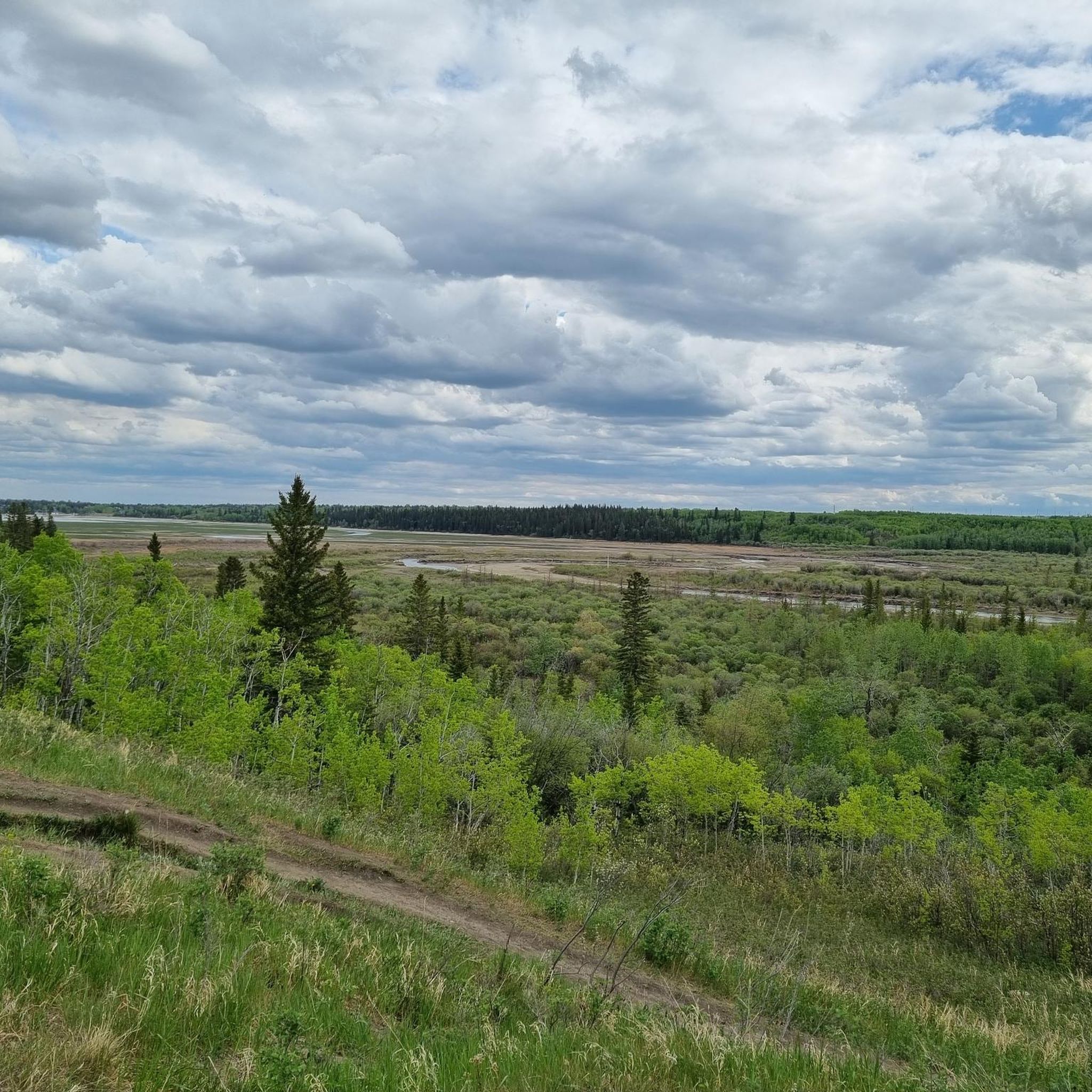
Road cycling in Weaselhead Flats offers routes through a unique natural environment where the Elbow River meets the Glenmore Reservoir, creating a diverse delta landscape. The area features wetlands, woodlands, and open meadows, providing varied scenery for cyclists. Pathways wind through stands of white spruce, balsam poplar, and trembling aspen forests. The terrain includes relatively flat sections along the reservoir and gentle rises, suitable for road cycling.
Best road cycling routes in Weaselhead Flats
- The most popular road cycling route is Glenmore Reservoir – View of the Reservoir loop from North Glenmore, a 18.4 miles (29.6 km) trail that takes 1 hour 21 minutes to complete. This easy route offers continuous views of the Glenmore Reservoir.
- Another top favourite among local road cyclists is Barry Erskine Bridge – Weaselhead Natural Area loop from Mount Royal University, a moderate 17.2 miles (27.7 km) path. This route navigates through the natural area, featuring woodlands and river views.
- Local road cyclists also love the Barry Erskine Bridge – Glenmore Dam loop from Sirocco, a 35.7 miles (57.4 km) trail leading through the Elbow River valley, often completed in about 2 hours 53 minutes.
- Road cycling in Weaselhead Flats is defined by routes along the Elbow River, around the Glenmore Reservoir, and through diverse woodlands and meadows. The network offers options for easy, moderate, and more challenging ability levels.
- The routes in Weaselhead Flats are highly rated by the komoot community with an average score of 4.3 stars from over 80 reviews. More than 2800 road cyclists have used komoot to explore Weaselhead Flats's varied terrain.
Last updated: July 10, 2026
32
riders
Moderate road ride. Great for any fitness level. Some segments of this route may be unpaved and difficult to ride.
4.5
(6)
196
riders
57.5km
02:53
400m
400m
Moderate road ride. Good fitness required. Mostly well-paved surfaces and easy to ride.

Sign up for free
5.0
(2)
101
riders
51.0km
02:19
430m
430m
Moderate road ride. Good fitness required. Mostly well-paved surfaces and easy to ride.
4.0
(1)
54
riders
29.6km
01:18
160m
160m
Easy road ride. Great for any fitness level. Mostly well-paved surfaces and easy to ride.
5.0
(1)
53
riders
40.2km
01:43
230m
230m
Easy road ride. Great for any fitness level. Mostly well-paved surfaces and easy to ride.
Get access to more routes and recommendations from other explorers.
Sign up for free
Already have an account?
Our route recommendations are based on thousands of hikes, rides, and runs completed by other people on komoot.
Start today with a free account
Your next adventure awaits.
Login or Signup
Popular around Weaselhead Flats
Tips from the Community

The bike path takes you to an elevated lookout platform with two benches where you can rest and enjoy a view over the Bow River.
1
0
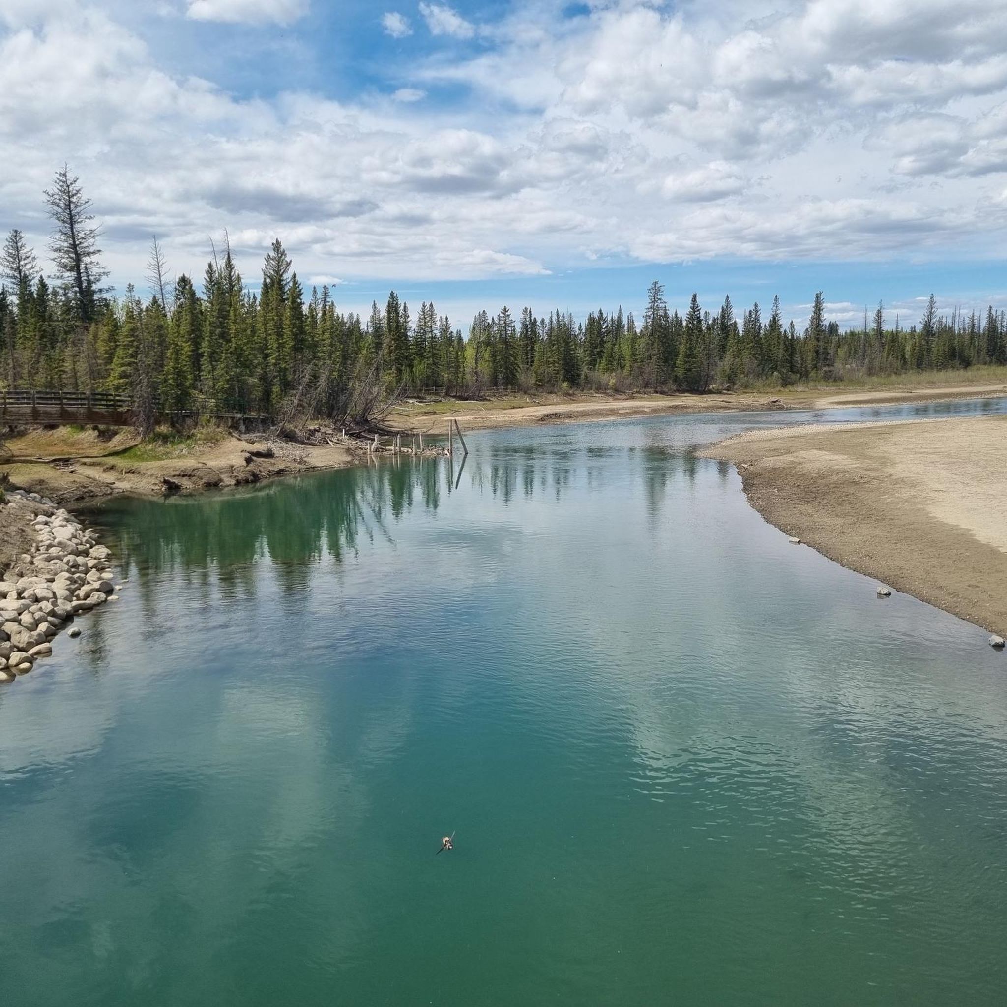
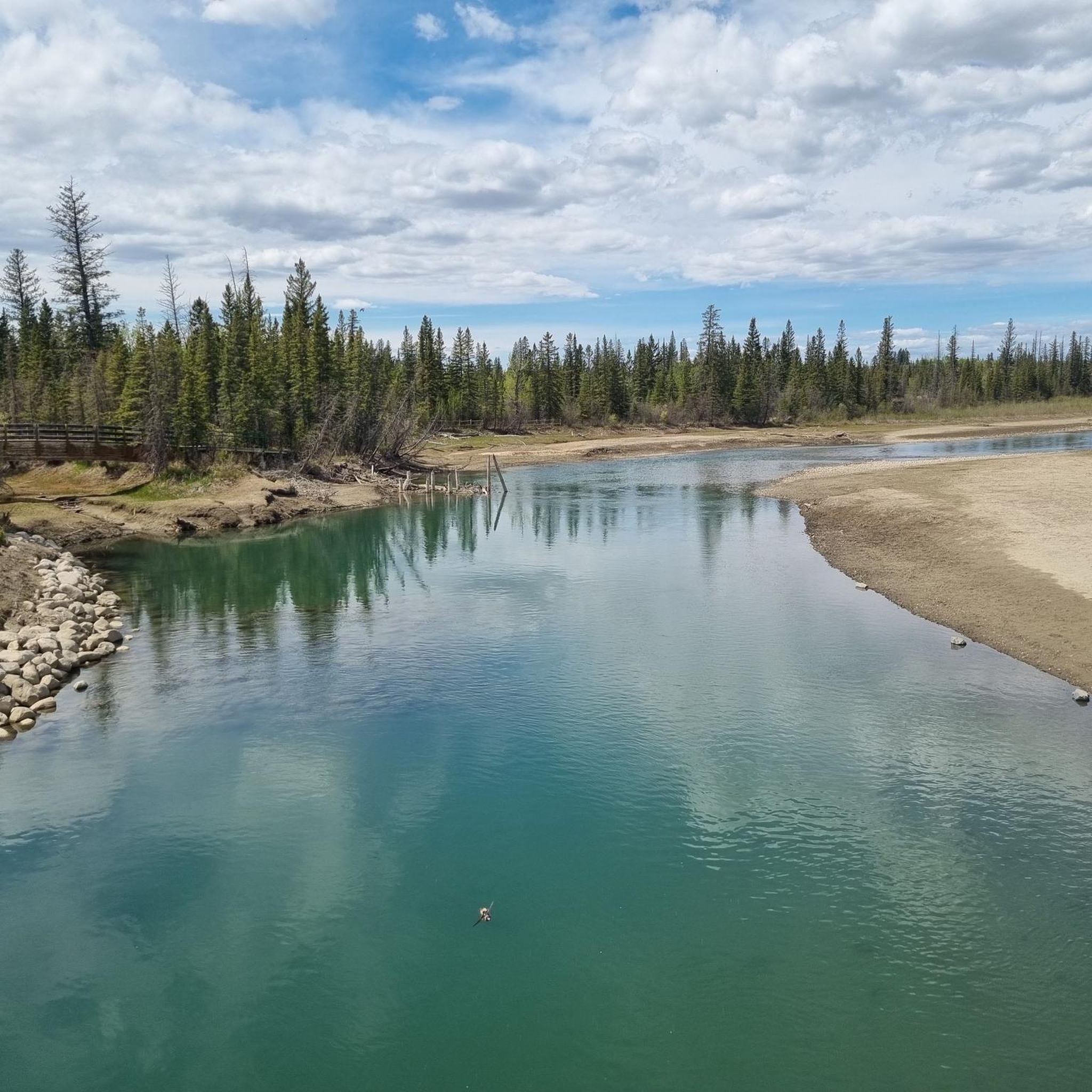
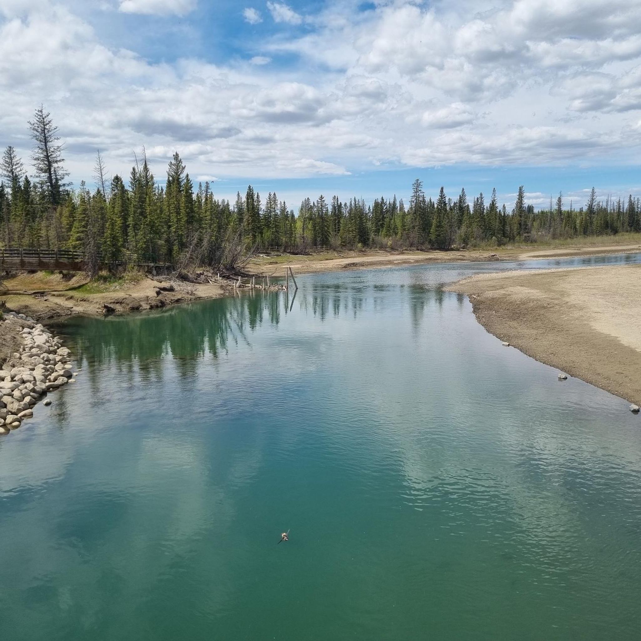
There is a little bench by the trail where you can sit and enjoy the views over the mouth of the Elbow River as it meanders into the reservoir.
0
0

Originating in the Rocky Mountains near Bragg Creek, the Elbow River flows east through Calgary before joining the Bow River downtown. Along its course, it passes through popular parks like Sandy Beach and Stanley Park, offering calm stretches for paddling and scenic riverside trails. Its clear waters and tree-lined banks make it one of Calgary’s most recognizable natural features.
0
0

Nose Creek Park preserves a beautiful stretch of the upper creek valley in northwest Calgary. Its unpaved, informal trails wind alongside the creek, weaving through grasslands and wetland areas. Unlike the more developed parks downstream, this space offers a more natural experience. The setting is open and minimally developed, with native vegetation and plenty of wildlife that reflect the typical prairie environment of Calgary.
0
0
The Bow River flows east through Calgary and forms part of the eastern boundary of Fish Creek Provincial Park. In this area, paved pathways and multi-use trails follow its banks, offering scenic access to water views, wildlife, and connections to Calgary’s greater pathway system. The river and adjacent parklands are popular for walking, cycling, fishing and enjoying open-air river scenery within the city’s natural green corridor.
0
0

From here, you can get a look at the docks of the Heritage Public Boat Launch and watch sailboats crisscross Glenmore Reservoir on a windy day.
0
0
Built in 1975, the big "H" is a massive log "H" with a rustic appearance, standing for Heritage Park.
0
0

The Barry Erskine Bridge spans over the Elbow River in Weaselhead Flats Natural Environment Park and is named after former city councillor Barry Erskine, who was an advocate for environmental protection and the preservation of the nature reserve. The bridge is an excellent viewpoint to watch wildlife.
1
0
Frequently Asked Questions
How many road cycling routes are available in Weaselhead Flats?
Weaselhead Flats offers a wide selection of road cycling routes, with over 60 different tours available. These routes cater to various skill levels, including 32 easy, 27 moderate, and 3 challenging options.
Are there road cycling routes suitable for beginners or families in Weaselhead Flats?
Yes, Weaselhead Flats is very accommodating for beginners and families. Many routes are integrated with the larger Glenmore Reservoir loop, which is a popular 16-kilometer paved path suitable for cyclists of all abilities. An excellent easy option is the Glenmore Reservoir – View of the Reservoir loop from North Glenmore, which is 29.6 km long and offers continuous scenic views.
What kind of terrain and natural features can I expect on road cycling routes in Weaselhead Flats?
Road cycling in Weaselhead Flats offers diverse scenery, from wetlands and woodlands to open meadows. You'll experience views of the Elbow River and the Glenmore Reservoir, with pathways winding through stands of white spruce, balsam poplar, and trembling aspen forests. The terrain includes relatively flat sections along the reservoir and gentle rises, making it ideal for road cycling.
Are there any notable landmarks or viewpoints along the road cycling routes?
Absolutely. The park is situated on a delta where the Elbow River meets the Glenmore Reservoir, offering unique views. A significant point of interest is the Barry Erskine Bridge over the Elbow River, known for hosting a large colony of cliff swallows. The cliff face on the north side of the park also provides a glimpse into geological history with visible silts from 'Glacial Lake Calgary'.
What is the best time of year to go road cycling in Weaselhead Flats?
The best time for road cycling in Weaselhead Flats is generally during the warmer months when the paved pathways are clear of snow and ice. Spring and autumn offer vibrant colors and comfortable temperatures, while summer provides longer daylight hours. The park's diverse flora, including trembling aspen forests, makes autumn particularly scenic.
Where can I park when visiting Weaselhead Flats for road cycling?
Weaselhead Flats is easily accessible, with a main parking lot located at 66th Avenue and 37th Street S.W. The park also connects to Calgary's extensive urban pathway network, offering various access points.
Are there any cafes or amenities near the road cycling routes in Weaselhead Flats?
While public washrooms within Weaselhead Flats are limited to portable toilets in the parking lot, adjacent North and South Glenmore Parks offer more amenities and facilities. For cafes, you might consider routes that pass closer to urban areas, such as the Annie's Café loop from Woodlands, which is an easy 29.3 km ride.
What do other road cyclists enjoy most about road cycling in Weaselhead Flats?
The komoot community highly rates road cycling in Weaselhead Flats, with an average score of 4.3 stars from over 90 reviews. Cyclists often praise the diverse scenery, the well-maintained paved pathways, and the tranquil escape offered by routes around the Glenmore Reservoir and through the natural areas.
Can I expect to see wildlife while road cycling in Weaselhead Flats?
Yes, Weaselhead Flats is known for its significant biodiversity. You might spot wildlife such as beavers, deer, coyotes, and occasionally even moose and black bears. The park is also home to over 200 bird species, offering opportunities for birdwatching during your ride.
Are there any longer, more challenging road cycling routes for experienced riders?
For experienced riders seeking a longer challenge, the Barry Erskine Bridge – Glenmore Dam loop from Sirocco is a moderate 57.4 km trail that leads through the Elbow River valley and can be completed in about 2 hours 53 minutes. Another moderate option is the Lazy Loaf Bakery – View of Bowmont Park loop from Sirocco, covering 50.7 km.
Are there any loop trails for road cycling in Weaselhead Flats?
Yes, many of the road cycling routes in Weaselhead Flats are designed as loops, allowing you to start and end at the same point. Popular loop options include the Glenmore Reservoir – View of the Reservoir loop from North Glenmore and the Barry Erskine Bridge – Weaselhead Natural Area loop from Mount Royal University.
Most popular routes in Weaselhead Flats
Most popular attractions in Weaselhead Flats

Get inspired with the komoot mobile app


Explore more
Browse the best Road cycling routes in other regions.
