The best cycling routes in Kootenay National Park
5.0
(6)
153
riders
8
rides
Touring cycling in Kootenay National Park offers routes through dramatic landscapes characterized by towering mountains, deep canyons, and lush forests. The park features significant geological formations such as Sinclair Canyon and Marble Canyon, carved by glacial melt and rivers. Cyclists can experience varied terrain, from paved segments to unpaved sections, with routes often following the Kootenay River and offering views of the Continental Divide. The region's elevation changes provide options for different fitness levels, from gentle valley rides to challenging climbs.
Best touring cycling routes in Kootenay National Park
- The most popular touring cycling route is Moraine Lake Road – Moraine Lake loop from Danger, a 48.5 miles (78.1 km) trail that takes 4 hours 56 minutes to complete, featuring significant elevation gain through mountain terrain.
- Another top favourite among local touring cyclists is Deja View Trail – View of Columbia Valley loop from Dry Gulch Provincial Park, a moderate 7.7 miles (12.5 km) path. This route offers views of the Columbia Valley and includes some elevation changes.
- Local touring cyclists also love the River's Edge View loop from Yearling Creek, an 8.3 miles (13.4 km) trail leading through river valleys, often completed in about 1 hour 17 minutes.
- Touring cycling in Kootenay National Park is defined by dramatic canyons, mountain vistas, and river valleys. The network offers options for various ability levels, from easy loops to difficult multi-hour rides.
- The routes in Kootenay National Park are highly rated by the komoot community with an average score of 5.0 stars from over 6 reviews. More than 170 touring cyclists have used komoot to explore Kootenay National Park's varied terrain.
Last updated: July 14, 2026
5.0
(1)
16
riders
Moderate bike ride. Good fitness required. Mostly paved surfaces. Suitable for all skill levels.
8
riders
13.4km
01:17
140m
140m
Easy bike ride. Great for any fitness level. Mostly paved surfaces. Suitable for all skill levels.

Sign up for free
5.0
(1)
12
riders
62.0km
03:57
710m
710m
Hard bike ride. Very good fitness required. Mostly paved surfaces. Suitable for all skill levels.
5.0
(1)
19
riders
79.7km
05:04
940m
940m
Hard bike ride. Very good fitness required. Mostly paved surfaces. Suitable for all skill levels.
4
riders
29.8km
01:51
270m
270m
Moderate bike ride. Good fitness required. Mostly paved surfaces. Suitable for all skill levels.
Get access to more routes and recommendations from other explorers.
Sign up for free
Already have an account?
Our route recommendations are based on thousands of hikes, rides, and runs completed by other people on komoot.
Start today with a free account
Your next adventure awaits.
Login or Signup
Popular around Kootenay National Park
Tips from the Community

A very beautiful lake. By far more beautiful than Lake Louise
1
0

For those who like to earn their views the Louise Creek Trail offers a great alternative to the busy bus stops and parking lots near the shore of Lake Louise. The trail climbs steeply from Lake Louise Village, tracing its namesake creek back to its source at Lake Louise. Along the way you'll be treated to great views of the creek and surrounding mountains. Though don't expect to catch a breather once you reach the lake, as the view is as likely to take your breath away as the steep trail.
0
0
The Markin-MacPhail Westside Legacy Trail is a 25 kilometer multi-use trail linking the towns of Invemere and Fairmont. The trail is dotted with a number of picnic area, viewpoint, benches, and information kiosks making it a great place for the family to get out and enjoy the scenery.
0
0
This multi-use trail traces the ledges overlooking the Columbia River Valley. You'll have great views along the way but keep an eye out for mountain bikers as well, especially around blind corners.
0
0
On a trail with many great viewpoints, this is one of the best. If the weather is clear you'll have a wide open look across the river and valley to the mountains on the other side.
0
0

It really feels like a fairy tale here.
4
0

This easy out-and-back trail leads to a viewpoint overlooking the expansive Columbia Wetlands — one of North America’s largest intact wetlands. Along the route you’ll pass forested sections and open ridge spots where you can pause and watch for birds, wildlife and sweeping valley views.
0
0
Lake Louise Village offers amenities like restaurants, grocery stores, and lodging. It's also just a short ride to the shoreline of the iconic Lake Louise.
0
0
Frequently Asked Questions
What kind of terrain can I expect when touring cycling in Kootenay National Park?
Kootenay National Park offers a diverse range of terrain for touring cyclists. You'll find both paved and unpaved segments, with routes often following the Kootenay River. Expect dramatic landscapes with towering mountains, deep canyons, and lush forests. Some routes involve significant elevation changes and steep climbs, while others are more gentle valley rides.
Are there any easy touring cycling routes suitable for beginners in Kootenay National Park?
Yes, there are routes suitable for beginners. For instance, the River's Edge View loop from Yearling Creek is an easy 13.4 km (8.3 miles) trail that leads through river valleys, typically completed in about 1 hour 17 minutes. This route is a great option for those looking for a less strenuous ride.
What natural attractions can I see along the touring cycling routes in Kootenay National Park?
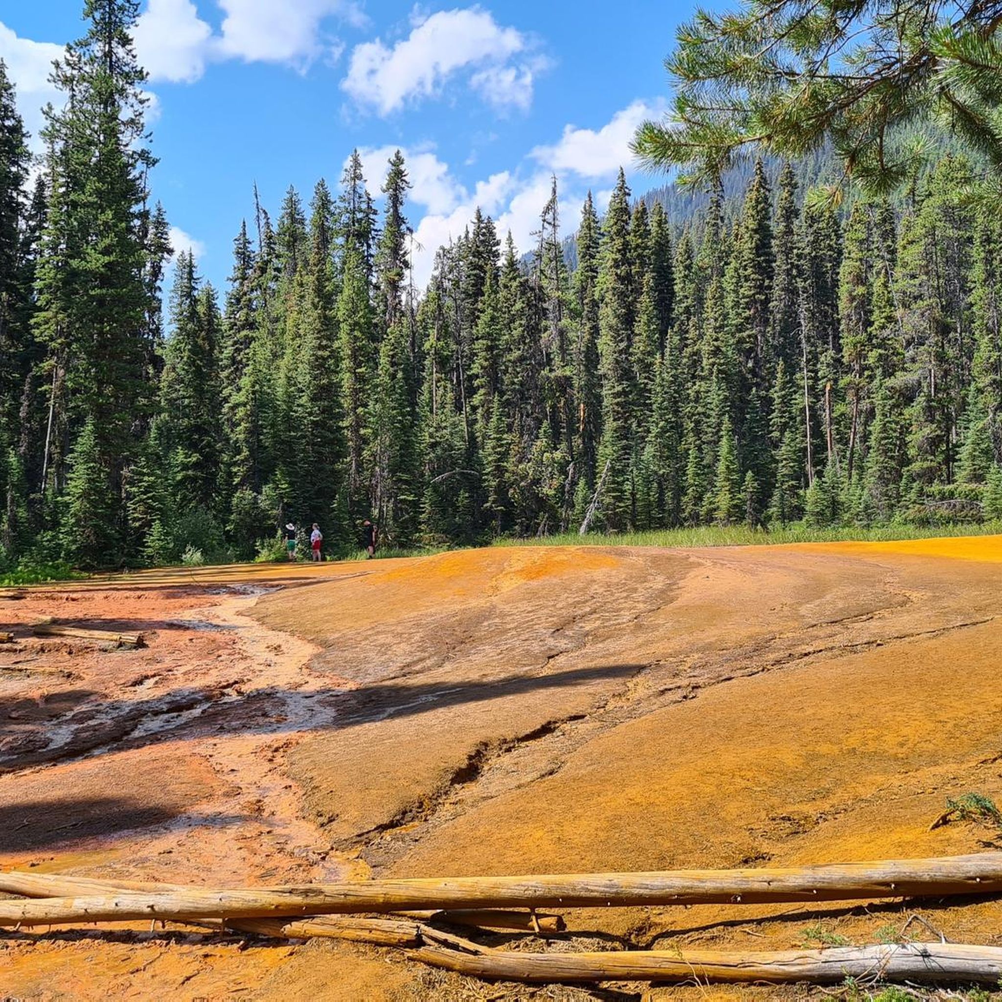
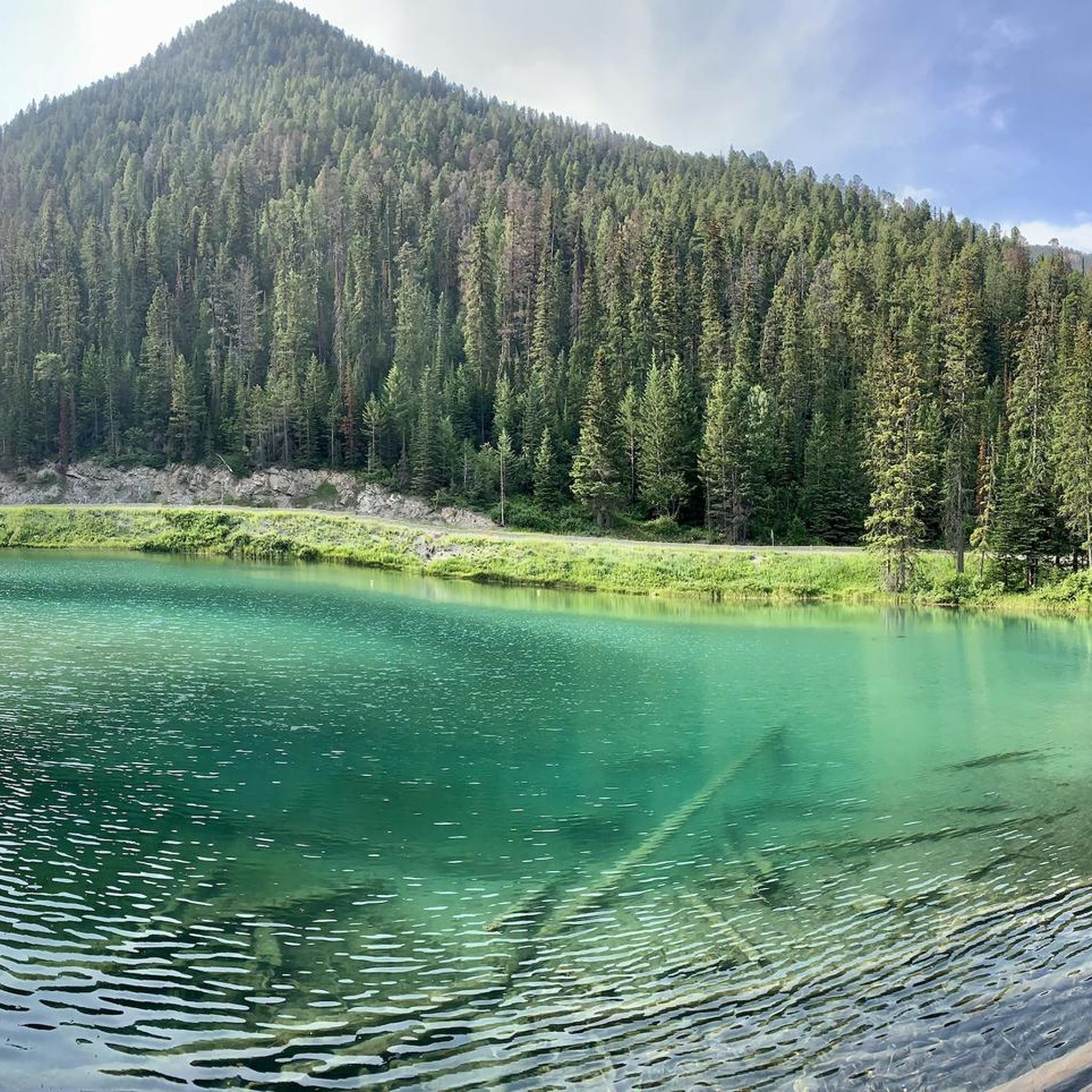
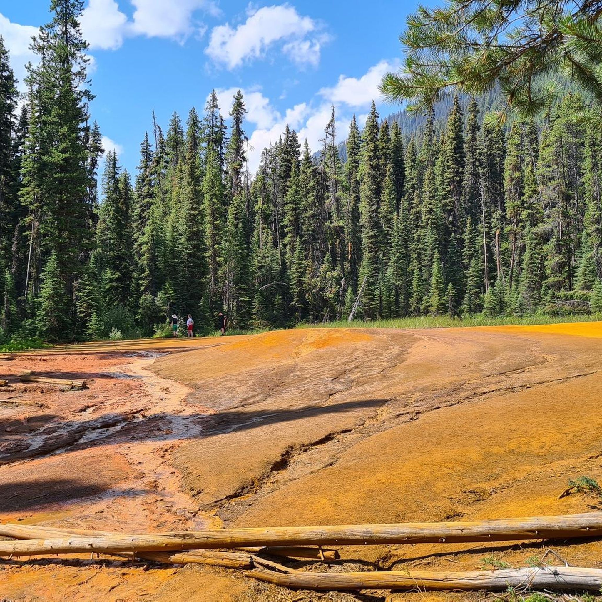
Kootenay National Park is rich with natural wonders. Along the routes, you can encounter impressive geological formations like Marble Canyon, where turquoise glacial waters carve through a deep gorge, or the vibrant Paint Pots. You might also pass by the powerful Numa Falls on the Vermilion River, or the serene Olive Lake. The Kootenay River itself is a prominent feature throughout the park.
Are there any moderate touring cycling routes with scenic views of the Columbia Valley?
Absolutely. The Deja View Trail – View of Columbia Valley loop from Dry Gulch Provincial Park is a moderate 12.5 km (7.7 miles) path that offers beautiful vistas of the Columbia Valley. This route includes some elevation changes, providing a rewarding experience with stunning scenery.
What is the best time of year for touring cycling in Kootenay National Park?
While specific seasonal conditions can vary, the warmer months, typically from late spring to early fall, are generally considered the best for touring cycling in Kootenay National Park. During this period, the weather is more favorable, and trails are usually clear of snow, allowing for optimal enjoyment of the park's dramatic landscapes and natural features.
What do other touring cyclists enjoy most about Kootenay National Park?
The touring cycling routes in Kootenay National Park are highly rated by the komoot community, with an average score of 5.0 stars. Cyclists often praise the dramatic canyons, towering mountains, and the serene river valleys. The diverse ecosystems and geological formations, such as Sinclair Canyon and Marble Canyon, are frequently highlighted as memorable aspects of their rides.
Are there any challenging touring cycling routes for experienced riders?
Yes, Kootenay National Park offers several challenging routes for experienced touring cyclists. For example, the Moraine Lake Road – Moraine Lake loop from Danger is a difficult 78.1 km (48.5 miles) trail with significant elevation gain through mountain terrain, taking nearly 5 hours to complete. Another demanding option is the Fairy Garden loop from James Chabot Provincial Park, which spans over 60 km and features substantial climbs.
Can I find any waterfalls or rivers along the cycling routes?
Absolutely. The park is home to several beautiful water features. You can easily access Numa Falls, a powerful display of the Vermilion River, which is a popular stop. The Kootenay River itself is a constant companion on many routes, offering scenic views and picnic areas along its banks. You might also encounter Sinclair Creek.
Are there any circular touring cycling routes available?
Yes, many of the touring cycling routes in Kootenay National Park are designed as loops, offering a convenient way to explore the area without needing a shuttle. Examples include the easy River's Edge View loop from Yearling Creek and the moderate Deja View Trail – View of Columbia Valley loop from Dry Gulch Provincial Park, both providing a complete circular experience.
What are some notable geological landmarks to look out for while cycling?
Kootenay National Park is renowned for its dramatic geological features. Keep an eye out for Sinclair Canyon, a narrow passage that serves as a dramatic entrance to the park. Marble Canyon is another impressive site where glacial waters have carved a deep limestone gorge. The Continental Divide, marking the boundary between British Columbia and Alberta, is also a significant geographical landmark and offers an epic photo opportunity.
Are there opportunities for multi-day touring cycling trips in the broader Kootenay region?
Yes, the broader Kootenay region is well-suited for multi-day road trips. Many cycling tours are designed to take visitors off the beaten path through majestic mountains, pristine forests, and winding rivers. These tours often feature tailored routes, local expertise, and support vehicles, ensuring a seamless experience for extended touring adventures.
How many touring cycling routes are available in Kootenay National Park?
There are over 9 touring cycling routes available in Kootenay National Park, catering to various skill levels. These include easy loops through river valleys, moderate rides with scenic views, and challenging routes with significant elevation gains through mountain terrain.
Most popular routes in Kootenay National Park
Most popular attractions in Kootenay National Park

Get inspired with the komoot mobile app


Explore more
Browse the best Cycling routes in other regions.
