The best cycling routes in Colony Farm Regional Park
4.4
(329)
2,042
riders
80
rides
Touring cycling in Colony Farm Regional Park offers accessible routes through varied landscapes. The park features largely flat, crushed gravel trails, providing scenic views of the Coquitlam River, expansive fields, and distant mountains. These paths connect to the broader Traboulay PoCo Trail, allowing for longer rides through diverse environments. The terrain includes open fields, hedgerows, and wetlands, supporting a rich ecological diversity.
Best touring cycling routes in Colony Farm Regional Park
- The most popular touring cycling route is Michael Forrest River Walkway loop from Mary Hill, a 12.5 miles (20.0 km) trail that takes 1 hour 33 minutes to complete, offering views along the Coquitlam River.
- Another top favourite among local touring cyclists is Gillnetter Pub – Taylight Brewing loop from Douglas Island, an easy 9.1 miles (14.6 km) path. This route navigates through areas with river views and urban connections.
- Local touring cyclists also love the Pitt River Bridge – Pitt River Dike Trail loop from Port Coquitlam, a 42.4 miles (68.2 km) trail leading through dike trails and riverfront areas, often completed in about 5 hours 2 minutes.
- Touring cycling in Colony Farm Regional Park is defined by flat crushed gravel paths, open fields, and wetlands, with routes offering options for easy, moderate, and difficult ability levels.
- The routes in Colony Farm Regional Park are highly rated by the komoot community with an average score of 4.4 stars from over 300 reviews. More than 2000 touring cyclists have used komoot to explore Colony Farm Regional Park's varied terrain.
Last updated: July 18, 2026
5.0
(5)
51
riders
Easy bike ride. Great for any fitness level. Mostly paved surfaces. Suitable for all skill levels.
3.0
(1)
12
riders
Easy bike ride. Great for any fitness level. Mostly paved surfaces. Suitable for all skill levels.

Sign up for free
4.3
(3)
59
riders
68.1km
04:51
160m
160m
Moderate bike ride. Good fitness required. Mostly paved surfaces. Suitable for all skill levels.
17
riders
88.4km
05:18
300m
300m
Hard bike ride. Very good fitness required. Mostly paved surfaces. Suitable for all skill levels.
13
riders
80.4km
05:31
1,280m
1,280m
Hard bike ride. Very good fitness required. Mostly paved surfaces. Suitable for all skill levels.
Get access to more routes and recommendations from other explorers.
Sign up for free
Already have an account?
Our route recommendations are based on thousands of hikes, rides, and runs completed by other people on komoot.
Start today with a free account
Your next adventure awaits.
Login or Signup

Tips from the Community

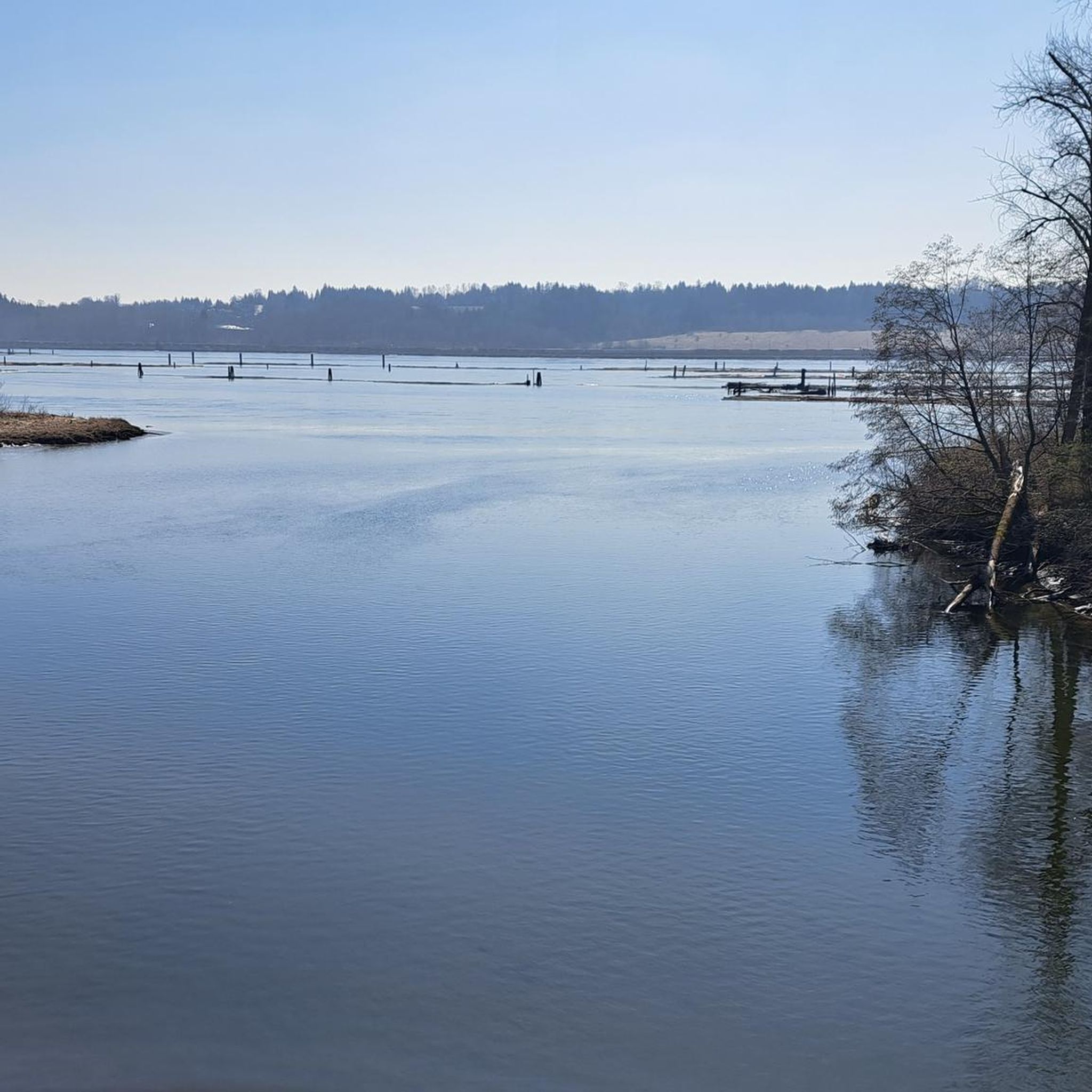
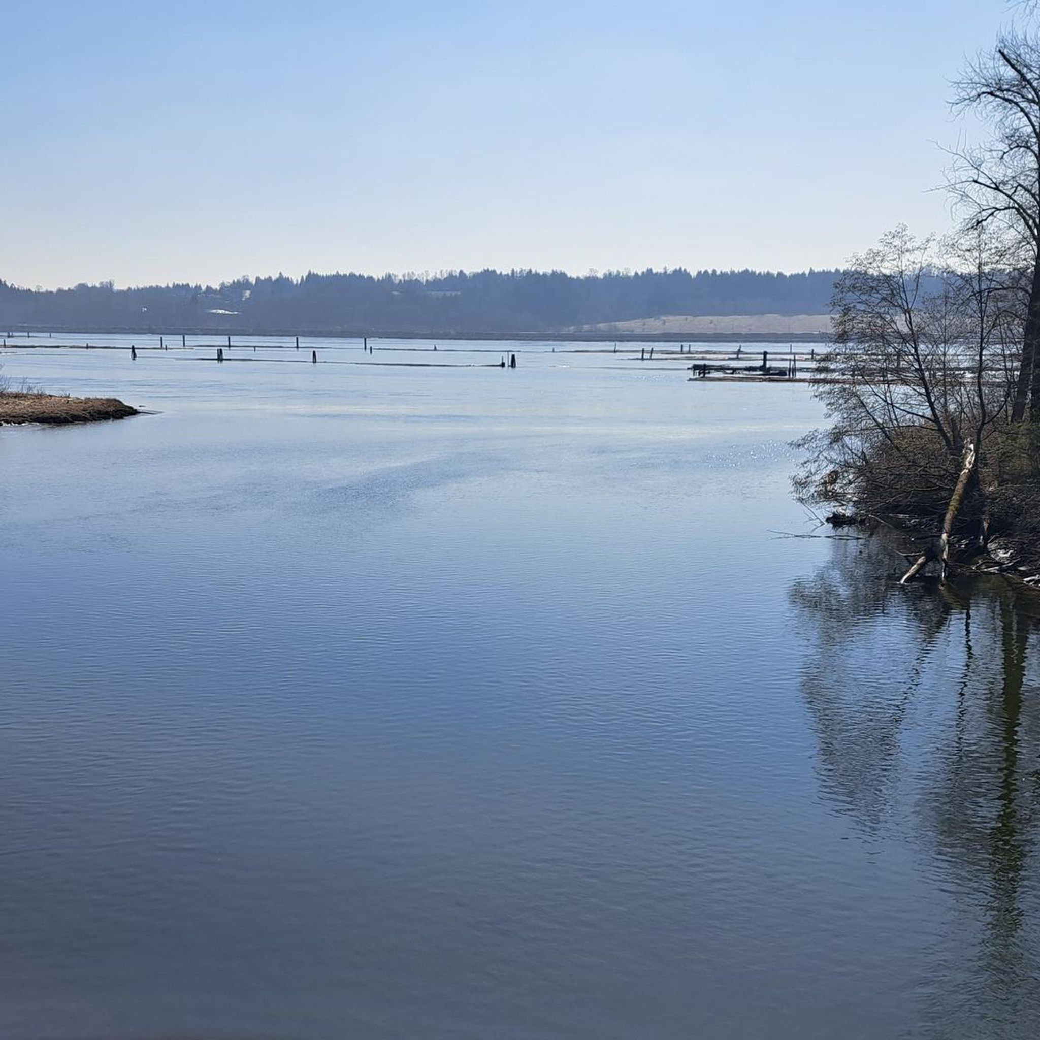
The view opens onto a slow, meandering river cutting through wide-open farmland — a mix of grassy fields, wetland patches, and hedgerows rather than dense forest crowding the banks.
0
0
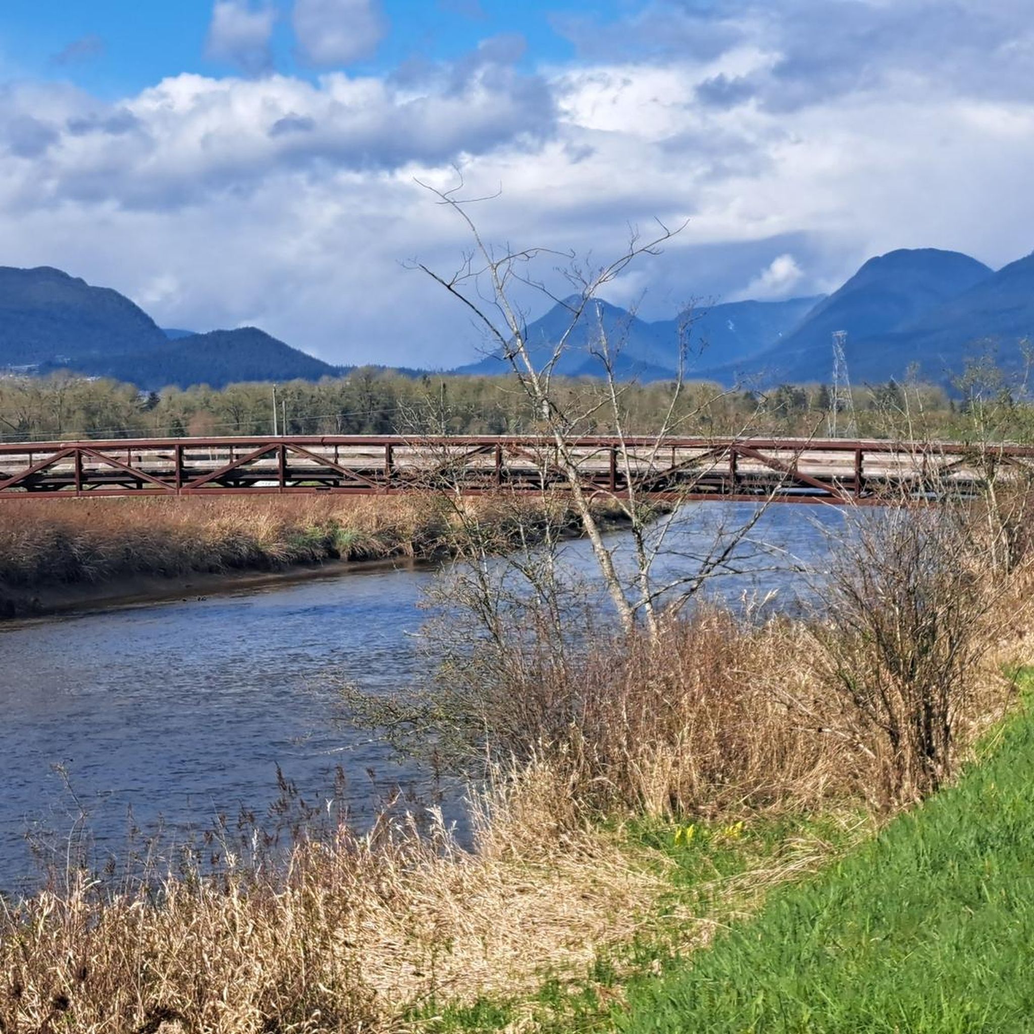
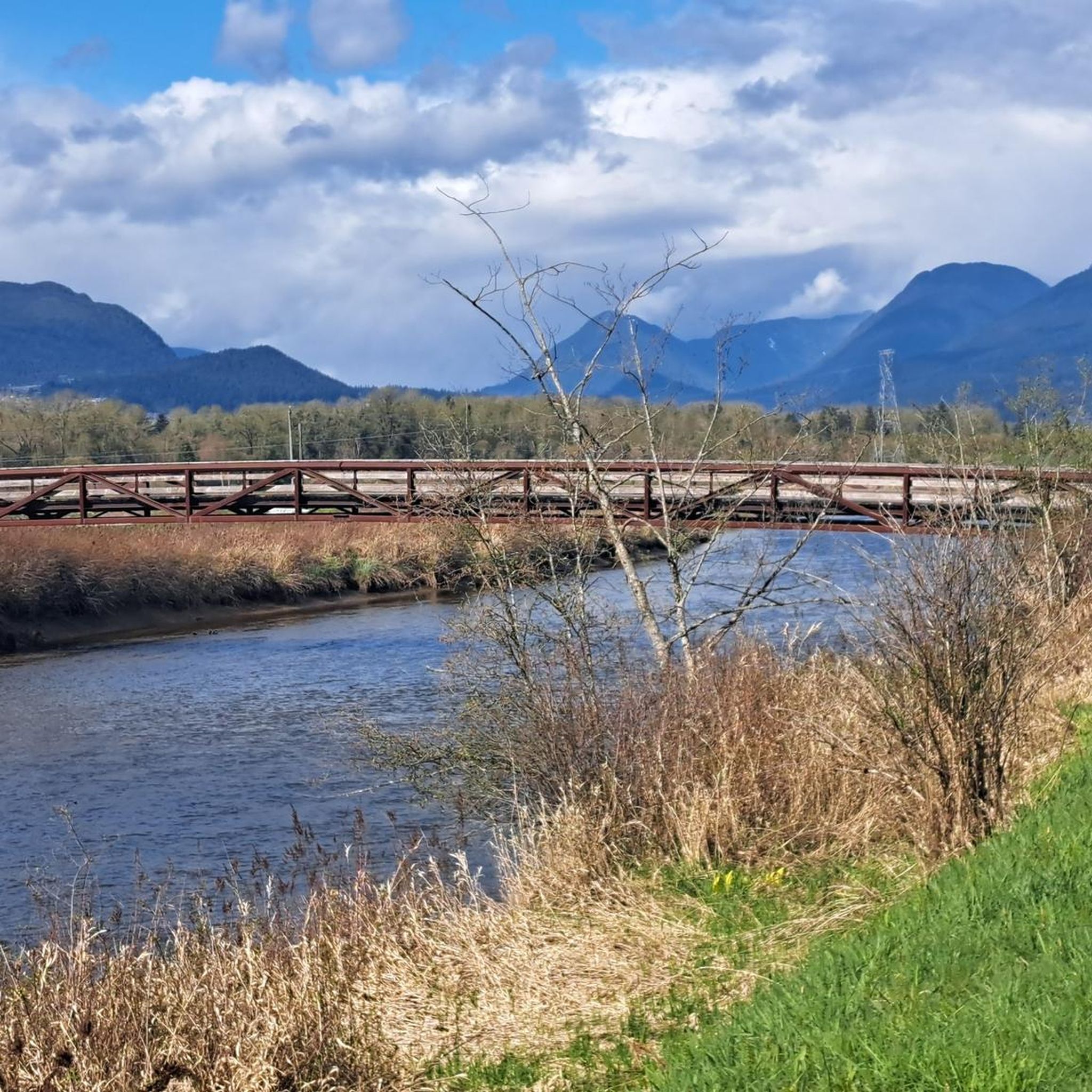
This brigde was built through community fundraising efforts led by the Colony Farm Park Association, working in partnership with Metro Vancouver, to give walkers and cyclists a direct river crossing within the park's trail network. It serves as a key junction point: crossing it lets visitors extend a walk into a longer loop, linking the western side of the park near the Community Gardens to the eastern Wilson Farm area, rather than backtracking the way they came.
0
0

You can walk down from the parking lot to a lookout point that peers between the treetops in the direction of Port Moody. The lookout is right along the road but separated from traffic by barricading.
0
0
Also known as the Harry Jerome Sports Centre, you can play volleyball here and the indoor cycling track has an incredible banked wooden oval. If it's open, the velodrome is well worth a step inside to see the cycling track if nothing else.
0
0
The park is very practical for visitors because it has clean public washrooms and a large, free parking lot. You can pack a lunch to enjoy at one of the many shaded picnic tables or check out the local food trucks that often park nearby.
0
0

Set along a quiet bend of the Fraser River, Fort Langley offers a window into the history of British Columbia. The wooden palisades, blacksmith shop, and heritage buildings trace the Hudson’s Bay Company era, while the parks live demonstrations bring the daily bustle of traders and voyageurs to life. For those interested in the Indigenous Stó꞉lō history you'll find traditional foods as the Ancestor Cafe, native artworks at Spirit Bear Designs, and storytelling from local Elders. It’s an easy place to wander and imagine yourself in a different time, soaking up river views, hands‑on demos, and the layered history that shaped the region.
0
0

This beautiful river is a major tributary of the Fraser River that flows south from the Garibaldi Ranges, through Pitt Lake, before joining the Fraser River near Port Coquitlam. The lower stretches of the river are tidal, and the surrounding wetlands are home to a rich diversity of wildlife. The river also holds cultural significance for the Kwantlen First Nation, serving as a natural corridor that connects the coastal region with the interior of the province.
0
0

On the east side of the bridge’s northern end, near the base of the bridge is a memorial to honor 27 workers who lost their lives on June 17, 1958, when a section of the original Second Narrows Bridge collapsed during construction.
0
0
Frequently Asked Questions
How many touring cycling routes are available in Colony Farm Regional Park?
There are over 90 touring cycling routes available in Colony Farm Regional Park, catering to various skill levels. This includes 27 easy routes, 47 moderate routes, and 17 difficult routes.
What is the typical terrain like for touring cycling in Colony Farm Regional Park?
The terrain in Colony Farm Regional Park is largely flat, primarily consisting of crushed gravel trails. Some routes may also include paved sections. The park features open fields, hedgerows, and wetlands, offering a diverse and scenic cycling experience.
Are there any family-friendly touring cycling routes in Colony Farm Regional Park?
Yes, Colony Farm Regional Park is well-suited for family cycling due to its largely flat and accessible crushed gravel trails. Many of the 27 easy routes are ideal for families. For example, the park's approximately nine kilometers of cycling trails are suitable for all skill levels.
Can I bring my dog on the touring cycling trails in Colony Farm Regional Park?
Colony Farm Regional Park is generally dog-friendly, but it's important to check specific park regulations regarding pets on trails. Dogs are typically welcome on leash, allowing you to enjoy the scenic rides with your canine companion.
What kind of natural features and wildlife can I expect to see while cycling?
The park offers scenic views of the Coquitlam River, expansive fields, and distant mountains. It's a vital wildlife habitat, home to over 200 bird species, including Great Blue Herons, owls, and hawks, as well as river otters and muskrats. You might also spot Chinook and Coho salmon fry in the enhanced wetlands.
Are there any specific points of interest or viewpoints along the cycling routes?
While cycling, you can enjoy picturesque views from the Millennium Bridge across the Coquitlam River. The park also features the Coquitlam River Community Garden and remnants of its agricultural past, such as a bunkhouse from around 1911 and the Manager's House from 1917.
What are some popular loop routes for touring cyclists in the area?
Many touring cyclists enjoy loop routes that allow them to explore different parts of the park and surrounding areas. A popular choice is the Michael Forrest River Walkway loop from Mary Hill, which offers views along the Coquitlam River. Another option is the Gillnetter Pub – Taylight Brewing loop from Douglas Island.
How long do the touring cycling routes typically take to complete?
The duration of routes varies significantly based on distance and your cycling pace. For instance, the Michael Forrest River Walkway loop from Mary Hill, at 12.5 miles (20.0 km), typically takes about 1 hour 33 minutes. Longer routes like the Pitt River Bridge – Pitt River Dike Trail loop from Port Coquitlam, which is 42.4 miles (68.2 km), can take around 5 hours.
Is there public transport access to Colony Farm Regional Park for cyclists?
Colony Farm Regional Park is accessible, and public transport options are available to get you close to the park. It's advisable to check local transit schedules and routes for the most convenient access points that accommodate bicycles.
Where can I park my car when visiting Colony Farm Regional Park for cycling?
Parking is available at Colony Farm Regional Park. Designated parking areas are provided for visitors, making it convenient to access the cycling trails. It's recommended to arrive early during peak times to secure a spot.
What do other touring cyclists say about their experience in Colony Farm Regional Park?
The touring cycling routes in Colony Farm Regional Park are highly rated by the komoot community, with an average score of 4.4 stars from over 300 reviews. Cyclists often praise the accessible, flat trails, the scenic river views, and the sense of being immersed in nature despite the park's urban proximity.
Are there any longer touring cycling routes that connect to other trails?
Yes, the trails within Colony Farm Regional Park connect to the extensive 25-kilometer Traboulay PoCo Trail, which loops around Port Coquitlam. This connection allows for significantly longer rides through diverse environments beyond the immediate park boundaries. An example of a longer route is the Pitt River Bridge – Fort-to-Fort Trail loop from Port Coquitlam.
Most popular routes in Colony Farm Regional Park

Get inspired with the komoot mobile app


Explore more
Browse the best Cycling routes in other regions.
