The best walks and hikes in Bowen Island Ecological Reserve
4.7
(107)
842
hikers
42
hikes
Hiking trails in Bowen Island Ecological Reserve traverse a landscape characterized by temperate rainforests, diverse forest ecosystems, and rocky outcrops. The region features tranquil lake views, old-growth forests, and significant elevation changes, particularly towards higher points. Many paths offer expansive views of Howe Sound, a UNESCO Biosphere Region. This varied terrain provides a range of hiking experiences within a preserved natural environment.
Best hiking trails in Bowen Island Ecological Reserve
- The most popular hiking route is Killarney Lake Loop Trail, a 4.7 miles (7.5 km) trail that takes 2 hours 1 minute to complete. This moderate path offers tranquil lake views and passes by Bridal Veil Falls.
- Another top favourite among local hikers is Killarney Lake – View of Killarney Lake loop from Bowen Island Municipality, an easy 2.6 miles (4.1 km) path. This route provides views of Killarney Lake and is suitable for shorter walks.
- Local hikers also love the Killarney Lake – View of Howe Sound loop from Bowen Island RCMP, a 9.6 miles (15.5 km) trail leading through varied terrain, often completed in about 6 hours 3 minutes.
- Hiking in Bowen Island Ecological Reserve is defined by temperate rainforests, Howe Sound views, and old-growth forests. The network offers options for different ability levels, from easy walks to challenging ascents.
- The routes in Bowen Island Ecological Reserve are highly rated by the komoot community with an average score of 4.8 stars from over 100 reviews. More than 900 hikers have used komoot to explore Bowen Island Ecological Reserve's varied terrain.
Last updated: July 18, 2026
4.9
(33)
186
hikers
7.51km
02:01
100m
100m
Moderate hike. Good fitness required. Easily-accessible paths. Suitable for all skill levels.
4.8
(8)
32
hikers
18.6km
06:34
770m
780m
Hard hike. Very good fitness required. Mostly accessible paths. Sure-footedness required.

Sign up for free
51
hikers
Easy hike. Great for any fitness level. Easily-accessible paths. Suitable for all skill levels.
5.0
(2)
37
hikers
Moderate hike. Good fitness required. Mostly accessible paths. Sure-footedness required.
4.7
(6)
16
hikers
16.4km
05:52
730m
720m
Hard hike. Very good fitness required. Mostly accessible paths. Sure-footedness required.
Get access to more routes and recommendations from other explorers.
Sign up for free
Already have an account?
Our route recommendations are based on thousands of hikes, rides, and runs completed by other people on komoot.
Start today with a free account
Your next adventure awaits.
Login or Signup
Popular around Bowen Island Ecological Reserve
Tips from the Community

The north summit of Mount Gardner offers one of the clearest viewpoints on the mountain, with open rock slabs overlooking Howe Sound and the surrounding islands. Compared to other viewpoints, it feels more exposed and elevated, with fewer trees blocking the view. The result is a wide, uninterrupted lookout with breathtaking views of the rugged coastline and distant mainland mountains.
0
0
From this scenic spot, you can soak in the view of Keats Island across Howe Sound, where the lush, forested island sits low in the water. This perspective is the perfect vantage point to see the layered inlets and smaller islets, creating a sense of depth rather than a wide panorama. On clear days, the contrast between the dark green shoreline and the sparkling water makes this one of the most impressive viewpoints on the mountain.
0
0

Bridal Veil Falls is a short cascade where Killarney Lake empties into Mannion Bay. You will see a fish ladder nearby where salmon can swim upstream.
0
0
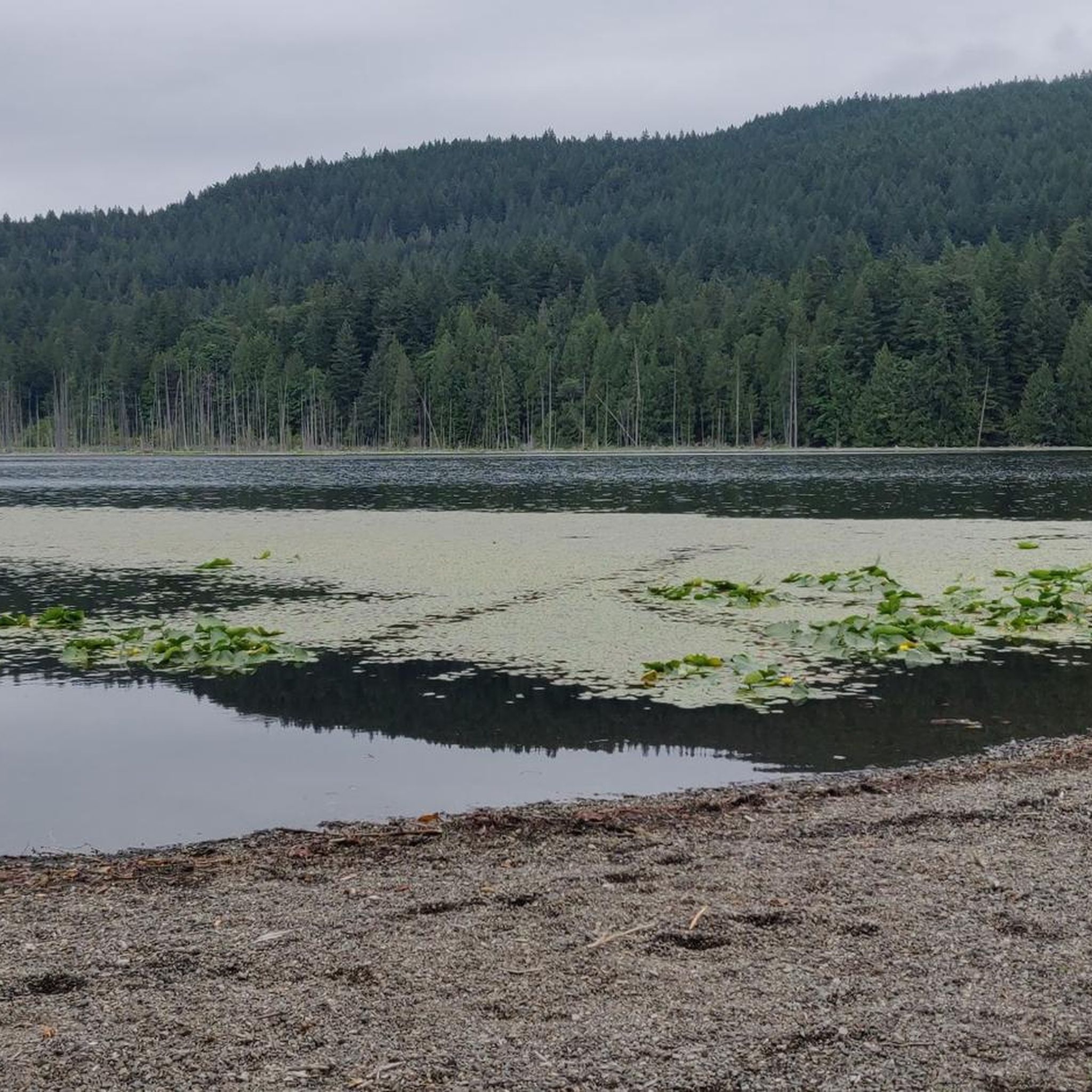
Killarney Lake View Point has a boulderous beach and great views from he south end of the lake to the north end. Swimming is allowed here but not recommended as there have been reporting of leeches in the water.
1
0
Killarney Lake can get a bit busy on the weekends, and for good reason, it's beautiful and accessible. Killarney Lake Loop Trail circles the entire lake, with plenty of viewpoints. Come early on the weekends in the summer for easier parking and less crowds.
0
0
Peer through an opening in the trees to get a view of Killarney Lake. This area feels truly wild and is inhabited by both bears and cougars, so be aware while hiking.
1
0

Not a real highlight, as it's in the middle of the forest and no view of Vancouver or the Pacific 😁
1
0

The lake has a healthy population of leeches. Swimming or wading is not advised.
0
0
Frequently Asked Questions
What types of landscapes will I encounter while hiking in Bowen Island Ecological Reserve?
You will hike through diverse landscapes, including temperate rainforests, old-growth forests dominated by Douglas-fir, and areas with western hemlock and western redcedar. Rocky outcrops are common, especially at higher elevations. Many trails also offer tranquil lake views and expansive vistas of Howe Sound, a UNESCO Biosphere Region.
Are there any waterfalls to see along the hiking trails?
Yes, the Killarney Lake Loop Trail features Bridal Veil Falls, a short cascade where Killarney Lake empties into Mannion Bay. It's a notable point of interest along this popular route.
What kind of views can I expect on the trails?
Many trails offer stunning panoramic views. From higher points like Mount Gardner, you can see Howe Sound, the Sunshine Coast, West Vancouver, and Burrard Inlet. Other trails, such as the Dorman Point Look-out, provide rewarding views of Howe Sound and surrounding islands like Passage Island, and on clear days, even Vancouver Island.
Are there family-friendly hiking options in the Ecological Reserve?
Yes, there are several easy trails suitable for families. For instance, the Killarney Lake – View of Killarney Lake loop from Bowen Island Municipality is an easy 4.1 km path that offers pleasant lake views and is perfect for shorter walks with children.
Are dogs allowed on the hiking trails?
The Bowen Island Ecological Reserve permits non-destructive activities such as hiking. Generally, dogs are allowed on trails in the broader Bowen Island area, but it's always best to keep them leashed to protect wildlife and ensure a pleasant experience for all hikers. Specific regulations for the Ecological Reserve itself should be observed.
How many hiking trails are available in Bowen Island Ecological Reserve?
There are over 35 hiking trails available in Bowen Island Ecological Reserve, catering to various fitness levels. This includes 9 easy routes, 19 moderate routes, and 11 difficult routes for more experienced hikers.
What is the most challenging hike in the area?
Mount Gardner, the island's highest peak, offers a more challenging hike with significant elevation gain. It features old-growth forests and rocky sections, rewarding persistent trekkers with extensive panoramic views. The Killarney Lake – View of Howe Sound loop from Bowen Island RCMP is another difficult option, covering 15.5 km with substantial elevation changes.
Are there circular hiking routes available?
Yes, many of the trails in Bowen Island Ecological Reserve are circular routes. Examples include the Killarney Lake Loop Trail and the Killarney Lake – View of Killarney Lake loop, both offering a complete circuit back to your starting point.
What wildlife might I see while hiking?
The reserve's focus on ecological preservation means it harbors important habitats. You might spot amphibians like the Northwestern Salamander and Pacific Treefrog, as well as Black-tailed Deer and Douglas's Squirrel. The diverse forest ecosystems also support various bird species.
What do other hikers enjoy most about the trails here?
The trails in Bowen Island Ecological Reserve are highly rated by the komoot community, with an average score of 4.8 stars. Hikers often praise the tranquil lake views, the beauty of the temperate rainforests, and the rewarding panoramic views of Howe Sound from higher elevations.
How can I get to Bowen Island Ecological Reserve?
Bowen Island is accessible by ferry from Horseshoe Bay in West Vancouver. Once on the island, various trailheads can be reached. For more detailed information on getting to Bowen Island and local transportation options, you can visit Tourism Bowen Island.
Are there any less crowded trails for a quieter experience?
While popular routes like the Killarney Lake Loop can see more visitors, exploring trails in the highlands on the east side of the island or those leading down to Cape Roger Curtis might offer a quieter experience, especially during off-peak times. The reserve's extensive network provides options to find solitude.
Most popular routes in Bowen Island Ecological Reserve

Get inspired with the komoot mobile app


Explore more
Browse the best Hikes in other regions.
