The best cycling routes in Reserva Forestal Protectora De Manantiales Cordillera Alux
5.0
(18)
186
riders
19
rides
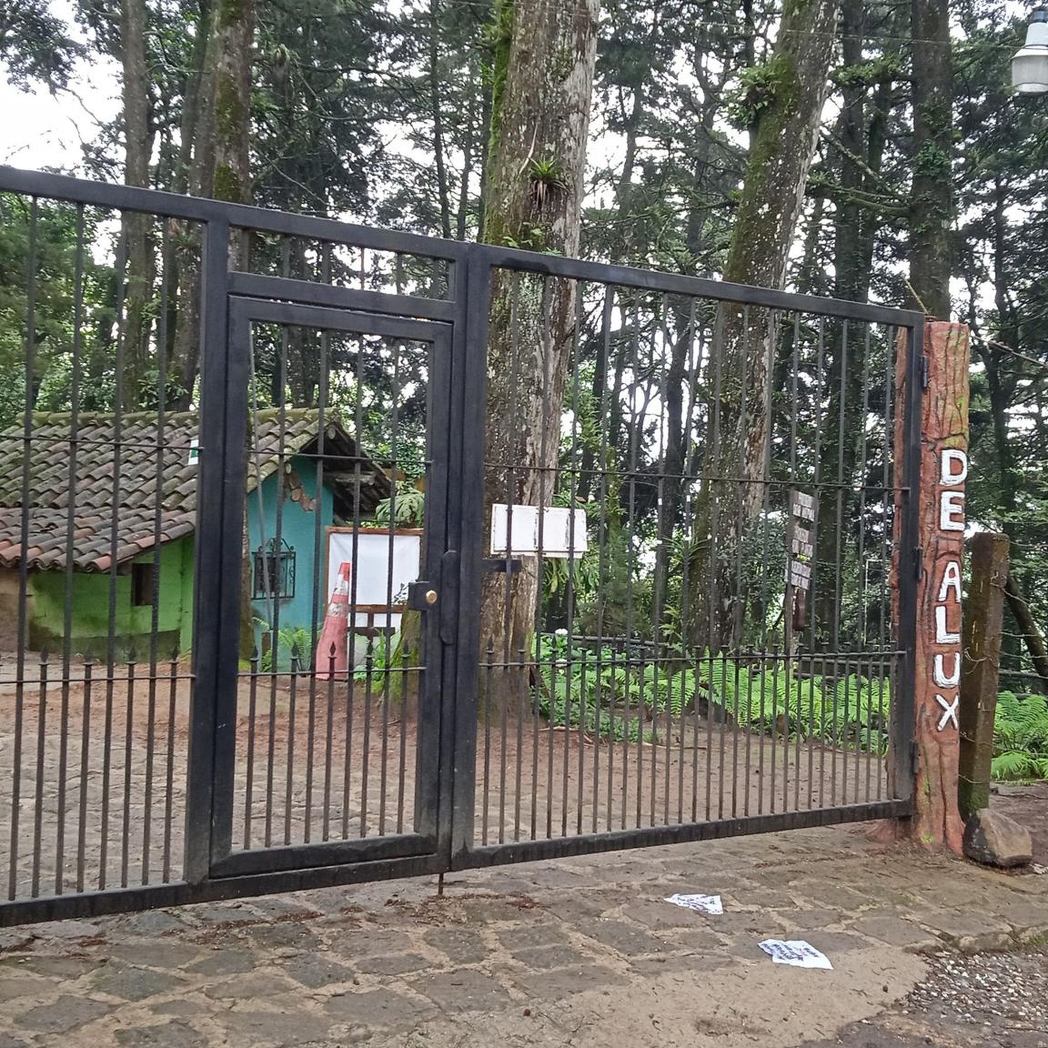
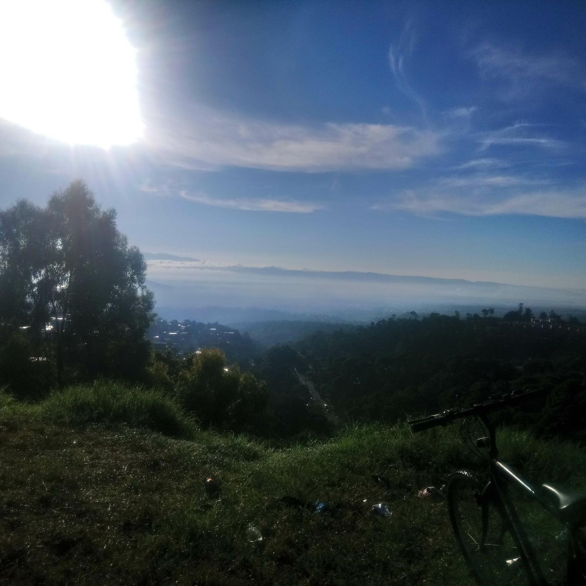
Touring cycling in Reserva Forestal Protectora De Manantiales Cordillera Alux offers routes through a landscape characterized by forested hills and valleys, with elevations typical of a cordillera. The region features natural springs and varied terrain suitable for cycling. These routes provide opportunities to explore the protected forest environment.
Best touring cycling routes in Reserva Forestal Protectora De Manantiales Cordillera Alux
- The most popular touring cycling route is Bike loop from Reserva Forestal Protectora de Manantiales Cordillera Alux, a 9.1…
Last updated: October 18, 2026
4
riders
14.7km
01:25
360m
360m
Moderate bike ride. Good fitness required. Mostly paved surfaces. Suitable for all skill levels.
5.0
(3)
34
riders
34.5km
03:01
850m
850m
Hard bike ride. Very good fitness required. Mostly paved surfaces. Suitable for all skill levels.

5.0
(2)
15
riders
34.0km
02:40
760m
760m
Hard bike ride. Very good fitness required. Mostly paved surfaces. Suitable for all skill levels.
5.0
(2)
10
riders
47.2km
03:41
1,110m
1,110m
Hard bike ride. Very good fitness required. Mostly paved surfaces. Suitable for all skill levels.
5.0
(1)
6
riders
36.1km
02:25
410m
410m
Moderate bike ride. Good fitness required. Mostly paved surfaces. Suitable for all skill levels.
Get access to more routes and recommendations from other explorers.
Already have an account?
Our route recommendations are based on thousands of hikes, rides, and runs completed by other people on komoot.
Start today with a free account
Your next adventure awaits.
Popular around Reserva Forestal Protectora De Manantiales Cordillera Alux
Tips from the Community

Right next to Plaza Central, a beautiful square with a park in the middle of the city
1
0
Located on the central square of Antigua in Guatemala. It serves as the headquarters of the Guatemalan Institute of Tourism, the Antigua Tourism Association, the National Police, and the Government of the Department of Sacatepquez. Wikipedia
2
0
The National Palace is in the center of Guatemala City, Zone 1. The Metropolitan Cathedral is next to it
0
0
The Palacio Nacional is a museum. Central square in Zone 1 of Guatemala City. The Metropolitan Cathedral is next to it.
0
0
beautiful green strip with bike path in Guatemala City
3
0
known as Plazuela Espagna until 2002, is a public square in Zone 9 of Guatemala City. In the center of the square stands the Carlos III Fountain in honor of King Carlos III of Spain. www.gpsmycity.com
0
0

The Palacio de los Capitanes Generales was the administrative headquarters of the Spanish colonial government. The building on the Parque Central was built in 1558, was damaged several times by earthquakes and is now a cultural center.
4
0

A wonderfully green park in the heart of the city. Sitting on one of the benches you can watch the hustle and bustle around you.
1
0
Frequently Asked Questions
What are the typical difficulty levels for touring cycling routes in Reserva Forestal Protectora De Manantiales Cordillera Alux?
The region offers a diverse range of routes. You'll find options for various skill levels, including 1 easy route, 11 moderate routes, and 10 difficult routes. This variety ensures that both beginners and experienced touring cyclists can find suitable paths through the forested hills and valleys.
How long do touring cycling routes in Reserva Forestal Protectora De Manantiales Cordillera Alux usually take to complete?
Route durations vary depending on distance and elevation. For example, the Bike loop from Reserva Forestal Protectora de Manantiales Cordillera Alux is a moderate 9.1-mile (14.7 km) trail that typically takes around 1 hour 24 minutes. More challenging routes, like the Short but Interesting loop from Zona 7 (21.7 miles / 34.9 km), can take over 3 hours due to significant elevation changes.
Are there any family-friendly touring cycling routes in the protected area?
While many routes feature varied terrain and elevation, there is at least one easy route available, which might be more suitable for families or those looking for a less strenuous ride. It's always recommended to check the route details on komoot for specific elevation and distance to ensure it matches your family's comfort level.
Are there circular touring cycling routes available in Reserva Forestal Protectora De Manantiales Cordillera Alux?
Yes, many of the touring cycling routes in the region are designed as loops, allowing you to start and end at the same point. A popular example is the Mirador Santo Domingo Mixco loop from La Brigada, which offers a 21.1-mile (34.0 km) journey through varied terrain.
What is the best time of year for touring cycling in Reserva Forestal Protectora De Manantiales Cordillera Alux?
Given its location as a protected forest area with natural springs and varied terrain, the region generally offers pleasant cycling conditions outside of the heaviest rainy seasons. The dry season, typically from November to April, often provides more stable weather and clearer paths, making it ideal for exploring the cordillera's landscapes.
What kind of terrain can I expect on touring cycling routes in this region?
The routes in Reserva Forestal Protectora De Manantiales Cordillera Alux are characterized by forested hills and valleys, with elevations typical of a cordillera. You can expect winding paths, some significant climbs and descents, and diverse scenery as you explore the protected forest environment.
What do other touring cyclists enjoy most about cycling in Reserva Forestal Protectora De Manantiales Cordillera Alux?
The area is highly rated by the komoot community, with an average score of 5.0 stars from over 10 reviews. Reviewers often praise the beautiful forested landscapes, the challenge of the varied terrain, and the opportunity to explore a protected natural environment.
Are there any routes that offer significant viewpoints or scenic overlooks?
Many routes in the cordillera region traverse elevated areas, providing opportunities for scenic viewpoints. For instance, the Mirador Santo Domingo Mixco loop from La Brigada suggests a route that includes a viewpoint, allowing cyclists to enjoy panoramic vistas of the surrounding landscape.
Are there any routes suitable for advanced touring cyclists looking for a challenge?
Absolutely. The region features 10 difficult routes designed for experienced cyclists. The Mountain – Santa Isabel Church loop from San Lucas Sacatepéquez is a challenging 29.3-mile (47.1 km) route with over 1100 meters of elevation gain, perfect for those seeking a demanding ride.
How many touring cycling routes are available in Reserva Forestal Protectora De Manantiales Cordillera Alux?
There are over 20 touring cycling routes documented in Reserva Forestal Protectora De Manantiales Cordillera Alux on komoot, offering a wide selection for various preferences and skill levels.
What kind of wildlife might I encounter while touring cycling in the protected forest?
As a protected forest area, Reserva Forestal Protectora De Manantiales Cordillera Alux is home to diverse flora and fauna. While specific sightings are never guaranteed, cyclists might encounter various bird species, small mammals, and insects typical of a Central American highland forest environment. Maintaining a respectful distance and observing quietly is always recommended.
Most popular routes in Reserva Forestal Protectora De Manantiales Cordillera Alux

Get inspired with the komoot mobile app


Explore more
Browse the best Cycling routes in other regions.
