The best cycling routes in Santuario De Flora Y Fauna Otún-Quimbaya
4.9
(26)
308
riders
6
rides
Touring cycling routes in Santuario De Flora Y Fauna Otún-Quimbaya traverse the western flank of Colombia's Central Andes Mountain Range. The region is characterized by humid Andean and sub-Andean forests, including extensive cloud forests, covering approximately 90% of its area. It features varied topography with hillsides, rivers, and numerous waterfalls, offering diverse terrain for cyclists. Unpaved access roads and trails provide opportunities for immersive cycling experiences through lush natural environments.
Best touring cycling routes in Santuario De Flora Y Fauna…
Last updated: October 28, 2026
5.0
(1)
157
riders
28.6km
03:26
1,110m
1,110m
Hard bike ride. Very good fitness required. Mostly paved surfaces.
4.7
(3)
35
riders
41.8km
03:35
880m
880m
Hard bike ride. Very good fitness required. Mostly paved surfaces.

19
riders
81.8km
05:51
1,670m
1,670m
Hard bike ride. Very good fitness required. Mostly paved surfaces.
18
riders
15.3km
01:25
410m
410m
Moderate bike ride. Good fitness required. Mostly paved surfaces.
9
riders
21.9km
02:36
910m
910m
Hard bike ride. Very good fitness required. Mostly paved surfaces.
Our route recommendations are based on thousands of hikes, rides, and runs completed by other people on komoot.
Start today with a free account
Your next adventure awaits.
Popular around Santuario De Flora Y Fauna Otún-Quimbaya


Tips from the Community

Unfortunately, it was closed this afternoon, but there was a lot of activity in the square in front of it.
0
0

The "Path to the River" refers to a trail leading down from the farm to the Río Quindío. The Finca is located about 4 km (approx. 1 hour on foot or 20 minutes by car/Willy-Jeep) southwest of Salento. A crystal-clear river flows about 300 meters below the farm. A marked path leads through the coffee plantations and a bamboo forest directly to the water. Alternative return route: Hikers often use a flat path along the river, which leads to the village of Boquía in about 35 minutes. From there, you can conveniently take a bus back to Salento to avoid the steep uphill return to the farm. In addition to river access, the farm offers guided tours.
0
0
The coffee farm Finca El Ocaso is a family-run plantation over 100 years old. The farm is located at about 1,900 meters altitude and is known for its sustainable farming practices and the traditional Colombian farmhouse with the characteristic colorful balconies. The Finca is open daily from 09:00 to 17:30. Various tours are offered.
0
0
The Calle Real (Carrera 6) is the pulsating heart of Salento and is considered one of the most photogenic streets in Colombia. The street is famous for its well-preserved colonial architecture. The two-story houses with their brightly painted balconies, doors, and window frames are the hallmark of the village. On the ground floors, you will find countless small shops selling traditional handicrafts, jewelry made from coffee beans, hand-woven ponchos (Ruanas), and of course, locally roasted specialty coffee.
0
0
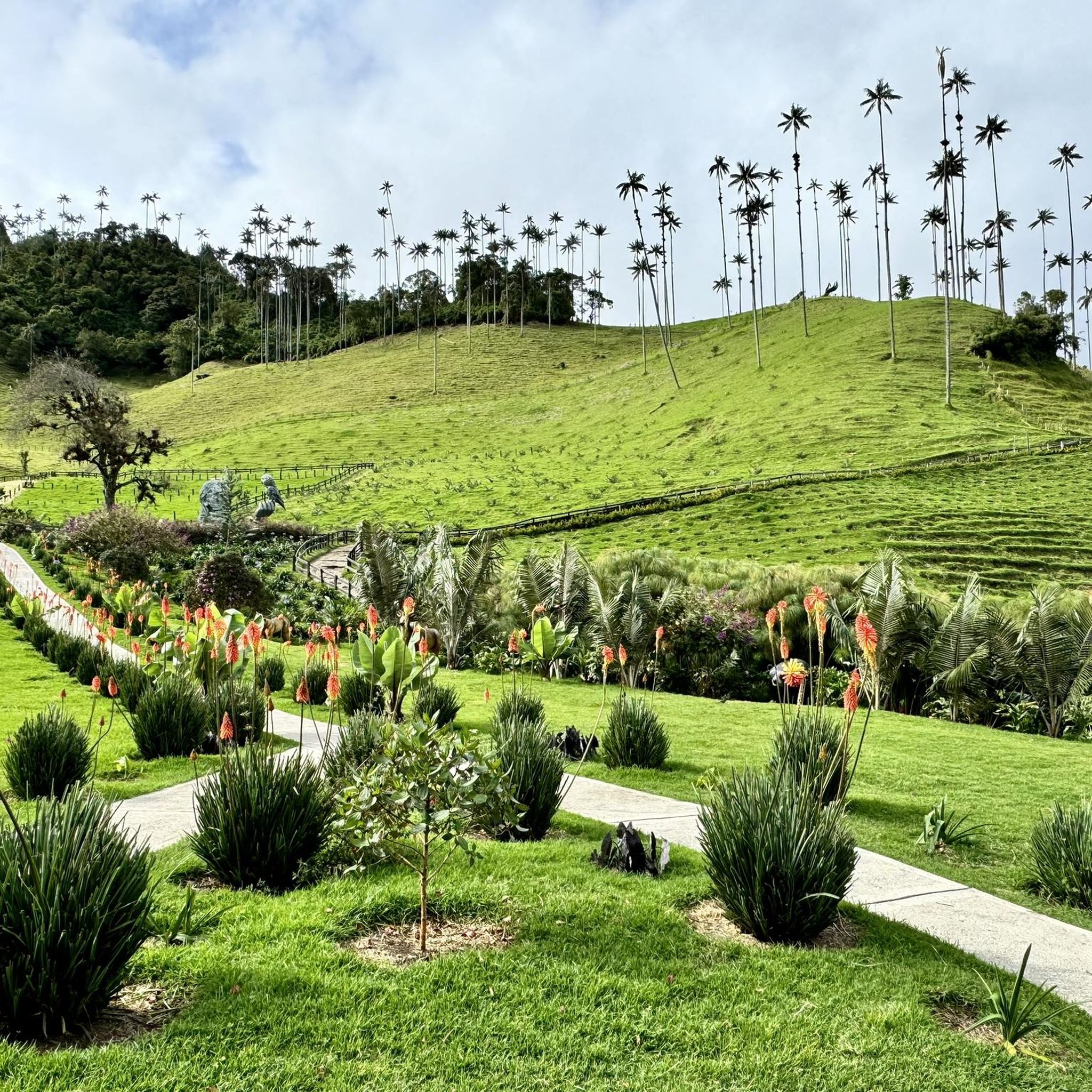
This is the viewpoint in Salento, Colombia, which offers a breathtaking view over the valley and the surrounding area. The place is a popular starting point for an easy hike, often referred to as the "Salento Viewpoint Loop". The area is known for the nearby Cocora Valley, which is famous for its tall wax palms. Nearby, there are also traditional coffee farms that offer tours of the production process.
0
0
A colorful municipality in the Colombian coffee region (Eje Cafetero), known for its colonial architecture and natural wonders. Famous for the wax palms (national tree of Colombia) up to 60 meters high. Culture: Colorful house facades in the Calle Real and numerous traditional coffee farms (Fincas) offering tours.
1
0
A colorful municipality in Colombia's Coffee Region (Eje Cafetero), known for its colonial architecture and natural wonders. Famous for the wax palms up to 60 meters high (Colombia's national tree). Culture: Colorful house facades in the Calle Real and numerous traditional coffee farms (Fincas) offering tours.
0
0
Plaza de Bolívar is the pulsating heart of Salento. This central square is known for its vibrant atmosphere, surrounded by colorful colonial buildings housing numerous restaurants, cafes, and artisan shops. Directly on the square stands the striking yellowish church of Nuestra Señora del Carmen. In the middle of the park, a statue of the liberator Simón Bolívar is enthroned. The square is the main hub for the famous Willys jeeps that transport hikers to the nearby Cocora Valley. Here you can try the local specialty trout with Patacón (fried plantains). On weekends, the square often transforms into a market with local crafts and street food.
0
0
Frequently Asked Questions
How many touring cycling routes are available in Santuario De Flora Y Fauna Otún-Quimbaya?
There are 7 touring cycling routes available in Santuario De Flora Y Fauna Otún-Quimbaya, offering a range of experiences through the region's diverse landscapes. Most of these routes are classified as difficult, with one moderate option.
What is the typical terrain like for touring cycling in the sanctuary?
The terrain for touring cycling in Santuario De Flora Y Fauna Otún-Quimbaya is highly varied, characterized by humid Andean and sub-Andean forests, hillsides (laderas), and unpaved roads. You can expect challenging ascents and descents, with routes like Salento – Cocora Valley loop from Boquía featuring over 1300 meters of elevation gain.
Are there routes suitable for beginners or families?
While most routes in the sanctuary are classified as difficult, there is one moderate option: Uik – Kiwi Café loop from Salento. This route covers 15.3 km with around 400 meters of elevation gain, making it a more accessible choice for those seeking a less strenuous ride or for families with some cycling experience.
What kind of natural features can I expect to see while cycling?
Cycling through Santuario De Flora Y Fauna Otún-Quimbaya offers an immersive experience in lush natural environments. You'll traverse extensive cloud forests, encounter beautiful rivers, and pass numerous waterfalls. The sanctuary is also a biodiversity hotspot, home to iconic wax palms, oak, and romerón trees, and offers opportunities for birdwatching, with over 300 species recorded.
Are there any circular touring cycling routes?
Yes, several touring cycling routes in the sanctuary are circular, allowing you to start and end in the same location. Examples include Salento – View of Predio El Tablazo loop from Salento and Salento Viewpoint – Salento loop from Salento, which offer varied terrain and scenic viewpoints.
What are the elevation changes like on these routes?
The touring cycling routes in Santuario De Flora Y Fauna Otún-Quimbaya feature significant elevation changes due to the region's varied topography. For instance, the Salento – Circasia Bridge loop from Salento involves over 1600 meters of ascent and descent, providing a challenging workout through the Andean forests.
What do other cyclists say about their experience in Santuario De Flora Y Fauna Otún-Quimbaya?
The touring cycling routes in Santuario De Flora Y Fauna Otún-Quimbaya are highly rated by the komoot community, with an average score of 4.8 out of 5 stars from more than 20 reviews. Cyclists often praise the immersive experience through lush Andean forests, the varied topography, and the opportunity to explore away from paved urban areas.
Is it possible to bring dogs on the touring cycling trails?
The Santuario de Flora y Fauna Otún-Quimbaya is a protected area managed by Parques Nacionales Naturales de Colombia. Generally, pets are not allowed inside national natural parks to protect wildlife and ecosystems. It is advisable to check the official regulations on the Parques Nacionales website before planning your visit with a dog.
What is the best time of year to go touring cycling in the sanctuary?
The Santuario de Flora y Fauna Otún-Quimbaya is characterized by humid Andean and sub-Andean forests, meaning it can experience rainfall throughout the year. However, generally, the drier months (often December to March and July to August) might offer more comfortable cycling conditions. Always check local weather forecasts closer to your travel dates.
Are there any specific permits required for cycling in the Santuario De Flora Y Fauna Otún-Quimbaya?
As a protected area, entry to the Santuario de Flora y Fauna Otún-Quimbaya typically requires an entrance fee and potentially a permit, especially for certain activities or extended stays. It is highly recommended to consult the official Parques Nacionales Naturales de Colombia website for the most current information on entry requirements and permits.
Where can I park my car if I'm bringing my touring bike?
The sanctuary is located about 14-16 km from Pereira, with unpaved access roads leading to it. If you are driving, you would typically park near the entrance or designated areas outside the core protected zones. For specific parking information related to starting points of routes, it's best to check local visitor information or the details provided on individual komoot tour pages.
Are there any places to eat or drink near the cycling routes?
While the sanctuary itself is a natural reserve, the nearby town of Salento, which serves as a common starting point for many routes, offers various cafes and restaurants. For example, the Uik – Kiwi Café loop from Salento suggests there are establishments accessible from the routes, particularly around the towns or villages bordering the sanctuary.
Most popular routes in Santuario De Flora Y Fauna Otún-Quimbaya

Get inspired with the komoot mobile app


Explore more
Browse the best Cycling routes in other regions.
