The best walks and hikes in Tharwa Bridge Recreation Area
4.4
(7)
192
hikers
6
hikes
Hiking in Tharwa Bridge Recreation Area offers diverse trails along the Murrumbidgee River, south of Canberra. The region is characterized by its riverine landscapes, prominent hills like Mount Tennent, and historical sites. Trails often follow the riverbanks, providing scenic views, while others ascend into the surrounding hills, offering varied elevation gains. The area serves as a gateway to Namadgi National Park, featuring a mix of open spaces and more rugged terrain.
Best hiking trails in Tharwa Bridge Recreation Area
- The…
Last updated: July 22, 2026
4.8
(6)
137
hikers
14.1km
04:49
760m
760m
Moderate hike. Good fitness required. Easily-accessible paths. Suitable for all skill levels.
13
hikers
20.4km
06:46
960m
960m
Hard hike. Very good fitness required. Easily-accessible paths. Suitable for all skill levels.

Sign up for free
4.0
(1)
6
hikers
5.82km
01:31
40m
40m
Easy hike. Great for any fitness level. Easily-accessible paths. Suitable for all skill levels.
13
hikers
2.29km
00:35
0m
0m
Easy hike. Great for any fitness level. Easily-accessible paths. Suitable for all skill levels.
12
hikers
9.75km
03:10
440m
440m
Moderate hike. Good fitness required. Easily-accessible paths. Suitable for all skill levels.
Our route recommendations are based on thousands of hikes, rides, and runs completed by other people on komoot.
Start today with a free account
Your next adventure awaits.
Login or Signup


Tips from the Community

Point Hut Pond District Park is a large neighbourhood recreation spot centred around a peaceful pond, with walking paths, open lawns, picnic tables, barbecues, and playgrounds. It’s a popular destination for families and outdoor recreation, with shelters for shade, toilets, and an off-leash dog area, making it an easy place to relax, enjoy a picnic, or stretch your legs by the water.
0
0
This path is flat and mostly sealed, and is a lovely route that circles Point Hut Pond, making it ideal for walkers, runners, cyclists, and prams. As you make your way around, you’ll pass open parkland and picnic areas with beautiful views across the pond along the way. It’s an easy loop that’s perfect for a stroll or, if you’re looking for more exercise, a great route for a few laps around the water.
0
0
Point Hut Pond is an urban reservoir designed to improve stormwater quality before it flows into the Murrumbidgee River. It’s a picturesque centrepiece for recreation in the park, with calm water surrounded by open green space and a walking path around the shoreline. It’s a peaceful spot to enjoy the views, watch waterbirds, or cast a line from the bank.
0
0
The summit of Mount Tennent rises to about 1,375 metres, making it one of the most prominent peaks visible from southern Canberra. From the top, there are beautiful views across Namadgi National Park, including the Gudgenby Valley and distant peaks of the Australian Alps.
0
0
Cypress Pine Lookout is one of the main viewpoints along the Mount Tennent Track, roughly halfway up the mountain. The lookout sits near stands of native cypress pine and opens up to wide views across the Gudgenby Valley toward the surrounding ranges of Namadgi National Park. It’s an ideal place for a scenic break before continuing the climb toward the summit.
0
0
Mount Tennent Track is a relatively challenging route that climbs steadily to the summit. The well-formed path passes through dry forest and rocky slopes, gaining significant elevation as it winds up the mountain’s ridgeline. Along the way, there are several viewpoints with expansive views across the Gudgenby Valley and surrounding ranges.
0
0

Best seen in the morning and take time to enjoy the small abundant details for example how trails left by the symbiotic relationship between ants and butterflies form tracks on gum trees!
0
0

Relatively new trail cut to the summit that's a lot less boggier and easier on your feet.
0
0
Frequently Asked Questions
How many hiking trails are available in Tharwa Bridge Recreation Area?
There are over 6 hiking routes recorded in the Tharwa Bridge Recreation Area on komoot. These range from easy riverside walks to more challenging summit ascents.
Are there any easy, family-friendly walks in the Tharwa Bridge Recreation Area?
Yes, the Tharwa Bridge Recreation Area offers easy walks suitable for families. The Tharwa Explorer Track, for instance, is an easy 2.8 km return track that follows the Murrumbidgee River upstream to the historic De Salis Cemetery, offering a gentle introduction to the area's history and scenery. Another easy option is the Hiking loop from Banks, which is about 5.8 km long.
What kind of natural features and landmarks can I expect to see while hiking here?
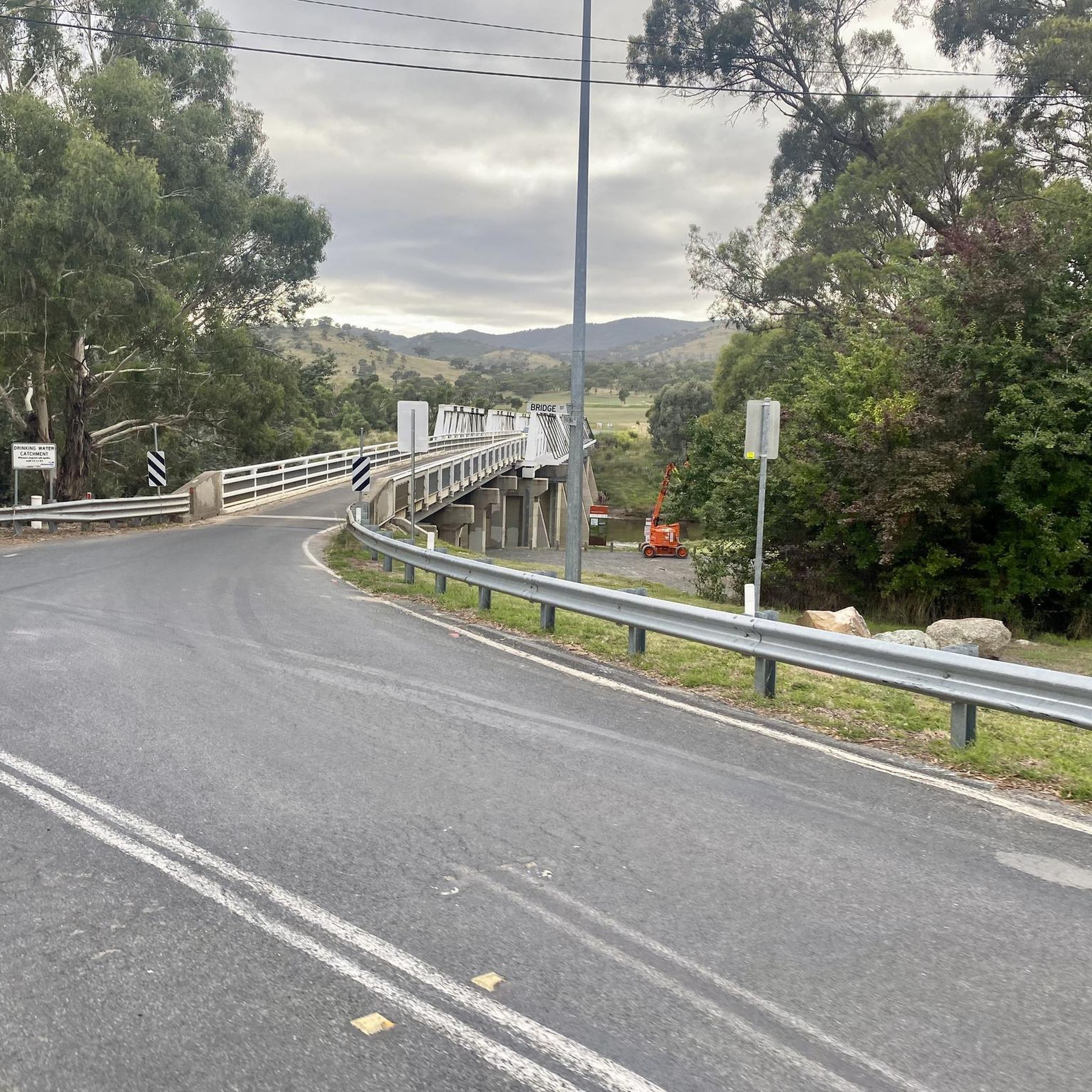
Hikers can enjoy scenic views of the Murrumbidgee River, which is wide and features shallow sections. Prominent natural features include Mount Tennent, which dominates the skyline. Historically significant landmarks include the iconic Tharwa Bridge itself, built in 1895, and the unique De Salis Cemetery, a 19th-century burial ground raised above ground after river flooding.
Are there any challenging hikes for experienced trekkers?
Yes, for experienced trekkers, there are challenging routes. The Namadgi Visitor Centre – Mount Tennent summit loop from Tharwa Sandwash is a difficult 20.4 km path featuring extensive climbs and panoramic views from the summit of Mount Tennent. This route requires good to very good fitness.
What do other hikers enjoy most about the trails in Tharwa Bridge Recreation Area?
The trails in Tharwa Bridge Recreation Area are highly rated by the komoot community, with an average score of 4.5 stars from over 6 reviews. Hikers often praise the diverse terrain, from riverside paths to challenging summit routes, and the blend of natural beauty with historical landmarks.
Is the Tharwa Bridge Recreation Area accessible by public transport?
While the Tharwa Bridge Recreation Area is approximately 30 minutes south of Canberra, direct public transport options to the trailheads are limited. It is generally recommended to access the area by car. Parking is available at various points, including near Tharwa Bridge and the Namadgi National Park Visitor Centre.
Are there any circular walks in the Tharwa Bridge Recreation Area?
Yes, there are circular walking options available. For example, the Mount Rob Roy Summit loop from Banks is a 9.7 km trail that offers a loop experience through varied terrain. The Namadgi Visitor Centre – Mount Tennent summit loop from Tharwa Sandwash is another challenging loop for those seeking a longer, more strenuous circular route.
What is the best time of year to go hiking in this region?
The Tharwa Bridge Recreation Area is enjoyable for hiking throughout much of the year. Spring and autumn generally offer the most pleasant temperatures for longer hikes. Summer can be hot, making early morning or late afternoon walks preferable, especially along the river. Winter can be cool but often clear, providing crisp hiking conditions.
Are dogs allowed on the hiking trails in Tharwa Bridge Recreation Area?
Regulations regarding dogs can vary within the broader Murrumbidgee River Corridor and adjacent areas like Namadgi National Park. Generally, dogs are permitted in designated recreation areas and on leash in some parts of the Murrumbidgee River Corridor, but often restricted or prohibited in national parks and nature reserves to protect wildlife. It's best to check specific signage at trailheads or the ACT Parks and Conservation Service for the most current rules.
What facilities are available near the Tharwa Bridge Recreation Area for hikers?
The Tharwa Bridge Recreation Area provides facilities for picnicking and access points for water-based activities like fishing and swimming (checking water quality is advised). The nearby historic Tharwa village, the oldest settlement in the ACT, offers a glimpse into local heritage. The Namadgi National Park Visitor Centre is also only a few kilometers away, providing additional information and facilities.
Can I find any trails that follow the Murrumbidgee River?
Absolutely. Many trails in the Tharwa Bridge Recreation Area are defined by the Murrumbidgee River. The Tharwa Explorer Track follows the river upstream, offering scenic riverside views. For more adventurous hikers, the extensive 27-kilometer Murrumbidgee Discovery Track can be accessed from points like Pine Island, within the broader Pine Island-Tharwa Bridge Reserve.

Get inspired with the komoot mobile app


Explore more
Browse the best Hikes in other regions.
