River Highlands State Park
River Highlands State Park
The best MTB trails in River Highlands State Park
46
riders
3
rides
Mountain bike trails in River Highlands State Park are characterized by a unique topography shaped by glaciers and the Connecticut River. The park features majestic bluffs rising up to 150 feet above the river, offering expansive views. Its terrain includes mixed woodlands and distinctive drainage crevasses, providing a varied landscape for riding. Notably, many trails offer flowy singletrack with a relative absence of rocks and roots, distinguishing it from other New England riding areas.
Best mountain bike trails in River Highlands State Park
- The most popular mountain bike trail is View of the Connecticut River loop from River Highlands State Park, a 5.8 miles (9.3 km) easy route that takes about 50 minutes to complete, offering scenic views of the Connecticut River.
- Another top favourite among local mountain bikers is View of the Connecticut River loop from River Highlands State Park, an easy 5.4 miles (8.7 km) path. This route winds through the park's mixed woodlands and along bluffs, providing a smooth riding experience.
- Local mountain bikers also love the Mountainbike loop from River Highlands State Park, a 3.1 miles (5.0 km) trail leading through varied terrain, often completed in about 26 minutes.
- Mountain biking in River Highlands State Park is defined by dramatic bluffs, Connecticut River views, and flowy singletrack trails. The network offers options for various ability levels, with many trails being easy to intermediate.
- The guide includes highly-rated routes that showcase the best of the region's landscape. More than 50 mountain bikers have used komoot to explore River Highlands State Park's varied terrain.
Last updated: July 12, 2026
24
riders
9.36km
00:50
100m
100m
Easy mountain bike ride. Great for any fitness level. Suitable for all skill levels.
9
riders
4.97km
00:26
50m
50m
Easy mountain bike ride. Great for any fitness level. Suitable for all skill levels.

Sign up for free
Moderate mountain bike ride. Good fitness required. Suitable for all skill levels.
Our route recommendations are based on thousands of hikes, rides, and runs completed by other people on komoot.
Start today with a free account
Your next adventure awaits.
Login or Signup


Tips from the Community

Beautiful spot to ride a bicycle or walk or run next to.
0
0

The Air Line State Park Trail in Connecticut is a rail trail and linear state park that is a part of the East Coast Greenway. There are several sections including: South (25 miles from East Hampton to Windham), North (21 miles from Windham to Putnam), Thompson addition (6.6 miles from Thompson to the Massachusetts state line), and an additional 3.6-mile spur to Colchester. Recognized as a national recreation trail by the U.S. Department of the Interior in 2002, it offers scenic routes for hiking and biking. This southern section of the trail near East Hampton is a gravel crushed trail that is great to ride on its own, or to access singeltrack in the nearby Salmon River Forest.
0
0

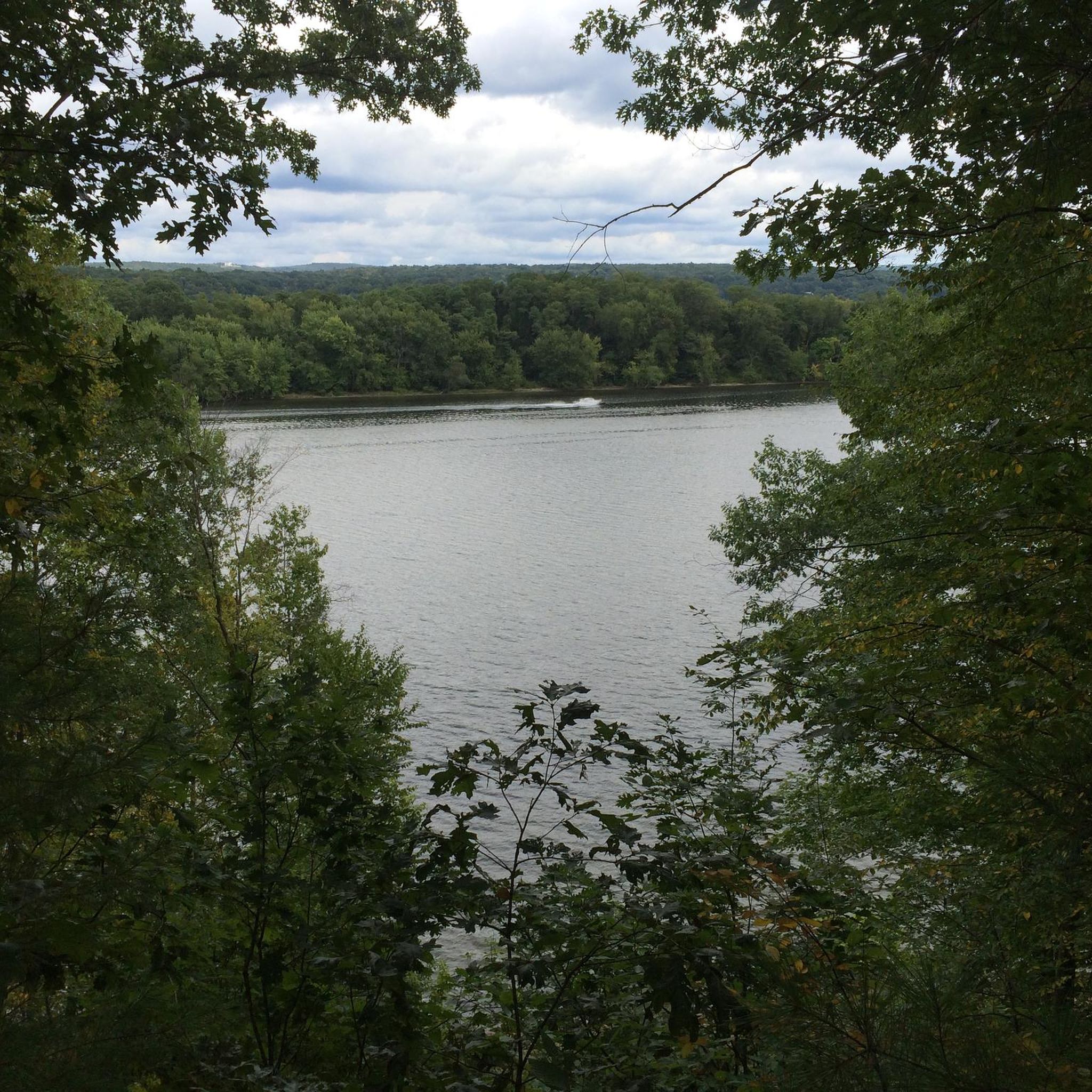
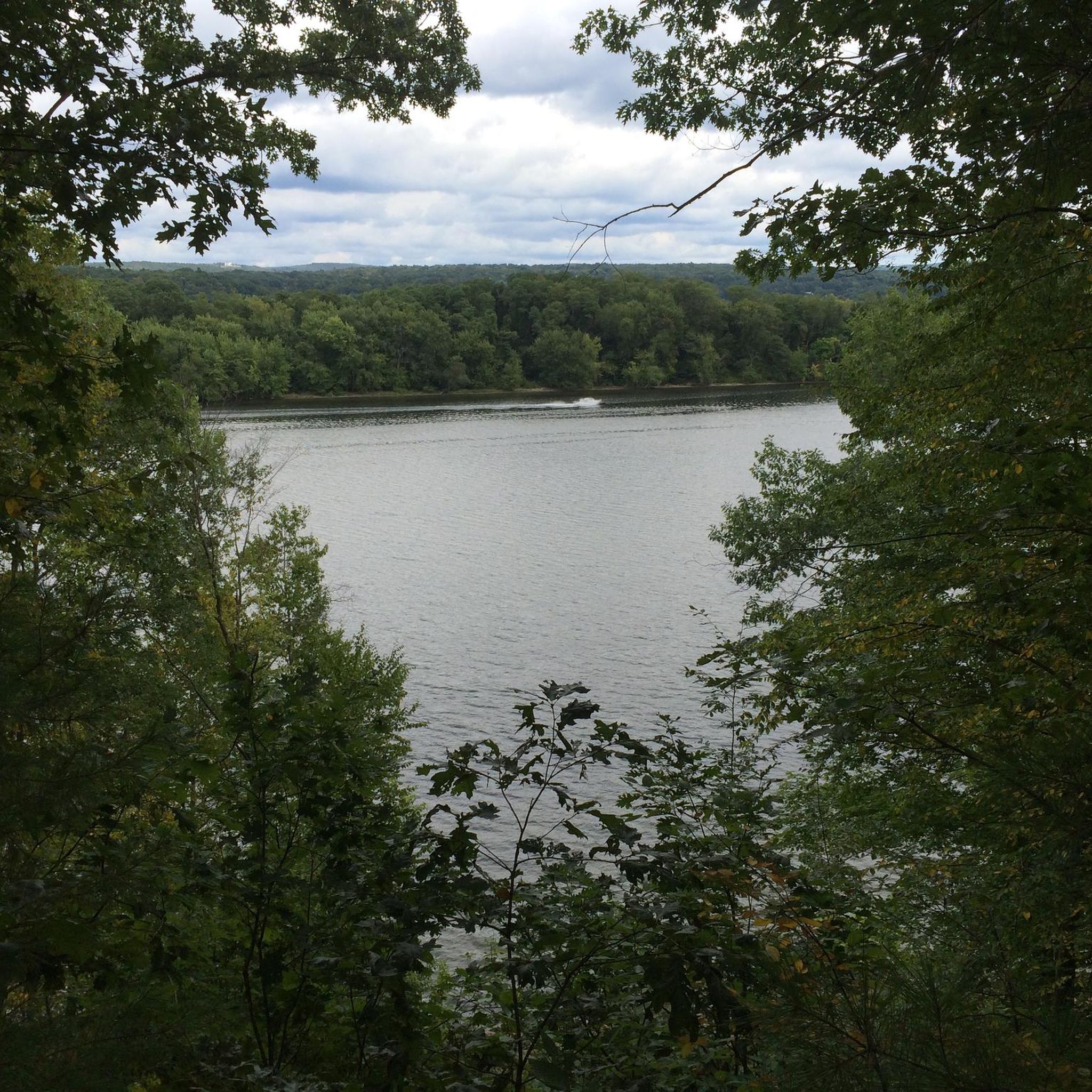
River Highlands State Park features miles of trails with various overlooks of the Connecticut River. The trails on the 177-acre property are tucked against the banks of the water and in dense forest pretty much the entire time.
0
0

This section of CT 85, also known as Gilead Street, is a classic New England road as it features a quaint church, cemetery, and tree-lined streets. It offers a glimpse into the region's rich heritage and scenic landscapes.
0
0
River Highlands State Park features miles of trails with various overlooks of the Connecticut River. The trails on the 177-acre property are tucked against the banks of the water and in dense forest pretty much the entire time.
0
0

From here you can take the Colchester Spur Trail. The area surrounding the trail played a small but fascinating role in the American Revolution. Look for markers mentioning skirmish sites and troop movements.
1
0

Air Line State Park Trail is a gravel crushed trail that runs on an old rail bed. It's a great trail to ride on its own or to access singeltrack in the Salmon River Forest.
0
0

speed limit is 25mph, but in case there is a wide sidewalk
0
0
Frequently Asked Questions
What kind of mountain biking terrain can I expect in River Highlands State Park?
River Highlands State Park offers a unique mountain biking experience with flowy singletrack trails. Unlike much of New England, the park is notable for a virtual absence of rocks and only a few scattered roots, providing a smoother ride. The terrain includes hilly sections, mixed woodlands, and dramatic bluffs overlooking the Connecticut River.
Are there trails suitable for beginners or families in River Highlands State Park?
Yes, many of the trails in River Highlands State Park are considered easy to intermediate, making them suitable for beginners and families. Difficult sections are generally avoidable. For a pleasant, easy ride, consider the Mountainbike loop from River Highlands State Park, which covers 5 km.
What are some notable natural features or viewpoints to look out for while mountain biking?
The park is famous for its dramatic bluffs that rise up to 150 feet above the Connecticut River, offering unparalleled views. A unique geological feature known as "The Blowhole" (or "Devil's Blowhole") is also present, where you can hear the wind whistle past the bluffs. The Yellow trail specifically leads to this area, which is also the only place with direct river access within the park.
Are there any longer mountain bike routes available in or around River Highlands State Park?
While many trails within the park are shorter, there are options for longer rides. For example, the Mountainbike loop from Dinosaur State Park offers a 16.3 km easy route. For a significantly longer and more challenging ride, consider the Former Lyman Viaduct – Colchester Spur Trail junction loop from Town Open Space (Pine Brook), which is a moderate 61.4 km route.
Can I find circular mountain bike routes in River Highlands State Park?
Yes, several circular routes are available for mountain biking. An example is the View of the Connecticut River loop from River Highlands State Park, which is an easy 9.3 km loop offering scenic views.
What is the best time of year to go mountain biking in River Highlands State Park?
The park's mixed woodlands and river views make it enjoyable across seasons. Spring and fall offer pleasant temperatures and vibrant foliage. While the trails are generally smooth with few roots or rocks, it's always advisable to check local conditions, especially after heavy rain, as some areas might become muddy due to the wetland systems and drainage crevasses.
Are there any specific trails recommended for their flow or views?
Many trails are described as flowy singletrack. Trails like "Powerglide" are known for being narrow, rolling, and fast with many turns and rolling hills. For views, the White trail goes high up on a ridge in the northern end, and the Green trail runs along the edge of crevasses leading to high overlooks, both offering great perspectives of the Connecticut River.
What is the typical difficulty level of mountain bike trails in River Highlands State Park?
The majority of mountain bike trails within River Highlands State Park are rated as easy to intermediate. The park is known for its smooth, flowy singletrack, making it accessible for a wide range of riders. More difficult sections are generally avoidable, allowing riders to tailor their experience.
Are there any trails that offer direct access to the Connecticut River?
Yes, the Yellow trail in River Highlands State Park leads down a crevasse, over narrow bridges, and directly to "The Blowhole" area, which is the only spot within the park that provides direct access to the Connecticut River.
Who maintains the mountain bike trails in River Highlands State Park?
A significant portion of the trails, particularly in the northern and southern sections of River Highlands State Park, were purpose-built by the local New England Mountain Bike Association (NEMBA) chapter, specifically with mountain bikers in mind. This ensures well-designed and maintained routes for riders.
Most popular routes in River Highlands State Park

Get inspired with the komoot mobile app


Explore more
Browse the best MTB trails in other regions.
