Routes

Planner

Features

Updates

App

Login or Signup

Get the App

Login or Signup

Routes
Hikes
United States
Connecticut
Northeastern Connecticut Planning Region

Beaver Brook State Park

The best walks and hikes in Beaver Brook State Park

5.0

(2)

34

hikers

15

hikes

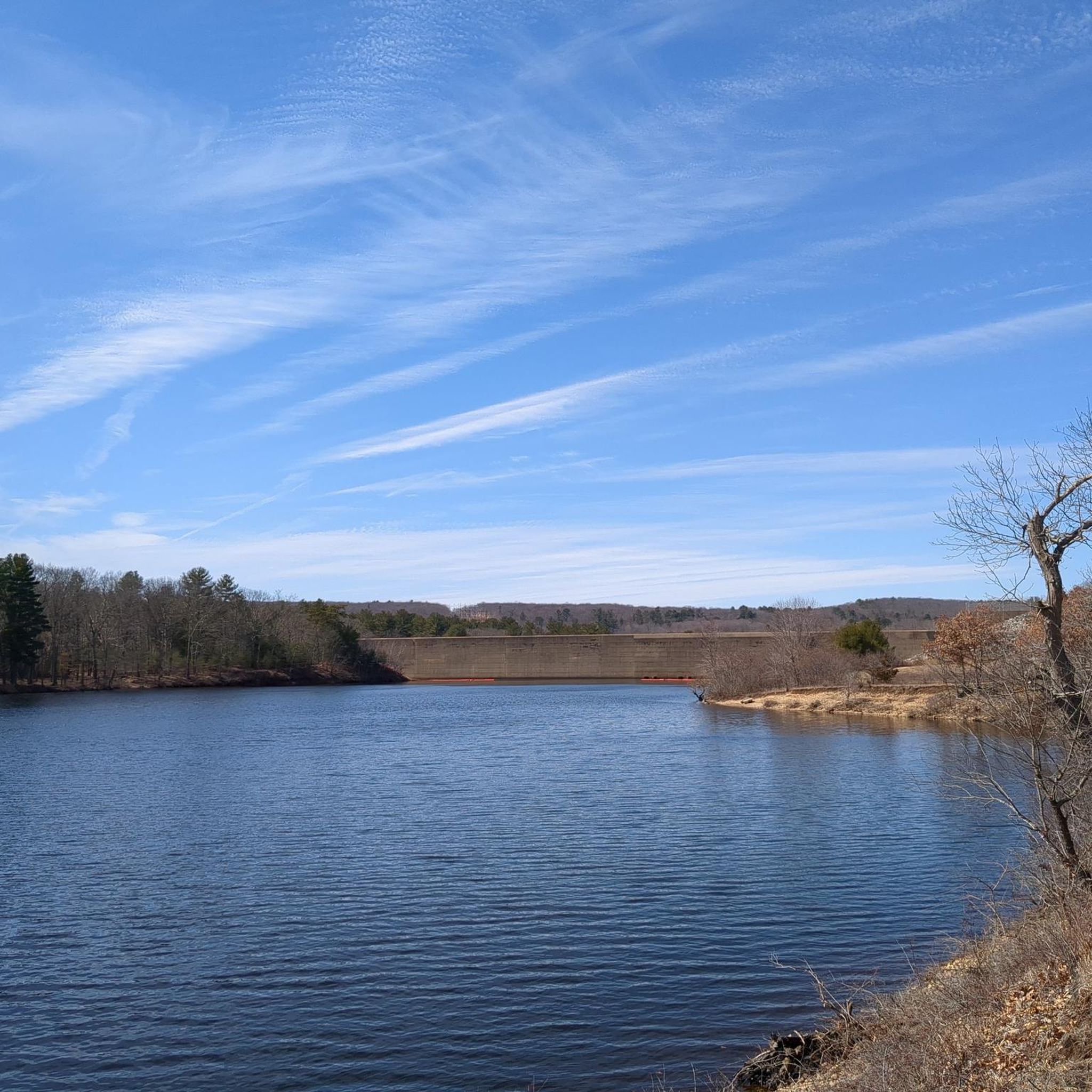
Hiking in Beaver Brook State Park, located in the Northeastern Connecticut Planning Region, offers access to an undeveloped public recreation area spanning 401 acres. The park's central feature is Bibbins Pond, also known as Beaver Brook Pond, which provides a focal point for outdoor activities. The northern boundary of the park is defined by the Air Line State Park Trail. This landscape primarily consists of woodlands and areas around the pond, offering varied terrain for hikers.

Best hiking trails in Beaver Brook State Park

  • The most popular hiking route is Mansfield Hollow Lake loop via Nipmuck Trail — Mansfield Hollow State Park, a 5.5 miles (8.8 km) trail that takes 2 hours 17 minutes to complete. This moderate route explores the area around Mansfield Hollow Lake.
  • Another top favourite among local hikers is Pine Acres Lake loop via Goodwin Heritage Trail — James L. Goodwin State Forest, a moderate 5.8 miles (9.4 km) path. This trail offers views of Pine Acres Lake and follows the Goodwin Heritage Trail.
  • Local hikers also love the Orchard Hill Lookout loop via Natchaug Trail — James L. Goodwin State Forest, a 3.6 miles (5.7 km) trail leading through woodlands, often completed in about 1 hour 32 minutes.
  • Hiking in Beaver Brook State Park is defined by Bibbins Pond, undeveloped woodlands, and sections of the Air Line State Park Trail. The network offers options for both easy and moderate ability levels.
  • The routes in Beaver Brook State Park are highly rated by the komoot community with an average score of 5.0 stars from more than 2 reviews. More than 20 hikers have used komoot to explore Beaver Brook State Park's varied terrain.

Last updated: July 12, 2026

#1.

North Windham Road to Mansfield Hollow Lake

1.47km

00:23

0m

10m

The North Windham Road to Mansfield Hollow Lake trail offers a surprisingly diverse and easy walk, perfect for a quick escape into nature. You'll enjoy constant views of the expansive Mansfield Hollow Lake and the Natchaug River, with the added novelty of watching small planes from the adjacent Windham Airport. This 0.9-mile (1.5 km) hike, with only 14 feet (4 metres) of elevation gain, is rated easy and takes about 22 minutes, making it an ideal choice for beginners or a relaxed outing.

Planning your visit is straightforward; the trail is generally less populated, especially the section accessible from the Windham Airport. Leashed dogs are welcome, but remember that swimming is prohibited in Mansfield Hollow Lake as it's a public water supply. The trail is beautiful in any season, from vibrant fall foliage to a serene winter wonderland, and is even popular for cross-country skiing in colder months.

This route is part of the larger Mansfield Hollow State Park, an area rich with geological formations from the last Ice Age, such as kames and eskers. While this specific trail is paved and flat, the broader park offers more rugged options if you're looking for a longer adventure. It's a great spot for birdwatching and fishing, providing a tranquil experience away from more crowded hiking trails.

Navigate with device

Send to Phone

Save

Easy

The Allanach-Wolf Woodlands Trail offers an easy hike through a peaceful forest, perfect for a quick escape into nature. You'll cover 1.4 miles (2.3 km) with a gentle elevation gain of just 67 feet (20 metres), making it a comfortable route that most people can complete in about 35 minutes. As you walk, you'll enjoy views of the 22-acre Lake Marie and catch glimpses of Ballymahack Brook, immersing yourself in the tranquil woodland atmosphere.

Planning your visit to the Allanach-Wolf Woodlands Trail is straightforward, as there are no fees required to access the paths. The driveway is plowed during winter, so you can enjoy this route year-round, regardless of the season. If you plan to bring your dog, they are welcome to join you on a leash, just remember to stick to the marked trails and practice Leave No Trace principles to help preserve the natural environment.

This trail is particularly notable for its rich natural environment, winding through a significant block of forest and wetlands. It's an excellent spot for birdwatching, with a dedicated waterfowl viewing blind accessible via a short side trail near Lake Marie. The diverse habitats along the route support various wildlife, offering a chance to observe local flora and fauna in a serene setting.

Easy
guide_signup
Let us show you the way with the komoot mobile app
With a free komoot account, you can easily find, customize, and navigate endless outdoor adventures.

Sign up for free

3

hikers

7.77km

02:01

50m

50m

The Pine Acres Pond Trail offers a moderate hike spanning 4.8 miles (7.8 km), where you will gain 168 feet (51 metres) in elevation over approximately 2 hours and 1 minutes. As you hike, you will pass through varied forest landscapes, including mixed hardwood sections and tranquil wetlands. A key feature is the 135-acre Pine Acres Lake, known for its distinctive protruding stumps and logs that dot the water. You can enjoy expansive views of the lake from the Governor's Island Observation Deck, which also provides insights into the area's natural history. The route provides a solid workout without being overly strenuous, making it accessible for many.

The Pine Acres Pond Trail is located within the James L. Goodwin State Forest, which is publicly accessible. You will find parking readily available at the forest entrance. While the trail is generally suitable for various skill levels, be prepared for some sections with rocky patches and uneven footing. Wearing appropriate footwear is recommended to ensure a comfortable and safe hike. This route is a good choice if you are looking for a well-maintained path with clear access.

Beyond the scenic lake views, the trail offers opportunities to observe local wildlife, particularly various birds and amphibians near the water. The Governor's Island Observation Deck not only provides expansive vistas but also features interpretive signs detailing the area's history and ecological significance. This makes the trail a good option if you are interested in learning more about the natural environment while enjoying your hike. It stands out as a well-rounded experience within the state forest.

Moderate

8.71km

02:21

110m

120m

Embark on the Black Spruce Pond Loop for a moderate hike through the diverse woodlands of James L. Goodwin State Forest. This 5.4-mile (8.7 km) route offers a peaceful escape, guiding you past varied forest scenery. You will experience a gentle ascent of 359 feet (109 metres) over approximately 2 hours and 20 minutes, making it an accessible yet rewarding outdoor adventure. Keep an eye out for the distinct junction where the Goodwin Heritage Trail meets the Natchaug Trail, a notable point along your journey.

When planning your visit, you will find general parking available for easy access to the trails within James L. Goodwin State Forest. There are no specific permits or fees mentioned for this particular trail, simplifying your preparation. However, it is always wise to check local conditions before you head out, especially if you are hiking during different seasons, to ensure a smooth and enjoyable experience.

The Black Spruce Pond Loop is set within the expansive James L. Goodwin State Forest, an area renowned for its rich and varied forest ecosystems. The trail itself incorporates sections of both the Goodwin Heritage Trail and the Natchaug Trail, offering a blend of the region's established pathways. This integration provides a comprehensive look at the forest's natural features, making it a distinctive option for exploring the local environment.

Moderate

Embark on the Mansfield Hollow Lake loop via Nipmuck Trail for a moderate hike that offers a diverse outdoor experience. This route covers 5.5 miles (8.8 km) with a gentle elevation gain of 196 feet (60 metres), typically taking around 2 hours and 17 minutes to complete. As you hike, you will pass through open fields, wooded ridges, and old woods roads, enjoying varied forest habitats. Keep an eye out for expansive water views of Mansfield Hollow Lake and the impressive glacial erratic known as Wolf Rock.

To plan your visit, you will find this trail generally accessible, with convenient parking available at Mansfield Hollow State Park. While the route is considered moderate, be aware that some sections along the Fenton River can be wet, especially after rain. Always check local conditions before you head out, particularly if you are hiking during wetter seasons, to ensure a comfortable and safe experience.

This trail is notable for showcasing the natural beauty of the region, providing glimpses of both the Natchaug and Fenton Rivers in addition to the prominent Mansfield Hollow Lake. The varied terrain and diverse forest habitats make it a great option for observing local flora and fauna. It offers a well-rounded outdoor adventure within Mansfield Hollow State Park.

Moderate
Sign up for free to see 11 more hikes in Beaver Brook State Park.

Get access to more routes and recommendations from other explorers.

Sign up for free

Already have an account?

Our route recommendations are based on thousands of hikes, rides, and runs completed by other people on komoot.

Start today with a free account

Your next adventure awaits.

Login or Signup

Popular around Beaver Brook State Park

Road Cycling Routes in Beaver Brook State Park

Running Trails in Beaver Brook State Park

Cycling in Beaver Brook State Park

Gravel biking in Beaver Brook State Park

Tips from the Community

oliviakellis
August 4, 2024, Mansfield Hollow Lake

Hikers at Mansfield Hollow Lake can explore trails around its 500-acre expanse, where anglers often catch prized trout and largemouth or smallmouth bass. The reservoir's crystal-clear waters also provide an excellent spot for kayaking, adding to the scenic outdoor experience.

0

0

The park offers over 18 miles of paved and unpaved trails. With its diverse trails, stunning scenery, and welcoming atmosphere, Mansfield Hollow State Park offers a fantastic escape.

0

0

The Governor's Island observation deck, located on Pine Acres Pond, features interpretive signs detailing the lake's history and local wildlife. This platform provides an informative and scenic spot for visitors to enjoy views of the pond while learning about the area's natural and historical significance.

0

0

At the junction of the Airline Trail and Natchaug Trail in James L. Goodwin State Forest, hikers have two enticing options. Following the Natchaug Trail leads deeper into the forest, eventually reaching the serene Black Spruce Pond. Alternatively, continuing along the Airline Trail provides beautiful views of the 135-acre Pine Acres Lake. Both routes offer unique scenic experiences, showcasing the diverse beauty of the forest.

0

0

The James L. Goodwin State Forest is a Connecticut state forest that spans around 2,000 acres. The land was donated by James L. Goodwin to the state in 1964. This forest can be seen along the East Coast Greenway near Pine Acres Lake.

0

1

Frequently Asked Questions

What kind of hiking experience can I expect in Beaver Brook State Park?

Beaver Brook State Park in Connecticut is an undeveloped public recreation area, primarily featuring woodlands and the central Bibbins Pond. Hiking here offers a natural, tranquil experience, with trails ranging from easy to moderate difficulty. The park's northern boundary is also part of the Air Line State Park Trail, providing additional exploration opportunities.

Are there easy hiking trails suitable for beginners or casual walkers?

Yes, Beaver Brook State Park offers several easy hiking options. For example, the Nipmuck Trail – Wolf Rock loop from Sawmill Pond is an easy 6.3 km route, and the Chaffeeville Valley loop from Mansfield is a shorter, easy 3.6 km path, both perfect for a relaxed outing.

Are there any loop trails in the Beaver Brook State Park area?

Yes, the area around Beaver Brook State Park features several loop trails. Popular options include the Mansfield Hollow Lake loop via Nipmuck Trail, a moderate 8.8 km route, and the Orchard Hill Lookout loop via Natchaug Trail, an easy 5.7 km trail.

What are the typical trail lengths and durations for hikes in this area?

Hikes in the Beaver Brook State Park area vary in length and duration. You can find shorter, easy routes like the Chaffeeville Valley loop, which is about 3.6 km and takes just over an hour. Longer, moderate trails such as the Pine Acres Lake loop extend to about 9.4 km and can take around 2.5 hours to complete.

What natural features or landmarks can I see while hiking?

The central feature of Beaver Brook State Park is Bibbins Pond, also known as Beaver Brook Pond, which is a focal point for the area's natural beauty. The park is characterized by its undeveloped woodlands. While specific named landmarks are limited within the park itself, nearby trails offer views of other bodies of water like Mansfield Hollow Lake and Pine Acres Lake.

Is Beaver Brook State Park suitable for families with children?

Yes, the park's undeveloped nature and the presence of easy trails make it suitable for families. The focus on Bibbins Pond and woodland paths provides a pleasant environment for children to explore nature. Shorter, easy routes like the Chaffeeville Valley loop are good options for families.

Can I bring my dog on the hiking trails?

While the guide data does not explicitly state dog-friendly policies for Beaver Brook State Park, most Connecticut State Parks allow leashed dogs on trails. It's always recommended to check the official Connecticut Department of Energy and Environmental Protection (DEEP) website for the most current regulations regarding pets before your visit.

What do other hikers say about Beaver Brook State Park?

The hiking routes in and around Beaver Brook State Park are highly regarded by the komoot community, holding an average score of 5.0 stars from over 2 reviews. Hikers often appreciate the tranquil woodland settings and the opportunities to enjoy nature around the ponds.

Are there opportunities for fishing or other water activities at Bibbins Pond?

Yes, Bibbins Pond (Beaver Brook Pond) is known for trout fishing. There is also a seasonal boat launch available for non-motorized watercraft, allowing for activities like kayaking or canoeing on the pond.

Is there public transport access to Beaver Brook State Park?

Beaver Brook State Park is an undeveloped area, and direct public transport access is typically limited. Visitors usually access the park by car. It's advisable to plan for private transportation to reach the trailheads.

What is the best time of year to hike in Beaver Brook State Park?

The park can be enjoyed year-round. Spring offers lush greenery and blooming wildflowers, while autumn provides vibrant fall foliage. Summer is pleasant for hiking, especially around the pond, and winter can offer peaceful snow-covered trails, though conditions may vary. Always check local weather before heading out.

Are there any specific wildlife I might encounter?

As an undeveloped woodland area centered around a pond, Beaver Brook State Park is home to various wildlife. You might encounter common forest animals such as deer, squirrels, and a variety of bird species. The pond also supports aquatic life, including the trout that are stocked for fishing.

Most popular routes in Beaver Brook State Park

Easy hikes in Beaver Brook State Park

Store rating

Get inspired with the komoot mobile app

With a free komoot account, you can easily find, customize, and navigate endless outdoor adventures.

or

Join komoot Now

Store rating

Explore more

Browse the best Hikes in other regions.

Natchaug State ForestAirline State Park Trail (Northern Section)WillimanticDanielsonDayvilleMechanicsvilleJames L. Goodwin State ForestNorth Grosvenor DaleMoosup Valley State Park TrailSouth WoodstockQuasset LakePutnamWitches WoodsEast BrooklynSouth WindhamQuaddick State ParkQuaddick State ForestMohegan State ForestLake ChaffeeNathaniel Lyon Memorial State ParkBrooklynLake BungeeMashamoquet Brook State ParkMoosupQuinebaugPlainfield VillageRock Spring Wildlife RefugeWest Thompson Dam Recreation AreaWaureganKillingly Pond State Park ReserveOld Furnace State Park And Ross Pond State Park

Nearby adventure guides

Things to Do in Mansfield Hollow Lake Recreation Area

background

Get ready to conquer new peaks

Sign up for Free

Explore
RoutesRoute plannerFeaturesHikesMTB TrailsRoad cycling routesBikepackingSitemap
Download the app
Follow Us on Socials

© komoot GmbH

Privacy Policy