The best running trails in Grafton Notch State Park
25
runners
12
runs
Jogging in Grafton Notch State Park offers diverse and challenging terrain across spectacular peaks, dramatic gorges, and dense woodlands. The region is characterized by the rugged mountains of the Mahoosuc Range, providing significant elevation gains and panoramic views. An extensive trail system caters to various fitness levels, featuring uneven ground, small hills, and steep sections with rocks and roots. Waterfalls and gorges like Screw Auger Falls and Mother Walker Falls add picturesque stops along many running routes.
Best jogging routes…
Last updated: October 10, 2026
13
runners
10.7km
01:53
800m
800m
Prepare for a challenging jogging experience on the Old Speck Trail, a difficult 6.6 miles (10.7 km) route that climbs 2621 feet (799 metres) in about 1 hour and 52…
2
runners
3.55km
00:58
270m
270m
The Eyebrow Trail Loop offers a truly demanding jogging experience, covering 2.2 miles (3.5 km) with a significant 888 feet (271 metres) of elevation gain. You will navigate extremely steep…

2
runners
3.64km
00:53
250m
250m
Prepare for a difficult jogging experience on the Table Rock Loop Trail, a challenging route spanning 2.3 miles (3.6 km). You will gain 809 feet (247 metres) in elevation, typically…
3.18km
00:21
50m
50m
You can enjoy an easy jogging experience on the Moose Cave loop & Mother Walker Falls via Bear River Road, covering 2.0 miles (3.2 km) with a gentle elevation gain…
9.44km
01:40
670m
670m
If you're looking for a demanding jogging experience, the West Peak via Appalachian Trail run offers a difficult 5.9 miles (9.4 km) route. You'll gain 2206 feet (672 metres) in…
Get access to more routes and recommendations from other explorers.
Already have an account?
Our route recommendations are based on thousands of hikes, rides, and runs completed by other people on komoot.
Start today with a free account
Your next adventure awaits.
Popular around Grafton Notch State Park
Tips from the Community

Moose Cave in Grafton State Park is named after the moose that fell down into the cave years ago. The trail leading to the cave overlook winds through rock gardens and boulder fields before arriving at the halfway steps. This isn't a super smooth trail, but it's pretty short and offers a submersion into the forest of Grafton State Park.
0
0
Table Rock is probably the most popular overlook within Grafton Notch State Park. There are a few trails that create a loop that you can hike, or you can just do an out-and-back on the Appalachian Trail.
0
0
The path to Mother Walker Falls is super short and super smooth. The waterfall is pretty popular since it's so easy to get to. The water, itself, is a collection of rapids and cascades along the Bear River and is one of the main attractions in Grafton Notch State Park.
0
0
Moose Cave in Grafton State Park is named after the moose that fell down into the cave years ago. The trail leading to the cave overlook winds through rock gardens and boulder fields before arriving at the halfway steps. This isn't a super speedy trail, but it offers a submersion into the forest of Grafton State Park.
0
0
Table Rock is probably the most popular overlook within Grafton Notch State Park. There are a few trails that create a loop that you can run, or you can just do an out-and-back on the Appalachian Trail.
0
0
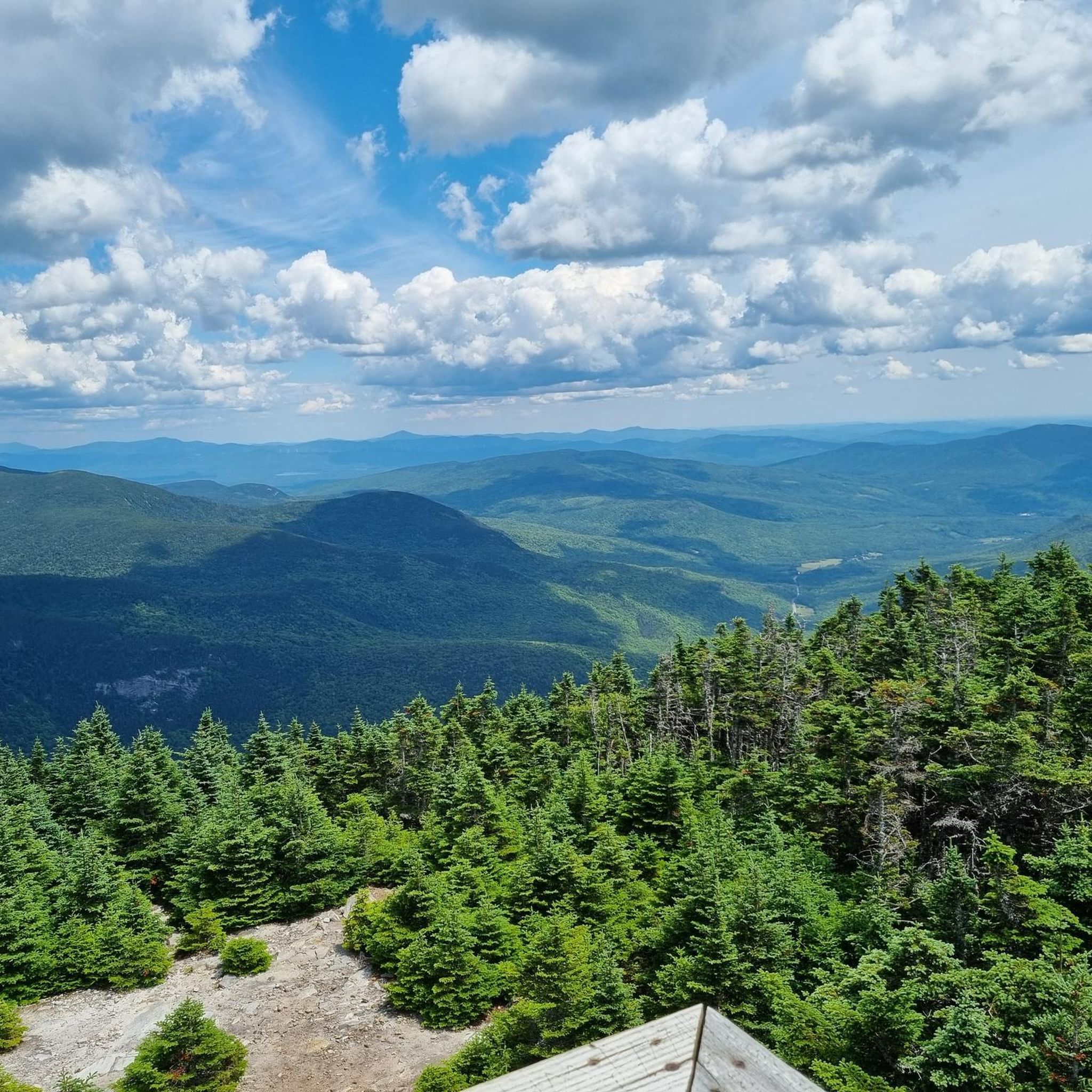
Old Speck Mountain is part of the 4,000-foot club, reaching up to 4,170 feet. The mountain is covered in trees, but you can walk up an old fire tower on the summit that offers unobstructed 360 degree views. On a clear day you can see Speck Pond 1,000 feet down below from the tower.
0
0
The Eyebrow Trail is a rough and highly technical trail in Grafton Notch State Park. There are lots of great views from the path and an overlook area at its intersection with the Appalachian Trail. The trail features steps, hold bars, ropes, and other features for balance; it's best to just power hike up this side and run down the Appalachian Trail route.
0
0
Rising up to an elevation of 3,662 feet, West Peak is one of the high points along the Baldpate Mountain ridge. The summit offers a few views through a window of trees, but you get much better views as you run north on the trail and come across more bald, granite rock faces.
0
0
Frequently Asked Questions
What kind of terrain can I expect when running in Grafton Notch State Park?
Grafton Notch State Park offers a diverse and challenging landscape for runners. You'll encounter rugged mountains of the Mahoosuc Range, significant elevation gains, and dense woodlands. Trails feature a mix of uneven ground, small hills, and steep sections with rocks and roots, providing a varied training experience. While some trails are demanding, there are also moderate options available.
Are there any easy or beginner-friendly running routes in Grafton Notch State Park?
While many routes in Grafton Notch State Park are considered difficult, there are a few options that are more accessible. For a moderate experience, consider the Step Falls Trail and Bear River Road Loop, which is 7.3 km long. The park also has some relatively flat sections, though truly easy, flat trails are less common due to the mountainous terrain.
Can I find running routes with scenic viewpoints or panoramic vistas?
Absolutely! Grafton Notch State Park is renowned for its stunning views. The Old Speck Trail leads to the summit of Old Speck Mountain, offering expansive 360-degree views from an old fire tower. The Table Rock Loop Trail also provides fabulous views down the notch and towards Old Speck. You can also visit the Table Rock viewpoint directly.
Are there any waterfalls or gorges to see along the running trails?
Yes, the park features several impressive waterfalls and gorges that make for picturesque stops. You can visit Screw Auger Falls, a 23-foot waterfall in a narrow gorge, or Mother Walker Falls, a cascade over broken rocks. Moose Cave, a 200-foot-long gorge where water disappears under granite, is another unique natural attraction.
How many running routes are available in Grafton Notch State Park on komoot?
There are over 10 curated running routes available for Grafton Notch State Park on komoot, catering to various fitness levels. These include a mix of difficult and moderate trails, ensuring options for different preferences.
Are there any loop running trails in the park?
Yes, Grafton Notch State Park offers several excellent loop trails for running. Popular options include the Eyebrow Trail Loop, a challenging 3.5 km path with steep sections, and the Table Rock Loop Trail, a 3.6 km route through mountainous terrain.
What is the best time of year for running in Grafton Notch State Park?
The best time for running in Grafton Notch State Park is typically from late spring through fall. During these seasons, the weather is generally milder, and the trails are free of snow and ice, making for safer and more enjoyable conditions. Fall offers spectacular foliage, adding to the scenic beauty of your run.
Are dogs allowed on the running trails in Grafton Notch State Park?
Grafton Notch State Park is generally dog-friendly, but it's always recommended to check the specific regulations for each trail or area within the park. Dogs are usually required to be on a leash. Please ensure your pet is well-behaved and that you clean up after them to preserve the natural environment for everyone.
Are there any family-friendly running options in the park?
While many trails are rugged, some shorter and less strenuous sections might be suitable for families looking for a gentle jog or hike. The 0.5-mile Cataracts Trail, which follows a brook to a narrow waterfall, could be a good option for a short, scenic outing. For longer runs, consider moderate trails like the Step Falls Trail and Bear River Road Loop, depending on the family's fitness level.
What are some notable landmarks or points of interest I might encounter?
Beyond the stunning natural features, you can encounter several points of interest. The Old Speck Mountain Fire Tower offers incredible panoramic views. The Table Rock viewpoint is another popular spot. The park also contains sections of the challenging Appalachian Trail, offering a glimpse into this iconic long-distance route.
Is parking available at the trailheads?
Yes, the Grafton Notch Scenic Byway, which bisects the park, offers several pull-offs and designated parking areas that serve as access points for many trails. It's advisable to check specific trailhead information for parking availability and any potential fees before your visit.
What is the difficulty level of most running routes in Grafton Notch State Park?
The majority of running routes in Grafton Notch State Park are considered difficult, with 9 out of 12 routes on komoot falling into this category. These trails often feature significant elevation changes, steep sections, and rugged terrain. There are also 2 moderate routes and 1 easy route available for those seeking less challenging options.
Most popular routes in Grafton Notch State Park
Most popular attractions in Grafton Notch State Park

Get inspired with the komoot mobile app


Explore more
Browse the best Running Trails & Routes in other regions.
