The best walks and hikes in Redcloud Peak Wilderness Study Area
5.0
(2)
132
hikers
19
hikes
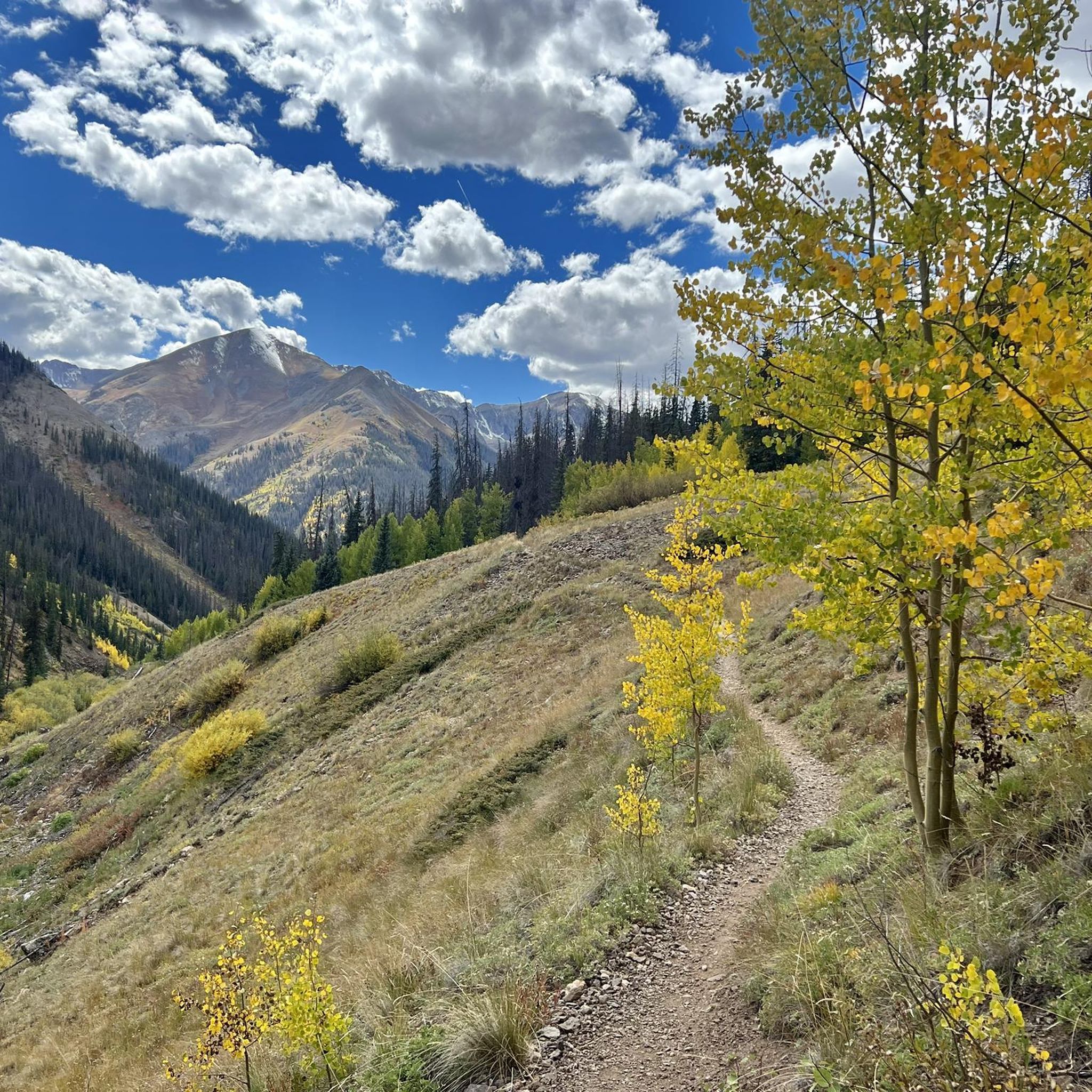
Hiking in Redcloud Peak Wilderness Study Area features rugged terrain within the Southern Rocky Mountains, encompassing 38,495 acres. The region is characterized by towering peaks, including two "Fourteeners" (peaks over 14,000 feet), and elevations ranging from 9,310 feet to 14,042 feet. Hikers will encounter diverse environments, from densely forested hillsides with spruce and fir to high-altitude alpine tundra, along with glacial cirques and various waterways.
Best hiking trails in Redcloud Peak Wilderness Study Area
- The most popular hiking route is Handies Peak via American Basin Trail — Hinsdale County, a 7.9 miles (12.7 km) trail that takes 5 hours 16 minutes to complete. This difficult route ascends to Handies Peak, offering expansive views of alpine basins.
- Another top favourite among local hikers is Redcloud Peak – Sunshine Peak loop from Silver Creek Trailhead, a difficult 12.0 miles (19.4 km) path. This loop connects two prominent Fourteeners, Redcloud Peak and Sunshine Peak, traversing high-altitude terrain.
- Local hikers also love the Nellie Creek Basin – Uncompahgre Peak loop from Nellie Creek Site 1, a 15.5 miles (25.0 km) trail leading through Nellie Creek Basin and ascending Uncompahgre Peak, often completed in about 8 hours 45 minutes.
- Hiking in Redcloud Peak Wilderness Study Area is defined by towering peaks, expansive alpine tundra, and dense forests, with options for challenging high-altitude ascents.
- The routes in Redcloud Peak Wilderness Study Area are highly rated by the komoot community with an average score of 5.0 stars from over 1 reviews. More than 160 hikers have used komoot to explore Redcloud Peak Wilderness Study Area's varied terrain.
Last updated: July 8, 2026
2
hikers
7.52km
03:13
1,070m
0m
Hard hike. Very good fitness required. Easily-accessible paths. Suitable for all skill levels.
2
hikers
6.39km
03:01
1,080m
0m
Hard hike. Very good fitness required. Easily-accessible paths. Suitable for all skill levels.

Sign up for free
2.73km
00:59
280m
0m
Easy hike. Great for any fitness level. Easily-accessible paths. Suitable for all skill levels.
53.8km
16:27
1,920m
1,750m
Hard hike. Very good fitness required. Easily-accessible paths. Suitable for all skill levels.
22
hikers
12.7km
05:17
1,080m
1,080m
Hard hike. Very good fitness required. Easily-accessible paths. Suitable for all skill levels.
Get access to more routes and recommendations from other explorers.
Sign up for free
Already have an account?
Our route recommendations are based on thousands of hikes, rides, and runs completed by other people on komoot.
Start today with a free account
Your next adventure awaits.
Login or Signup
Popular around Redcloud Peak Wilderness Study Area
Tips from the Community


Animas Forks is a former mining town situated along the Animas River and a popular spot to investigate along the Alpine Loop. There are still some remaining wooden buildings. A cool place to spend a break or even the night.
1
0
Cinnamon Pass is part of the iconic Alpine Loop. From here, you will enjoy a stunning view over the San Juan Mountains, especially Handies Peak, one of the Colorado 14ers. There is some old mining equipment in the area and you can most likely see some deer up here.
2
0

Cinnamon Pass, located within the San Juan Mountains, stands at an elevation of about 12,640 feet. This high mountain pass offers panoramic views of the surrounding peaks, as well as old mining remnants.
0
0
Located at an elevation of 12,640 feet, Cinnamon Pass offers breathtaking views over the San Juan Mountains. The pass is part of Colorado's historic Alpine Loop and popular for 4x4 drivers.
3
0
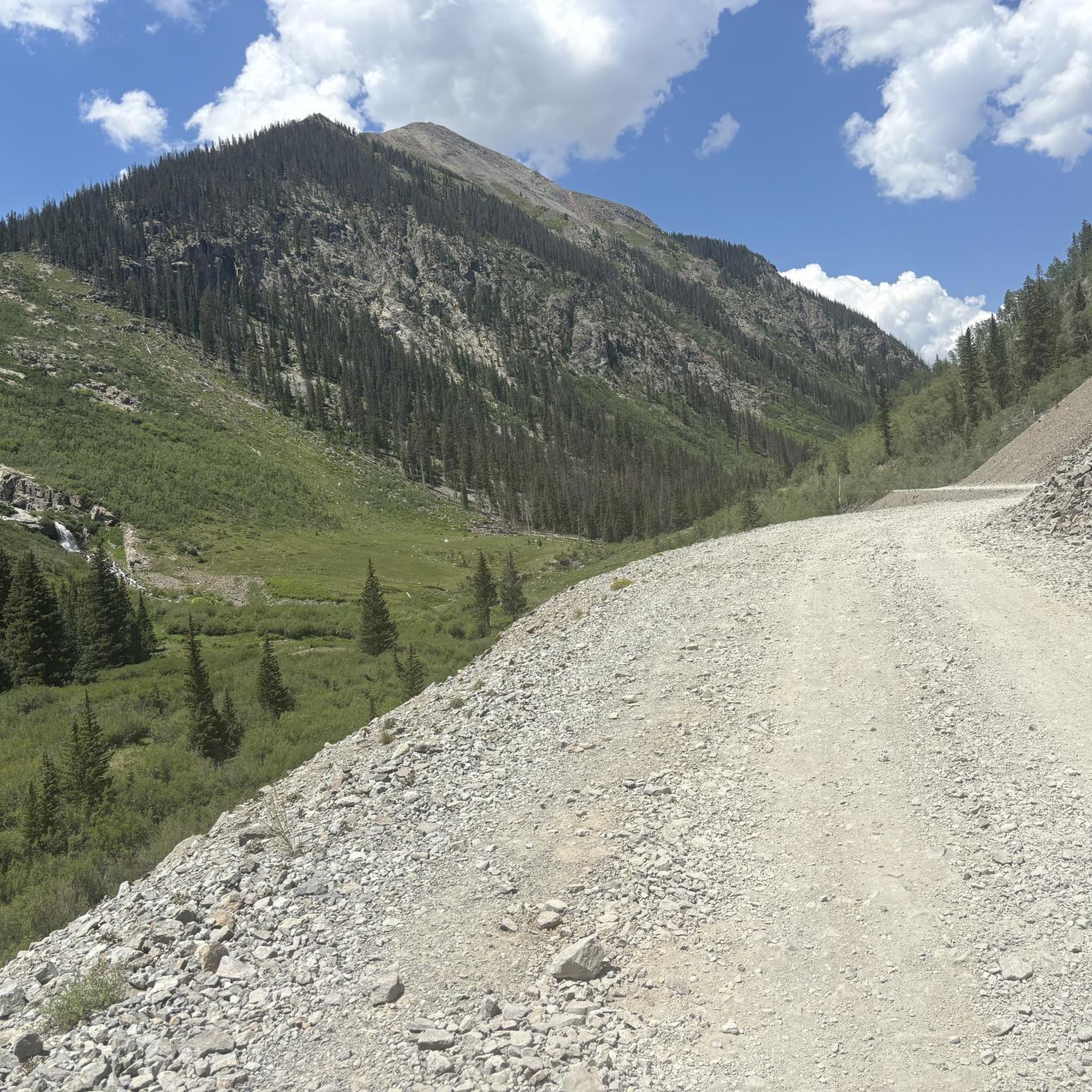
Cinnamon Pass Road is a section of the Alpine Loop which leads up to Cinnamon Pass and over to the ghost town of Animas Forks. Along the backcountry road, besides exceptional views, you can find relics of the mining past. It is not necessarily a hiking route, but you can take it to hike a loop from Grouse Gulch via the Hardrock 100 Route and the American Basin.
0
0
With an elevation of 14,058 feet, Handies Peak is one of the Colorado 14,000ers. You can access the summit either from the American Basin, passing beautiful Sloan Lake or via Grizzly Gulch from Cinnamon Pass Road on the other side of the mountain. The view from the top is spectacular! Keep in mind, that the weather can change quickly and expect thunderstorms especially during the summer months. So start your hike early and descent in the early afternoon at the latest.
3
0

There is parking on both sides of the road near the old mining ruins. Public restrooms are available and dispersed camping is allowed near the trailhead. From here you can run up Redcloud to the east, or Handies to the west; both are long nontechnical creek trails of comparable difficulty. It is best to get here super early in the summer or camp overnight to summit before afternoon storms.
0
0
Frequently Asked Questions
What kind of terrain can I expect when hiking in Redcloud Peak Wilderness Study Area?
The Redcloud Peak Wilderness Study Area offers a diverse range of terrain. You'll find densely forested hillsides at lower elevations, transitioning to tundra-like alpine landscapes at higher altitudes. The area is characterized by dramatic mountainous features, including glacial cirques, craggy peaks, and sweeping ridgelines, with elevations reaching over 14,000 feet.
Are there any easier hiking options available in the Redcloud Peak Wilderness Study Area?
While many routes in the Redcloud Peak Wilderness Study Area are challenging, there are some moderate options. For example, the Wetterhorn Peak Trail — Uncompahgre Wilderness is a moderate 5.3-mile hike, offering a less strenuous experience compared to the high-altitude Fourteeners.
What are the notable natural features or landmarks to look out for?
The area is renowned for its majestic peaks, including Redcloud Peak and Sunshine Peak, both exceeding 14,000 feet. Redcloud Peak itself is distinctive for its unique red color. You'll also encounter glacial formations, including unusual rock glaciers, and several scenic waterways like Henson Creek and the Lake Fork Gunnison River.
When is the best time of year to hike in Redcloud Peak Wilderness Study Area?
The best time to hike, especially for climbing the Fourteeners, is typically during the warmer months, from late spring through early autumn. During this period, the alpine landscapes are vibrant with wildflowers, and conditions are generally more favorable for high-altitude ascents. Winter hiking presents significant challenges due to snow and extreme weather.
Are there any loop trails in the Redcloud Peak Wilderness Study Area?
Yes, there are several loop trails available. A prominent example is the challenging Redcloud Peak – Sunshine Peak loop from Silver Creek Trailhead, which connects two Fourteeners. Another option is the Sloan Lake – American Basin loop from Silver Creek Trailhead, offering a different high-altitude experience.
What is the typical difficulty level of hikes in this region?
Hiking in the Redcloud Peak Wilderness Study Area is generally considered challenging, with many routes involving significant elevation gain and high-altitude exposure. Out of the 9 routes listed, 6 are rated as difficult, and 3 are moderate. There are no easy routes in this area.
Are there any specific regulations or permits required for hiking or camping?
The Redcloud Peak Wilderness Study Area is managed by the Bureau of Land Management (BLM). While specific hiking permits are generally not required for day use, it's always advisable to check the latest regulations for camping and other activities. You can find more detailed information on the official BLM website for the area: blm.gov/red-cloud-peak-wsa.
What do other hikers enjoy most about the Redcloud Peak Wilderness Study Area?
The area is highly rated by the komoot community, with an average score of 5.0 stars. Hikers frequently praise the profound sense of vastness and solitude found in the higher elevations, along with the exceptional scenic quality and the challenge of ascending the towering peaks.
Are there any trails suitable for families with children?
Given the challenging nature of most trails, with significant elevation gains and high altitudes, many routes in the Redcloud Peak Wilderness Study Area may not be suitable for young children or inexperienced families. It's recommended to thoroughly research specific trail conditions and difficulty before planning a family hike.
Can I bring my dog on the hiking trails?
As a Wilderness Study Area, the Redcloud Peak WSA generally allows dogs, but they must be kept under control, typically on a leash, to protect wildlife and ensure a positive experience for all visitors. Always practice Leave No Trace principles, including packing out pet waste.
Where can I find parking and trailheads for the main routes?
Many of the prominent routes, such as the Redcloud Peak – Sunshine Peak loop and the Sloan Lake – American Basin loop, originate from the Silver Creek Trailhead. Other trails, like the Nellie Creek Basin – Uncompahgre Peak loop, start from locations like Nellie Creek Site 1. Parking availability can vary, especially during peak season, so plan to arrive early.
Are there any opportunities for wild swimming or water activities?
The Redcloud Peak Wilderness Study Area features several creeks and rivers, including Henson Creek and the Lake Fork Gunnison River. While these waterways contribute to the scenic beauty, the high-altitude environment means water temperatures are typically very cold. Opportunities for wild swimming are limited and should be approached with caution due to cold water and remote locations.
What kind of wildlife might I encounter?
The diverse ecosystems, from forested hillsides to alpine tundra, support various wildlife. Hikers might spot marmots and pikas in the rocky alpine areas, deer and elk in the forests, and a variety of bird species. Always maintain a respectful distance and avoid disturbing animals in their natural habitat.
Most popular routes in Redcloud Peak Wilderness Study Area

Get inspired with the komoot mobile app


Explore more
Browse the best Hikes in other regions.
