The best running trails in Whiting Ranch Wilderness Park
4.6
(10)
700
runners
73
runs
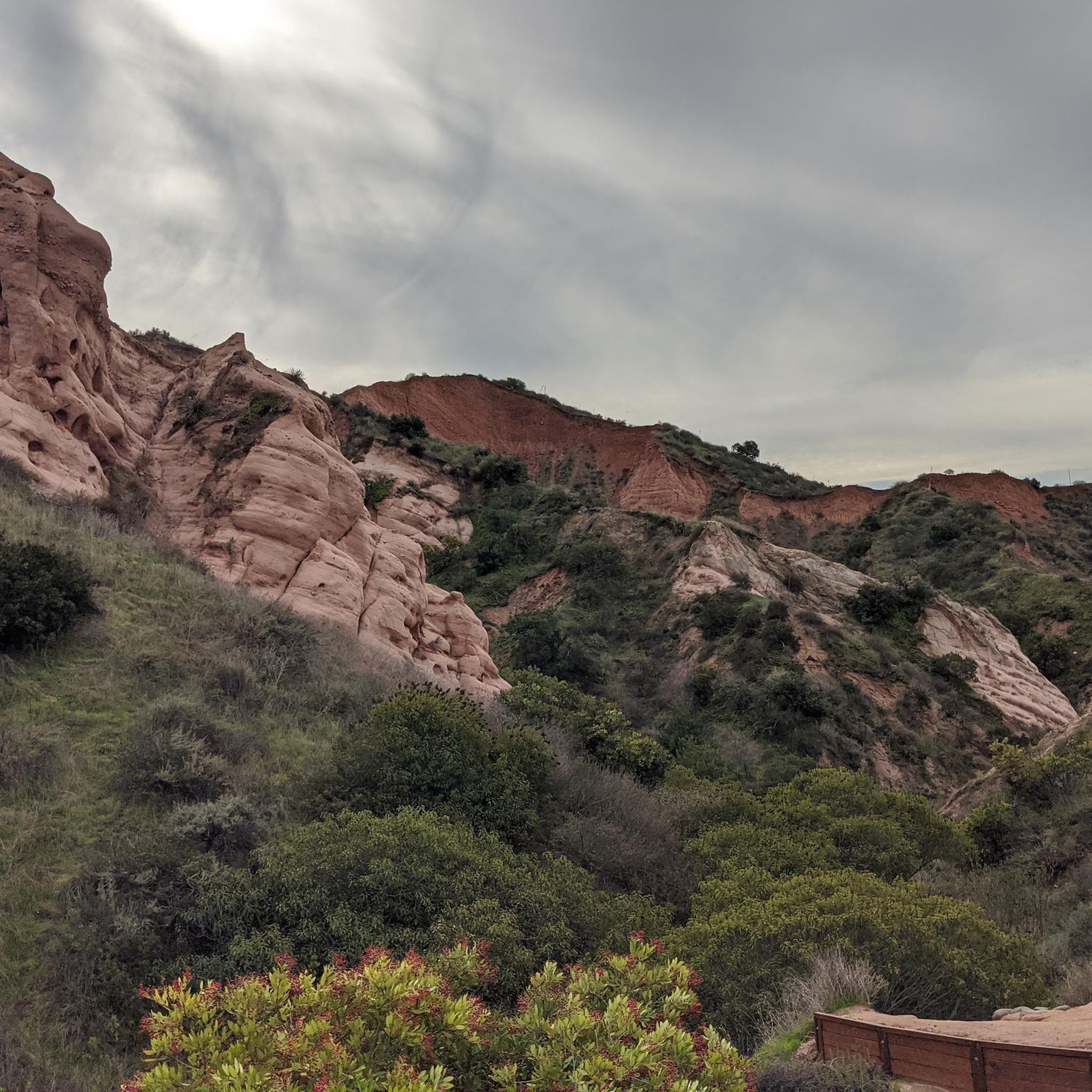
Jogging in Whiting Ranch Wilderness Park offers diverse landscapes across approximately 2,500 acres. The park features riparian and oak woodland canyons, rolling grassland hills, and steep slopes with coastal sage scrub. A notable natural feature is Red Rock Canyon, characterized by its distinctive red sandstone formations. Three intermittent streams, Borrego, Serrano, and Aliso Creek, also traverse the park, providing varied terrain for running.
Best jogging routes in Whiting Ranch Wilderness Park
- The most popular jogging route is Borrego, Mustard, and…
Last updated: July 7, 2026
8
runners
10.2km
01:20
240m
240m
The Borrego, Mustard, and Billy Goat Loop offers a dynamic jogging experience through Whiting Ranch Wilderness Park, blending flat, easy sections with a genuinely challenging ridge-line climb. You'll start on…
7
runners
9.63km
01:17
270m
270m
The Borrego Canyon and Red Rock Canyon Trail offers a fascinating journey through contrasting landscapes, starting in lush oak woodlands along Borrego Canyon before transitioning to a more arid, desert-like…

Sign up for free
1
runners
6.45km
00:54
260m
260m
The Dreaded Hill and Whiting Road Loop offers a challenging yet rewarding jogging experience through the diverse Southern California landscapes of Whiting Ranch Wilderness Park. You'll traverse oak woodland canyons,…
13
runners
The Whiting Ranch Trailhead – Whiting Ranch Wilderness Park loop from Foothill Ranch offers a dynamic jogging experience through diverse Southern California landscapes. This difficult 10.4-mile (16.8 km) route, with…
7
runners
The Santiago Canyon Road – Cook's Corner loop from Whiting Ranch Wilderness Park offers a challenging jogging experience through diverse Orange County landscapes. You'll transition from the open, rolling hills…
Get access to more routes and recommendations from other explorers.
Sign up for free
Already have an account?
Our route recommendations are based on thousands of hikes, rides, and runs completed by other people on komoot.
Start today with a free account
Your next adventure awaits.
Login or Signup
Tips from the Community

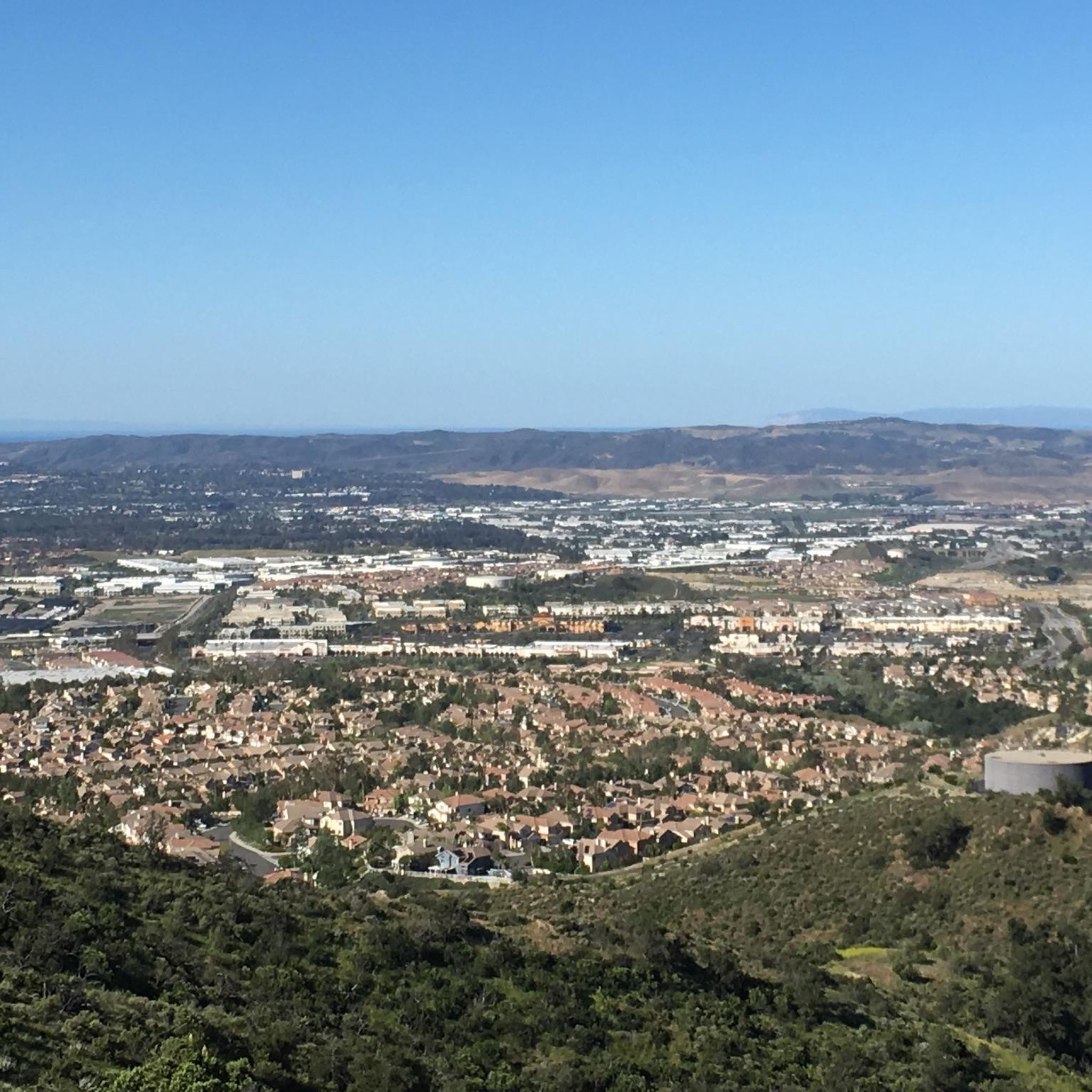
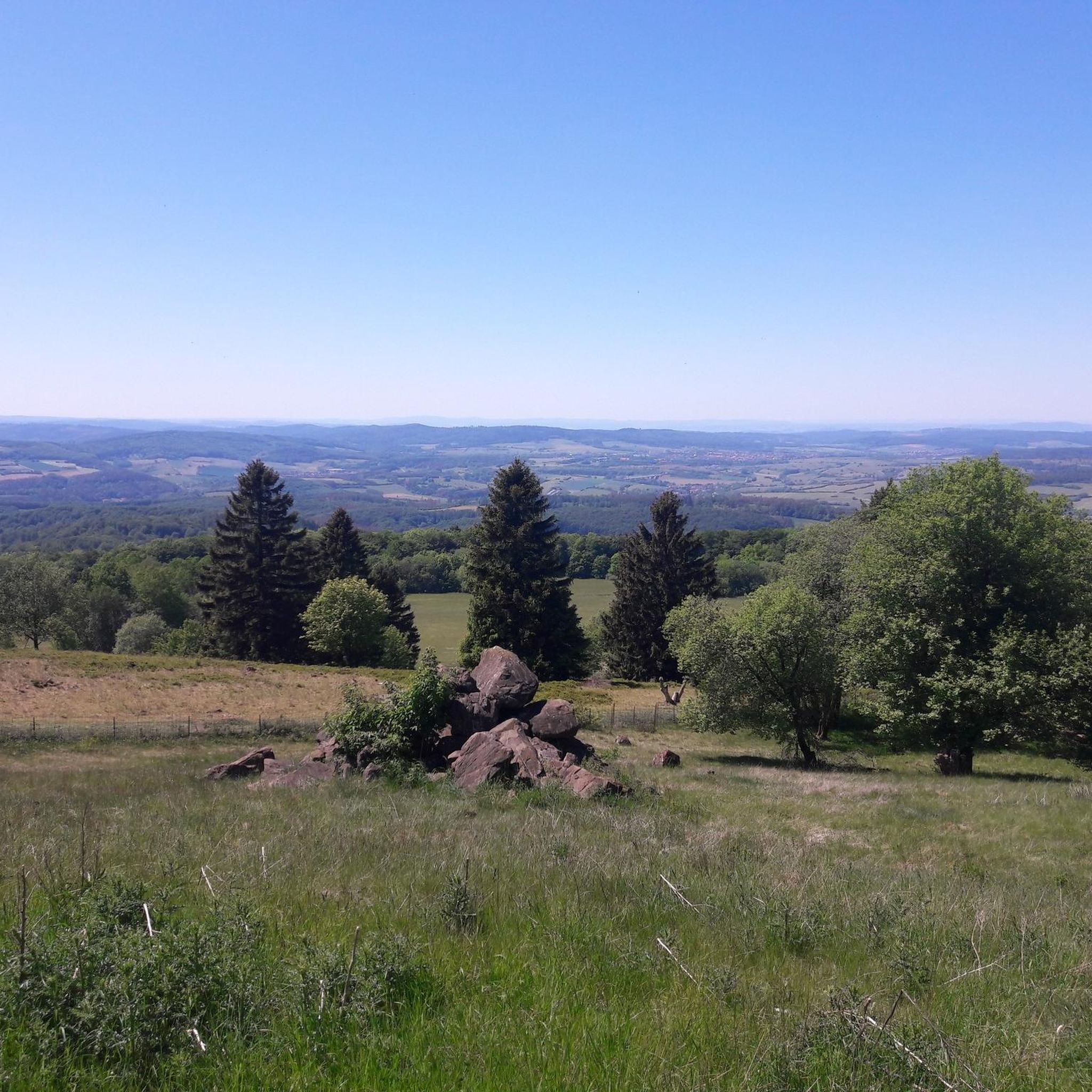
You can find this viewpoint along Line Shacking trail, giving a nice view of the Whiting Ranch Wilderness, its hills and canyons.
0
0

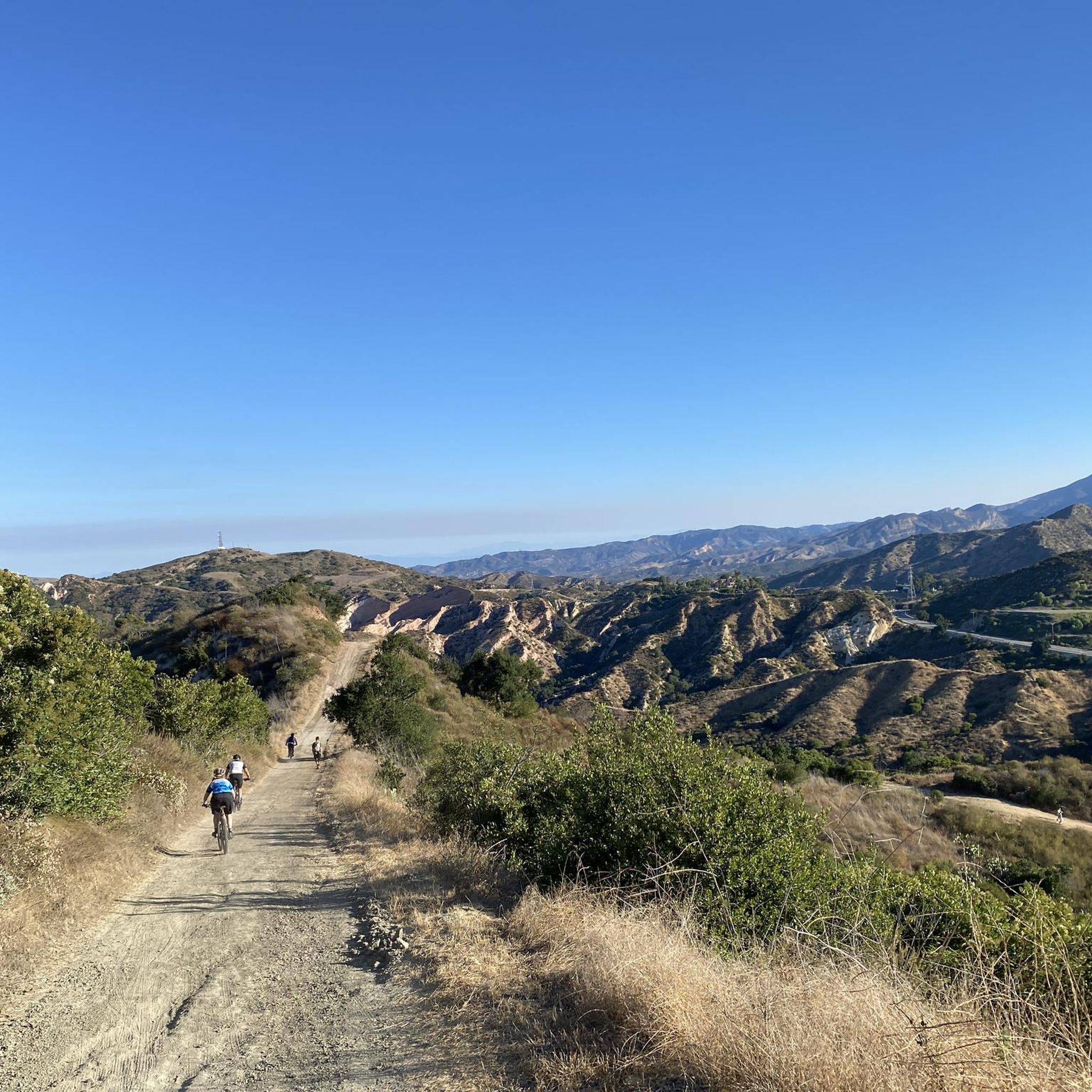
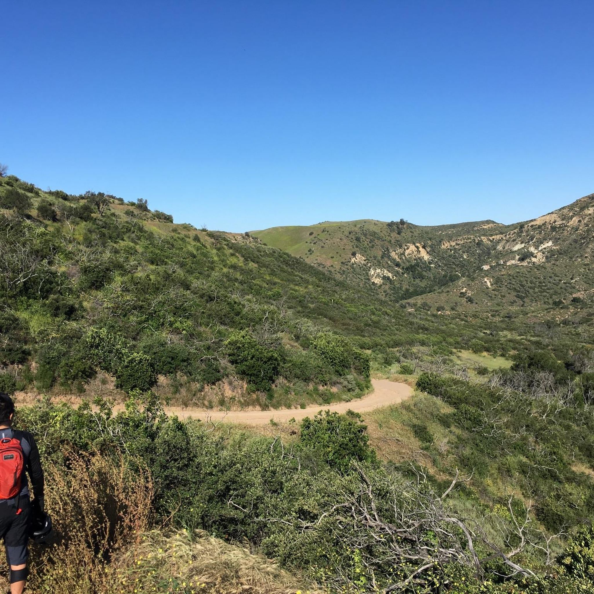
Whiting Ranch Wilderness Park is about 2,500 acres of diverse landscapes. There is about 17 miles of trails to run that take you through canyons, woodlands, rolling grasslands, and red‑rock formations
0
0
The Borrego Canyon Trail winds through oak woodlands and past creeks. The trail is somewhat challenging and will eventually take you to some dramatic red‐rock.
0
0
Santiago Canyon Road is a scenic favorite for road cyclists in Orange County. It’s a long, winding stretch with rolling hills, light traffic, and wide shoulders in most parts. The views of open hills and oak trees make the climb worth it, and you’ll find classic stops along the way for a break.
0
0
Cook’s Corner is a classic stop for cyclists riding through Santiago Canyon and one of the most popular biker hangouts in Southern California. It’s casual and bike-friendly, with shaded picnic tables and plenty of space to park. Grab a burger or a cold drink, rest your legs, and soak in the lively atmosphere—especially on weekends when it’s packed with motorcycles and live music.
0
0

Whiting Ranch Wilderness Park is a 2,500-acre park in southern Orange County. The park offers 17 miles of graded roads and single track through woodland canyons, rolling grassland hills, and red rock formations.
0
0

The trail ends in a unique, smooth, red rock canyon that feels more like Arizona than Orange County. This feels like a fantastic wilderness getaway despite being not far from town.
0
0
The top of the lookout has a wide open top with a picnic table and a tree that casts shade in the morning. From here you get incredible panoramic views across Whiting Ranch and the foothills.
0
0
Frequently Asked Questions
How many running routes are available in Whiting Ranch Wilderness Park?
Whiting Ranch Wilderness Park offers a wide variety of running experiences, with over 70 routes documented on komoot. These range from easy paths to more challenging trails, catering to different fitness levels.
Are there any easy jogging routes suitable for beginners or families in Whiting Ranch Wilderness Park?
Yes, the park features some trails suitable for all skill levels, including beginners and families. While many routes are moderate, there are at least 2 easy routes available. Look for paths with less elevation gain and smoother terrain for a more relaxed experience.
What are some of the most scenic natural features or points of interest I can see while jogging?
The park is renowned for its diverse landscapes. You can experience the dramatic red sandstone formations of Red Rock Canyon, explore serene oak woodlands, and pass by intermittent streams like Borrego, Serrano, and Aliso Creek. For panoramic views, consider routes that pass by Vista Lookout, offering the highest vantage point in the area.
Are dogs allowed on the running trails in Whiting Ranch Wilderness Park?
No, dogs are generally not permitted on the trails within Whiting Ranch Wilderness Park. It's important to respect park regulations to protect the wildlife and natural environment.
What kind of terrain can I expect on the jogging routes?
The terrain in Whiting Ranch Wilderness Park is quite varied. You'll encounter riparian and oak woodland canyons, rolling grassland hills, and steep slopes covered in coastal sage scrub. Some sections, particularly into Red Rock Canyon, can be sandy and rocky, while other parts are well-marked and accessible.
Is there a parking fee at Whiting Ranch Wilderness Park?
Yes, there is a parking fee to access Whiting Ranch Wilderness Park. The fee is $3 per vehicle. The park is open daily from 7:00 a.m. until sunset.
Are there any circular running routes in the park?
Yes, several routes in Whiting Ranch Wilderness Park are loops, offering a convenient way to explore without retracing your steps. For example, the Dreaded Hill and Whiting Road Loop is a popular 4.0-mile circular trail through rolling grassland hills.
What do other runners enjoy most about jogging in Whiting Ranch Wilderness Park?
The area is highly rated by the komoot community, with an average score of 5.0 stars. Reviewers often praise the diverse landscapes, from the unique red rock formations to the peaceful oak woodlands, and the variety of trails that cater to different fitness levels.
What should I know about wildlife when running in the park?
Whiting Ranch Wilderness Park is home to abundant wildlife, including mule deer. However, mountain lions are also present in the park, so visitors are advised to be aware of their surroundings and take appropriate precautions.
Are there any challenging running routes for experienced runners?
Absolutely. While many routes are moderate, the park also features 14 difficult routes for those seeking a greater challenge. An example is the Whiting Ranch Wilderness Park – Whiting Ranch Trailhead loop from Saddleback Church, which covers over 10 miles with significant elevation gain.
Can I expect significant elevation changes on the trails?
Yes, many trails in Whiting Ranch Wilderness Park feature notable elevation changes. For instance, the Borrego, Mustard, and Billy Goat Loop includes an 800-foot elevation gain, providing a good workout and rewarding views.
What is the best time of year to go running in Whiting Ranch Wilderness Park?
The park is open year-round, but conditions can vary. Mornings are generally cooler and more pleasant, especially during warmer months. Be aware that trails may be subject to temporary closures following heavy rain due to potential hazards.
Most popular routes in Whiting Ranch Wilderness Park
Most popular attractions in Whiting Ranch Wilderness Park

Get inspired with the komoot mobile app


Explore more
Browse the best Running Trails & Routes in other regions.
