The best running trails in Stetson Ranch Park
4.3
(3)
102
runners
23
runs
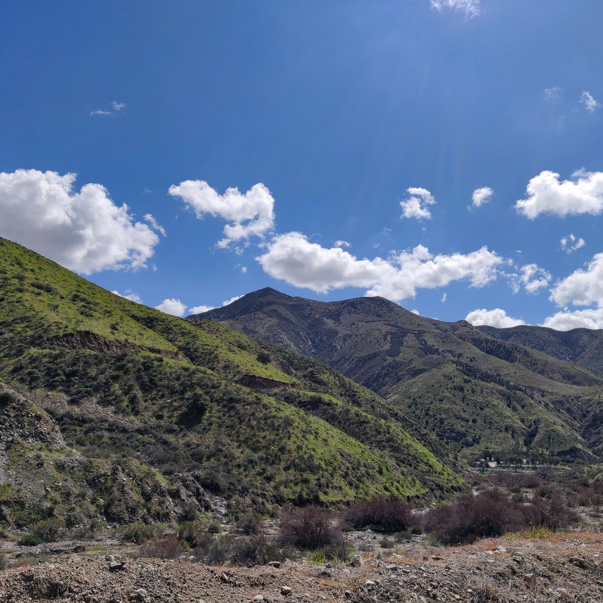
Jogging in Stetson Ranch Park offers access to a diverse trail network within a rugged, natural setting. The region features rolling hills, canyon paths, and open chaparral landscapes, providing varied terrain for running. Situated near the San Gabriel Mountains, the park serves as a gateway to routes with different lengths and elevations. This environment allows for trail running away from urban areas, connecting runners with the natural beauty of the Sylmar area.
Best jogging routes in Stetson Ranch Park
- The most popular jogging route is O'Melveny Park to Mission Point Loop, a difficult 5.1 miles (8.2 km) trail that takes 1 hour 10 minutes to complete. This path involves significant elevation gain, rewarding runners with 360-degree views of the San Fernando Valley, Santa Monica Mountains, and San Gabriel Mountains.
- Another top favourite among local runners is Whitney Canyon Road Trail, a moderate 3.0 miles (4.8 km) path. This route winds through a scenic canyon landscape, offering a less strenuous running experience.
- Local runners also love the Elsmere Canyon Loop Trail, a 3.4 miles (5.4 km) trail leading through rolling hills and chaparral landscapes, often completed in about 41 minutes.
- Jogging in Stetson Ranch Park is defined by rolling hills, canyon paths, and chaparral landscapes. The network offers options for different ability levels, from moderate runs to more challenging routes with significant elevation.
- The routes in Stetson Ranch Park are highly rated by the komoot community with an average score of 4.5 stars from over 2 reviews. More than 100 runners have used komoot to explore Stetson Ranch Park's varied terrain.
Last updated: August 29, 2026
5.0
(1)
9
runners
15.5km
01:53
640m
640m
Hard run. Very good fitness required. Mostly paved surfaces. Suitable for all skill levels.
5
runners
8.24km
01:10
400m
400m
Hard run. Very good fitness required. Mostly paved surfaces. Suitable for all skill levels.

Sign up for free
5
runners
7.22km
01:03
350m
350m
Hard run. Very good fitness required. Mostly paved surfaces. Suitable for all skill levels.
4
runners
4.81km
00:35
100m
100m
Moderate run. Good fitness required. Mostly paved surfaces. Suitable for all skill levels.
8.71km
01:05
340m
340m
Hard run. Very good fitness required. Mostly accessible paths. Some sure footedness required.
Get access to more routes and recommendations from other explorers.
Sign up for free
Already have an account?
Our route recommendations are based on thousands of hikes, rides, and runs completed by other people on komoot.
Start today with a free account
Your next adventure awaits.
Login or Signup
Popular around Stetson Ranch Park



Tips from the Community

Steep going up but we'll worth the views at Mission Point. Watch for coyotes. Not too technical. usually dry and exposed trail.
0
0

Beautiful views, difficult due to the steepness of the trail, you must be in good health due to the steepness of the terrain
0
0

At 3,560 feet, Los Pinetos Peak serves as the highest point along Santa Clara Divide Road. The lower sections of the roads leading to the summit are paved, but all the paths turn to dirt and are closed to public vehicles (besides bikes and pedestrians). There are great views of the valley and foothills from the summit.
0
0

Elsmere Canyon, once slated to become the world’s largest landfill, now holds significant importance for providing connectivity to existing wildlife corridors. This section of the trail system comprises a dirt service road with a notable elevation change, culminating in the area's highest point and offering stunning views.
0
0

Mission Point is a popular destination for hikers and mountain bikers. The views from the top are spectacular and you can see most of the San Fernando Valley and on a clear day the ocean.
0
0

Elsmere Canyon Road is a dirt road that is easy to pedal.
0
0

O'Melveny Park in Granada Hills is a large park, it is the second largest park in Los Angeles County after Griffith Park. It is a great place to hike or run. Having a run out up the O'Melveny Trail up to Mission Point is great fun, not that overcrowded and it has great mountain views.
0
0
At 3,560 feet, Los Pinetos Peak serves as the highest point along Santa Clara Divide Road. The lower sections of the roads leading to the summit are paved, but all the paths turn to dirt and are closed to public vehicles (besides bikes and pedestrians). There are great views of the valley and foothills from the summit.
0
0
Frequently Asked Questions
How many running routes are available in Stetson Ranch Park?
Stetson Ranch Park offers a diverse network of over 20 running routes. These include a mix of easy, moderate, and difficult trails, catering to various fitness levels and preferences.
What kind of terrain can I expect on the jogging trails in Stetson Ranch Park?
The park features a rugged and natural setting with varied terrain. You'll find rolling hills, picturesque canyon paths, and open chaparral landscapes. This diverse environment provides options from leisurely jogs to more strenuous runs with significant elevation changes.
Are there any easy or beginner-friendly jogging routes in Stetson Ranch Park?
Yes, Stetson Ranch Park has a few easy routes suitable for beginners or those looking for a less strenuous run. While specific easy routes are not detailed in the provided data, the park's diverse network includes options for all ability levels.
Which trails offer the best views in Stetson Ranch Park?
For breathtaking vistas, consider the O'Melveny Park to Mission Point Loop. This challenging route rewards runners with 360-degree views of the San Fernando Valley, Santa Monica Mountains, and San Gabriel Mountains from Mission Point.
Are there any loop trails for running in Stetson Ranch Park?
Yes, Stetson Ranch Park and its surrounding areas offer several loop options. The Elsmere Canyon Loop Trail is a popular moderate option, and the broader region includes trails like the Wilson Canyon Loop and Mission Point Trail Loop for varied experiences.
What do other runners say about the trails in Stetson Ranch Park?
The running routes in Stetson Ranch Park are highly rated by the komoot community, with an average score of 4.5 stars from over 2 reviews. Runners often praise the varied terrain and the opportunity to connect with nature away from urban areas.
Are the jogging routes in Stetson Ranch Park suitable for families?
Many of the trails in Stetson Ranch Park offer a natural and engaging environment for families. While some routes involve significant elevation, there are also easier paths that can be enjoyed by those looking for a less challenging family outing. It's recommended to check individual route details for suitability.
Can I bring my dog on the running trails in Stetson Ranch Park?
Stetson Ranch Park is generally dog-friendly, with many trails allowing leashed dogs. Given its rugged and natural character, it's a great place to enjoy a run with your canine companion. Always ensure your dog is on a leash and you clean up after them.
What are some notable natural features or landmarks to look out for while running?
Beyond the panoramic views from Mission Point, you'll encounter unique desert geology along trails like the Wilson Canyon Loop. The park's 'rugged natural state' means you'll experience rolling hills, scenic canyon landscapes, and open chaparral, providing an immersive natural environment.
Is there parking available at Stetson Ranch Park for runners?
Yes, Stetson Ranch Park provides access to various trailheads, including the Saddletree Ranch Trailhead, which features shady picnic grounds and an interpretive display. Parking facilities are typically available at these access points.
How can I access the Saddletree Ranch Trailhead?
The Saddletree Ranch Trailhead is accessible from Stetson Ranch Park. For more detailed information on access and facilities, you can visit the official MRCA website: Saddletree Ranch Trailhead.
What is the typical elevation gain on the more challenging routes?
On more challenging routes, such as the O'Melveny Park to Mission Point Loop, you can expect significant elevation gain, often exceeding 400 meters (around 1300 feet). These routes provide a strenuous workout and rewarding climbs.
Most popular routes in Stetson Ranch Park

Get inspired with the komoot mobile app


Explore more
Browse the best Running Trails & Routes in other regions.
