The best road cycling routes in Table Rock State Park
245
riders
12
rides
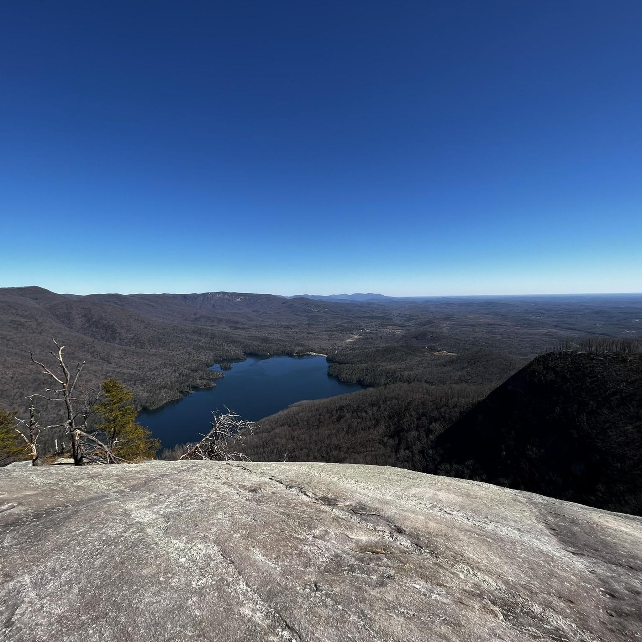
Road cycling routes in Table Rock State Park are situated at the edge of South Carolina's Blue Ridge Mountains, offering challenging and scenic rides. The region is characterized by granite domes like Table Rock Mountain and the higher Pinnacle Mountain, part of the Blue Ridge Escarpment. Road cyclists can expect demanding climbs and panoramic views of the mountainous terrain. The area includes two scenic lakes, Lake Pinnacle and Lake Oolenoy, which contribute to the varied landscape.
Best road cycling routes in Table Rock State Park
- The most popular road cycling route is Grant Meadow Overlook – Bald Rock loop from The Stool, a 30.4 miles (48.9 km) trail that takes 2 hours 43 minutes to complete. This difficult route features significant elevation gain and offers panoramic views of the surrounding mountains.
- Another top favourite among local road cyclists is Green Creek Waterfalls – Carrick Creek Falls loop from Table Rock State Park, a moderate 33.0 miles (53.1 km) path. This route includes scenic sections near waterfalls and mountain streams.
- Local road cyclists also love the Paris Mountain – Batson Mill loop from Table Rock State Park, a 69.6 miles (111.9 km) trail leading through the Blue Ridge Mountains, often completed in about 5 hours 32 minutes.
- Road cycling in Table Rock State Park is defined by granite domes, the Blue Ridge Escarpment, and mountain streams. The network offers options for moderate and difficult ability levels.
- The guide includes highly-rated routes that showcase the best of the region's landscape. More than 200 road cyclists have used komoot to explore Table Rock State Park's varied terrain.
Last updated: July 21, 2026
16
riders
49.4km
02:45
1,060m
1,060m
Hard road ride. Very good fitness required. Mostly well-paved surfaces and easy to ride.
10
riders
The Green Creek Waterfalls – Carrick Creek Falls loop from Table Rock State Park offers a challenging and scenic road cycling experience through the foothills of the Blue Ridge Mountains. You'll navigate significant elevation changes, pedaling through dense oak-hickory, pine, and hemlock forests, with picturesque views of mountain streams and lakes like Pinnacle Lake. This moderate 33.0-mile (53.1 km) route, with 1937 feet (590 metres) of climbing, is designed for experienced cyclists who appreciate a good workout and stunning natural beauty, typically taking around 2 hours and 31 minutes to complete.
Planning your ride here means preparing for mountainous terrain, steep climbs, and exhilarating descents. Table Rock State Park serves as a prime access point for this route, which is part of an area known for its demanding cycling opportunities. While specific parking details for this exact road cycling route aren't provided, the state park generally offers facilities; arriving early is always a good strategy, especially on weekends. Spring and fall offer ideal weather for tackling these roads.
This particular road cycling route is a testament to the region's appeal for serious cyclists, with some local roads even used as training grounds for professionals. The area around Table Rock State Park is rich with diverse landscapes, from panoramic mountain views at overlooks like Caesars Head to serene lake vistas and numerous waterfalls. It's a destination that combines physical rigor with visual reward, making it a standout choice for those seeking advanced road cycling trails near Table Rock State Park.

Sign up for free
6
riders
112km
05:32
1,310m
1,310m
Hard road ride. Very good fitness required. Mostly well-paved surfaces and easy to ride.
3
riders
51.2km
02:18
530m
530m
Moderate road ride. Good fitness required. Mostly well-paved surfaces and easy to ride.
64
riders
81.4km
04:26
1,510m
1,510m
The Caesars Head Hotel & Caesars Head Mountain loop is a demanding road cycling route that plunges you into the heart of the Blue Ridge Escarpment. You'll navigate dense woodlands and tackle the legendary Caesars Head climb, a favorite training ground for professional cyclists. The reward for your effort is a series of panoramic views of the Blue Ridge Mountains, culminating in the breathtaking vista from the View of the Blue Ridge Mountains from Caesars Head. This difficult 50.6-mile (81.4 km) journey, with its 4956 feet (1511 metres) of elevation gain, is a true test of endurance and skill, typically taking around 4 hours and 25 minutes.
Planning your ride requires attention to detail. Spring and fall are ideal for this route, offering pleasant temperatures and vibrant scenery, especially the exceptional fall foliage. Be prepared for cooler temperatures at the summit and potential increased traffic during peak leaf-peeping season in October. While the roads are generally paved, some sections may have bumps and cracks, requiring good bike handling. The visitor center at Caesars Head State Park provides amenities like snacks and drinks.
This area is renowned among the cycling community, with Hotel Domestique serving as a prominent hub for various challenging loops. The connection to professional cyclists like George Hincapie adds a prestigious feel to the ride. Beyond the physical challenge, you'll encounter dramatic geological formations, granitic gneiss outcroppings, and numerous waterfalls along the way, making it a visually rich experience for advanced cyclists seeking the best road cycling Caesars Head has to offer.
Get access to more routes and recommendations from other explorers.
Sign up for free
Already have an account?
Our route recommendations are based on thousands of hikes, rides, and runs completed by other people on komoot.
Start today with a free account
Your next adventure awaits.
Login or Signup
Popular around Table Rock State Park

Tips from the Community

This is a beautiful spot to sit and take it easy after a long hike!
0
0
The Foothills Trail ends at Table Rock State Park and is really beautiful. The terminus is a welcome sight after a long hike
0
0

The bike lane on Hwy 11 isn’t bad. There are spots that need debris removed, but for the portion of it that I rode, it was pretty good.
0
0

This scenic river is a popular trout fishing spot. It may be tempting to take a dip to cool off on a hot day; however, keep in mind that the water can be very cold, even during summer.
0
0

Grant Meadow Overlook is a scenic pull-off along the Cherokee Foothills Scenic Highway in Pickens, South Carolina. This is a great place to stop on your ride to sip some water and snap some photos of the fantastics views of Table Rock over the open meadow.
0
0

Lake Oolenoy is a 67-acre lake located in Table Rock State Park. From the lake, you can get a nice view of Table Rock Mountain. The lake is a popular spot for boating and fishing.
0
0
Timmons Pond is a small pond just off of Pumpkintown Road in Slater-Marietta, South Carolina, on the border of North and South Carolina. This is a nice spot to keep an eye out for birds and other wildlife as you ride by.
0
0

For those who enjoy the thrill of off-the-beaten-path exploration, reaching Mashbox Falls is a truly rewarding experience. The secluded beauty and serene atmosphere make it a hidden gem worth discovering.
0
0
Frequently Asked Questions
How many road cycling routes are available in Table Rock State Park?
There are 14 road cycling routes in Table Rock State Park, offering a range of experiences from moderate to difficult. These routes are designed to showcase the region's unique mountainous terrain.
What kind of terrain and difficulty can I expect on road cycling routes in Table Rock State Park?
Road cycling in Table Rock State Park is characterized by challenging routes with demanding climbs and significant elevation gains, typical of the Blue Ridge Escarpment. The terrain features impressive granite domes like Table Rock Mountain and Pinnacle Mountain, offering panoramic views. Routes are generally classified as moderate or difficult, with 9 difficult and 5 moderate options available.
Are there any family-friendly road cycling options in Table Rock State Park?
While many routes in Table Rock State Park feature demanding climbs, there are shorter, less strenuous paved routes available for those seeking a more relaxed ride. The guide primarily features moderate to difficult routes, so it's best to check individual route profiles for suitability for families or less experienced riders.
What are some scenic points of interest or landmarks along the road cycling routes?
Many routes offer stunning views of the Blue Ridge Mountains and pass by significant natural features. You might encounter picturesque waterfalls like Green Creek Waterfalls and Carrick Creek Falls. Routes also provide glimpses of scenic lakes such as Lake Oolenoy, and offer panoramic vistas from viewpoints like Governor's Rock.
What do other road cyclists enjoy most about road cycling in Table Rock State Park?
Road cyclists frequently praise the challenging climbs and the rewarding panoramic views of the Blue Ridge Mountains. The diverse landscape, featuring granite domes, scenic lakes, and waterfalls, also contributes to a highly enjoyable experience. Routes like the Grant Meadow Overlook – Bald Rock loop from The Stool are popular for their significant elevation gain and stunning vistas.
Are there any routes that feature waterfalls?
Yes, some routes incorporate scenic waterfalls. For example, the Green Creek Waterfalls – Carrick Creek Falls loop from Table Rock State Park is a moderate 33.0-mile path that includes sections near waterfalls and mountain streams, offering a refreshing visual experience during your ride.
What is the best time of year for road cycling in Table Rock State Park?
The region offers enjoyable riding conditions for much of the year. Spring and fall generally provide the most pleasant temperatures and vibrant scenery, with cooler weather and colorful foliage. Summer can be warm, but the mountainous terrain can offer some relief. Always check the local weather forecast before heading out.
Are there any long-distance road cycling routes for experienced riders?
Yes, for experienced riders seeking a longer challenge, the Paris Mountain – Batson Mill loop from Table Rock State Park is a substantial 69.6-mile (111.9 km) route. This difficult trail leads through the Blue Ridge Mountains and typically takes around 5 hours 32 minutes to complete, offering extensive riding and significant elevation.
Are there any circular road cycling routes in the area?
Many of the routes in Table Rock State Park are designed as loops, allowing you to start and finish at the same point. Examples include the Grant Meadow Overlook – Bald Rock loop from The Stool and the Grant Meadow Overlook – Lake Oolenoy loop from Lake Oolenoy, providing convenient circular journeys through the scenic landscape.
What are the typical distances for road cycling routes in Table Rock State Park?
Route distances vary to accommodate different preferences and fitness levels. You can find routes ranging from approximately 27 miles (43 km) to over 69 miles (111 km). For instance, the Green Creek Waterfalls – Carrick Creek Falls loop from Table Rock State Park is about 27 miles, while the Paris Mountain – Batson Mill loop from Table Rock State Park is significantly longer at 69.6 miles.
Are there any specific permits or fees required for road cycling within Table Rock State Park?
Table Rock State Park is a South Carolina State Park, and typically, a park entrance fee is required per vehicle. It's advisable to check the official South Carolina State Parks website for the most current information on fees and any specific regulations for cycling within the park boundaries.
Where can I find parking for road cycling routes in Table Rock State Park?
Parking is generally available at designated areas within Table Rock State Park. Many routes start from locations like 'The Stool' or directly from Table Rock State Park's main entrance, where parking facilities are provided for visitors. Always check the starting point of your chosen route for specific parking recommendations.
Most popular routes in Table Rock State Park
Most popular attractions in Table Rock State Park

Get inspired with the komoot mobile app


Explore more
Browse the best Road cycling routes in other regions.
