The best gravel rides around Eckertalsperre
4.4
(135)
849
riders
60
rides
Gravel biking around Eckertalsperre offers a diverse landscape characterized by dense forests, rolling hills, and significant water bodies like the Eckertalsperre dam and other reservoirs. The region, situated within the Harz mountains, features varied terrain suitable for gravel bikes, including forest paths and trails with elevation changes. Riders can expect routes that navigate around these reservoirs and ascend to viewpoints overlooking the surrounding natural environment.
Best gravel bike trails around Eckertalsperre
- The most popular gravel bike trail is Rehberger Graben…
Last updated: July 2, 2026
4.1
(15)
99
riders
39.0km
03:03
1,010m
1,010m
Hard gravel ride. Very good fitness required. Mostly paved surfaces. Suitable for all skill levels.
4.0
(7)
27
riders
64.5km
04:24
1,300m
1,300m
Hard gravel ride. Very good fitness required. Mostly paved surfaces. Suitable for all skill levels.

Sign up for free
4.0
(2)
15
riders
41.4km
03:13
1,060m
1,060m
Hard gravel ride. Very good fitness required. Mostly paved surfaces. Suitable for all skill levels.
5.0
(2)
15
riders
Hard gravel ride. Very good fitness required. Mostly paved surfaces. Suitable for all skill levels.
4.2
(5)
52
riders
16.7km
01:10
350m
350m
Moderate gravel ride. Good fitness required. Mostly paved surfaces. Suitable for all skill levels.
Get access to more routes and recommendations from other explorers.
Sign up for free
Already have an account?
Our route recommendations are based on thousands of hikes, rides, and runs completed by other people on komoot.
Start today with a free account
Your next adventure awaits.
Login or Signup
Tips from the Community

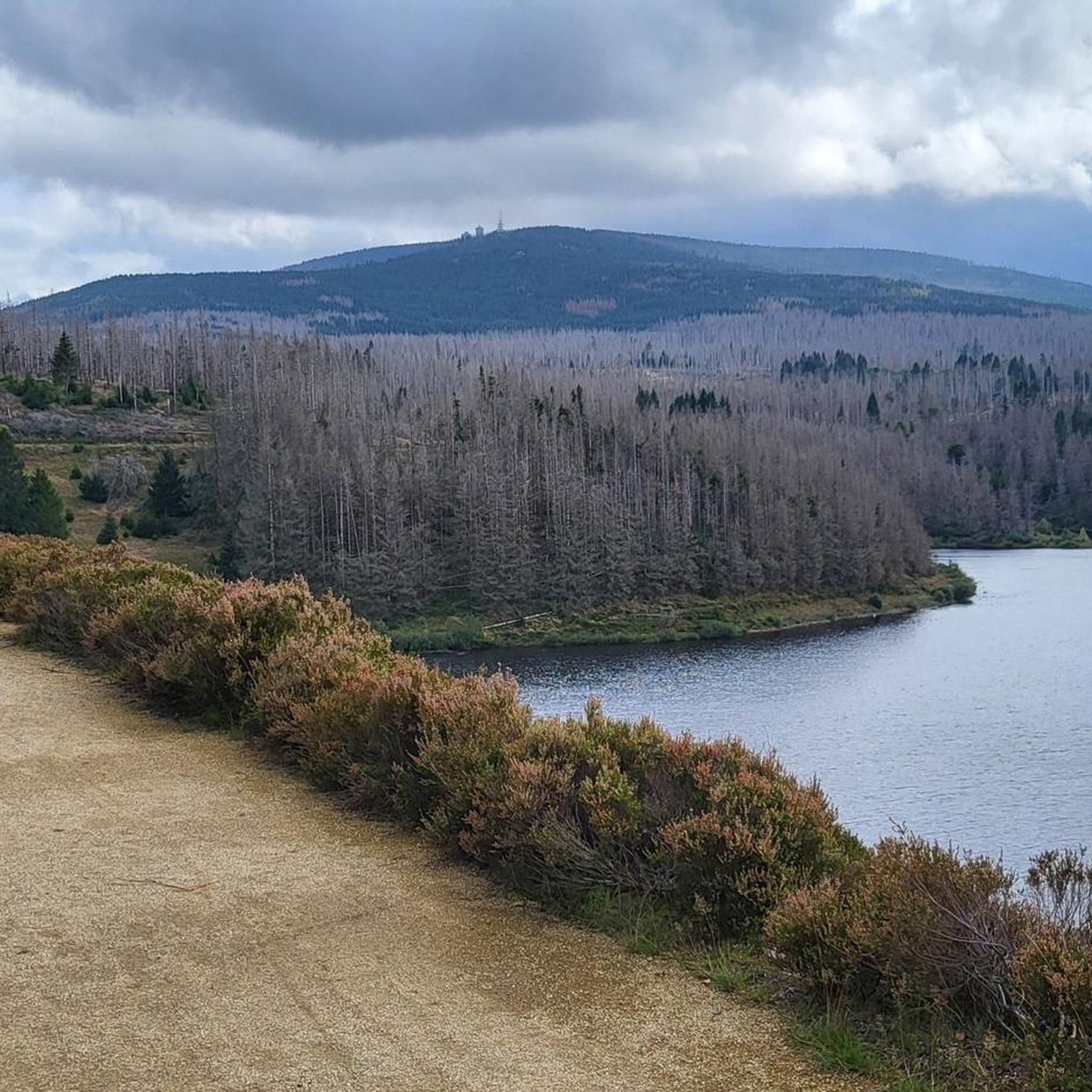
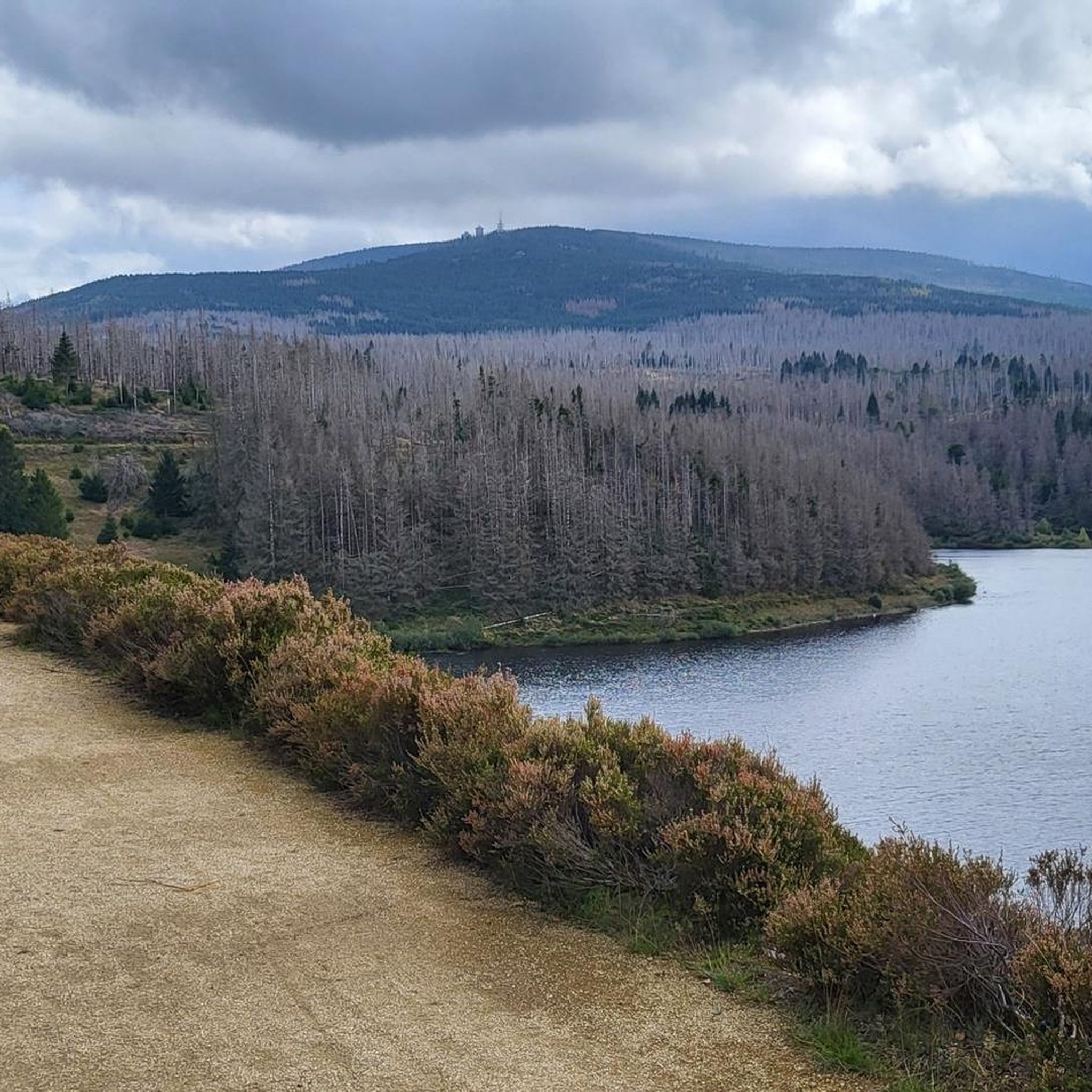
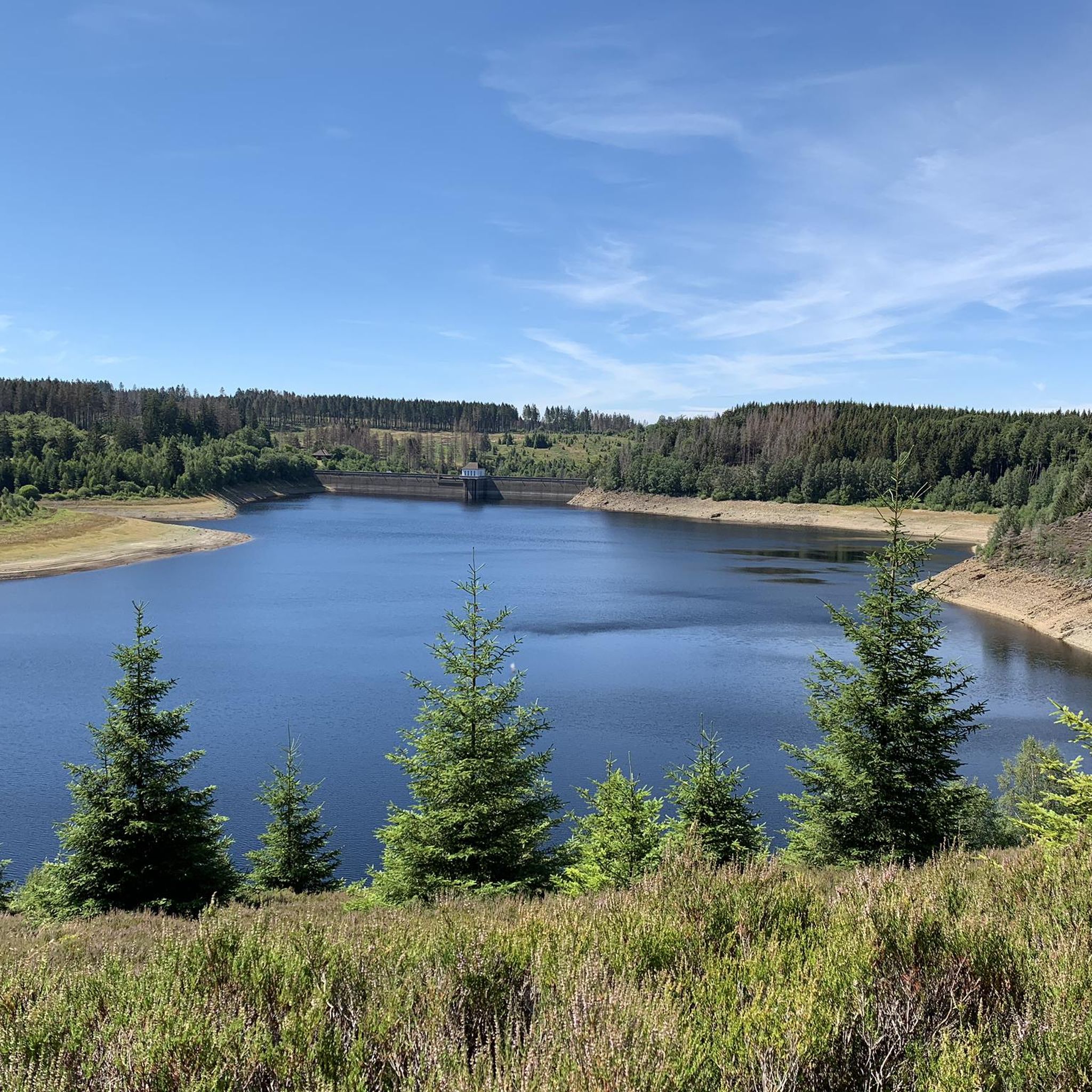
The journey is the destination - not always easy terrain, but very beautiful in dry weather
1
0

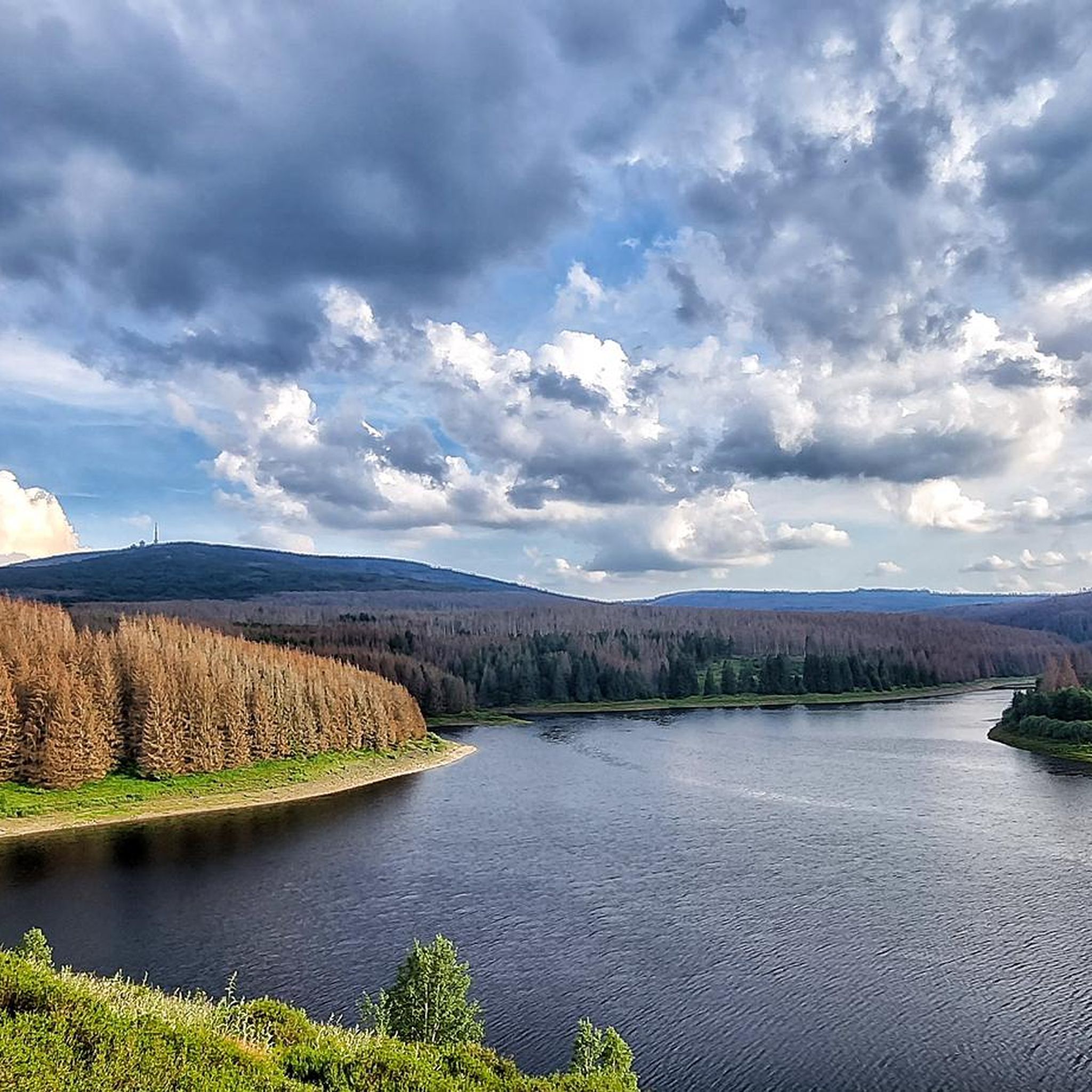
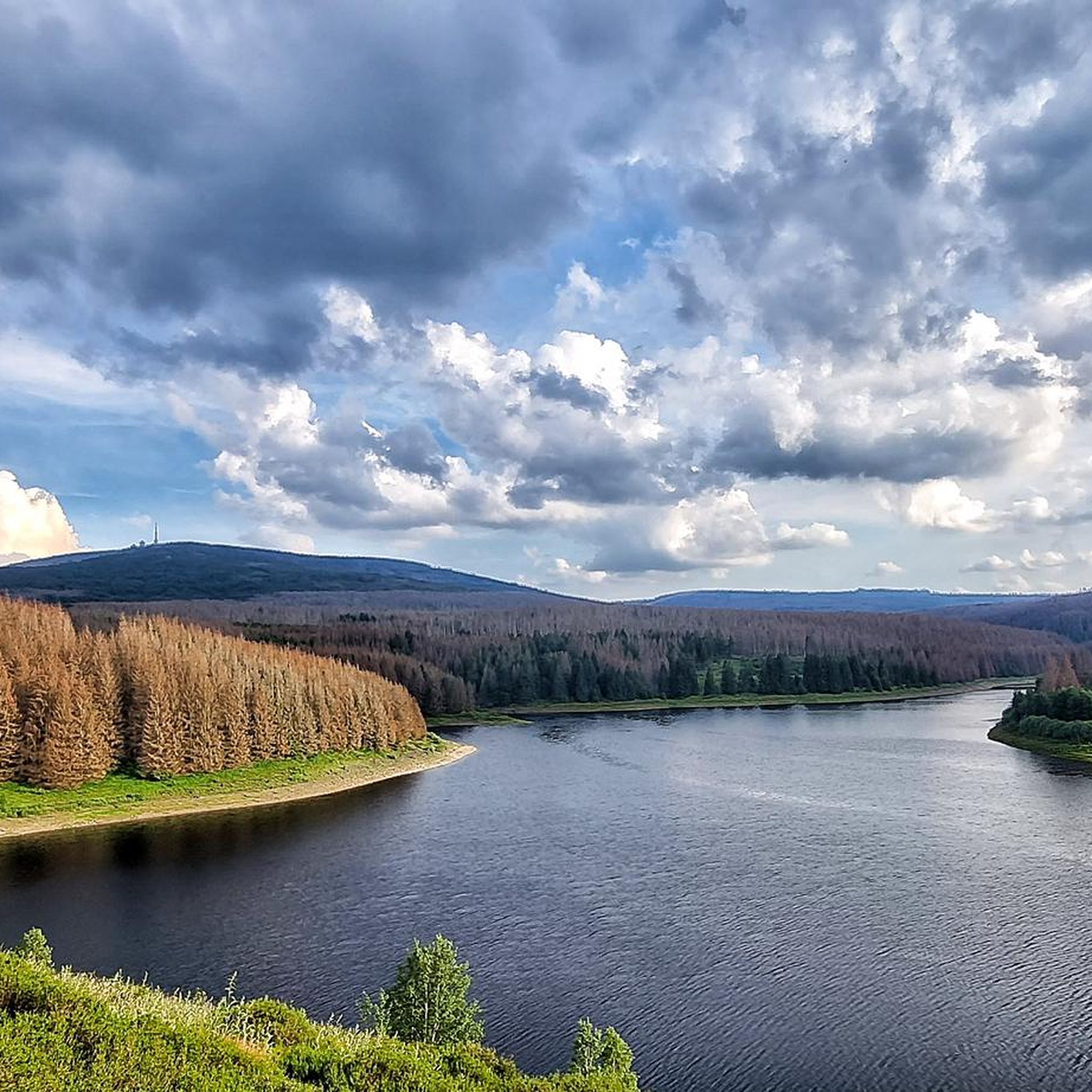
Beautiful view and a nice place to rest
2
0

a nice place to take a break 🙂👍
0
0

The reservoir supplies drinking water to the cities of Braunschweig, Wolfenbüttel, and Wolfsburg. The water is piped to the Lewerberg reservoir near Liebenburg, where drinking water from the Grane Dam also arrives. From there, a pipeline leads to the Thieder Lindenberg and further to the cities of Braunschweig and Wolfsburg. The water of the Ecker River is relatively acidic, with a pH of 4.6, due to the humic acid-rich moor streams. It is also low in nutrients and therefore well suited for drinking water treatment.[3] The dam is not used for fishing, as most fish cannot tolerate the low pH.[5] Below the dam, the water is almost neutral. Source: https://de.wikipedia.org/wiki/Eckertalsperre
3
0
The Ecker Dam (sometimes also called the Ecker Reservoir) is a dam near Bad Harzburg in the Harz Mountains, which was commissioned in 1943[1] and impounds the Ecker River and its tributaries. Operated by Harz Waterworks, the facility serves to supply drinking water, protect against flooding, increase low water levels, and generate energy.[2] Source: https://de.wikipedia.org/wiki/Eckertalsperre
3
0
Frequently Asked Questions
How many gravel bike trails are available around Eckertalsperre?
There are over 70 gravel bike routes in the Eckertalsperre region, offering a wide range of options for different skill levels and preferences. The komoot community has explored these trails over 800 times.
Are there gravel bike trails suitable for beginners around Eckertalsperre?
Yes, while many routes are challenging, there is one easy gravel bike trail available. A good option for those starting out is the View of the Brocken – Neuer Goetheweg loop from Torfhaus, which is a moderate 10.4-mile (16.7 km) path.
What kind of views can I expect along the gravel bike routes in Eckertalsperre?
The routes frequently offer extensive views of the region's reservoirs, including the Eckertalsperre itself, and the surrounding Harz mountains. You can find excellent vantage points like the View of the Eckertalsperre (Ecker Reservoir), providing panoramic vistas of the water and forested landscape.
Are there any family-friendly gravel biking options near Eckertalsperre?
While many routes in the region are rated as difficult or moderate due to significant elevation changes, the area does offer paths that can be adapted for families. For a less strenuous experience, consider exploring sections of the trails around the reservoirs, which often feature flatter terrain. Always check the route details for elevation and distance to ensure it suits your family's abilities.
What are the typical durations for gravel bike routes in the Eckertalsperre area?
Route durations vary significantly based on distance and difficulty. For instance, shorter, moderate routes like the View of the Brocken – Neuer Goetheweg loop from Torfhaus can take around 2 hours. Longer, more challenging routes, such as the Rehberger Graben – Steinatalsperre loop from Oderbrück, can require over 5 hours to complete.
Are there any circular gravel bike routes around Eckertalsperre?
Yes, many of the gravel bike trails in the region are designed as loops, allowing you to start and end at the same point. Examples include the View of the Zillierbach Reservoir – Eckertalsperre dam loop from Bad Harzburg and the Eckertalsperre dam – View of the Eckertalsperre (Ecker Reservoir) loop from Bad Harzburg.
What kind of attractions can I find along the gravel bike trails?
Beyond the natural beauty, you can encounter historical and man-made landmarks. Notable attractions include the impressive Dam wall of the Eckertalsperre (HWN 001) and the Inner German border marker on the Eckertal Reservoir dam, which offers a glimpse into the region's past.
What is the best time of year for gravel biking around Eckertalsperre?
The Harz mountains, including the Eckertalsperre area, are generally best for gravel biking from spring through autumn (April to October). During these months, the weather is typically milder, and trails are more accessible. Winter riding is possible but can be challenging due to snow and ice, requiring appropriate gear and caution.
Are there cafes or places to stop for refreshments near the gravel trails?
Yes, depending on your chosen route, you can find opportunities for refreshments. Towns like Bad Harzburg, which serve as starting points for several tours, offer various cafes and restaurants. Along some trails, you might also encounter smaller huts or guesthouses, especially in popular hiking and biking areas within the Harz.
What do other gravel bikers enjoy most about the Eckertalsperre region?
The area is highly rated by the komoot community, with an average score of 4.5 stars. Reviewers often praise the diverse terrain, the stunning reservoir views, and the extensive network of forest trails that make for an engaging gravel biking experience within the Harz mountains.
Where can I find parking for gravel biking near Eckertalsperre?
Common starting points for gravel bike tours, such as Bad Harzburg and Oderbrück, typically offer designated parking areas. It's advisable to check specific route descriptions on komoot for detailed parking information related to your chosen trailheads.
Most popular routes around Eckertalsperre
Most popular attractions around Eckertalsperre

Get inspired with the komoot mobile app


Explore more
Browse the best Gravel rides in other regions.
