The best gravel rides around Saint-Martin-En-Vercors
4.2
(42)
310
riders
40
rides
Gravel biking around Saint-Martin-En-Vercors offers a diverse landscape within the Vercors Regional Natural Park, characterized by a mid-mountain range. The terrain features extensive forest paths, winding secondary roads, and gravel tracks, providing varied riding surfaces. Riders can explore gorges, plateaus, and dense woodlands, with elevations reaching up to the Grand Veymont. This region provides a natural playground for gravel cyclists seeking varied routes.
Best gravel bike trails around Saint-Martin-En-Vercors
- The most popular gravel bike trail is Plateau de Château Julien…
Last updated: October 6, 2026
5.0
(1)
25
riders
27.8km
02:15
580m
580m
Hard gravel ride. Very good fitness required. Mostly paved surfaces. Suitable for all skill levels.
4.6
(5)
28
riders
47.6km
03:58
1,310m
1,310m
Hard gravel ride. Very good fitness required. Mostly paved surfaces. Suitable for all skill levels.

12
riders
28.2km
02:24
660m
660m
Hard gravel ride. Very good fitness required. Mostly paved surfaces. Suitable for all skill levels.
5.0
(2)
24
riders
46.4km
03:14
960m
960m
Hard gravel ride. Very good fitness required. Mostly paved surfaces. Suitable for all skill levels.
14
riders
17.8km
01:13
380m
380m
Moderate gravel ride. Good fitness required. Mostly paved surfaces. Suitable for all skill levels.
Get access to more routes and recommendations from other explorers.
Already have an account?
Our route recommendations are based on thousands of hikes, rides, and runs completed by other people on komoot.
Start today with a free account
Your next adventure awaits.


Tips from the Community


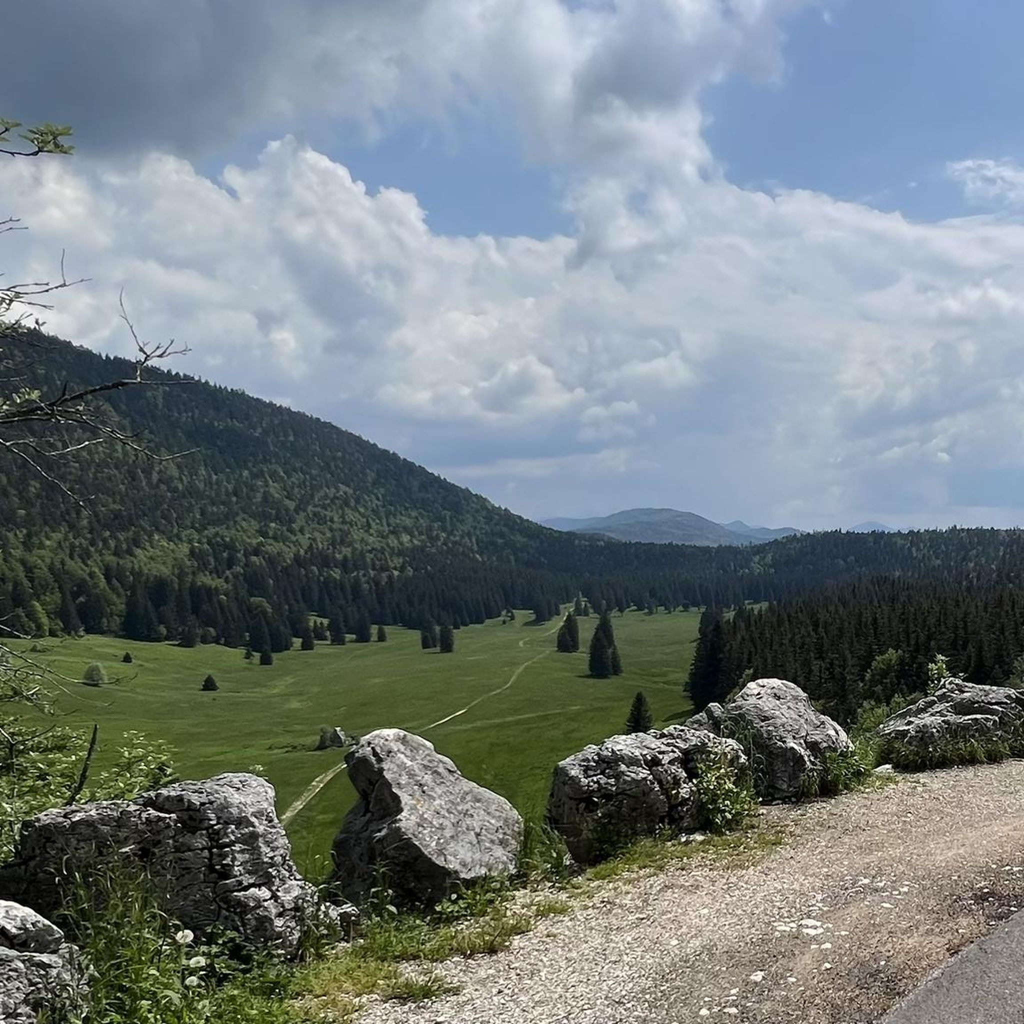
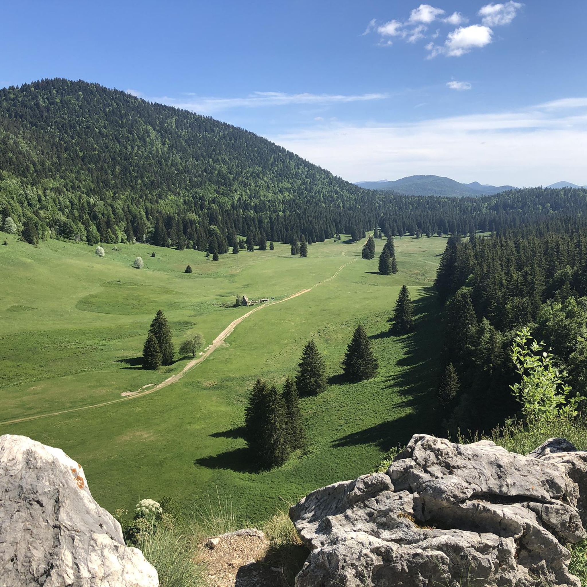
The Vercors Plateau (also known as the Vercors Massif) is one of the most spectacular natural jewels of the French Prealps, located straddling the departments of Isère and Drôme, a short distance from Grenoble. This vast limestone mountainous area, which extends over more than 206,000 hectares, is famous for its unique geological conformation that earned it the nickname of "fortress": an immense rocky block surrounded by impressive vertical cliffs, deep canyons, and spectacular internal plateaus. [1] (https://turismo-it.saintmarcellin-vercors-isere.com/i-10-principali-elementi-essenziali/parco-naturale-regionale-del-vercors/), [2] (https://it.wikipedia.org/wiki/Prealpi_del_Vercors), [3] (https://www.france.fr/it/articolo/scoprite-varieta-naturale-del-massiccio-del-vercors/), [4] (https://mapy.com/it/?source=osm&id=1209791721)
12
0
Place of worship characterized by a sober and evocative architecture, a testament to the history and traditions of the local community. The facade, architectural elements, and interiors reflect the different eras that have marked the territory.
7
0
The Necropolis of the Resistance of Vassieux-en-Vercors is one of the most significant memorial sites in the Vercors. It was inaugurated in 1948 and brings together the graves of 187 resistance fighters and civilians who fell during the fighting in July 1944. The graves, neatly arranged and marked by simple white crosses, give the place a very strong, austere, and commemorative character.
8
0
One of the most striking passes in the Vercors, nestled between dense forests and wide mountain landscapes. The climb offers a wild and tranquil environment, with the road winding through woods and plateaus. An ideal place to savor the most authentic and spectacular side of the Vercors by bike.
8
0

At the edge of the woods, traditional restaurant and guesthouse with 5 rooms (19 beds in total). For a family meal before or after a hike.
0
0
Valchevrière, a place of silence and contemplation, is one of the most moving and evocative sites of the Resistance in Vercors. This hamlet, deep in the forest, served as a camp for the maquisards before becoming the scene of a severe confrontation on July 22 and 23, 1944. On the belvedere overlooking the village, men sacrificed themselves to slow the advance of the Nazi armies and died with weapons in hand. The houses were then set on fire, only the chapel was spared. The hamlet has remained as it was, with its bare stones blackened by fire. A Stations of the Cross, each station of which is an original structure, connects Villard de Lans to Valchevrière.
0
0
Valchevrière, a place of silence and contemplation, is one of the most moving and evocative sites of the Resistance in Vercors. This hamlet, deep in the forest, served as a camp for the maquisards before being the scene of a severe confrontation on July 22 and 23, 1944. On the belvedere overlooking the village, men sacrificed themselves to delay the advance of the Nazi armies and died with weapons in hand. The houses were then set on fire, only the chapel was spared. The hamlet has remained as it was, with its bare stones blackened by fire. A Stations of the Cross, each station being an original edifice, connects Villard de Lans to Valchevrière.
0
0
Frequently Asked Questions
What kind of terrain can I expect on gravel bike trails around Saint-Martin-en-Vercors?
The Vercors Regional Natural Park offers a diverse landscape for gravel biking. You'll encounter extensive forest paths, winding secondary roads, gravel tracks, and undergrowth trails. The region is characterized by a mid-mountain range, featuring gorges, plateaus, and dense woodlands, with routes ranging from moderate to difficult.
Are there any family-friendly gravel bike routes in the Saint-Martin-en-Vercors area?
While many routes in the region are rated difficult, the Vercors Regional Natural Park does offer varied terrain. For easier options, look for routes that stick to the less challenging forest paths and secondary roads. The Via Vercors, a 55 km route connecting villages, offers a blend of paved roads and tracks that can be adapted for different fitness levels, making parts of it suitable for families.
What natural landmarks or viewpoints can I see while gravel biking in Saint-Martin-en-Vercors?
The region is rich in natural beauty. You can explore dramatic features like the Gorges de la Bourne and the fascinating Grottes de Choranche. Keep an eye out for the distinctive Mont Aiguille. Many routes offer stunning vistas, such as those near Pas de la Charmatte, providing views of surrounding villages and valleys. The Carri Pass – View of the Vercors Plateau loop from La Chapelle-en-Vercors specifically offers expansive views across the Vercors Plateau.
Are there any waterfalls accessible from the gravel bike trails?
Yes, the Vercors region features several beautiful waterfalls. You might encounter the White Waterfall, Pont-en-Royans Waterfalls, Cascade des Fauges, or the Moulin-Marquis Waterfall and Bournillon Cave. These natural attractions can be a refreshing stop during your ride.
What is the best time of year for gravel biking around Saint-Martin-en-Vercors?
The Vercors massif is a mid-mountain range, so the best time for gravel biking is typically from spring through autumn. Once the snow melts, many winter cross-country ski trails transform into perfect gravel biking routes. Summer offers pleasant conditions, but always check local weather and trail conditions, especially at higher elevations.
What do other gravel bikers enjoy most about gravel biking in Saint-Martin-en-Vercors?
The area is highly rated by the komoot community, with an average score of 4.5 stars from over 40 reviews. Reviewers often praise the varied terrain, which includes forest paths, winding secondary roads, and high plateaus, offering a true natural playground for gravel cyclists.
Are there any specific regulations for gravel biking within the Vercors Regional Natural Park, especially regarding dogs?
The Vercors Regional Natural Park is a protected area. While gravel biking is generally permitted on marked trails, it's crucial to respect park regulations. This includes staying on designated paths, protecting wildlife, and packing out all trash. For specific rules regarding dogs, especially in sensitive areas like the Réserve des Hauts Plateaux, it's best to consult the official Vercors Regional Natural Park website, as regulations can vary and may require dogs to be on a leash or restrict access in certain zones.
Are there any challenging gravel routes for experienced riders?
Absolutely. The Saint-Martin-en-Vercors area is known for its challenging routes. For instance, the Plateau de Château Julien – Plaine d'Herbouilly loop from Pied des Pistes is a difficult 28.2 km trail exploring the high plateau landscape. Another demanding option is the Bourne Gorge – Bourne Gorge loop from Choranche, which features significant elevation gain.
Where can I find parking for gravel bike trails in Saint-Martin-en-Vercors?
Many gravel bike routes in the Vercors region start from villages or designated trailheads, where parking is typically available. For example, routes like the Plateau de Château Julien – Plaine d'Herbouilly loop starts from Pied des Pistes, and the Plateau de Château Julien – Col d'Herbouilly loop begins from Corrençon-en-Vercors. Look for parking areas in or near these starting points.
How long are the gravel bike routes typically around Saint-Martin-en-Vercors?
The routes vary significantly in length. You can find shorter loops, but many popular gravel trails are quite substantial. For example, the Meaudre – The Méaudret gorges loop from Corrençon-en-Vercors is about 44 km, and the Carri Pass – View of the Vercors Plateau loop is nearly 46 km. There are 48 routes in total, offering a wide range of distances to suit different preferences.
Are there any cafes or places to stop for refreshments along the gravel bike routes?
The Vercors region is dotted with picturesque villages. While specific cafes directly on every trail might be rare, routes often pass through or near villages like Saint-Martin-en-Vercors, La Chapelle-en-Vercors, or Corrençon-en-Vercors, where you can find local establishments for refreshments. Planning your route to include these stops is recommended.
Most popular routes around Saint-Martin-En-Vercors
Most popular attractions around Saint-Martin-En-Vercors

Get inspired with the komoot mobile app


Explore more
Browse the best Gravel rides in other regions.
