The 20 Most Amazing Peaks around Bartholomä
Best mountain peaks around Bartholomä are situated on the Albuch, a part of the Swabian Alb, at an elevation of 641 meters above NHN. The geography is characterized by undulating terrain, elevated landscapes, and prominent hills rather than sharp peaks. This region offers scenic views and opportunities for outdoor activities within its natural setting. Visitors are drawn to the area for its tranquil environment and picturesque landscapes, which include rolling hills, forests, and meadows.
Best mountain peaks around Bartholomä
- The…
Last updated: July 7, 2026
Franz-Keller Hut
Highlight • Mountain Hut
Translated by Google •
Tip by

Pilgrimage Church of St. Mary on Hohenrechberg
Highlight • Religious Site
Translated by Google •
Tip by

Sign up now to discover places like this
Get recommendations on the best single tracks, peaks, & plenty of other exciting outdoor places.
Sign up for free
Volkmarsberg Observation Tower
Highlight • Viewpoint
Translated by Google •
Tip by

Stuifen Summit
Highlight • Summit
Barbecuing is currently prohibited.
Translated by Google •
Tip by

View from Messelberg
Highlight • Viewpoint
Translated by Google •
Tip by

Sign up for free to discover even more peaks around Bartholomä.
Sign up for free
Already have an account?
Start today with a free account
Your next adventure awaits.
Login or Signup

Tips from the Community

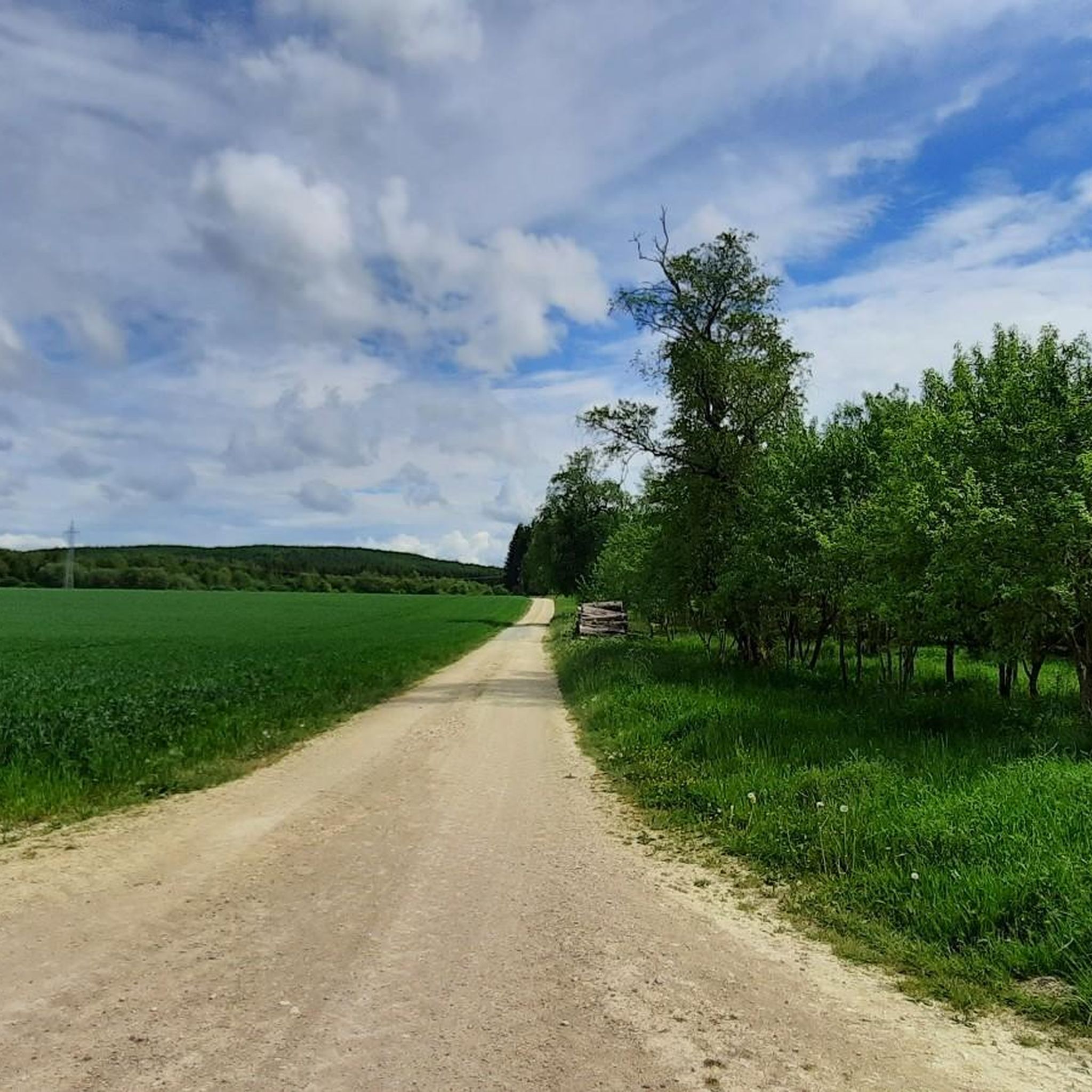
The Messelberg is a soaring mountain. A rocky cliff at 743 m above sea level, it protrudes from the Messelberg. From here, on a clear day, you can see as far as the Black Forest, about 130 km away. The Swabian Alb North Rim Trail, which runs along the edge of the Alb trauf, offers particularly beautiful views far down into the Fils Valley at the Rötelstein and Messelstein viewpoints near Donzdorf. One of the Lion Trails also leads along the Messelberg, a bare rock that protrudes from the green Messelberg. The Messelberg is also home to the Donzdorf Flying Group's gliding airfield. Not far from there, next to the Rötelstein, is the launch pad of the Staufen Hang Gliding and Paragliding Club.
0
0

It is worth stopping here for a great view
2
0

Good place to take a break. Simple dishes like hot reds or snacks are available here. Great open space, a paradise for children.
7
0
This great place to stop and rest is located at the highest point of the Ostalb
5
0


From here, on a clear day, you can see as far as the Black Forest, approx. 130 km away. The Swabian Alb North Edge Trail, which leads along the Albtraufkante, offers particularly beautiful views far down into the Filstal near Donzdorf at the Rötelstein and Messelstein viewing points. One of the lion paths also leads along the Messelberg, a bare rock that protrudes from the green Messelberg. The flying area of the Fliegergruppe Donzdorf e.V. for gliding is also located on the Messelberg. And not far from there is the launch ramp of the Staufen e.V. hang gliding and paragliding club next to the Rötelstein.
4
0

On days with good visibility, the Alps can be seen.
3
0

Actually a nice place with a great view towards Reichenbach on one side and the Rechberg on the other. Unfortunately one bench is in dire need of repair. Barbecuing is currently prohibited.
15
0
Frequently Asked Questions
What kind of mountain peaks can I expect to find around Bartholomä?
The region around Bartholomä, situated on the Albuch part of the Swabian Alb, is characterized by undulating terrain, elevated landscapes, and prominent hills rather than sharp, towering peaks. These elevated areas offer scenic views and opportunities for outdoor activities within a tranquil environment of rolling hills, forests, and meadows.
Are there any family-friendly elevated spots or viewpoints near Bartholomä?
Yes, several spots are great for families. The Volkmarsberg Observation Tower is family-friendly and offers extensive vistas. Another excellent option is the Franz-Keller Hut, located on the highest peak of the Kaltes Feld, which provides facilities, food, and plenty of space for children to play.
What are some of the most popular viewpoints in the Bartholomä area?
Visitors highly appreciate the Volkmarsberg Observation Tower, where on clear days you can see as far as the Zugspitze. Another popular spot is the Pilgrimage Church of St. Mary on Hohenrechberg, which offers beautiful views of the Remstal valley. The View from Messelberg also provides expansive vistas, potentially reaching the Black Forest on clear days.
Are there historical or cultural sites on the elevated landscapes around Bartholomä?
Absolutely. The Pilgrimage Church of St. Mary on Hohenrechberg is a significant historical and religious site. This baroque church has been a pilgrimage destination since the 15th century and is a landmark of the region, offering beautiful views.
What kind of natural features can I expect to see on the mountain peaks around Bartholomä?
The elevated areas around Bartholomä are part of the Swabian Alb, known for its picturesque landscapes. You'll encounter rolling hills, dense forests, and open meadows. Specific highlights like the Franz-Keller Hut area feature wide plateaus with junipers, meadows, and forests, along with viewing rocks like Tannhaldenstein and Christentalfelsen offering picturesque views.
What outdoor activities can I do near the mountain peaks around Bartholomä?
The region offers diverse outdoor activities. You can explore numerous hiking trails, such as those found in the Hiking around Bartholomä guide, which includes routes like the Wental Rock Sea loop. There are also cycling opportunities, detailed in the Cycling around Bartholomä guide, and dedicated MTB Trails around Bartholomä for mountain biking enthusiasts.
Are there challenging mountain climbs or more beginner-friendly routes in the area?
While Bartholomä doesn't feature dramatic mountain ascents, the elevated landscapes offer a range of difficulties. You can find challenging hiking routes like the 'Wental Rock Sea – Wentalweible Rock Formation loop' which is 24.4 km long. For easier options, there are many moderate and easy trails, such as the 'Felsenmeer Wental – Wentalweible Rock Formation loop' for MTB, or the 'Rötenbach Pond – View of Bartholomä loop' for cycling, which is rated easy.
What is the best season to hike the mountain peaks around Bartholomä?
The Swabian Alb region around Bartholomä is beautiful year-round. Spring and autumn offer pleasant temperatures and vibrant scenery, ideal for hiking. Summer is also popular, though it can be warmer. Winter provides opportunities for serene winter walks, especially on the rolling hills and through the forests.
Are there places to eat or rest near the elevated trails and viewpoints?
Yes, several spots offer refreshments and rest. The Franz-Keller Hut is a hiking lodge with food and drinks, open all year on weekends and public holidays. The Volkmarsberg Observation Tower also has a hut that is sometimes staffed, offering coffee, cake, and Vespers on Saturdays and Sundays.
What do visitors enjoy most about the mountain peaks around Bartholomä?
Visitors particularly enjoy the tranquil environment and the picturesque landscapes, characterized by rolling hills, forests, and meadows. The panoramic vistas from various viewpoints, such as the Stuifen Summit, are highly praised. The combination of natural beauty, opportunities for recreation, and historical sites makes the area very appealing.
Can I bring my dog on the hiking trails around Bartholomä's elevated areas?
While specific regulations for dog-friendly trails are not detailed, the natural environment of rolling hills, forests, and meadows around Bartholomä generally welcomes dogs on leashes. It's always advisable to check local signage for any specific restrictions in nature reserves or protected areas.
How long do hikes typically take on the elevated routes near Bartholomä?
Hike durations vary significantly depending on the route and your pace. For example, a moderate route like 'The Two Lovers Rock Formation – Wental Rock Sea loop' is about 12.5 km. More challenging routes, such as the 'Wental Rock Sea – Wentalweible Rock Formation loop', can be over 24 km, requiring several hours to a full day to complete. Shorter, easier paths are also available for quicker excursions.
Most popular routes around Bartholomä
Most popular attractions around Bartholomä

Get inspired with the komoot mobile app


Explore more
See even more amazing summits around Bartholomä with these guides:
