The best gravel rides around Hatley
4.8
(25)
182
riders
27
rides
Gravel biking around Hatley features a landscape characterized by a mix of forest trails, natural paths, and rural roads. The region includes varied terrain with moderate elevation changes, offering routes that traverse woodlands and pass by local landmarks. Gravel bike trails in Hatley often incorporate sections alongside natural features like the Tomifobia River and local ponds. The area provides a diverse environment for gravel cyclists, from rolling hills to more challenging ascents.
Best gravel bike trails around Hatley
- The most…
Last updated: July 17, 2026
5.0
(6)
49
riders
54.4km
02:48
270m
270m
Moderate gravel ride. Good fitness required. Mostly paved surfaces. Suitable for all skill levels.
4.0
(2)
7
riders
43.1km
03:19
400m
400m
Moderate gravel ride. Good fitness required. Mostly paved surfaces. Suitable for all skill levels.

Sign up for free
4
riders
25.5km
02:04
310m
310m
Moderate gravel ride. Good fitness required. Mostly paved surfaces. Suitable for all skill levels.
6
riders
65.3km
05:36
810m
810m
Hard gravel ride. Very good fitness required. Mostly paved surfaces. Suitable for all skill levels.
4
riders
30.8km
02:35
330m
330m
Moderate gravel ride. Good fitness required. Mostly paved surfaces. Suitable for all skill levels.
Get access to more routes and recommendations from other explorers.
Sign up for free
Already have an account?
Our route recommendations are based on thousands of hikes, rides, and runs completed by other people on komoot.
Start today with a free account
Your next adventure awaits.
Login or Signup
Popular around Hatley

Tips from the Community

Tomifobia Nature Trail is a 19-kilometre rail trail in the Eastern Townships region of Quebec that follows the former route of a Canadian Pacific railway from Ayer’s Cliff to Stanstead. The gravel-surfaced trail is open to cyclists, hikers, and cross-country skiers year-round, and is privately owned and maintained by the Sentiers Massawippi nonprofit organization. The trail passes through a beautiful wildlife-rich landscape, so you’re likely to see plenty of herons, beavers, deer, and turtles along the way.
0
0
The Roue de la médecine (Medicine Wheel) is a monument along the Tomifobia Nature Trail made up of a circle of four stones, each oriented to a cardinal point and engraved with one of four animals: a moose, a coyote, an eagle, and a bear, with a short text explaining each animal’s symbolic significance in Indigenous beliefs around Unity and Healing. Designed by Metis Algonquin-Anishnabe Elder Paul-Conrad Carignan, it’s dedicated to the spiritual and healing teachings of the Medicine Wheel and its four directions.
0
0
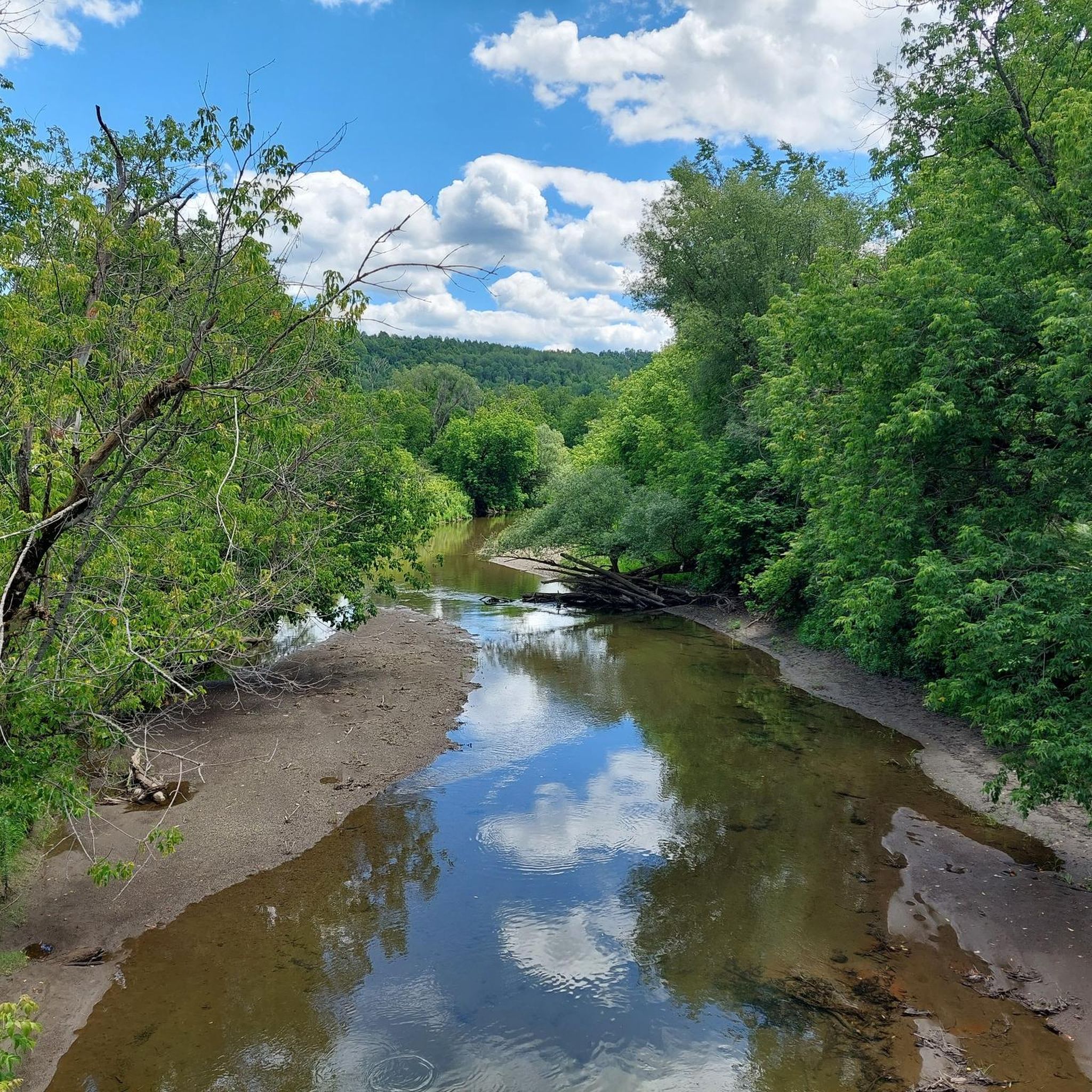
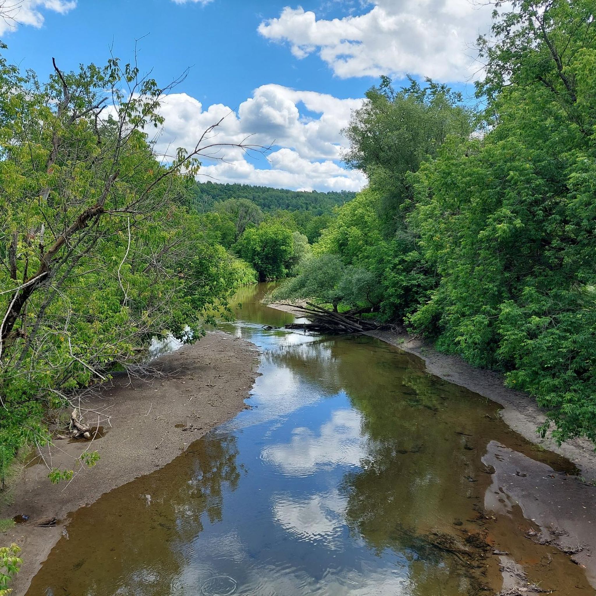
The Tomifobia River is beautiful and flows just under 11 kilometres through Quebec's Eastern Townships, through a largely protected Green Zone, before draining into Lake Massawippi and ultimately into the Saint Lawrence. Its Algonquian name reflects its history as a travel route for Abenaki peoples, and its valley was later settled by United Empire Loyalists, leading to the development of mill villages along its banks in the early 19th century. Today it's an important ecological corridor, home to trout, Atlantic salmon, the endangered wood turtle, bald eagles, and river otters, and is a popular spot for fishing, canoeing, and birdwatching.
0
0

Goosebumps after a quick decent
0
0

Summer is often hot and dry in this region, the convenience store is a race for food and fresh water on this course !! It feels good
0
0

Great place for a coffee and food.
0
0
Great view here of Owl's head and Jay Peak Mountain in Vermont.
0
0
Great place to stop for a coffee and a bite to eat. Owners are super friendly!
0
0
Frequently Asked Questions
How many gravel bike trails are available around Hatley?
There are over 25 gravel bike trails around Hatley, offering a diverse range of experiences. These routes are highly rated by the komoot community, with an average score of 4.6 stars.
Are there any easy or beginner-friendly gravel bike routes in Hatley?
While the guide primarily features moderate to difficult routes, many sections of the trails, particularly those along the Tomifobia River, offer relatively flat and less technical terrain suitable for beginners. For a moderate introduction, consider the Tomifobia Forest Trail – Depanneur Ayer's Cliff loop from Ayer's Cliff, which combines forest sections with rural road riding.
What are the typical distances for gravel bike trails in Hatley?
Gravel bike trails in Hatley vary significantly in length. You'll find routes ranging from moderate 15-mile (25 km) loops to more challenging 30-mile (50 km) and even 38-mile (61 km) expeditions. For example, the Tomifobia Forest Trail – Tomifobia Nature Trail loop from Ayer's Cliff is about 33.8 miles (54.4 km).
Are there any loop trails for gravel biking in Hatley?
Yes, many of the gravel bike routes in Hatley are designed as loops, allowing you to start and end at the same point. Popular loop options include the Pothole Warning loop from North Hatley, which is 19.2 miles (30.8 km), and the longer Étang St-Louis loop from Hatley at 38 miles (61 km).
What is the best season for gravel biking in Hatley?
The best season for gravel biking in Hatley is generally from late spring through early autumn (May to October). During these months, the weather is milder, and the trails are typically dry and well-maintained. Fall offers stunning foliage, making it a particularly scenic time to ride.
What are the winter conditions like for gravel biking in Hatley?
Winter conditions in Hatley can be challenging for gravel biking due to snow and ice. Many trails may be covered, making them unsuitable for standard gravel bikes. Some local roads might be plowed, but conditions can be unpredictable. It's advisable to check local weather and trail reports before planning a winter ride.
Are there options for advanced gravel cyclists in Hatley?
Absolutely. Hatley offers several routes with significant elevation gain and longer distances that cater to advanced gravel cyclists. The Étang St-Louis loop from Hatley, for example, is a difficult 38-mile (61 km) route with over 730 meters of elevation gain, providing a substantial challenge.
Are the gravel trails in Hatley suitable for families?
While the guide highlights moderate to difficult routes, families with older children or those comfortable with longer distances might enjoy sections of the trails. Look for routes with less elevation change and consider shorter segments of the longer loops. Always check the route difficulty and distance to ensure it matches your family's capabilities.
Are there any gravel bike trails in Hatley that are less crowded?
To find less crowded trails, consider riding during off-peak hours (weekdays) or exploring some of the longer, more challenging routes that naturally attract fewer riders. The extensive network of rural roads and forest paths means it's often possible to find quieter sections away from the most popular starting points.
What kind of terrain can I expect on Hatley's gravel bike trails?
Hatley's gravel bike trails feature a varied landscape, including forest trails, natural paths, and rural roads. You'll encounter a mix of surfaces, from packed gravel to dirt, with moderate elevation changes. Many routes incorporate sections alongside natural features like the Tomifobia River and local ponds, offering diverse scenery.
Is public transport available to access gravel trails in Hatley?
Public transport options directly to trailheads in Hatley are limited. Most gravel bikers typically access the trails by car, often parking in towns like Ayer's Cliff or North Hatley, which serve as common starting points for many routes. It's best to plan your journey assuming car access.
Are the gravel trails in Hatley dog-friendly?
Many of the rural roads and multi-use trails in the Hatley area are generally dog-friendly, provided dogs are kept on a leash and owners clean up after them. However, specific regulations can vary by trail section or private land. It's always recommended to check local signage or specific trail guidelines before bringing your dog.
Are there any cafes or stops along the gravel bike trails in Hatley?
Yes, several routes pass through or near small towns like Ayer's Cliff and North Hatley, where you can find cafes, depanneurs (convenience stores), or small eateries for a break and refreshments. For instance, the Tomifobia Forest Trail – Depanneur Ayer's Cliff loop from Ayer's Cliff explicitly mentions a depanneur, indicating a potential stop.
Most popular routes around Hatley

Get inspired with the komoot mobile app


Explore more
Browse the best Gravel rides in other regions.
