The best gravel rides around Crest
3.5
(6)
39
riders
4
rides
Gravel biking around Crest offers access to varied terrain, characterized by rolling hills, valleys, and routes that often follow natural water features like reservoirs and rivers. The region provides diverse landscapes suitable for gravel cycling, ranging from moderate paths to more challenging trails with significant elevation changes. This area is well-suited for exploring on a gravel bike, with routes that traverse open spaces and offer a sense of isolation.
Best gravel bike trails around Crest
- The most popular gravel bike…
Last updated: July 12, 2026
4.0
(1)
9
riders
37.8km
03:18
570m
570m
Hard gravel ride. Very good fitness required. Mostly paved surfaces. Suitable for all skill levels.
5.0
(1)
17
riders
100km
08:18
2,120m
2,120m
Hard gravel ride. Very good fitness required. Mostly paved surfaces. Suitable for all skill levels.

Sign up for free
2.0
(3)
5
riders
28.8km
02:11
340m
340m
Moderate gravel ride. Good fitness required. Mostly paved surfaces. Suitable for all skill levels.
6
riders
39.8km
03:33
590m
590m
Hard gravel ride. Very good fitness required. Mostly paved surfaces. Suitable for all skill levels.
3.0
(1)
1
riders
21.6km
01:28
330m
320m
Moderate gravel ride. Good fitness required. Mostly paved surfaces. Suitable for all skill levels.
Our route recommendations are based on thousands of hikes, rides, and runs completed by other people on komoot.
Start today with a free account
Your next adventure awaits.
Login or Signup

Tips from the Community


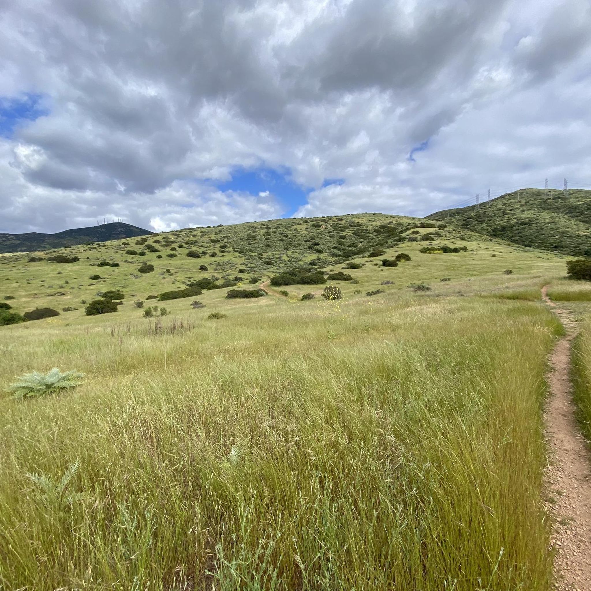
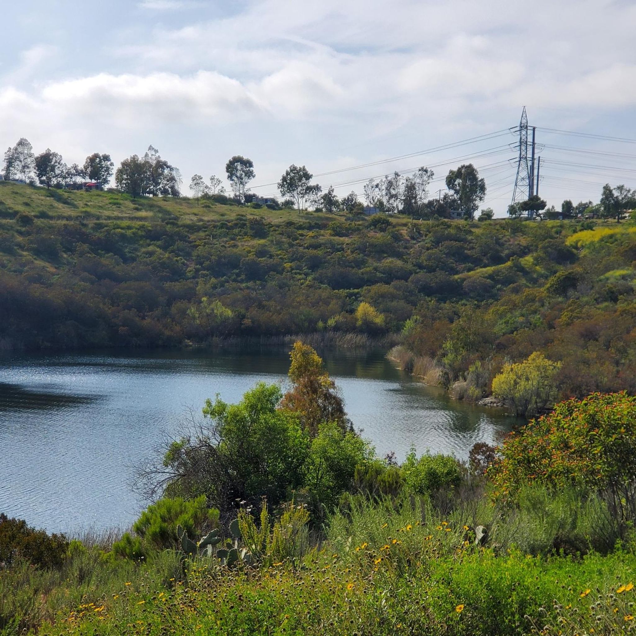
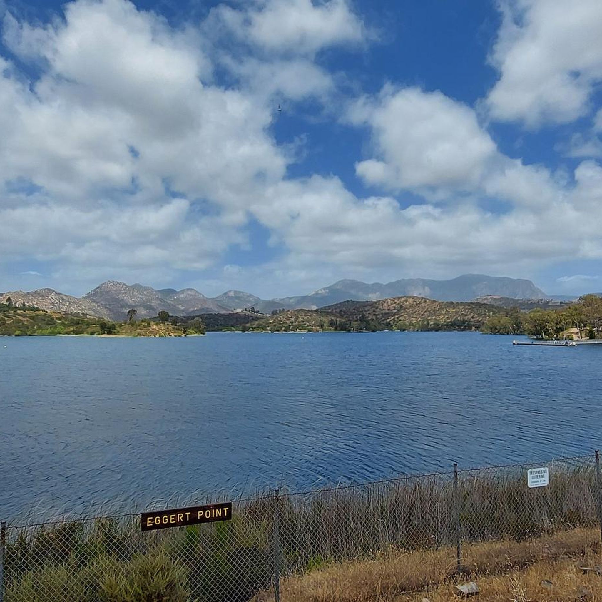
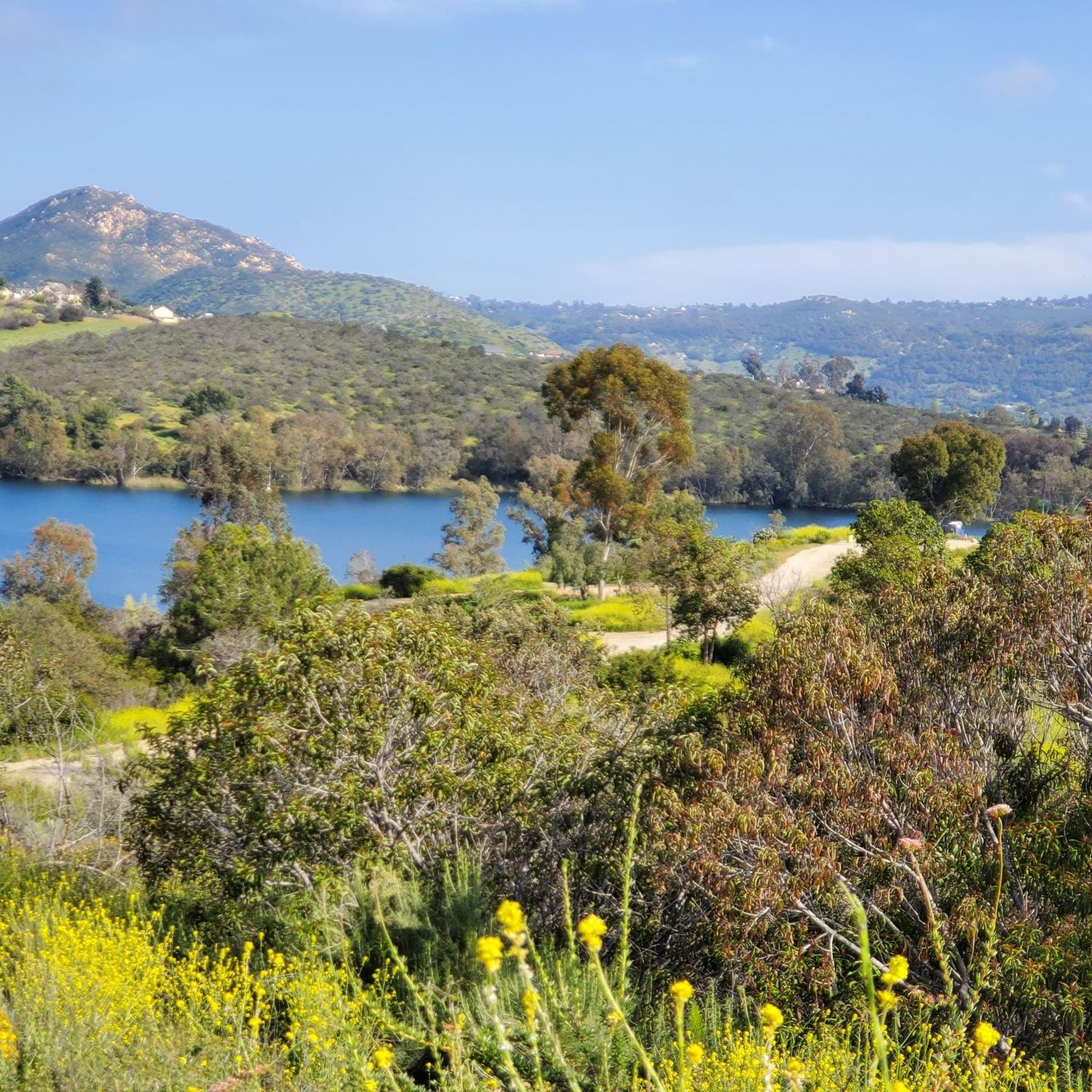
The paths around Sweetwater Reservoir are primarily well-worn dirt, with most junctions clearly signed, though some of the less frequented routes can become overgrown. As you near San Miguel Mountain, the terrain becomes increasingly rugged and challenging, while open views of the reservoir and surrounding hills remain a constant backdrop.
1
0

Long and smooth gravel climb. Beautiful views into the valley, but the climb is very exposed with zero shade so be sure to plan acording to weather. Between Via Arturo and Chiquita Road, there is an entrance to a ranch with a railroad crossing sign. There is a public water spigot on the left side.
0
0

Bring your legs. Grade is steady with no surprises.
0
0

The Steele Canyon Bridge, also known as the Sweetwater River Bridge, is a beautiful landmark crossing the Sweetwater River. It is on the National Register of Historic places, and is no longer used for vehicles but is a great hiking, running or biking spot.
0
0

Lake Cuyamaca is a picturesque 110-acre reservoir nestled in the Cuyamaca Mountains. Created in the 1880s to supply water to the city of San Diego, it now serves as a recreational haven for fishing, boating, and picnicking.
0
0

This area is the northernmost part of Otay Ranch and the southern part of the San Diego National Wildlife Refuge. The scenic views of rolling hills and well-maintained trails make it a highly popular biking area.
0
0
Frequently Asked Questions
How many gravel bike trails are there in Crest?
There are over 4 gravel biking routes around Crest listed on komoot, offering a diverse range of experiences from moderate to difficult. These trails are highly rated by the komoot community, with an average score of 2.75 stars.
What is the best time of year for gravel biking in Crest?
The best time for gravel biking in the Crest area, particularly around Southern California, is typically during the cooler months from fall through spring (October to May). Summers can be very hot, especially at lower elevations, making early mornings or late afternoons preferable if riding during that season. Higher elevation routes, like those found in Angeles Crest, offer a cooler escape during warmer periods but can be subject to snow in winter.
Are there challenging gravel bike routes in Crest?
Yes, Crest offers several challenging gravel bike routes. For instance, the Upper Otay Reservoir Dam – Tiki Hut loop from Rancho San Diego is a difficult 23.2-mile trail with significant elevation gain. Another demanding option is the Lake Cuyamaca – Camp Hual-Cu-Cuish Ruins loop from Alpine, which spans 62.0 miles and features substantial climbing.
Are there any easy or moderate gravel bike routes suitable for less experienced riders?
Yes, there are moderate options available. The Sweetwater Reservoir – Tiki Hut loop from Rancho San Diego is a moderate 18.0-mile path offering a mix of terrain. Another moderate choice is the Gravel loop from Spring Valley, which covers 16.1 miles.
What kind of landscapes can I expect on gravel bike routes around Crest?
Gravel biking around Crest, particularly in the Southern California region, is characterized by diverse landscapes. You'll encounter rolling hills, paths alongside reservoirs like Sweetwater and Otay, and open valleys. Routes often traverse varied terrain, from well-maintained gravel to more rugged sections, providing a sense of isolation and expansive views, especially at higher elevations.
Are there any scenic landmarks or points of interest along the gravel trails?
Yes, several routes offer scenic views and points of interest. You might encounter highlights such as the Sweet Water River Trail, Steele Canyon Bridge, and the Sweetwater River Crossing. For panoramic vistas, consider visiting Mount Helix or enjoying the View of Lake Emma and Golf Course.
Are the gravel bike routes in Crest typically circular?
Many of the gravel bike routes around Crest are designed as loops, allowing you to start and end at the same point. Examples include the Upper Otay Reservoir Dam – Tiki Hut loop from Rancho San Diego and the Sweetwater Reservoir – Tiki Hut loop from Rancho San Diego. This makes planning your ride and parking more convenient.
What do other gravel bikers enjoy most about gravel biking in Crest?
The area is highly rated by the komoot community, with an average score of 2.75 stars from over 3 reviews. Reviewers often praise the varied terrain, the sense of isolation on many routes, and the scenic views, particularly around the reservoirs and higher elevations.
Is parking available at the trailheads for gravel biking in Crest?
While specific parking details vary by trailhead, many popular starting points for gravel routes in the Crest area, especially those near parks or recreational areas like Rancho San Diego or Alpine, typically offer designated parking facilities. It's always a good idea to check the specific route details on komoot for recommended starting points and parking information.
Are there any routes that follow natural water features?
Yes, several routes in the Crest area incorporate natural water features. You can find paths that run alongside the Sweetwater Reservoir and the Upper Otay Reservoir, offering picturesque views and a refreshing element to your ride. The Sweetwater Reservoir – Tiki Hut loop from Rancho San Diego is a prime example.
Can I find less crowded gravel bike trails in Crest?
While some popular routes can see more traffic, the extensive network of trails around Crest, particularly those that venture into more remote areas or have significant length/elevation, often provide a sense of isolation. Exploring routes further from urban centers or during off-peak hours can help you find a quieter experience.
Most popular attractions around Crest

Get inspired with the komoot mobile app


Explore more
Browse the best Gravel rides in other regions.
