The best gravel rides around Day Valley
4.0
(2)
19
riders
3
rides
Gravel biking around Day Valley offers diverse landscapes, from lush redwood forests to scenic orchards and rural farmland. The region features a mix of paved and unpaved surfaces, including challenging fire roads and dirt paths with significant elevation gains. Riders can experience towering redwood trees, engaging canyons, and ridge lines, showcasing varied ecosystems. This area provides a compelling mix of terrains for gravel biking.
Best gravel bike trails around Day Valley
- The most popular gravel bike trail is Aptos Creek Fire Road Loop, a 35.6 miles (57.4 km) trail that takes 6 hours 23 minutes to complete. This route traverses through majestic redwood forests and includes extensive fire road sections.
- Another top favourite among local gravel bikers is Hihn's Mill and Ridge Trail Loop, a moderate 10.3 miles (16.6 km) path. It offers a mix of forested trails and ridge line views, often completed in about 1 hour 51 minutes.
- Local gravel bikers also love the Mount Madonna County Park via Summit Road, a 22.8 miles (36.7 km) trail leading through varied terrain with significant elevation, often completed in about 3 hours 44 minutes.
- Gravel biking around Day Valley is defined by redwood forests, orchards, and varied terrain with significant elevation changes. The network offers options for different ability levels, from moderate paths to challenging climbs.
- The routes in Day Valley are highly rated by the komoot community with an average score of 5.0 stars from over 1 review. More than 30 gravel bikers have used komoot to explore Day Valley's varied terrain.
Last updated: July 11, 2026
5.0
(1)
16
riders
57.4km
06:24
1,350m
1,350m
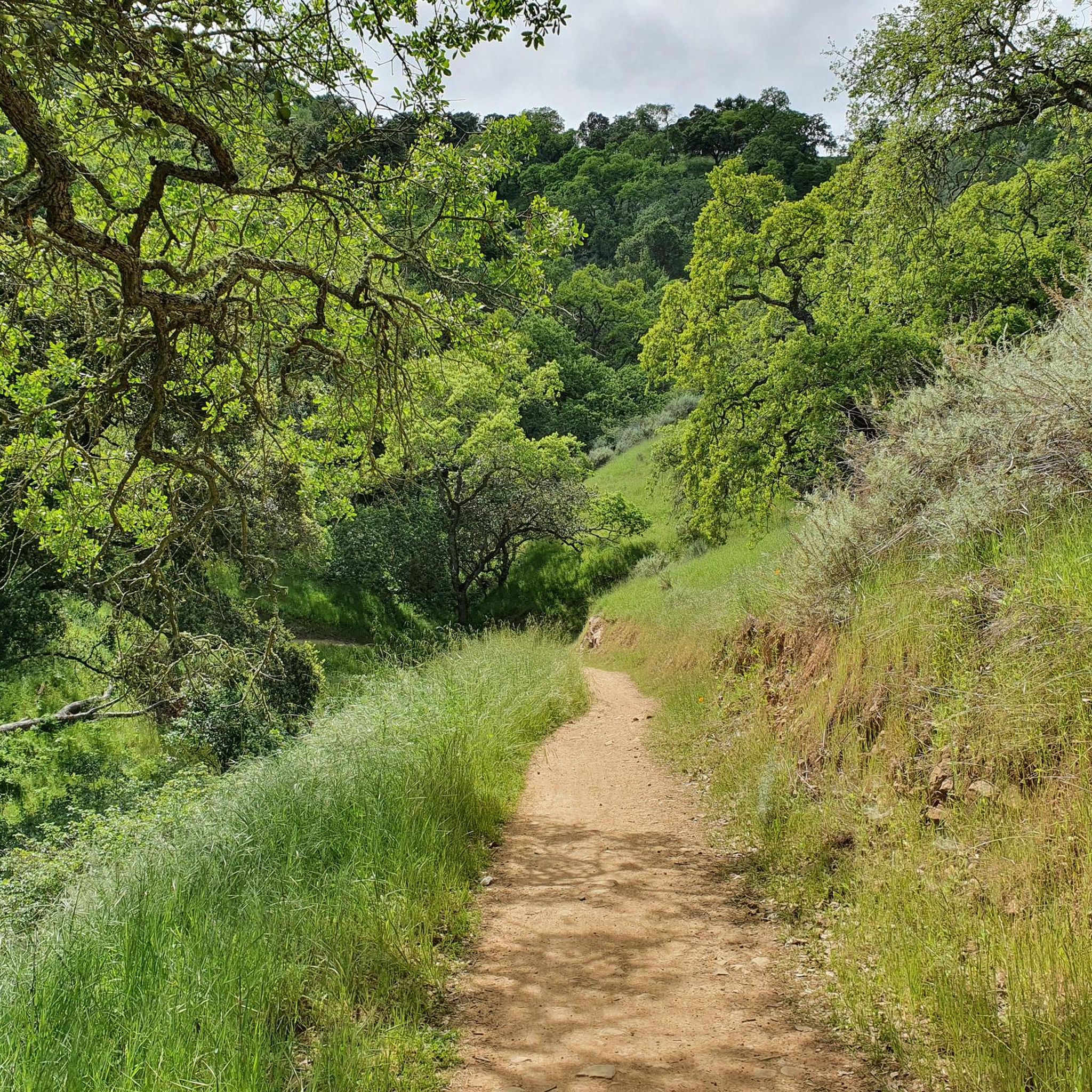
Embark on the Aptos Creek Fire Road Loop, a difficult gravel biking adventure that takes you through diverse landscapes. You will cover 35.7 miles (57.4 km) and climb a substantial 4437 feet (1352 metres) in elevation, typically taking around 6 hours and 23 minutes to complete. The route begins with gentle rollers past olive farms and vineyards before ascending into the majestic redwood forests of The Forest of Nisene Marks State Park, offering a rewarding challenge for experienced riders.
Planning your visit requires good to very good fitness due to the significant elevation gain and steep inclines, with some sections exceeding a 10% grade. While parts of the Aptos Creek Fire Road itself can help build stamina for beginners, the entire loop is considered a hard gravel ride demanding advanced riding skills. Be prepared for a long day in the saddle and ensure your bike is in excellent condition for the varied terrain.
This challenging loop offers more than just a workout; as you gain elevation, the scenery transitions to oak trees, and you might catch views of Aptos and the Pacific Ocean from overlooks like the Santa Rosalia Viewpoint. The long descent follows the path of a former logging railroad, providing a shaded and historically rich journey back. It's a route that combines natural beauty with a glimpse into the region's past.
3.0
(1)
3
riders
16.6km
01:51
420m
430m
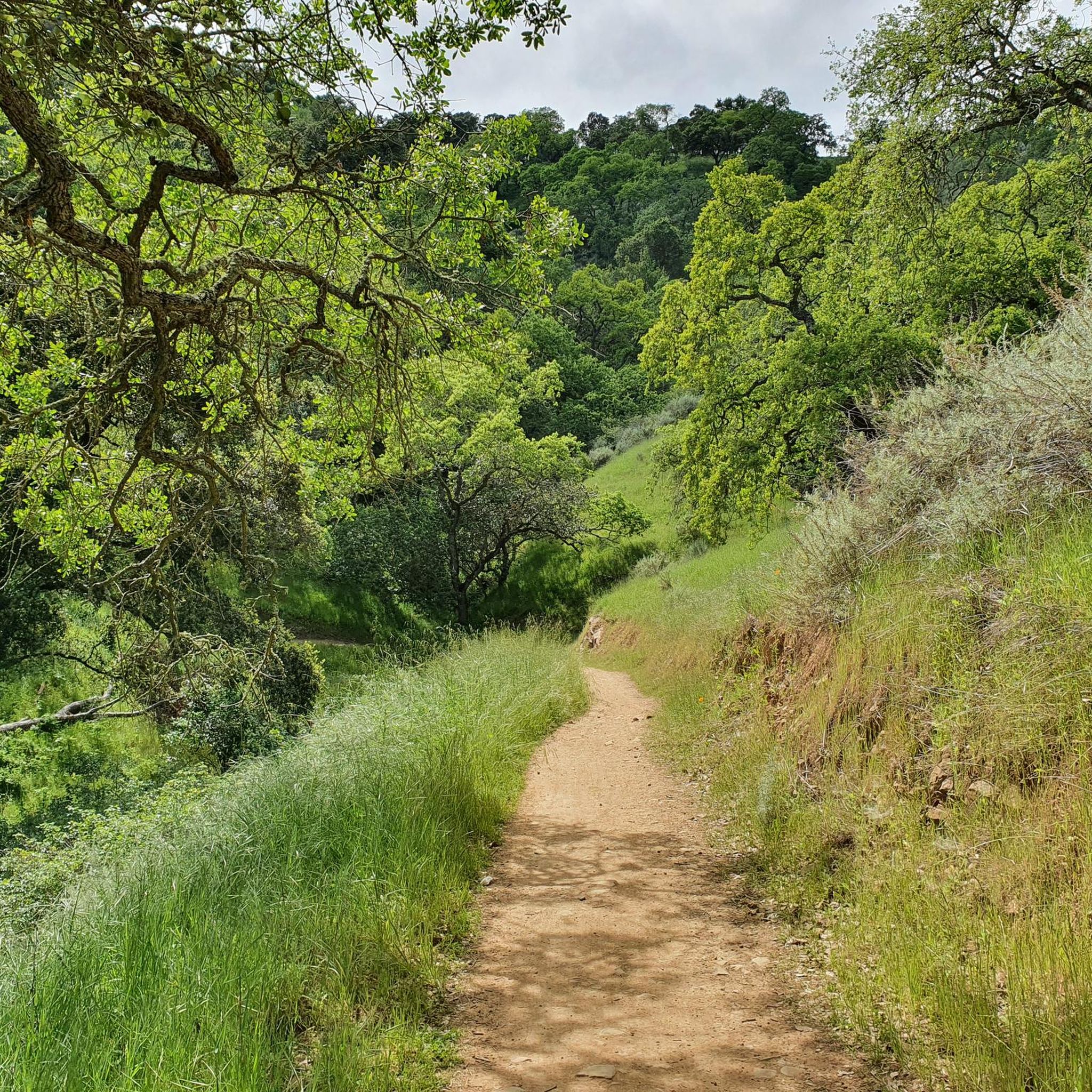
The Hihn's Mill and Ridge Trail Loop offers a moderate gravel biking experience through the lush Soquel Demonstration State Forest. You will navigate a varied landscape, from scenic dirt and gravel climbs on Hihn's Mill Road to potentially technical singletrack sections on the Ridge Trail. This route covers 10.3 miles (16.6 km) with a total elevation gain of 1392 feet (424 metres), typically taking around 1 hour and 51 minutes to complete. Keep an eye out for glimpses of surrounding ridges and consider a stop at the Santa Rosalia Viewpoint for expansive vistas.
When planning your visit, remember that this route is situated within the popular Soquel Demonstration State Forest. Hihn's Mill Road serves as a crucial access point and return route for many trails in the area. Parking is generally available, but it is always wise to check local regulations before you arrive to ensure a smooth start to your ride. This forest is a favored spot for outdoor activities, so an early start can help you avoid crowds.
This loop provides a unique opportunity to explore a forest characterized by tall redwood trees and dappled sunlight filtering through the canopy. The combination of Hihn's Mill Road and the Ridge Trail offers a dynamic ride, blending smoother sections with more challenging terrain. The Soquel Demonstration State Forest is a significant natural area, making this route a great way to experience its diverse environment and extensive trail network.

Sign up for free
36.7km
03:44
740m
740m
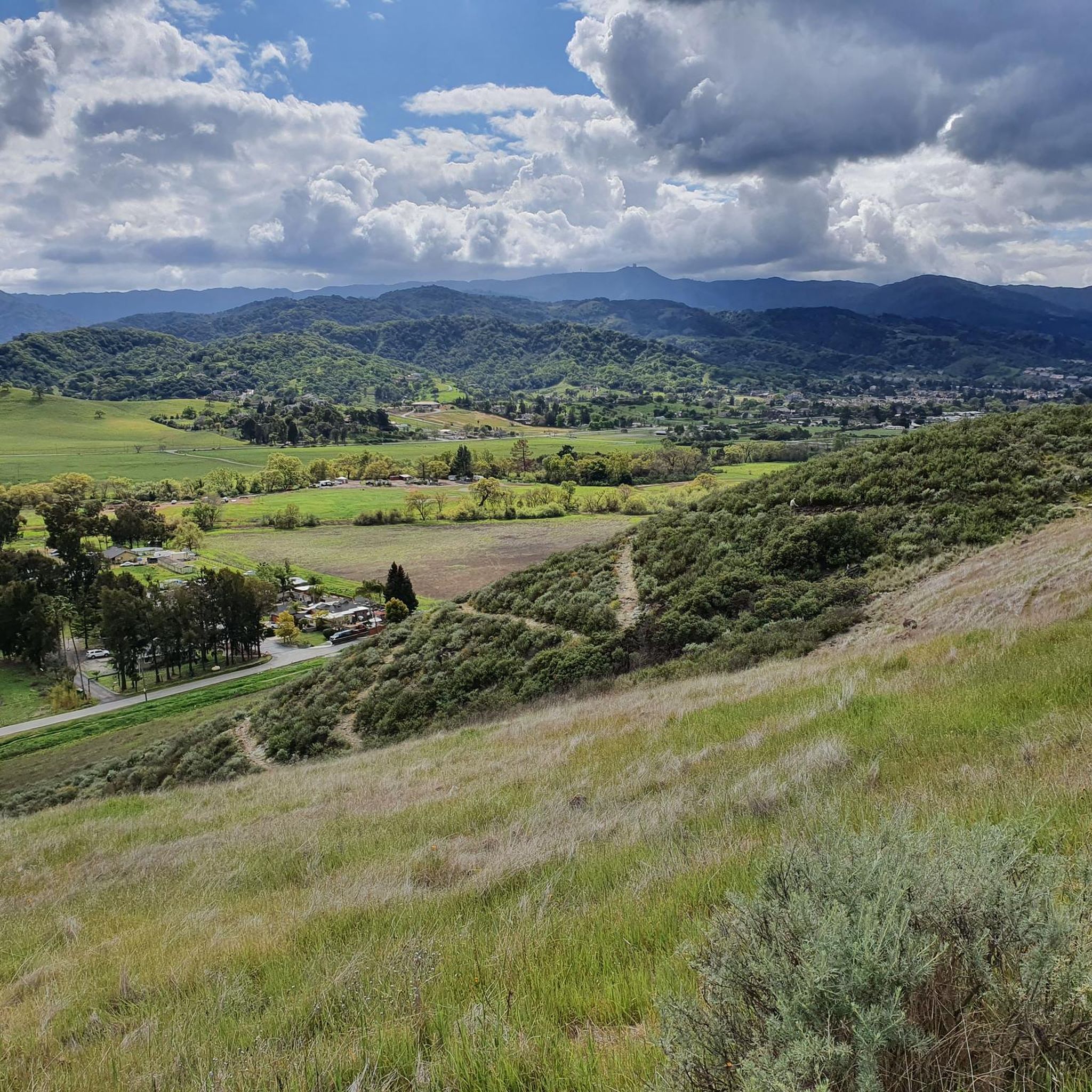
The Mount Madonna County Park via Summit Road offers a challenging gravel biking experience, immersing you in towering redwood forests and diverse landscapes. This route takes you through oak woodlands, chaparral, and grassy meadows, with the reward of sweeping vistas of Monterey Bay and the Santa Clara Valley from its higher points. You'll encounter varied terrain, from paved sections to packed and loose gravel, dirt with tree roots, and ruts, making it a demanding 22.8-mile (36.7 km) ride.
This is a difficult route, requiring very good fitness and advanced riding skills to tackle its 2416 feet (736 metres) of elevation gain over an estimated 3 hours and 44 minutes. Be prepared for sustained, steep gradients on the climb to the summit. While Summit Road has had complicated public access in the past, it is currently open, though you might see some older, intimidating signs. Ensure your bike is equipped for varied gravel conditions.
Beyond the physical challenge, the trail offers unique natural and historical features. You can explore the ruins of Henry Miller's 19th-century mansion and might even spot the park's distinctive white fallow deer, descendants of Miller's private collection. An unexpected waterfall also adds to the scenic charm of this ride, making it a memorable adventure for experienced gravel cyclists.
Our route recommendations are based on thousands of hikes, rides, and runs completed by other people on komoot.
Start today with a free account
Your next adventure awaits.
Login or Signup

Other adventures around Day Valley

Tips from the Community

Summit Road has a long and complicated history of public access. These days it is court ordered to remain accessible to the public but you may see some intimidating signs saying that you are trespassing. As is usually the case, if you are respectful and courteous to the route and any home owners you encounter you shouldn't have any trouble.
0
0
This 4,605-acre park covers a large area of Redwood forest. There are many miles of trails, campsites, guided trail rides and more.
0
0
Hihn's Mill Road serves as an access point for most of the rides in the area. It's right by the parking lot some most of the time you'll be starting or ending your ride along this stretch of double track.
0
0

Seacliff State Beach is a long stretch of sand backed by bluffs and is best known for its concrete freighter, the SS Palo Alto, lying in the water just off the beach.
0
0

The Santa Rosalia Viewpoint marks the top of the Ridge Trail and offers a great view of Soquel Demonstration State Forest and the surrounding foothills. A few different trails converge in this spot, so you have a number of route and loop options.
0
0

The Aptos Creek Road winds through The Forest of Nisene Marks State Park. It is worth parking up your bike and spending some time here to explore the network of trails through Redwood forests and along Aptos Creek.
0
0
The Santa Rosalia Viewpoint marks the top of the Ridge Trail and offers a great view of Soquel Demonstration State Forest and the surrounding foothills. A few different trails converge in this spot, so you have a number of route and loop options.
1
0

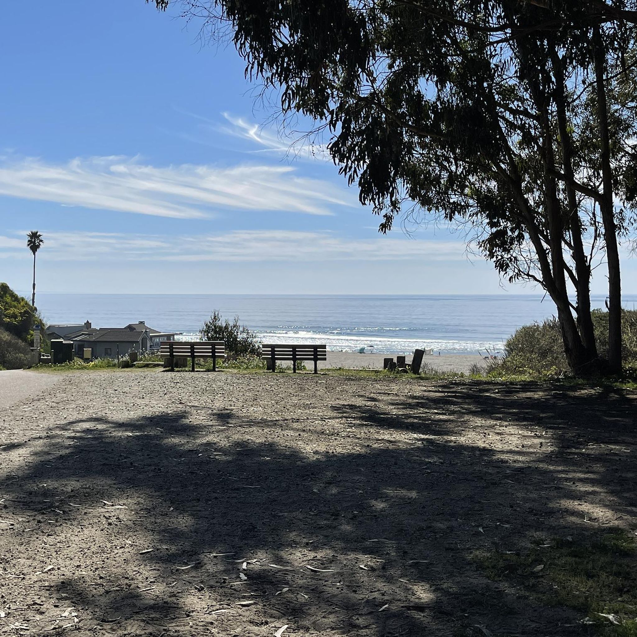
An opening of the trees leaves you with a splendid view of the Santa Cruz coast. There is a bench on which you can rest and admire the landscape.
0
0
Frequently Asked Questions
How many gravel bike trails are available in Day Valley?
Day Valley offers a selection of 4 gravel bike routes, catering to various skill levels. These trails provide diverse experiences, from challenging climbs through redwood forests to scenic loops with ridge line views.
What kind of terrain can I expect on gravel bike trails in Day Valley?
Gravel biking in Day Valley features a compelling mix of terrains. You'll encounter lush redwood forests, scenic orchards, and rural farmland. The routes combine paved and unpaved surfaces, including challenging fire roads and dirt paths, often with significant elevation changes. Expect dynamic views through canyons and along ridge lines.
Are there any easy or beginner-friendly gravel bike routes in Day Valley?
While many routes in Day Valley offer significant challenges, the area does have options for those seeking a more moderate experience. For example, the Hihn's Mill and Ridge Trail Loop is rated as moderate, covering 10.3 miles with a mix of forested trails and ridge line views. It's a good option for those looking for a less strenuous ride compared to the more difficult routes.
Are there challenging gravel biking routes for experienced riders?
Absolutely. Day Valley is known for its challenging routes with significant elevation gains. The Aptos Creek Fire Road Loop, for instance, is a difficult 35.6-mile trail that traverses majestic redwood forests and includes extensive fire road sections with substantial climbing. Another challenging option is Mount Madonna County Park via Summit Road, a 22.8-mile route through varied terrain with considerable elevation.
Can I find circular gravel bike routes in Day Valley?
Yes, several gravel bike routes in Day Valley are designed as loops, allowing you to start and end at the same point. Notable examples include the challenging Aptos Creek Fire Road Loop and the moderate Hihn's Mill and Ridge Trail Loop, both offering a complete circuit of the area's diverse landscapes.
What natural features or landmarks can I see while gravel biking in Day Valley?
Day Valley's gravel routes offer access to stunning natural features. You'll ride through majestic redwood forests, picturesque orchards, and rural farmland. The area is characterized by engaging canyons and ridge lines, providing dynamic views. A significant natural landmark is The Forest of Nisene Marks State Park, which features over 30 miles of trails through serene, shaded redwood groves.
Are there any waterfalls or scenic viewpoints along the trails?
Yes, the Day Valley area is home to some beautiful natural attractions. You can find waterfalls such as Granuja Falls and Upper Falls. For scenic viewpoints, routes often traverse ridge lines, offering expansive vistas of the surrounding landscapes, including the transition from farmland to redwood forests and oak-laced hilltops. The Bald Mountain Summit, Sierra Azul Open Space Preserve, is another notable summit in the broader region offering views.
What is the best time of year to go gravel biking in Day Valley?
Day Valley offers good gravel biking conditions for much of the year. The region's diverse landscapes, including shaded redwood forests, can provide pleasant riding even during warmer months. However, for the most comfortable experience, spring and fall generally offer ideal temperatures and less chance of extreme weather. Winter rides are possible, but it's always wise to check local conditions, especially after rainfall, as some dirt paths can become muddy.
What do other gravel bikers enjoy most about Day Valley?
The komoot community highly rates gravel biking in Day Valley, with an average score of 5.0 stars. Riders frequently praise the area's diverse landscapes, particularly the immersive experience of cycling through majestic redwood forests and the varied terrain that includes both challenging fire roads and scenic dirt paths. The mix of natural beauty and engaging routes makes it a favorite among local gravel bikers.
Are there any specific attractions or points of interest near the gravel biking routes?
Beyond the trails themselves, Day Valley's location in Santa Cruz County provides access to various attractions. You can visit Manresa State Beach or Pleasure Point Beach for coastal views. The charming Capitola Village is also nearby, offering a pleasant stop. For those interested in more challenging cycling, the Mount Umunhum Road (climb) is a notable point of interest.
Are the gravel bike trails in Day Valley suitable for families or those with dogs?
While specific trails may have varying regulations, the general character of Day Valley's gravel routes, with their mix of fire roads and dirt paths through natural areas, can be suitable for families with older children or experienced riders. For those with dogs, it's crucial to check the specific rules for each park or trail, such as The Forest of Nisene Marks State Park, regarding leash laws and permitted areas before heading out.
Where can I find parking or access trails using public transport?
While specific parking details vary by trailhead, many of the gravel routes in Day Valley are accessible from areas with designated parking, particularly near trailheads for parks like The Forest of Nisene Marks State Park. Public transport options directly to remote trailheads might be limited, so planning your route and checking local transit schedules for connections to Day Valley or nearby towns like Aptos is recommended for the most convenient access.
Are there cafes or places to stop for refreshments along the gravel bike routes?
Many of the gravel routes in Day Valley traverse natural and rural areas, meaning amenities like cafes are not typically found directly on the trails themselves. However, the region's proximity to towns and villages in Santa Cruz County means you can often find refreshments before or after your ride. For example, Capitola Village is a charming spot nearby with dining options.
Most popular attractions around Day Valley

Get inspired with the komoot mobile app


Explore more
Browse the best Gravel rides in other regions.
