The best gravel rides in Reserva Natural De La Sociedad Civil El Encenillo
5.0
(2)
24
riders
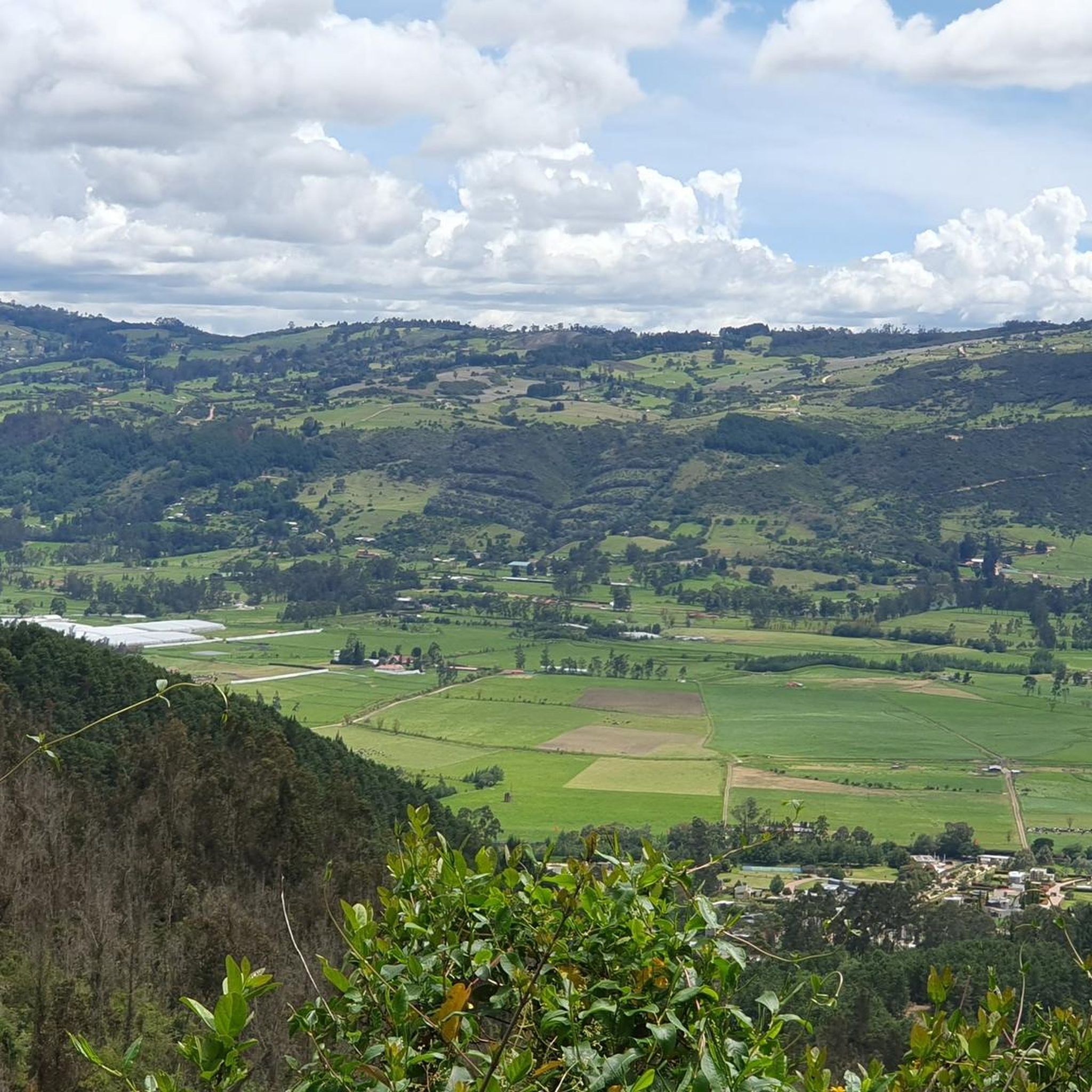
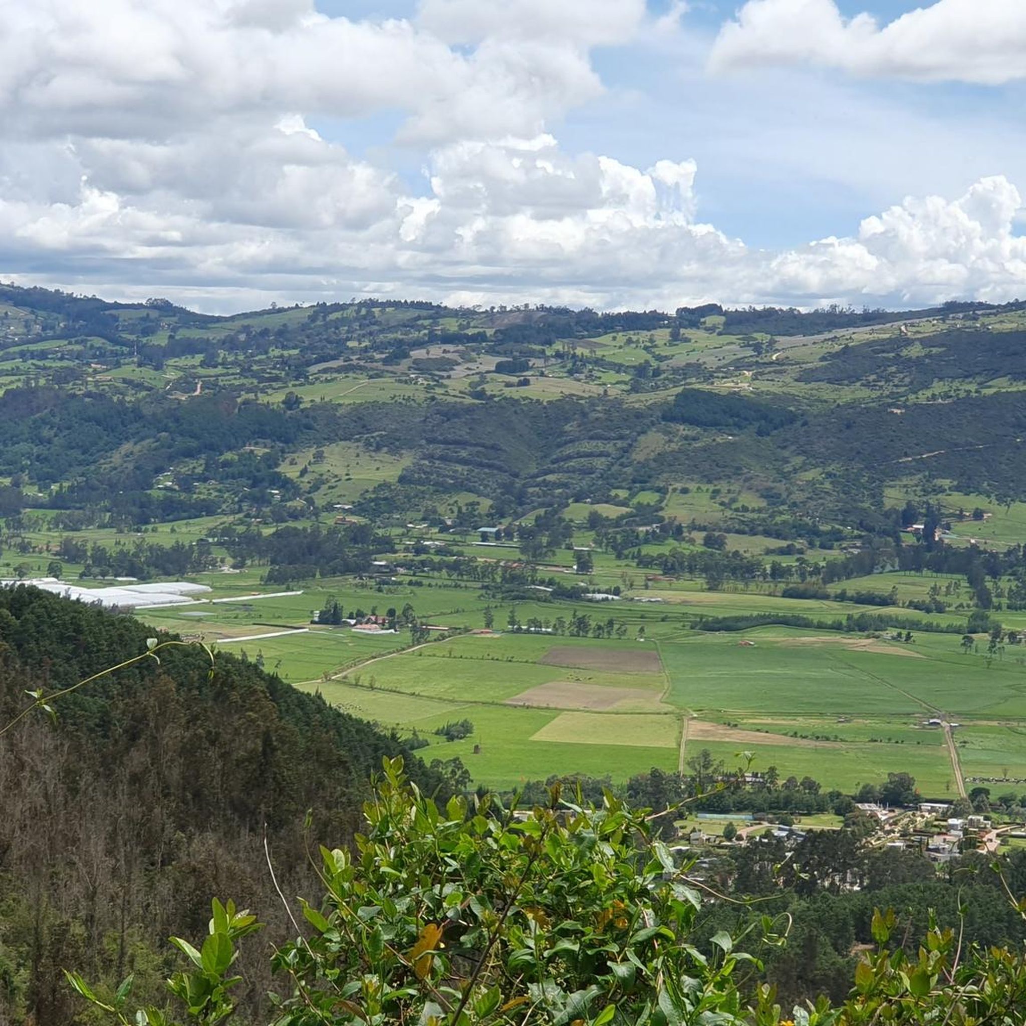
Gravel biking in Reserva Natural De La Sociedad Civil El Encenillo offers routes through a landscape characterized by significant elevation changes and natural features. The region includes high points like Alto de Chingaza and Alto de La Cuchilla, indicating a hilly or mountainous terrain suitable for challenging rides. Riders can expect varied surfaces typical of a natural reserve, often featuring unpaved roads and paths. The area provides opportunities to explore natural environments, including views of water bodies such as the Tominé Reservoir.
Best gravel bike trails in Reserva Natural De La Sociedad Civil El Encenillo
- The most popular gravel bike trail is Plaza de La Calera – Alto de Chingaza loop from La Calera, a 22.1 miles (35.6 km) trail that takes 3 hours 27 minutes to complete. This difficult route features substantial elevation gain.
- Another top favourite among local gravel bikers is Alto de La Cuchilla – Guasca loop from Guasca, a difficult 35.5 miles (57.1 km) path. This route traverses varied terrain with significant climbs.
- Local gravel bikers also love the View of Tominé Reservoir – Guasca loop from Guasca, a 21.2 miles (34.2 km) trail leading through natural landscapes with reservoir views, often completed in about 2 hours 54 minutes.
- Gravel biking in Reserva Natural De La Sociedad Civil El Encenillo is defined by challenging climbs, natural reserve environments, and reservoir vistas. The network primarily offers difficult routes for experienced gravel bikers.
- The routes in Reserva Natural De La Sociedad Civil El Encenillo are highly rated by the komoot community with an average score of 5.0 stars from 1 review. More than 20 gravel bikers have used komoot to explore Reserva Natural De La Sociedad Civil El Encenillo's varied terrain.
Last updated: October 19, 2026
5.0
(2)
14
riders
35.6km
03:27
1,080m
1,080m
Hard gravel ride. Very good fitness required. Mostly paved surfaces.
5
riders
57.1km
05:01
1,570m
1,570m
Hard gravel ride. Very good fitness required. Mostly paved surfaces.

3
riders
34.2km
02:54
830m
830m
Hard gravel ride. Very good fitness required. Mostly paved surfaces.
2
riders
22.3km
01:53
580m
580m
Hard gravel ride. Very good fitness required. Mostly paved surfaces.
Our route recommendations are based on thousands of hikes, rides, and runs completed by other people on komoot.
Start today with a free account
Your next adventure awaits.
Popular around Reserva Natural De La Sociedad Civil El Encenillo

Tips from the Community

If the day is sunny, the view is more enjoyable, but it is still demanding. Besides, as it is a paramo, the weather tends to change very easily, so you have to bring a coat just in case!
0
0

Great ride with my mates. The downhill in Montenquiva deserves respect. A friend fell and broke his clavicule. Apart from that incident the ride was awesome, the landscape breathtaking
0
0

Route to go out on Saturday, to have breakfast watching the dam, in Guatavita, and if you want it easy, go back along the highway, without eagerness.
0
0
Port with a manageable slope, it becomes hard at the end due to the altitude (3,500 meters) and the wind in the last km. Very cold up, and on the way down, I suggest a good jacket and FULL FINGER gloves.
0
0

feed the dogs ... take a pause enjoy a light meal, also a beverage and prepare for a steady climbing in 20km
0
0

Always be prepared for rain and cold. At 3500m above sea level, the detour to Montaña del Oso is a descent made of loose stone and difficult to maneuver, then you can take the path (not pedalable) to connect the path with Mundo Nuevo.
1
0


paramos are simply great. you do not need a special reason to visit them
0
0
Frequently Asked Questions
What is the typical difficulty level for gravel biking in Reserva Natural El Encenillo?
Gravel biking in Reserva Natural El Encenillo is characterized by challenging routes. The terrain features significant elevation changes, including high points like Alto de Chingaza and Alto de La Cuchilla, making most trails suitable for experienced gravel bikers. For example, the Plaza de La Calera – Alto de Chingaza loop from La Calera involves substantial elevation gain.
Are there any beginner-friendly gravel bike routes in Reserva Natural El Encenillo?
The routes in Reserva Natural El Encenillo are generally considered difficult, featuring significant climbs and varied terrain. There are no routes specifically categorized as easy or moderate within this guide, so beginners should exercise caution and be prepared for challenging conditions.
How long do gravel bike rides typically take in Reserva Natural El Encenillo?
The duration of gravel bike rides in Reserva Natural El Encenillo varies depending on the route and your pace. For instance, the View of Tominé Reservoir – Guasca loop from Guasca typically takes around 2 hours 54 minutes, while the longer Alto de La Cuchilla – Guasca loop from Guasca can take approximately 6 hours 5 minutes.
Are there many circular gravel bike routes available in Reserva Natural El Encenillo?
Yes, all the gravel bike routes highlighted in this guide are circular loops. This allows riders to start and finish at the same point, offering convenient exploration of the natural reserve. Examples include the Plaza de La Calera – Alto de Chingaza loop from La Calera and the Alto de La Cuchilla – Guasca loop from Guasca.
What kind of views and natural features can I expect along the gravel bike trails?
Riders can expect diverse natural environments and scenic viewpoints. The region is known for its hilly and mountainous terrain, offering panoramic vistas. A notable feature is the Tominé Reservoir, which can be viewed along routes like the View of Tominé Reservoir – Guasca loop from Guasca, providing beautiful water body views amidst the natural landscapes.
What are the starting points for gravel biking in Reserva Natural El Encenillo?
Common starting points for gravel biking in the area include La Calera and Guasca. For example, the Plaza de La Calera – Alto de Chingaza loop begins from La Calera, and the Alto de La Cuchilla – Guasca loop starts from Guasca. These locations serve as convenient access points to the trail network.
What is the best time of year to go gravel biking in Reserva Natural El Encenillo?
While specific seasonal recommendations are not available, given the region's significant elevation changes and natural reserve environment, it's generally advisable to check local weather forecasts before your ride. Conditions can vary, and drier periods might offer more comfortable riding on unpaved surfaces.
What should I wear for gravel biking in this region?
Considering the challenging terrain and varied surfaces, we recommend wearing appropriate gravel biking attire, including padded shorts, a moisture-wicking top, and sturdy cycling shoes. Given the potential for elevation changes and exposure, layers are advisable, and always carry rain gear, even if the forecast looks clear.
Are there any cafes or amenities near the gravel bike trails?
The routes often start or pass near towns like La Calera and Guasca, where you may find local amenities, including cafes or small shops. It's always a good idea to carry sufficient water and snacks, especially on longer routes, as services might be sparse once you are deep into the natural reserve.
What do other gravel bikers enjoy most about riding in Reserva Natural El Encenillo?
The komoot community highly rates the gravel biking experience in Reserva Natural El Encenillo, with an average score of 5.0 stars. Riders often praise the challenging climbs, the immersive natural reserve environments, and the rewarding reservoir vistas. The area offers a true adventure for those seeking demanding gravel rides.
What kind of wildlife might I encounter while gravel biking?
As a natural reserve, Reserva Natural El Encenillo is home to various flora and fauna. While specific wildlife sightings are not guaranteed, riders might encounter local bird species and other small animals typical of a high-altitude natural environment. Always respect the wildlife and maintain a safe distance.
What are the typical surface conditions on the gravel bike trails?
The trails in Reserva Natural El Encenillo feature varied surfaces typical of a natural reserve, often including unpaved roads and paths. Riders should be prepared for a mix of gravel, dirt, and potentially rocky sections, which contribute to the challenging nature of the rides.
Most popular routes in Reserva Natural De La Sociedad Civil El Encenillo

Get inspired with the komoot mobile app


Explore more
Browse the best Gravel rides in other regions.
