The best gravel rides in Oakbrook Regional Park
39
riders
11
rides
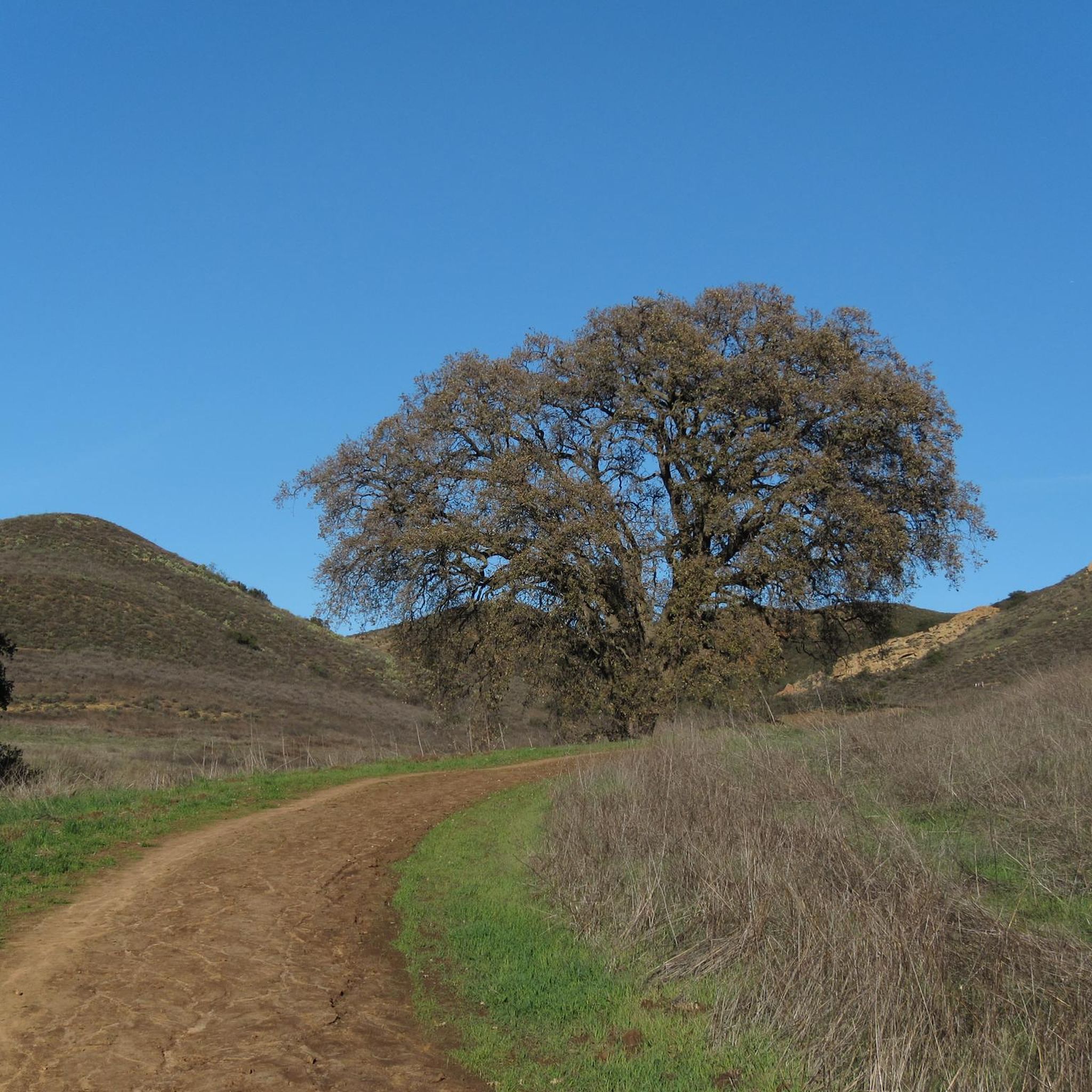
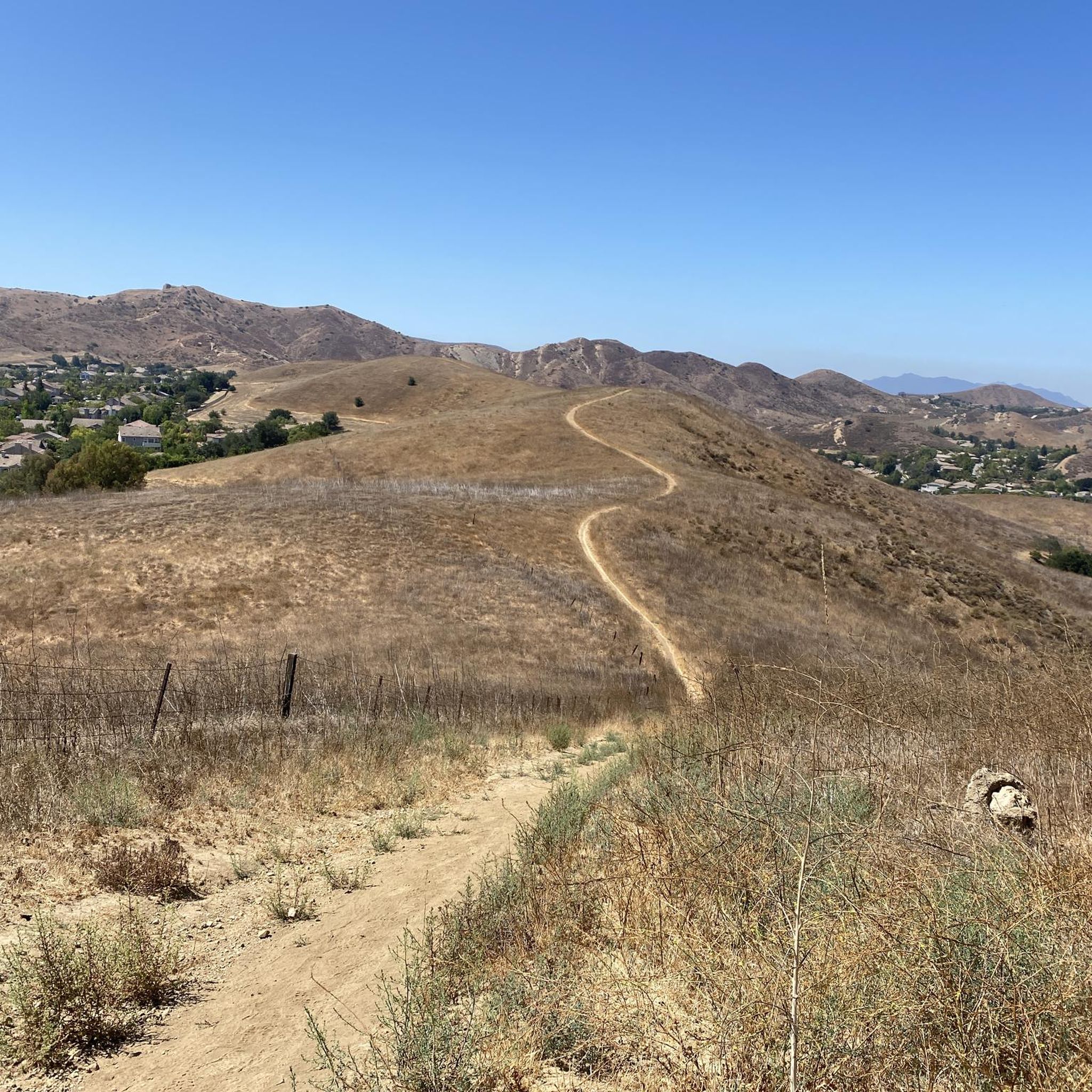
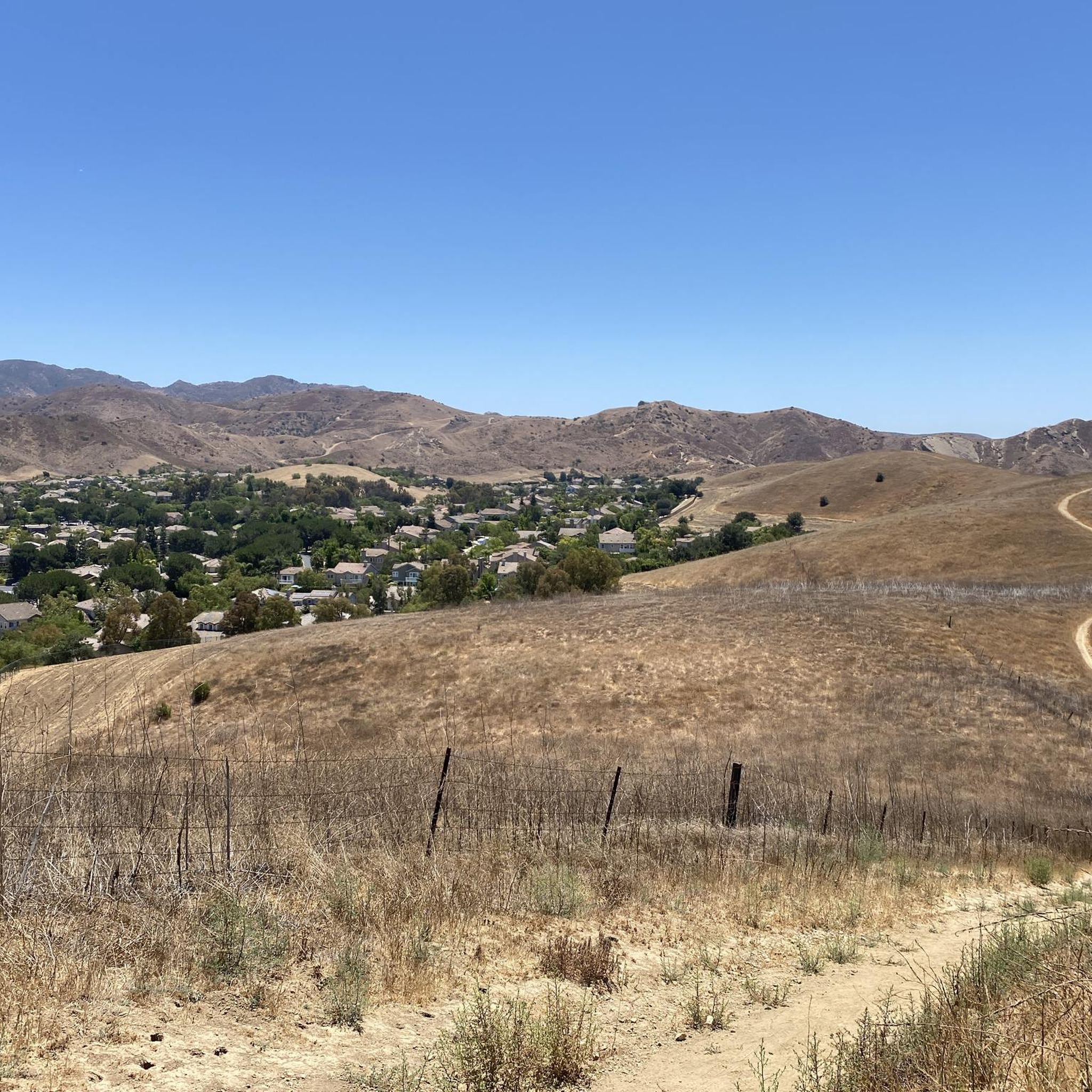
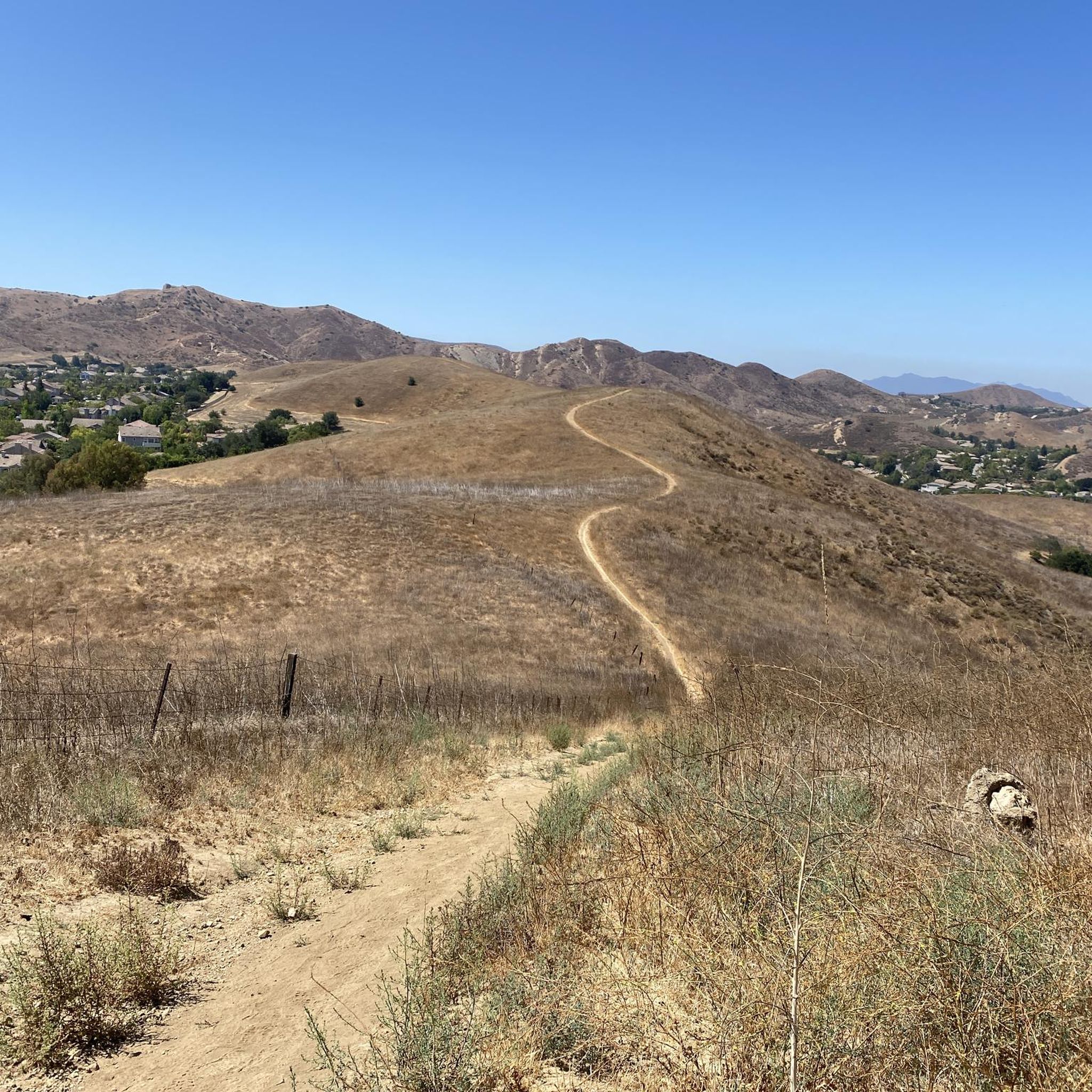
Gravel biking in Oakbrook Regional Park offers diverse landscapes across its 1,025 acres, connecting to thousands more acres of open space within the Santa Monica Mountains National Recreation Area. The region features rolling hills, varied elevations, and a network of double-track, single-track, and unpaved Edison roads. Riders can expect lush meadows, ancient oak groves, and panoramic views of the Simi Hills and Santa Susana Mountains. The terrain includes moderate elevation changes, providing options for various skill levels.
Best gravel bike trails in Oakbrook Regional Park
- The most popular gravel bike trail is Deep Ridge Open Space – Conejo Canyons Open Space loop from Thousand Oaks Grant R. Brimhall Library, a 21.6 miles (34.7 km) trail that takes 2 hours 47 minutes to complete. This difficult route navigates varied terrain and connects to extensive open space systems.
- Another top favourite among local gravel bikers is China Flat plateau – Lang Ranch Open Space loop from Thousand Oaks High School, a difficult 31.7 miles (51.1 km) path. This route features significant elevation changes and expansive views across the Lang Ranch Open Space.
- Local gravel bikers also love the West Potrero Road – Sycamore Canyon North climb loop from Westlake High School, a 40.9 miles (65.7 km) trail leading through challenging climbs and varied landscapes, often completed in about 4 hours 35 minutes.
- Gravel biking in Oakbrook Regional Park is defined by rolling hills, lush meadows, and double-track and single-track sections. The network offers options for different ability levels, from moderate to difficult routes.
- The routes in Oakbrook Regional Park are highly rated by the komoot community with an average score of 4.0 stars from 1 review. More than 30 gravel bikers have used komoot to explore Oakbrook Regional Park's varied terrain.
Last updated: October 26, 2026
7
riders
Hard gravel ride. Very good fitness required. Mostly paved surfaces.
3
riders
Hard gravel ride. Very good fitness required. Mostly paved surfaces.

3
riders
33.9km
02:05
380m
380m
Moderate gravel ride. Good fitness required. Mostly paved surfaces.
2
riders
58.2km
04:02
860m
860m
Hard gravel ride. Very good fitness required. Mostly paved surfaces.
1
riders
Hard gravel ride. Very good fitness required. Mostly paved surfaces.
Get access to more routes and recommendations from other explorers.
Already have an account?
Our route recommendations are based on thousands of hikes, rides, and runs completed by other people on komoot.
Start today with a free account
Your next adventure awaits.
Tips from the Community

Tucked in the Santa Monica Mountains near Agoura Hills, Malibou Lake is a private reservoir surrounded by rustic homes and hillsides dotted with oak trees. Created in 1922, the Medea and Triunfo creeks feed the reservoir, which sits adjacent to Malibu Creek State Park. The lake has a long history as a Hollywood filming location, most notably Frankenstein (1931)—the iconic scene of the monster and a little girl.
0
0

Pick up the Wendy Trail from hear and head off into the Boney Mountain State Wilderness. There are miles and miles of trails to explore, so take your pick and enjoy your run.
0
0

China Flat is a scenic plateau at around 2,000 ft elevation. It is full of native oak woodlands, chaparral-covered meadows, and striking sandstone outcroppings. There are several trails that cut through the land.
0
0
Pedalers Fork is a unique combination of a restaurant, bar, coffee shop, and boutique bike shop in the heart of Calabasas. It offers delicious farm-to-table dining and artisan coffee with a casual vibe and a great patio, making it a fantastic place to relax after a ride.
0
0

Cheeseboro Canyon Trailhead features a parking lot, toilets and a water fountain.
0
0
The Grasslands Trail is an easy, beginner-friendly singletrack that connects Malibu State Park to Calabasas. Here you can have beautiful views of open grasslands with gentle terrain and minimal elevation change, making it perfect for new riders. Here you can have beautiful views of open grasslands. The trail is accessed from the parking area along Mulholland Highway.
0
0

At the end of Victory Blvd is a parking spot (USD 3 per car). From here you can choose wide trails and small paths throughout a hilly landscape. From top of the hills you can enjoy the view.
0
0

Food, coffee and tools
1
0
Frequently Asked Questions
How many gravel bike trails are available in Oakbrook Regional Park?
Komoot currently lists 8 gravel bike routes within Oakbrook Regional Park and its connecting open spaces. These routes range in difficulty from moderate to difficult, offering diverse experiences for gravel cyclists.
What kind of terrain can I expect on gravel bike trails in Oakbrook Regional Park?
The terrain in Oakbrook Regional Park is characterized by rolling hills, varied elevations, and a mix of trail types. You'll find double-track and single-track sections, as well as unpaved Edison roads. Trails like the Sandstone Hills Trail offer both double-track and single-track experiences, providing varied terrain. Expect moderate elevation changes, with some routes featuring significant climbs, such as the 780-foot gain on the Oakbrook Vista – Sandstone Hills Trail.
Are there any trails suitable for beginners or families in Oakbrook Regional Park?
While many routes in Oakbrook Regional Park are rated moderate to difficult due to elevation changes and varied terrain, the park's extensive network offers options. For families or beginners, it's recommended to look for shorter, less steep sections, particularly on double-track trails. Always check the route details for elevation profiles and surface types before heading out.
Can I bring my dog on the gravel bike trails in Oakbrook Regional Park?
Oakbrook Regional Park and the surrounding open spaces generally welcome dogs, but they must be kept on a leash. Always check specific trail regulations or signage, as rules can vary in different sections of the larger Santa Monica Mountains National Recreation Area.
What natural features or viewpoints can I see while gravel biking?
You'll encounter lush meadows, large oak groves with ancient trees, and native vegetation. Many trails offer panoramic views of the Simi Hills and Santa Susana Mountains. The diverse landscape also includes steep, north-facing slopes with dense chaparral and occasional sandstone outcrops, providing a scenic backdrop for your ride.
Are there any historical or cultural attractions near the trails?
Yes, the Chumash Indian Museum is located within Oakbrook Regional Park. Built on the site of an old Chumash village, it preserves the heritage of the Chumash people. Adjacent to the museum is a 25-acre nature preserve with a garden of native California plants, and the park also contains 11 archaeological sites, including ancient Chumash pictographs and shelters.
What is the best time of year to go gravel biking in Oakbrook Regional Park?
The region generally offers good gravel biking conditions year-round, but spring and fall are often ideal due to milder temperatures and vibrant natural scenery. Summers can be hot, so early morning rides are recommended. Winters are typically mild, though some trails might be muddy after heavy rains.
Are there options for longer, more challenging gravel rides?
Absolutely. The trails in Oakbrook Regional Park connect to an additional 8,000 acres of open space, including the Lang Ranch/Woodridge Open Space and the Santa Monica Mountains National Recreation Area. This connectivity allows for extended rides with significant elevation changes, such as the West Potrero Road – Sycamore Canyon North climb loop from Westlake High School, which covers over 40 miles with substantial climbing.
Where can I park when visiting Oakbrook Regional Park for gravel biking?
Parking is typically available at designated trailheads and access points around Oakbrook Regional Park. Many routes, such as the Deep Ridge Open Space – Conejo Canyons Open Space loop, start from locations like the Thousand Oaks Grant R. Brimhall Library, which usually offers parking facilities. Always check local signage for specific parking regulations.
Are there any circular gravel bike routes available?
Yes, many of the gravel routes in Oakbrook Regional Park are designed as loops, allowing you to start and end at the same point. Examples include the Sheep Corral Trail – Cheeseboro Canyon Trail loop from Oak Park and the China Flat plateau – Lang Ranch Open Space loop from Thousand Oaks High School.
What wildlife might I encounter on the trails?
The park is home to various wildlife species. While specific sightings are never guaranteed, you might spot deer, rabbits, various bird species, and occasionally coyotes or bobcats. Always maintain a respectful distance and do not feed any animals.
What do other gravel bikers say about the trails in Oakbrook Regional Park?
The gravel biking routes in Oakbrook Regional Park are highly rated by the komoot community, with an average score of 4.0 stars. Riders often praise the diverse landscapes, challenging climbs, and the extensive network of trails that connect to larger open space systems, offering a true adventure.
Are there any specific trail maps available for the area?
Yes, detailed trail maps for the broader Conejo Open Space system, which includes areas connected to Oakbrook Regional Park, are available. For example, you can find a map for the Lang Ranch Trail system, which connects to Oakbrook, at conejoopenspace.gov.
Most popular routes in Oakbrook Regional Park

Get inspired with the komoot mobile app


Explore more
Browse the best Gravel rides in other regions.
