The best mountain hikes around Irissarry
5.0
(5)
16
hikers
3
hikes
Mountaineering routes around Irissarry offer access to the rugged and diverse landscapes of the Basque Country, situated at the foot of the Pyrenees. The region is characterized by varied terrain, including significant natural features like limestone and granite formations, dense forests, and mountain peaks. This geological diversity provides a range of ascents and challenging trails for mountaineers.
Best mountaineering routes around Irissarry
- The most popular mountaineering route is Erregelu loop from Blantzarte, a 5.2 miles (8.4 km) trail that…
Last updated: June 29, 2026
5.0
(2)
9
hikers
8.38km
03:28
540m
540m
Moderate mountaineering route. Good fitness required. Mostly accessible paths. Sure-footedness required.
5.0
(2)
3
hikers
11.4km
05:18
830m
830m
Hard mountaineering route. Very good fitness required. Sure-footedness, sturdy shoes and alpine experience required.

Sign up for free
5.0
(1)
3
hikers
7.92km
03:00
500m
500m
Moderate mountaineering route. Good fitness required. Mostly accessible paths. Sure-footedness required.
1
hikers
10.7km
04:22
810m
810m
Moderate mountaineering route. Good fitness required. Mostly accessible paths. Sure-footedness required.
Our route recommendations are based on thousands of hikes, rides, and runs completed by other people on komoot.
Start today with a free account
Your next adventure awaits.
Login or Signup

Tips from the Community

Avoid public holidays and vacation periods...
2
0

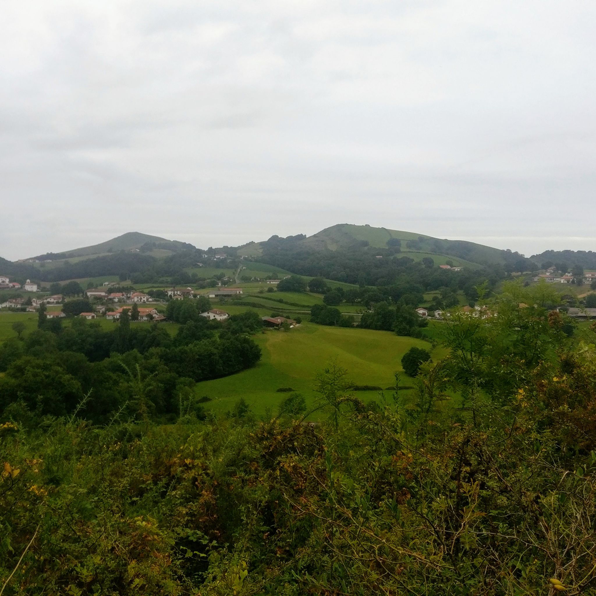
Baïgura, and Erregelu which is located on the same ridge, are a beautiful place for hiking with the family, particularly because of the presence of a leisure center at the foot of the massif.
2
0


This small car park is accessible by a small road which comes from Bidarray. Located right on the border with Spain, it is very practical because many trails converge there.
0
0
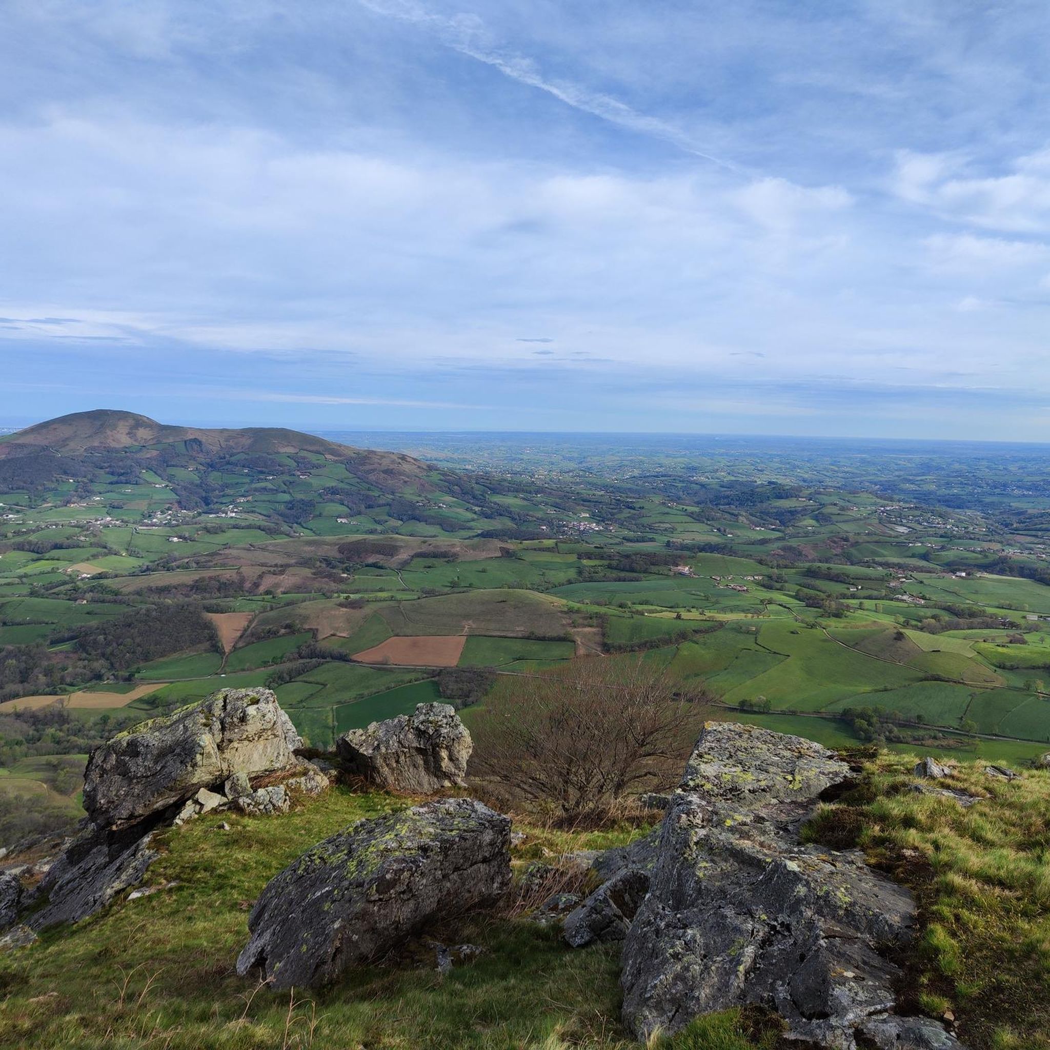
Mount Baïgura culminates at 897 meters in the province of Labourd. Its position set back from the chain offers an exceptional belvedere on the Pyrenees.
9
2
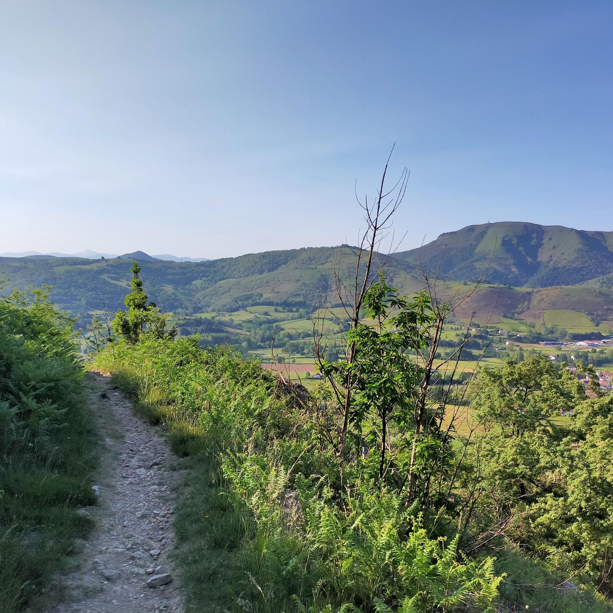
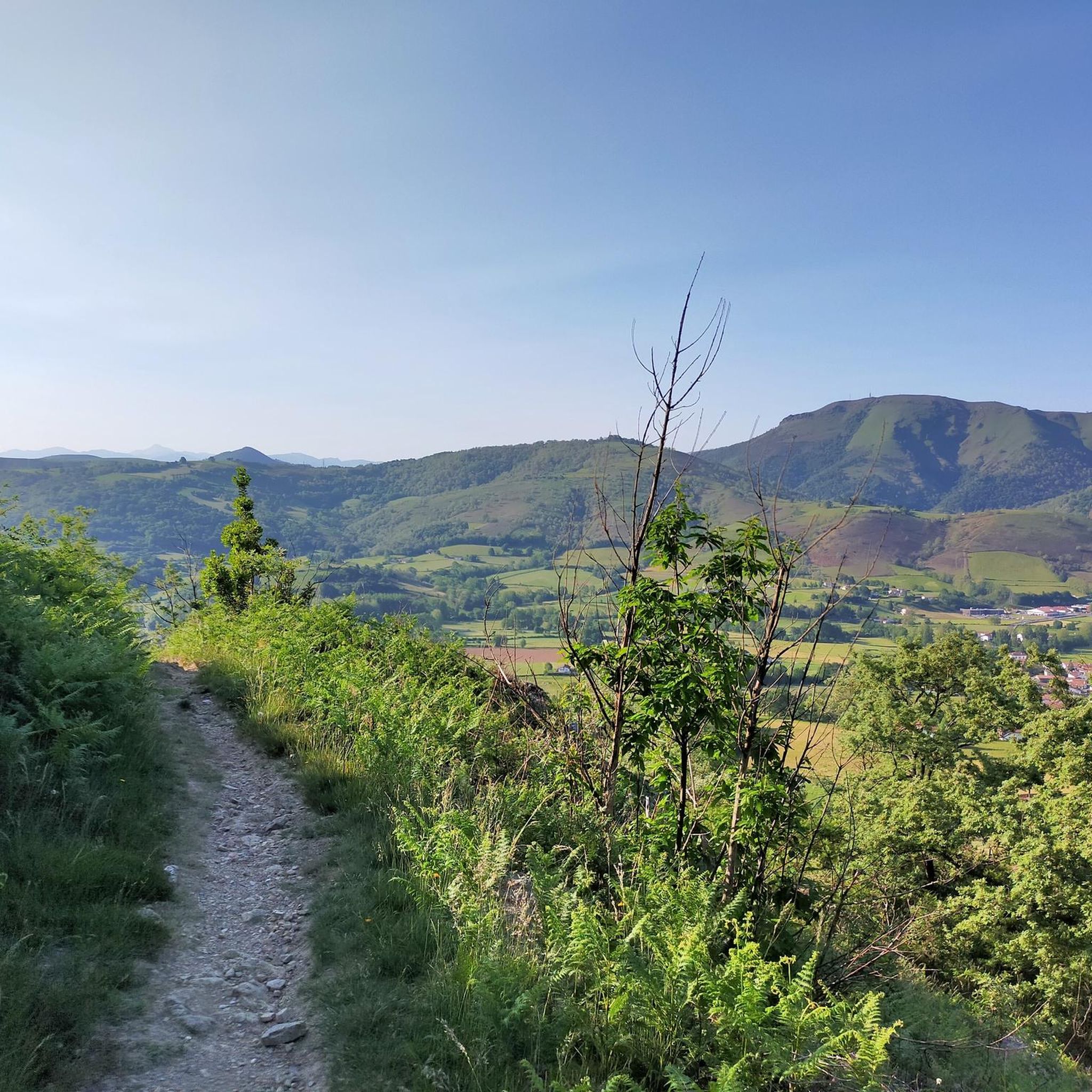
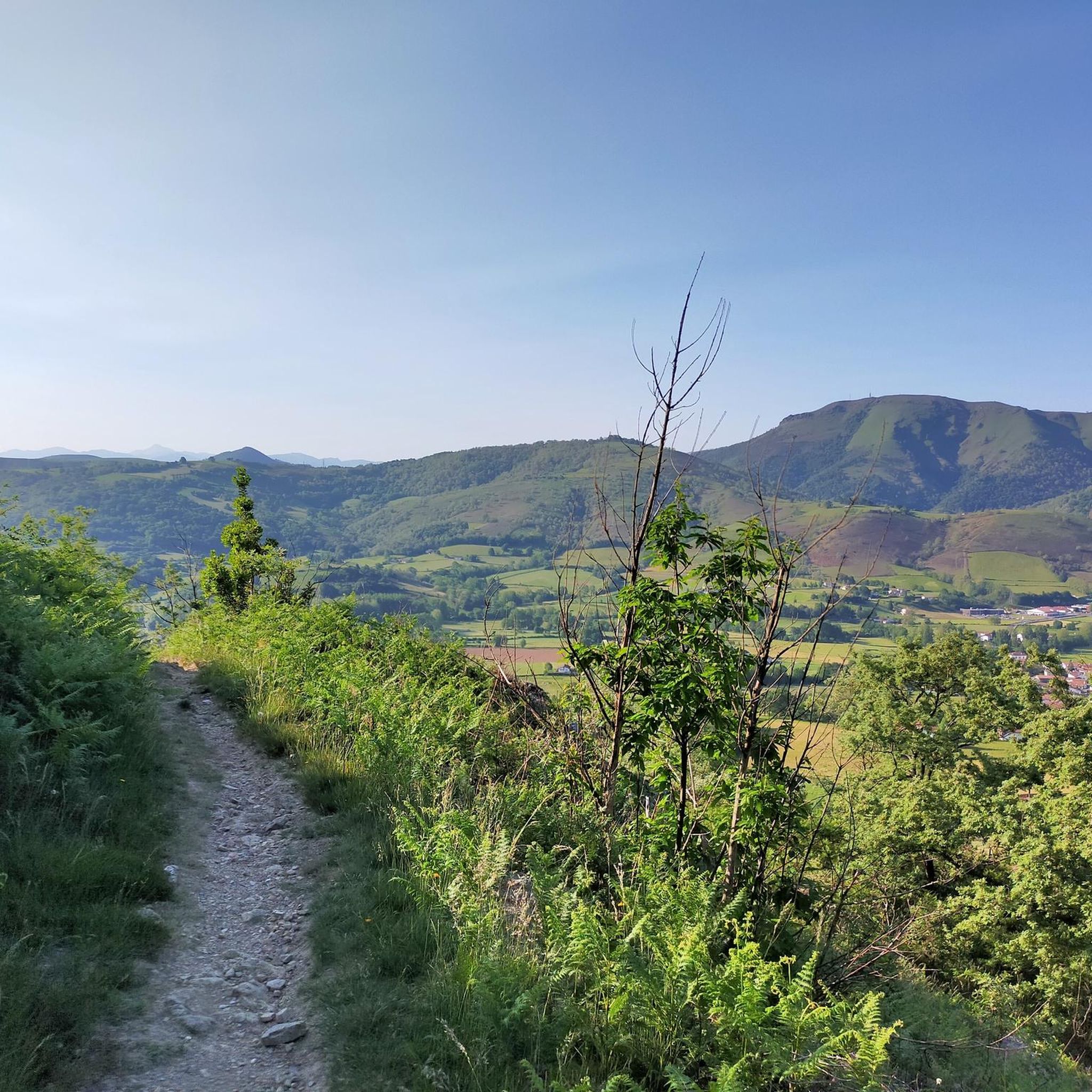
The Alkaxuri dominates a superb ridge at an altitude of 949 meters. The panorama is magnificent, especially on the neighboring ridge of Iparla as well as the peaks of the Pyrenees chain in the distance. Access to this ridge is not easy, but the view is well worth it.
3
0
The Alkaxuri dominates a superb ridge at an altitude of 949 meters. The panorama is magnificent, especially on the neighboring ridge of Iparla as well as the peaks of the Pyrenees chain in the distance. Access to this ridge is not easy, but the view is well worth it.
1
0
Perched on its rocky promontory, the small village of Bidarray offers magnificent views of the mountains that surround it. Nestled at the foot of the Iparla ridges, Bidarray is on the GR 10 path and offers plenty of supplies.
3
0
Frequently Asked Questions
What are the general difficulty levels of mountaineering routes around Irissarry?
The mountaineering routes in the Irissarry area are primarily categorized as moderate to difficult. For example, the Erregelu loop from Blantzarte and the Pagalepoa – Ruine Cabane loop from Bidarray are both moderate, offering a good challenge without being overly strenuous. For those seeking a more demanding experience, the Alkaxuri – Enterramenduko kaskoa loop from Harpeko Saindua is rated as difficult, featuring significant elevation gain across rugged landscapes.
Are there any circular mountaineering routes in the Irissarry region?
Yes, several mountaineering routes around Irissarry are designed as loops, allowing you to start and finish at the same point. Examples include the Erregelu loop from Blantzarte, the challenging Alkaxuri – Enterramenduko kaskoa loop from Harpeko Saindua, and the Pagalepoa – Ruine Cabane loop from Bidarray. Another option is the Baigura – Santsoreneko Lepoa loop from Blantzarte.
What kind of natural features and landscapes can I expect to see on these routes?
The mountaineering routes around Irissarry offer a diverse range of natural features, reflecting the region's position at the foot of the Pyrenees. You'll encounter rugged landscapes with significant limestone and granite formations, dense woodlands, and panoramic views from mountain peaks. The area's geological history has created varied terrain, including ancient mountain chains and striking rock formations. Notable peaks in the wider Basque Country, such as Mount Baïgura, offer exceptional vistas of the Pyrenees and the Atlantic Ocean.
Are there any interesting landmarks or points of interest near the mountaineering routes?
Yes, the region around Irissarry is rich in historical and natural landmarks. While on your mountaineering adventures, you might consider exploring nearby attractions such as the historic Saint-Jean-Pied-de-Port Old Town or the dramatic Roland's Pass (Pas de Roland), a gorge with a unique geological formation. The area also features several mountain passes like Col d'Iparlatze and Col de Gastangarte, which offer their own scenic beauty.
When is the best time of year for mountaineering in Irissarry?
The best time for mountaineering in Irissarry and the surrounding Basque Country generally spans from spring through autumn. During these seasons, the weather is typically more stable, and trails are clear of snow, making for safer and more enjoyable ascents. While specific conditions can vary, avoiding the peak heat of summer or the snow and ice of winter in higher elevations is advisable for most mountaineers.
What do other mountaineers say about the routes in Irissarry?
The mountaineering routes around Irissarry are highly regarded by the komoot community, holding an impressive average rating of 5.0 stars from 5 reviews. Mountaineers often praise the varied terrain, the challenging ascents, and the stunning natural beauty of the Basque Country and its proximity to the Pyrenees. Many appreciate the diverse options available, from moderate climbs to more difficult paths, catering to different skill levels.
Are the mountaineering routes around Irissarry suitable for families?
While the listed mountaineering routes are rated moderate to difficult, making them more suitable for experienced hikers, the broader region around Irissarry offers many outdoor activities that are family-friendly. For instance, adventure parks like Irrisarri Land provide activities such as ziplines and tree-top walks. For gentler walks, the Iraty Forest, Europe's largest beech forest, offers numerous hiking options that might be more suitable for families with younger children.
Is parking available at the trailheads for these routes?
Specific parking details for each trailhead are best checked on the individual route pages on komoot. However, given Irissarry's role as a base for outdoor activities, it's common to find designated parking areas near popular starting points for trails, especially in villages or at key access points to natural areas. Always plan to arrive early, particularly during peak seasons, to secure a spot.
Can I reach the mountaineering routes by public transport?
While Irissarry is well-situated for accessing the region's outdoor activities, direct public transport links to specific remote trailheads can be limited. It's advisable to check local bus schedules or consider using a car to reach the starting points of many mountaineering routes. Some larger towns in the Basque Country may offer better public transport connections, but for direct access to mountain trails, a personal vehicle often provides the most flexibility.
Are dogs allowed on the mountaineering trails in Irissarry?
Generally, dogs are permitted on many hiking and mountaineering trails in the Basque Country, provided they are kept under control, especially in areas with livestock or wildlife. It's always best to check for specific local regulations or signage at the trailhead, as rules can vary. Ensure your dog is well-behaved, on a leash where required, and that you carry out all waste to preserve the natural environment.
What other outdoor activities are available near Irissarry besides mountaineering?
Beyond mountaineering, Irissarry is an excellent base for a wide array of outdoor pursuits. The region is popular for hiking, mountain biking, and cycling on its extensive network of trails. For water-based adventures, nearby Bidarray offers opportunities for canyoning and rafting on the lively rivers of the Basque Country. Additionally, the area provides rock climbing and via ferrata options in locations like Etxauri and near Bidarray, with certified guides available for instruction.
Most popular routes around Irissarry
Most popular attractions around Irissarry

Get inspired with the komoot mobile app


Explore more
Browse the best Mountain Hikes & Routes in other regions.
