The best MTB trails around Alfândega Da Fé
5.0
(1)
52
riders
4
rides
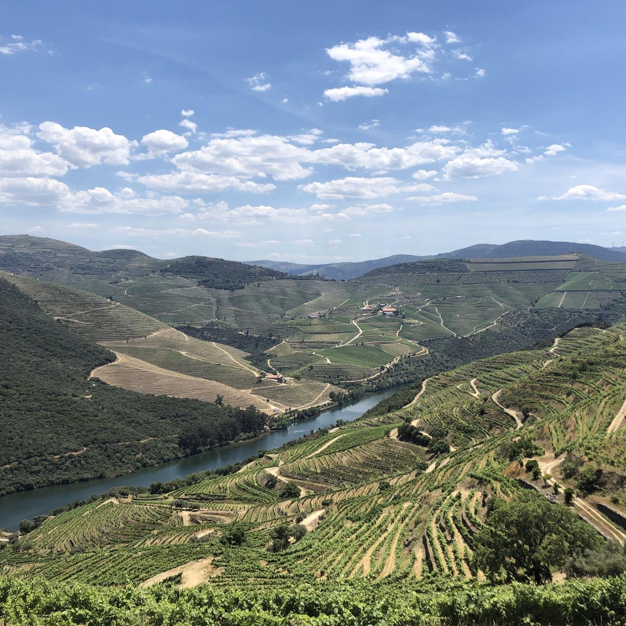
Mountain biking around Alfândega Da Fé offers diverse terrain across varied altitudes, ranging from 400 to 1200 meters. The region is characterized by the prominent Serra de Bornes mountain range, the Sabor River valley, and the Vilariça Valley. These features provide a mix of challenging climbs and descents, making it well-suited for mountain bike trails. The landscape includes mountainous terrain, river valleys, and expansive plateaus, with opportunities for scenic rides.
Best mountain bike trails around Alfândega Da Fé
- The most…
Last updated: July 13, 2026
22
riders
Moderate mountain bike ride. Good fitness required. Advanced riding skills necessary.
10
riders
Moderate mountain bike ride. Good fitness required. Advanced riding skills necessary.

Sign up for free
9
riders
66.8km
05:52
1,080m
1,080m
Hard mountain bike ride. Very good fitness required. Suitable for all skill levels.
7
riders
65.7km
06:06
1,370m
1,370m
Hard mountain bike ride. Very good fitness required. Suitable for all skill levels.
5.0
(1)
4
riders
26.2km
02:16
400m
400m
Moderate mountain bike ride. Good fitness required. Advanced riding skills necessary.
Our route recommendations are based on thousands of hikes, rides, and runs completed by other people on komoot.
Start today with a free account
Your next adventure awaits.
Login or Signup
Popular around Alfândega Da Fé
Tips from the Community

It's a spectacular spot for those seeking freshwater swimming, natural landscapes, and outdoor activities. It stands out for its cleanliness, well-maintained infrastructure, and protected environment within the Vale do Tua Regional Natural Park. Ideal for families, hikers, and water sports enthusiasts.
2
0
Praia Fluvial da Fraga da Pegada is a river beach located in the Albufeira do Azibo, near Macedo de Cavaleiros, in the Trás-os-Montes region (northern Portugal). It is one of the most highly regarded destinations for nature tourism and water sports in the area.
2
0

Azibo Reservoir in Macedo de Cavaleiros, the Paradise of Trás-os-Montes. 👍🥾🚲
1
0

The Podence Carnival Festival is held by the community of Podence, which belongs to the municipality of Macedo de Cavaleiros, in the district of Bragança. This is a social practice related to the end of winter and the beginning of spring. It takes place between Sunday and Shrove Tuesday in the most colourful village in Portugal, Podence. In the heart of the Northeast of Trás-os-Montes, the much-acclaimed Podence Carnival – Entrudo Chocalheiro – is celebrated during the carnival week, where the Podence Caretos (a pagan performance) bring colour to the village and to the many tourists who pass through with their costumes. This ritual event, which originated in the so-called “long time”, when life was organised according to the rhythms of the agricultural cycle, refers to the festivities celebrating the end of the winter cycle and the beginning of the spring production cycle. Unique in relation to other Carnival festivities held in other parts of the country and adapting to a post-rural socio-economic context, the Podence Caretos Carnival festival today takes on its own particularities, through its elements – the mask and the costume, the behaviours that characterise the ritual and the protagonists of the festival, the masked people, known as “caretos”, and its current social function, assuming a distinctive and unique format.
5
0
The Azibo Reservoir, classified as a Protected Landscape, is located in the municipality of Macedo de Cavaleiros. This magnificent body of water, combined with sand and a vast diversity of fauna and flora, is home to two beautiful river beaches: Praia Fluvial da Ribeira and Praia Fluvial da Fraga da Pegada. Both beaches are very popular throughout the bathing season, not only because of the quality of the water but also because of the quality of the infrastructure.
1
0
Albufeira do Azibo is an impressive body of water located in the municipality of Macedo de Cavaleiros, in Portugal. This place, assessed as a Protected Landscape, is home to two beautiful river beaches: Praia Fluvial da Ribeira and Praia Fluvial da Fraga da Pegada.
3
0

5G does not yet work well in this area. I was only able to save a very short part of my ride and could not pin the photos to the route. Hopefully it will get better soon.
5
0
Drive into the village with the castillo with a beautiful view
10
0
Frequently Asked Questions
What kind of terrain can I expect on mountain bike trails around Alfândega Da Fé?
The region offers diverse terrain with significant altitude changes, ranging from 400 to 1200 meters. You'll encounter challenging climbs and descents across the Serra de Bornes mountain range, the Sabor River valley, and the Vilariça Valley, providing a varied and engaging experience for mountain bikers.
Are there mountain bike trails suitable for beginners or more advanced riders?
Yes, the trails around Alfândega Da Fé cater to a range of abilities. You'll find routes classified as both moderate and difficult. For example, the Albufeira do Azibo – Albufeira do Azibo Beach loop is a moderate option, while the Albufeira do Azibo loop presents a more difficult challenge.
What are some of the natural features or viewpoints I can see while mountain biking in the area?
The trails often pass through scenic areas like the Sabor River valley and near the Sabor Lakes. You can also enjoy panoramic views from various points, such as the Santo Antão da Barca Viewpoint overlooking the Sabor Lakes, or the Cabreira Viewpoint. The nearby Geopark of Macedo de Cavaleiros also offers geological interest.
What is the best time of year to go mountain biking in Alfândega Da Fé?
Alfândega Da Fé is known as 'terra quente' (hot lands), suggesting warmer conditions. Spring, particularly February and March, is a beautiful time to visit when the region's almond trees are in blossom, creating stunning landscapes. Autumn also offers pleasant temperatures and vibrant scenery.
Are there any circular mountain bike routes available?
Yes, many of the mountain bike routes in the area are designed as loops. Examples include the moderate Albufeira do Azibo – Albufeira do Azibo Beach loop and the more challenging Albufeira do Azibo loop, both offering a return to your starting point.
What do other mountain bikers say about the trails in Alfândega Da Fé?
The mountain bike routes in Alfândega Da Fé are highly rated by the komoot community, with an average score of 5.0 stars. Riders often appreciate the varied terrain and the scenic beauty of the region.
Are there any specific landmarks or attractions near the mountain bike trails?
Beyond the natural beauty, you can find interesting points like the View of Mogadouro Castle. The region is also close to the UNESCO Global Geopark of Terras de Cavaleiros, which boasts 42 geosites showcasing millions of years of geological history.
What are the typical distances and durations for mountain bike trails in this region?
Trail distances vary, with routes ranging from approximately 23 miles (37 km) to over 38 miles (62 km). Durations can range from around 3.5 hours for shorter, moderate routes to over 6 hours for longer, more difficult trails, depending on your pace and the specific route chosen.
Is it possible to find accommodation or places to eat near the mountain bike trails?
While Alfândega Da Fé is considered a 'hidden gem' with picturesque villages, you can find local amenities. For a wider range of options, the nearby settlement of Macedo de Cavaleiros is a good starting point and is often associated with several of the popular routes.
Are there any specific trails that follow river valleys?
Yes, the Sabor River valley is a prominent geographical feature in the region. Routes like the Vale da Porca Reservoir – Albufeira do Azibo loop navigate through varied landscapes, including sections of the Sabor River valley, offering scenic riverside paths.
What is the elevation gain like on these mountain bike trails?
The trails feature significant elevation changes, reflecting the region's diverse topography. For instance, a moderate route like the Albufeira do Azibo – Albufeira do Azibo Beach loop involves around 590 meters of ascent, while a difficult one such as the Vale da Porca Reservoir – Albufeira do Azibo loop can have over 1360 meters of climbing.
Most popular routes around Alfândega Da Fé
Most popular attractions around Alfândega Da Fé

Get inspired with the komoot mobile app


Explore more
Browse the best MTB trails in other regions.
