The best MTB trails around Knighton On Teme
5.0
(1)
18
riders
2
rides
Mountain biking around Knighton On Teme offers routes through a landscape characterized by rolling hills, dense woodlands, and historic estate tracks. The area features varied terrain with significant elevation changes, providing both challenging climbs and scenic descents. Riders can explore rural paths and quiet country lanes, often passing through small villages and past historic sites. The region's geography provides a mix of open views and sheltered forest sections suitable for mountain biking.
Best mountain bike trails around Knighton On Teme
…Last updated: July 5, 2026
5.0
(1)
8
riders
28.2km
02:38
760m
760m
Moderate mountain bike ride. Good fitness required. Advanced riding skills necessary.
2
riders
39.9km
02:50
620m
620m
Moderate mountain bike ride. Good fitness required. Suitable for all skill levels.

Sign up for free
2
riders
21.5km
01:23
280m
280m
Easy mountain bike ride. Great for any fitness level. Suitable for all skill levels.
2
riders
Moderate mountain bike ride. Good fitness required. Suitable for all skill levels.
2
riders
15.2km
00:56
180m
180m
Easy mountain bike ride. Great for any fitness level. Suitable for all skill levels.
Our route recommendations are based on thousands of hikes, rides, and runs completed by other people on komoot.
Start today with a free account
Your next adventure awaits.
Login or Signup

Tips from the Community


Nice route to the Clee Hills. Parking to the north as well at the excitingly named Cockshutford
0
0


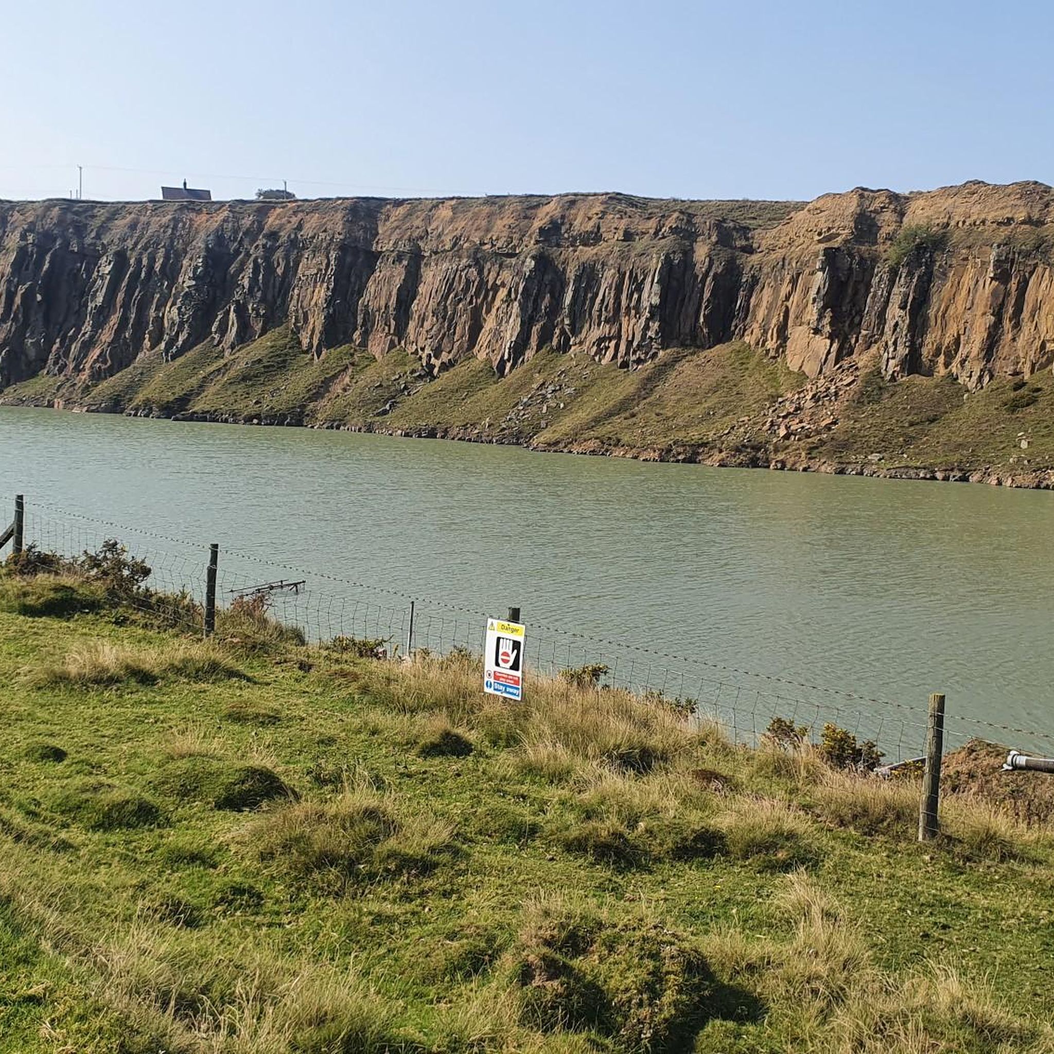
Discover this tranquil little lake tucked away in the Shropshire Hills. The lake makes a great picnic spot, or if you're feeling daring, a wild swimming spot, too.
1
0

From Stoke St Milborough, if you have appetite for further exploration, take in Scirmidge Lane. It lies alongside a small area of common land on the parish boundary of Cold Weston, Hopton Cangeford and Stoke St Milborough. We often find common land where parish boundaries converge, but in the late 18c. this area was ‘no-man’s-land’. Between 1784 and 1796, the Scirmidge Cottage (related to the the term skirmish, Scirmidge is said to refer to a disorderly place) was home to an enterprising midwife. The three parishes sent unmarried expectant woman there to have their babies, to avoid them being born in their parish, and hence taking on responsibility for their wellbeing and ‘upkeep’. The register records 52 illegitimate births at the Scirmidge. It is now part of Cold Weston Parish and the common called Weston common with rights to graze cattle and sheep.
0
0
First enshrined in law in the Magna Carta in 1215, Common Land traditionally sustained the poorest people in rural communities who owned no land of their own, providing them with a source of wood, bracken for bedding and pasture for livestock. Over one-third of England’s moorland is common land. Common Land now accounts for just 3% of England, but this includes large tracts of our most well-loved and ecologically rich landscapes including where you are standing in the Shropshire Hills but also in the Yorkshire Dales, on Dartmoor and in the Lake District. Common Land is privately owned land with ‘Rights of Common’ over that land, most commonly to graze animals. Visitors have a right roam the commons while recognising and respecting the wildlife, landowners and farmers who work tirelessly to maintain it. This includes making sure all visiting dogs have their owner with them and are under close control. Our nesting birds, sheep, lambs and other stock will thank you for it. There are 86 pieces of registered common land in the county of Shropshire. Many of these and certainly the largest ‘working’ commons, can be found within the Shropshire Hills Area of Outstanding Natural Beauty. Clee Liberty, known for its Iron Age Hill Fort and extensive industrial quarrying activity is part of Shropshire’s highest hill, the Brown Clee. This common is owned by the Parish Council of Clee St Margaret. Local residents enjoy common rights on the hill, several commoners turn out sheep and one also grazes a small herd of ponies. For this walk, we access the common from ‘the Yeld’ where there is parking for a small number of cars. To start the walk, go through the gate onto the common and follow the track straight ahead.
0
0
Stoke St Milborough, known in Saxon period as Godstoke, was part of the huge Saxon parish of St Milburga, subject to the minster church at Much Wenlock. Small dependent chapels were set up within the large parish and Stoke St Milborough (then called Godstoke) may have had one by the 8th century. The tower of the church of St. Milburga is believed to date back to 1250. The Church worth a visit if you have allowed enough time on this walk. There is some great information inside and much to see. Take a look at the church and see the textures of the different stone used to build it, from small layered tiles, to large interesting shapes. As you exit the church grounds, find your way to the holy well of St Milburga. A small plaque tells her story and the miracles she became known for, including the banishment of seed-eating geese. The holy well is a piece of registered common land (not all common land has graziers, some are protected by this status for a wider group of beneficiaries, is this case the local residents). The holy well is a spring with an old stone basin, dating back as early as 1321. It was later a common clothes washing place. Stories of its origin were recorded in the mid 19th century, with mention to its miraculous ability to cure blindness. Notice the strong connections to geese dotted around the Church, engraved into the woodwork inside the church, and on the gate and handrails as you enter the well. How many can you find?
0
0

Frequently Asked Questions
What types of mountain bike trails can I expect around Knighton On Teme?
The area around Knighton On Teme features a landscape of rolling hills, dense woodlands, and historic estate tracks. You'll find a mix of rural paths and quiet country lanes, offering varied terrain with both challenging climbs and scenic descents. The routes often pass through small villages and past historic sites.
Are there mountain bike trails suitable for beginners or families in Knighton On Teme?
Yes, there are options suitable for less experienced riders or families. For example, the Parish Church of St. Milburga – Cuckoopen Coppice loop from Bitterley is an easy 13.4-mile (21.5 km) trail through woodlands. Another easy option is the Middleton loop from Bitterley, which is 9.4 miles (15.2 km) long.
What are the typical lengths of mountain bike trails in this region?
The mountain bike routes around Knighton On Teme vary in length, generally ranging from around 9.4 miles (15.2 km) to 25.6 miles (41.2 km). This provides options for both shorter rides and longer, more enduring excursions.
Are there any challenging mountain bike routes for experienced riders?
While there are no trails explicitly graded as 'difficult' in the immediate selection, many of the moderate routes feature significant elevation changes and varied terrain that can provide a good challenge. For instance, the Nordy Bank Hillfort – Clee Burf loop from Bromdon Caravan Park is a 17.5-mile (28.2 km) moderate trail with substantial climbs and descents.
Are the mountain bike trails around Knighton On Teme circular routes?
Yes, all the featured mountain bike routes in this guide are designed as circular loops, allowing you to start and finish at the same point without needing to arrange transport back to your starting location.
What kind of scenery can I expect on the mountain bike trails?
The trails offer diverse scenery, including expansive views across the countryside, ancient woodlands, and picturesque rural landscapes. You'll often pass through charming villages and alongside historic landmarks, providing a rich visual experience.
What are some interesting places to see near the mountain bike trails?
While riding, you might encounter various points of interest. Notable attractions in the wider area include the Titterstone Clee Hill summit for panoramic views, the historic Ruins of St Michael's Church, Abberley, and the scenic Stanford Bridge Over the River Teme.
Are there places to stop for refreshments or food along the routes?
While specific cafes are not listed for each route, many trails pass through or near small villages like Bitterley or Hopton Wafers. These villages often have local pubs or small shops where you can find refreshments. It's always a good idea to check opening times in advance.
What is the best time of year to go mountain biking in Knighton On Teme?
Spring and autumn generally offer the most pleasant conditions for mountain biking, with milder temperatures and beautiful seasonal foliage. Summer is also popular, but trails can be busier. Winter riding is possible, but be prepared for potentially muddy conditions and shorter daylight hours.
What do other mountain bikers say about the trails in Knighton On Teme?
The mountain bike trails in Knighton On Teme are highly regarded by the komoot community, with an average rating of 5.0 stars. Riders often praise the varied terrain, the quiet rural paths, and the scenic beauty of the woodlands and rolling hills.
Is parking available near the trailheads?
Many of the routes start from locations like Bromdon Caravan Park or near villages such as Bitterley and Hopton Wafers. While specific parking facilities are not detailed for every trailhead, you can typically find public parking in or near these starting points. Always check local signage for restrictions.
Most popular attractions around Knighton On Teme

Get inspired with the komoot mobile app


Explore more
Browse the best MTB trails in other regions.
