The best MTB trails in Верила
4.8
(24)
274
riders
4
rides
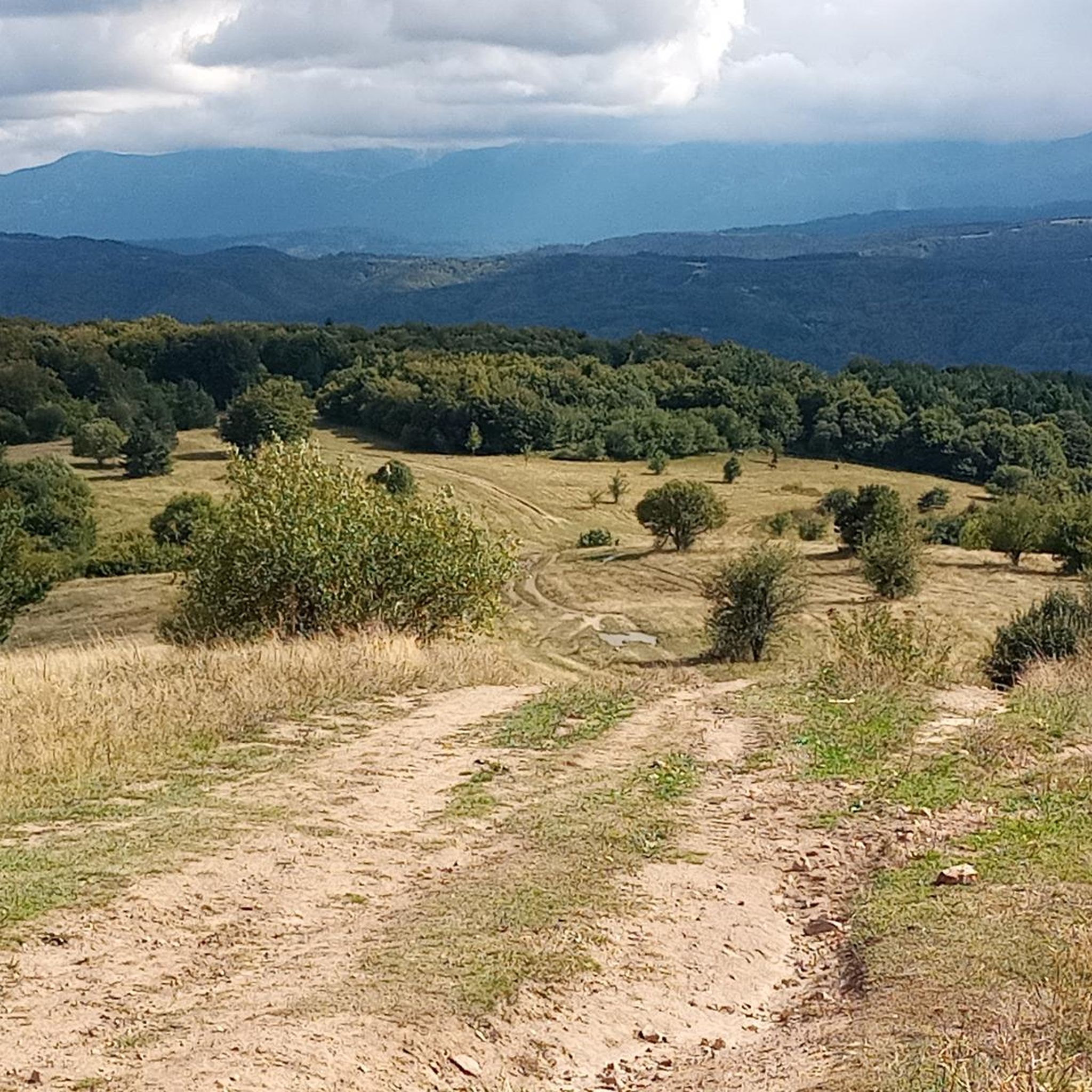
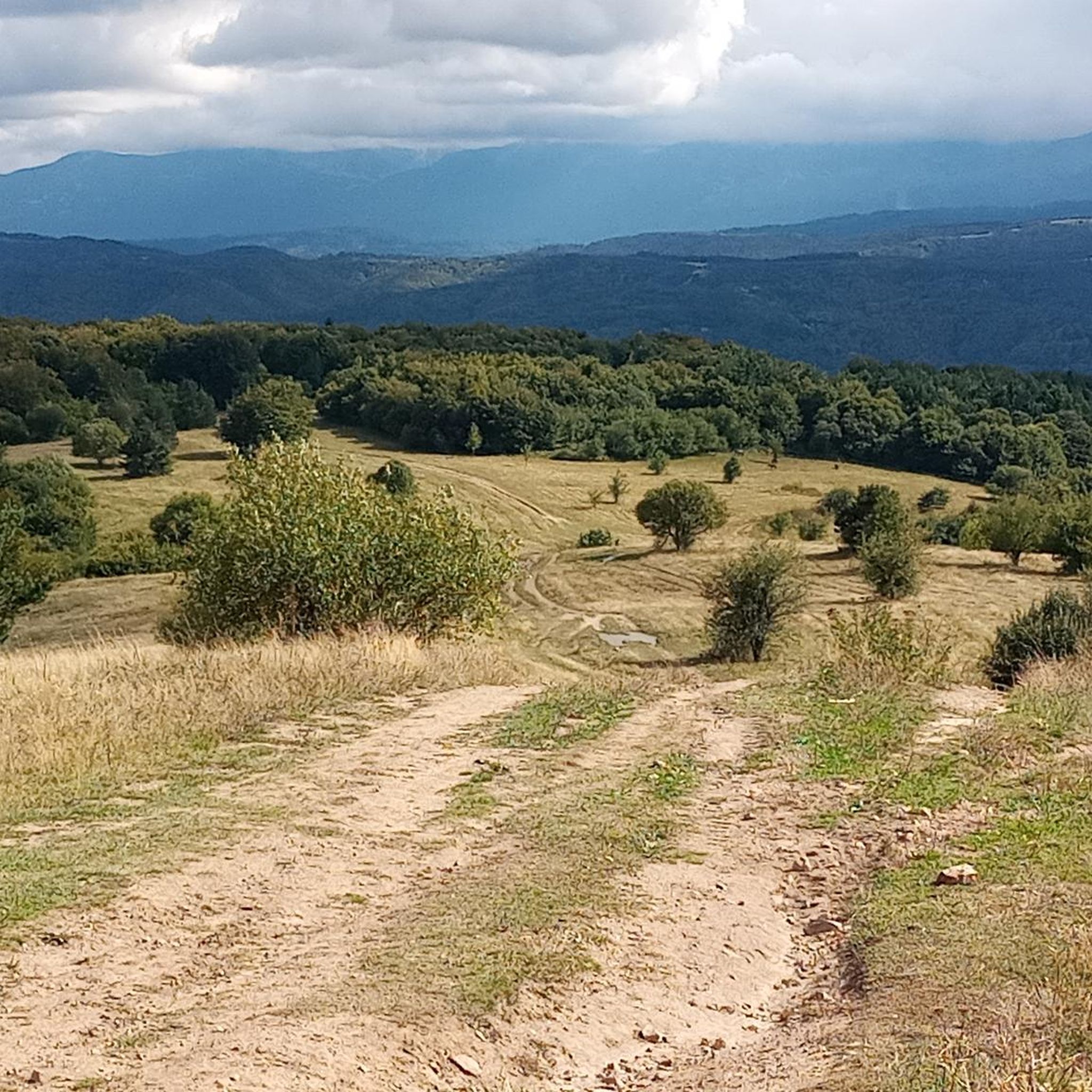
Mountain biking in Верила offers a destination characterized by a flat main ridge and deeply dissected slopes, situated between the Rila and Vitosha mountains. The region features dense coniferous and deciduous forests of beech, oak, spruce, and fir, alongside alpine meadows. Its highest point is Golyam Debelets peak at 1,415 meters. The terrain provides a mix of challenging routes through varied natural environments.
Best mountain bike trails in Верила
- The most popular mountain bike trail is Pupulkyata – Buka Preslap…
Last updated: July 4, 2026
5.0
(1)
8
riders
40.2km
03:48
1,000m
1,000m
Hard mountain bike ride. Very good fitness required. Suitable for all skill levels.
5.0
(1)
8
riders
40.4km
03:47
1,000m
1,000m
Hard mountain bike ride. Very good fitness required. Suitable for all skill levels.

Sign up for free
2
riders
30.7km
03:45
1,520m
1,520m
Hard mountain bike ride. Very good fitness required. Suitable for all skill levels.
4.5
(22)
256
riders
Hard mountain bike ride. Very good fitness required. Advanced riding skills necessary. Some portions of the route may require you to push your bike.
Our route recommendations are based on thousands of hikes, rides, and runs completed by other people on komoot.
Start today with a free account
Your next adventure awaits.
Login or Signup
Popular around Верила
Tips from the Community


The eco path from Bosnek to Gorna Dikanya is super fun to ride in this direction. Nice terrain and views.
1
0

You can find everything you need in the store. I stop at this place every time.
0
0

The fountain is not working.
0
0

Be stable, wear 🪖 and protectors and have fun
1
0


It is called the "Retirees" path. Usually there are a lot of people hiking here in Saturday and Sunday so it is recommended to avoid conflicts to do this segment via a bike during the week or in the evening. It is very technical easy and very pleasant segment but be aware that there are wooden bridges that can be dangerous!
4
0

Frequently Asked Questions
What is the typical difficulty level of mountain bike trails in Верила?
The mountain bike trails highlighted in this guide are generally considered difficult, featuring significant elevation gains and varied terrain. For example, routes like Pupulkyata – Buka Preslap loop from Yarlovo and Ostro bardo – Gradishte loop from Bosnek are demanding rides. However, the Верила range itself offers a mix of terrain, including its relatively flat main ridge, which can accommodate less challenging rides suitable for various skill levels.
Are there any family-friendly mountain bike trails in Верила?
While the specific routes featured in this guide are rated as difficult, the Верила mountain range is known for offering a variety of trails, including some low-difficulty options suitable for all ages. The relatively flat main ridge, which is part of the E4 European long-distance path, can be a good starting point for families looking for easier cycling experiences.
What kind of natural features and landscapes can I expect to see while mountain biking in Верила?
Верила offers a diverse natural environment. You'll ride through dense coniferous and deciduous forests of beech, oak, hornbeam, spruce, and fir, alongside open alpine meadows. The terrain is characterized by a flat main ridge and deeply dissected slopes. From higher sections, you can enjoy expansive views of the surrounding Samokov, Dupnitsa, and Radomir valleys.
Are there any circular mountain bike routes in Верила?
Yes, many of the mountain bike routes in Верила are designed as loops, allowing you to start and finish in the same location. Examples include the challenging Pupulkyata – Buka Preslap loop from Yarlovo and the Паничище – Зелени преслап loop from Sapareva Banya, which takes you through forested landscapes.
What is the best time of year for mountain biking in Верила?
Верила experiences a temperate continental climate with cool summers and cold winters. The best time for mountain biking is typically during the warmer months, from late spring through early autumn, when trails are clear of snow and the weather is most pleasant. Winter conditions can make some trails inaccessible or more challenging.
What do other mountain bikers enjoy most about the trails in Верила?
The mountain bike trails in Верила are highly rated by the komoot community, with an average score of 4.8 stars from over 20 reviews. Riders often praise the tranquil, wild nature of the region, the diverse landscapes, and the authentic Bulgarian scenery. The challenging routes through forested areas and the expansive views from higher sections are frequently highlighted.
Are there options for parking near the mountain bike trails in Верила?
While specific parking information for each trailhead isn't always detailed, access points to the Верила mountain range, such as villages like Yarlovo, Bosnek, and Sapareva Banya, typically offer parking facilities. It's advisable to check local conditions or specific route descriptions for the most convenient parking spots.
Can I access mountain bike trails in Верила using public transport?
The town of Sapareva Banya, a known access point to Верила and the Rila mountains, is generally accessible by public transport. From there, you can reach trailheads like the start of the Паничище – Зелени преслап loop. For other trailheads, public transport options might be more limited, and a car may be necessary.
Are there any specific landmarks or points of interest along the mountain bike routes in Верила?
Верила is known for its unspoiled character and natural beauty rather than numerous traditional landmarks. However, the mountain itself is a significant natural corridor between Vitosha and Rila. You'll encounter diverse forests and alpine meadows, and the main watershed divide of the Balkan Peninsula runs along the range. The highest point, Golyam Debelets peak (1,415 meters), offers panoramic views.
Is Верила suitable for advanced mountain bikers looking for a challenge?
Absolutely. The routes listed in this guide, such as Pupulkyata – Buka Preslap loop from Yarlovo and Ostro bardo – Gradishte loop from Bosnek, are rated as difficult and feature significant elevation changes and varied terrain, making them ideal for experienced riders seeking a demanding and rewarding experience.
Can I bring my dog on the mountain bike trails in Верила?
While there are no specific restrictions mentioned for dogs on the trails, it's generally recommended to keep dogs on a leash, especially in forested areas or near wildlife. Always practice responsible pet ownership by cleaning up after your dog and ensuring they are well-behaved around other trail users and animals.

Get inspired with the komoot mobile app


Explore more
Browse the best MTB trails in other regions.
