The best running trails in Vtáčnik
48
runners
8
runs
Jogging in Vtáčnik offers diverse routes through a volcanic mountain range in central Slovakia. The region features varied landscapes, including dense forests, open meadows, and distinctive andesite rock formations. Joggers can explore paths that traverse dramatic mountains and provide panoramic views from higher elevations. This terrain provides a range of running experiences, from challenging ascents to more tranquil forest trails.
Best jogging routes in Vtáčnik
- The most popular jogging route is Kláštorská Skala loop from Kľak, a 11.1 miles…
Last updated: August 20, 2026
2
runners
18.3km
02:32
870m
880m
Hard run. Very good fitness required. Mostly paved surfaces. Suitable for all skill levels.
9
runners
11.7km
02:20
860m
860m
Hard run. Very good fitness required. Sure-footedness, sturdy shoes and alpine experience required.

Sign up for free
4
runners
18.3km
02:53
940m
940m
Hard run. Very good fitness required. Sure-footedness, sturdy shoes and alpine experience required.
2
runners
5.27km
00:35
130m
130m
Moderate run. Good fitness required. Mostly paved surfaces. Suitable for all skill levels.
10
runners
22.2km
03:07
980m
980m
Hard run. Very good fitness required. Sure-footedness, sturdy shoes and alpine experience required.
Get access to more routes and recommendations from other explorers.
Sign up for free
Already have an account?
Our route recommendations are based on thousands of hikes, rides, and runs completed by other people on komoot.
Start today with a free account
Your next adventure awaits.
Login or Signup
Popular around Vtáčnik
Tips from the Community


Great rocky formation with a 360 ° view
0
0

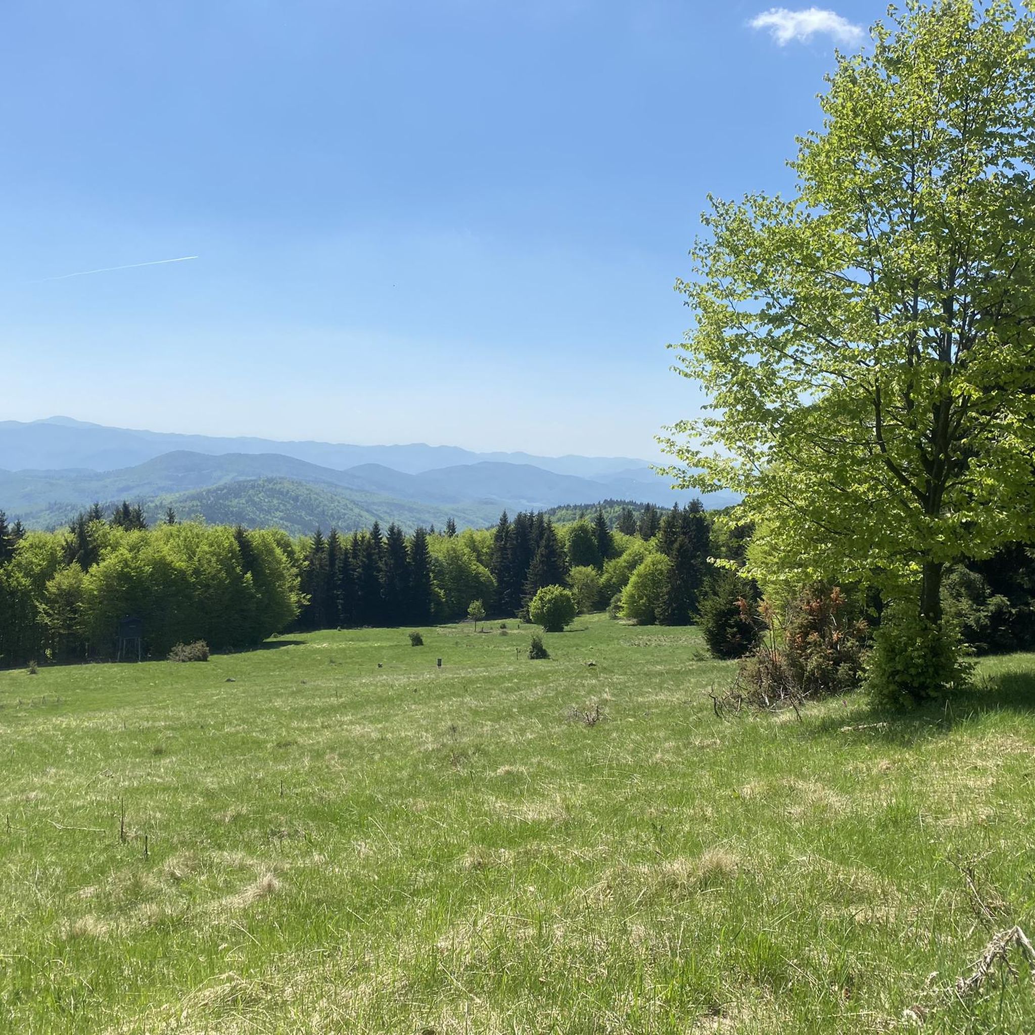
To the attractions of the hill, but also to the entire mountain range created in ancient times by volcanic activity, there are beautiful andesite rock formations. The Vtáčnik Hill and its surroundings are part of the same national nature reserve, characterized by old forest stands of places of forest-like character.
4
0

Several marked hiking trails lead to Vtáčnik. The starting points of the tours can be Kľak, Lehota pod Vtáčnikom, Kamenec pod Vtáčnikom or Bystričany. The top is covered with dense mixed forests, but the top decorated with an iron cross is partially deforested and offers great views of the Kremnické, Štiavnické and Strážovské Hills, Veľký and Malá Fatra and the whole area of Nitra.
4
1
Frequently Asked Questions
How many running routes are available in Vtáčnik?
Vtáčnik offers several dedicated running routes, with over 8 routes documented on komoot. These routes cater to various preferences, from moderate forest paths to more challenging mountain ascents.
Are there any easy running routes for beginners in Vtáčnik?
While many routes in Vtáčnik are challenging, there are options for those seeking a more relaxed run. The region features paths that wind through gentle slopes and wooded areas. For example, the Papiereň loop from Končitá is a moderate 5.3 km trail that leads through dense forests, perfect for a less strenuous jog.
What kind of terrain can I expect on the jogging trails in Vtáčnik?
The jogging trails in Vtáčnik are characterized by their diverse volcanic terrain. You'll encounter dramatic mountains, lush forests, open meadows, and distinctive andesite rock formations. The region offers a mix of challenging ascents and serene paths through dense woodlands, providing a varied running experience.
Are there any circular running routes in Vtáčnik?
Yes, many of the running routes in Vtáčnik are designed as loops, allowing you to start and finish in the same location. Popular circular options include the challenging Kláštorská Skala loop from Kľak and the scenic Vtáčnik Summit loop from Končitá, both offering extensive views.
What are some notable natural features or attractions I might see while running in Vtáčnik?
Vtáčnik's volcanic landscape offers several interesting sights. You might encounter impressive rock cliffs and ridges, such as those around Žarnov and Buchlov. The region is also home to the scenic Pokutsky Waterfall and the unique Andesite Stone Sea near Malá Lehota, which highlight the area's geological history.
Can I find routes with panoramic views in Vtáčnik?
Absolutely. The higher elevations in Vtáčnik, including the peak of Vtáčnik itself (1,346 m) and other prominent peaks like Biela skala and Orlí kameň, offer breathtaking panoramic views. On clear days, you can see surrounding towns and even distant landmarks like Bojnice Castle. The Vtáčnik Summit loop from Končitá is an excellent choice for extensive vistas.
Are there any historical points of interest along the running trails?
Yes, Vtáčnik has historical significance that adds a cultural dimension to your run. You can find sites like Partizánska Chata (Partisan Cottage) and the Partisan Forest, which was planted in the shape of a five-pointed star with a central memorial. These offer unique points of interest along some routes.
What do other runners say about jogging in Vtáčnik?
Many runners have explored Vtáčnik's varied terrain, with over 40 komoot users having completed routes here. They often praise the region for its diverse volcanic landscapes, dense forests, and the peaceful, less crowded environment, which allows for an immersive experience amidst 'divine silence'.
Are there any particularly challenging running routes in Vtáčnik?
For experienced runners seeking a challenge, Vtáčnik offers several difficult routes with steep ascents and rugged terrain. The Vtáčnik – Zraz loop from Končitá, for instance, is a demanding 11.7 km trail with significant elevation gain, providing a rigorous workout.
What is the typical duration for running routes in Vtáčnik?
The duration of running routes in Vtáčnik varies significantly based on distance and difficulty. Shorter, moderate trails like the Papiereň loop from Končitá can be completed in about 35 minutes, while longer, difficult routes such as the Kláštorská Skala loop from Končitá, spanning over 18 km, may take more than 2 hours.
Most popular routes in Vtáčnik

Get inspired with the komoot mobile app


