Santa Rosa Mountains State Wilderness
Santa Rosa Mountains State Wilderness
The best road cycling routes in Santa Rosa Mountains State Wilderness
4.7
(8)
378
riders
15
rides
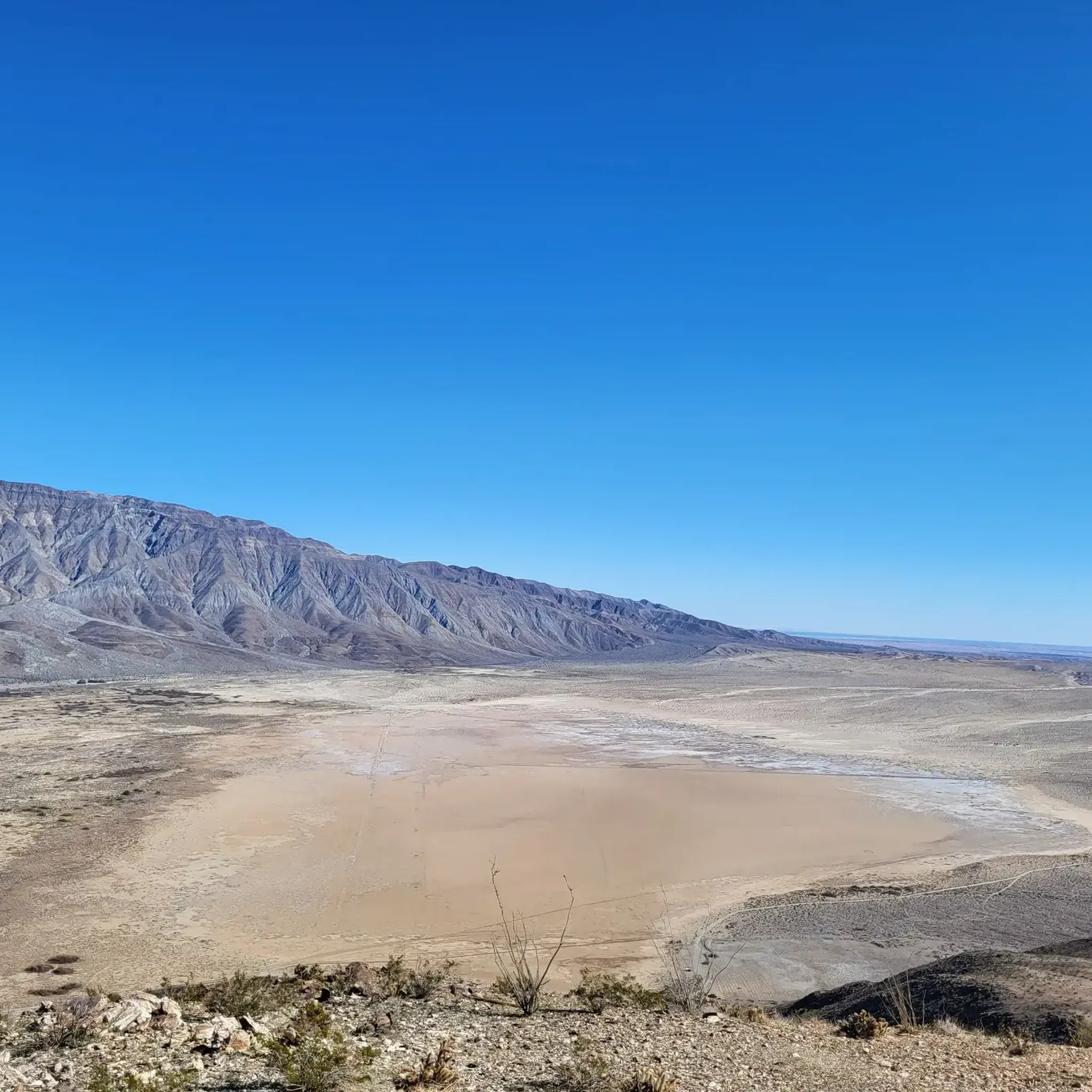
Road cycling routes in Santa Rosa Mountains State Wilderness traverse a landscape characterized by a blend of desert and mountain environments. The region features significant elevation changes, with rugged terrain marked by deep washes, shallow drainages, and boulder-strewn areas. This challenging topography, formed by uplifted blocks of igneous and metamorphic rock, presents demanding routes for cyclists.
Best road cycling routes in Santa Rosa Mountains State Wilderness
- The most popular road cycling route is Galleta Meadows Sculptures – Serpent Sculpture loop from Peg leg legal RV boondocks side, a 15.9 miles (25.7 km) trail that takes 1 hour 0 minutes to complete. This easy route explores the unique sculpture installations of Galleta Meadows.
- Another top favourite among local road cyclists is Galleta Meadows Sculptures loop, an easy 18.1 miles (29.2 km) path. This route offers views of the desert landscape interspersed with artistic sculptures.
- Local road cyclists also love the Galleta Meadows Sculptures loop from Borrego Springs, a 4.9 miles (7.9 km) trail leading through Galleta Meadows, often completed in about 18 minutes.
- Road cycling in Santa Rosa Mountains State Wilderness is defined by desert and mountain environments, deep washes, and dramatic canyon walls. The network offers options for different ability levels, from easy loops to more difficult climbs.
- The routes in Santa Rosa Mountains State Wilderness are highly rated by the komoot community with an average score of 4.75 stars from over 5 reviews. More than 300 road cyclists have used komoot to explore Santa Rosa Mountains State Wilderness's varied terrain.
Last updated: October 15, 2026
9
riders
Easy road ride. Mostly well-paved surfaces and easy to ride.
48
riders
7.98km
00:19
20m
20m
Easy road ride. Mostly well-paved surfaces and easy to ride.

4.0
(1)
40
riders
29.2km
01:07
100m
100m
The Galleta Meadows Sculptures loop offers an easy road cycling experience through the unique desert landscape of Anza-Borrego Desert State Park. As you cycle this 18.1-mile (29.2 km) route, you will discover over 130 giant metal "sky art" sculptures by artist Ricardo Breceda, including a massive serpent. The ride, which takes around 1 hour and 7 minutes to complete, features well-paved surfaces and minimal traffic. You will gain about 330 feet (100 metres) in elevation, making it a relaxed journey. Expect classic desert vistas with cacti and ocotillo plants, providing a surreal backdrop to the art.
Planning your ride on the Galleta Meadows Sculptures loop is straightforward. Parking is generally accessible throughout the Borrego Springs area, allowing you to easily begin your adventure. While the main route features clean, near-flawless pavements, be aware that some sculptures are accessed via unpaved and sandy tracks. These side paths can be challenging for road bikes, so plan accordingly if you wish to explore every installation up close. Borrego Springs is known for its low traffic, especially during winter months, making it a favorable destination for cyclists.
This route stands out for its unique blend of outdoor activity and large-scale public art. The Galleta Meadows sculptures transform the desert into an open-air gallery, offering a distinctive cultural experience not found on typical cycling trails. Beyond the art, you will enjoy the serene beauty of the desert, with views of the Santa Rosa mountains in the distance. It is a perfect way to combine a leisurely ride with an exploration of imaginative and impressive artwork.
48
riders
7.95km
00:18
20m
20m
Easy road ride. Mostly well-paved surfaces and easy to ride.
5.0
(1)
35
riders
46.1km
02:44
1,150m
1,150m
Hard road ride. Very good fitness required. Mostly well-paved surfaces and easy to ride.
Get access to more routes and recommendations from other explorers.
Already have an account?
Our route recommendations are based on thousands of hikes, rides, and runs completed by other people on komoot.
Start today with a free account
Your next adventure awaits.
Popular around Santa Rosa Mountains State Wilderness
Tips from the Community

Get ready for a dramatic and challenging road bike climb up the Montezuma Borrego Highway, also known as Montezuma Valley Road, starting from Borrego Springs. As you tackle the 10-12 miles of climbing, gaining an impressive 3,300 to 3,400 feet at an average gradient around 6% you'll ascend what's often called the "Glass Elevator," the scenery is spectacular. Transforming from the arid Anza-Borrego desert floor with its unique plants to offering expansive, panoramic views of rugged mountains, canyons, and the distant Salton Sea. Be prepared for potentially extreme heat in the warmer months and possible strong winds higher up as you climb towards the cooler elevations and the summit area near Ranchita.
0
0

The Galleta Meadows Sculptures, situated in Anza-Borrego Desert State Park, comprise a collection of over 130 metal sculptures crafted by artist Ricardo Breceda. Spread out across the desert for over 10 miles, most sculptures are located right off the road.
0
0

Frequently Asked Questions
How many road cycling routes are available in the Santa Rosa Mountains State Wilderness?
There are 11 road cycling routes in the Santa Rosa Mountains State Wilderness. These include 7 easy routes, 2 moderate routes, and 2 difficult routes, offering options for various skill levels.
What kind of terrain can I expect when road cycling in the Santa Rosa Mountains State Wilderness?
The Santa Rosa Mountains State Wilderness offers a unique blend of desert and mountain environments. Cyclists will encounter significant elevation changes, rugged terrain with deep washes, and dramatic canyon walls. The landscape transitions from arid desert flora to chaparral and pine at higher altitudes, providing diverse scenery.
Are there any easy or beginner-friendly road cycling routes in the area?
Yes, there are several easy routes suitable for beginners. For instance, the Galleta Meadows Sculptures – Serpent Sculpture loop from Peg leg legal RV boondocks side is an easy 15.9-mile (25.7 km) ride, and the Galleta Meadows Sculptures loop offers an easy 18.1-mile (29.2 km) path with artistic sculptures.
What are some challenging road cycling routes for experienced riders?
For experienced riders seeking a challenge, the Roadbike loop from Borrego Springs is a difficult 47.2-mile (76 km) route with over 1,100 meters of elevation gain. While specific paved routes within the immediate wilderness are limited, the area's topography, including sections of Highway 74, offers demanding climbs.
When is the best time of year to go road cycling in the Santa Rosa Mountains State Wilderness?
The best time for road cycling in the Santa Rosa Mountains State Wilderness is typically during the cooler months, from late fall through spring (October to April). Summer temperatures in the Coachella Valley can be extremely high, making cycling challenging and potentially unsafe due to intense heat.
Are there scenic viewpoints or overlooks along the road cycling routes?
Yes, the region is known for its incredible views. While cycling, you can expect panoramic vistas of the lower Southern California desert, especially as you gain elevation. The dramatic transition from desert to mountain environments provides many scenic overlooks, particularly along routes that climb into the higher sections of the mountains.
Where can I find parking for road biking in the Santa Rosa Mountains area?
Parking availability varies by specific route starting points. For routes originating near Borrego Springs or other towns bordering the wilderness, you can often find parking in designated areas or near trailheads. For example, the Galleta Meadows Sculptures – Serpent Sculpture loop from Peg leg legal RV boondocks side mentions a starting point near 'Peg leg legal RV boondocks side', suggesting parking options for larger vehicles.
What do other road cyclists enjoy most about road cycling here?
The area is highly rated by the komoot community, with an average score of 4.75 stars from over 5 reviews. Cyclists often praise the unique desert landscapes, the artistic installations of Galleta Meadows, and the challenging climbs that offer rewarding views.
Are there any loop road cycling routes available?
Yes, many of the routes are designed as loops. For example, the Galleta Meadows Sculptures loop and the Roadbike loop from Borrego Springs are popular circular routes, allowing you to start and end at the same point without retracing your path.
What kind of wildlife might I encounter while cycling in the Santa Rosa Mountains State Wilderness?
The wilderness is home to diverse wildlife. You might spot Peninsular bighorn sheep, especially near riparian oases in canyons. Mule deer inhabit the coniferous forests at higher elevations, and various reptiles, including the desert slender salamander, are found at lower elevations. Birdwatchers may see great horned owls, prairie falcons, and golden eagles.
Are there any cafes or coffee shops near the road cycling routes?
While the immediate wilderness area is remote, towns bordering the region, such as Borrego Springs, Palm Desert, and La Quinta, offer various amenities including cafes and coffee shops where cyclists can refuel before or after their rides. It's advisable to plan your route to pass through or start near these towns if you require such services.
Is it possible to use public transport to access cycling routes in the Coachella Valley or Santa Rosa Mountains?
Public transport options directly into the Santa Rosa Mountains State Wilderness are limited due to its rugged and protected nature. However, the Coachella Valley does have public transit services that connect various towns. Cyclists would likely need to combine public transport with cycling to reach specific trailheads or starting points, especially if coming from further afield. It's best to check local transit schedules and bike-on-bus policies for the Coachella Valley.
Are permits required for road cycling in the Santa Rosa Mountains State Wilderness?
Generally, permits are not required for road cycling on established public roads or designated routes within the Santa Rosa Mountains State Wilderness. However, if you plan to venture into specific wilderness areas or private lands, it's always wise to check with the Bureau of Land Management (BLM) or local authorities for any specific regulations or permit requirements. More information can be found on the BLM website.
Most popular routes in Santa Rosa Mountains State Wilderness

Get inspired with the komoot mobile app


Explore more
Browse the best Road cycling routes in other regions.
