The best mountain hikes around Eichhofen
5.0
(1)
7
hikers
2
hikes
Mountaineering around Eichhofen features a landscape characterized by forested hills and historic sites. The region offers varied terrain, including ascents to notable peaks like Mount Sainte-Odile and Elsberg. These routes often traverse woodlands and provide views of the surrounding valleys.
Best mountaineering routes around Eichhofen
- The most popular mountaineering route is Mont Sainte-Odile Abbey – Mount Sainte-Odile loop from Ottrott, an 8.3 miles (13.4 km) trail that takes 4 hours 15 minutes to complete. This route explores a significant…
Last updated: September 29, 2026
4
hikers
13.4km
04:16
540m
540m
Moderate mountaineering route. Good fitness required. Easily-accessible paths. Suitable for all skill levels.
5.0
(1)
2
hikers
9.44km
03:03
420m
420m
Moderate mountaineering route. Good fitness required. Easily-accessible paths. Suitable for all skill levels.

1
hikers
4.34km
01:25
200m
200m
Easy mountaineering route. Great for any fitness level. Easily-accessible paths. Suitable for all skill levels.
Our route recommendations are based on thousands of hikes, rides, and runs completed by other people on komoot.
Start today with a free account
Your next adventure awaits.

Tips from the Community

The Odilienberg (763 m) in Alsace is the most important spiritual center of the region. Founded around 690 by Saint Odilia, the monastery attracts hundreds of thousands of pilgrims annually. The centerpiece of the complex is the Basilica of the Assumption of Mary (1687–1692) with the burial chapel, where the relics of the patron saint rest in an 8th-century sandstone sarcophagus. Directly on the panoramic terrace are the Chapel of Tears and the Chapel of Angels (12th century), known for their luminous gold mosaics from 1935. Inside the basilica, there is also a fine wooden inlaid Way of the Cross by Charles Spindler. Below the monastery rocks runs a magnificent hiking trail. It leads past the monumental, colorful ceramic Way of the Cross (14 stations) and the Lourdes Grotto, both integrated directly into the red sandstone by Léon Elchinger in the 1930s. About a 15-minute walk further down, the Odilien spring emerges in the forest, its water traditionally sought for eye ailments. The entire mountain plateau is enclosed by the Heidenmauer, a mysterious, 11-kilometer-long prehistoric defensive wall. Following the hiking trails further south, you reach the Maennelstein (817 m), the highest point of the ridge, which offers a wide panoramic view over the Rhine plain to the Black Forest. The monastery grounds are open all year round and admission is free. Would you like to use this short text for a brochure or are you still looking for information on how to get there for your tour? AI answers may contain errors. For legal advice, you should consult an expert. More information
0
1
Ramstein Castle ruins were built in the 13th century as a small fortified castle near Ortenbourg to defend it. Destroyed in the 15th century, they were never rebuilt. Today, only remnants of the walls remain, and the peacefully situated ruins are freely accessible and a popular destination for hikers.
1
0

Beautiful tour with many small highlights and viewpoints.
0
0

Seating area "Schmusbangala" with a view of Ramstein Castle and the surrounding hills.
5
1
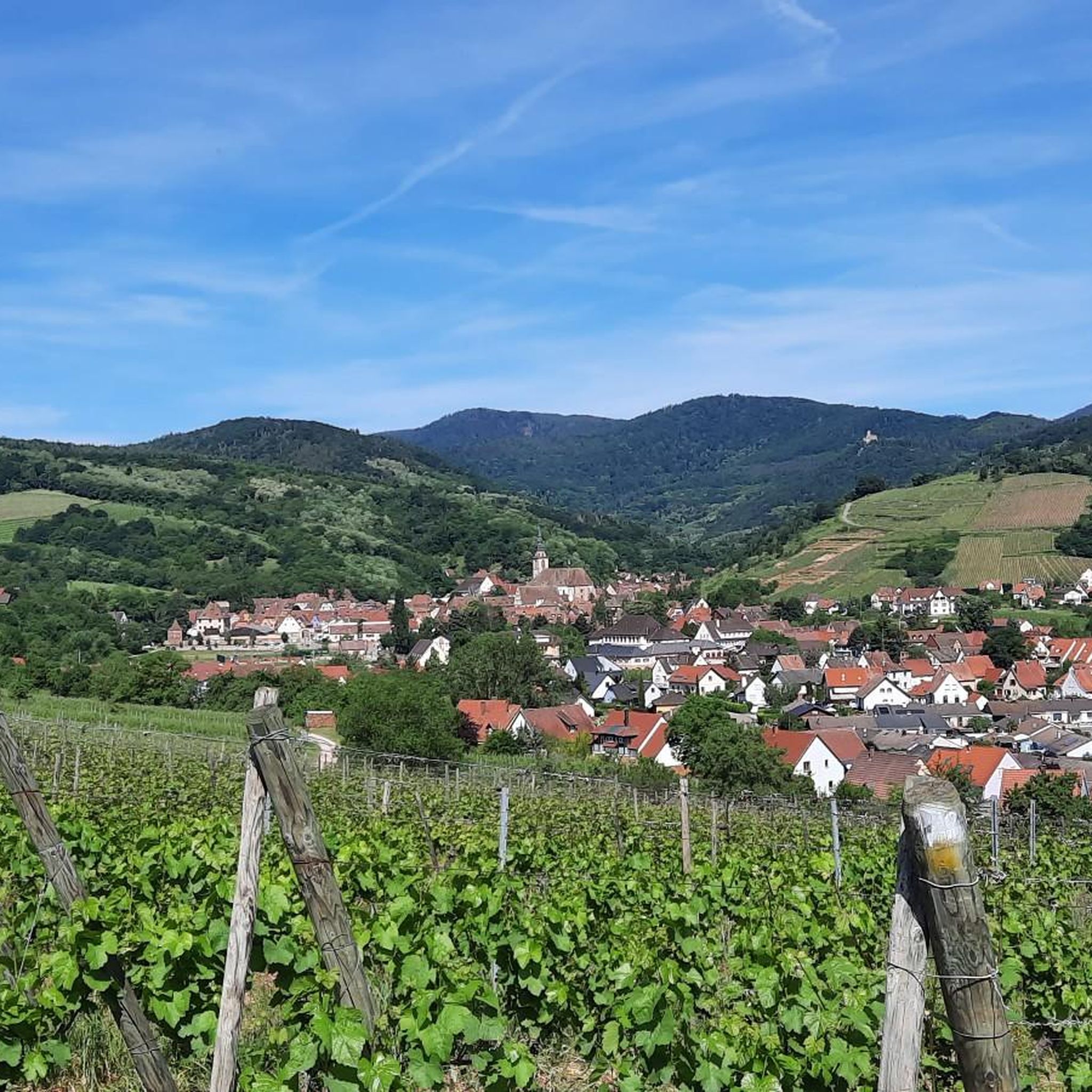
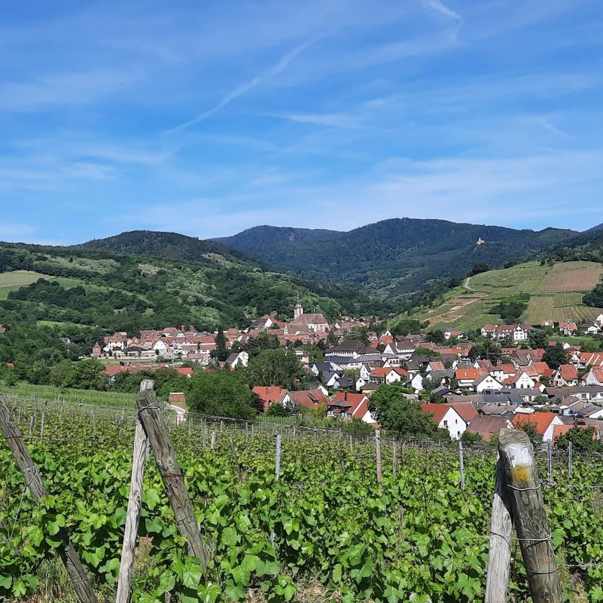
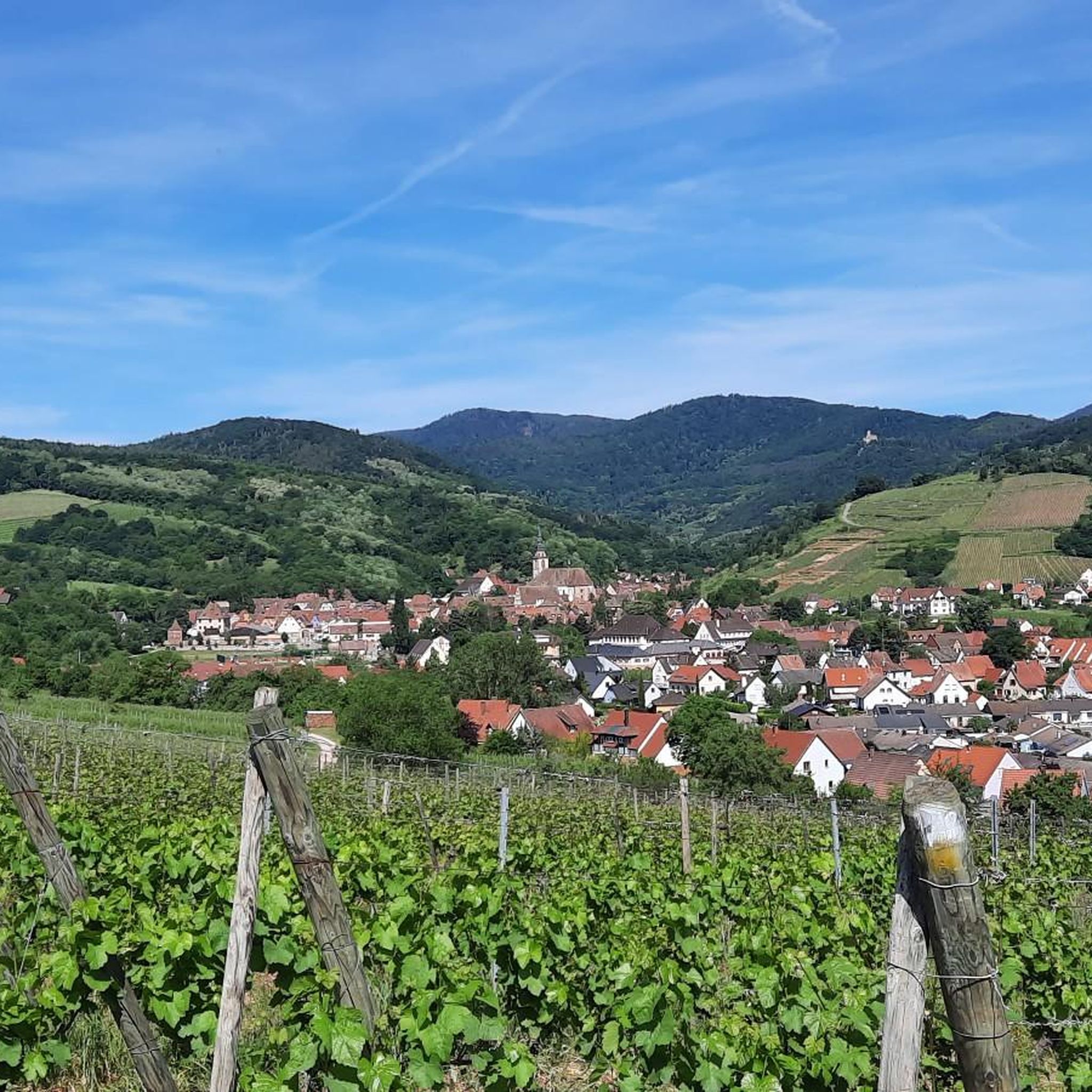
Two-story building nestled in the vineyards. From here you have a beautiful view of Scherwiller.
6
0
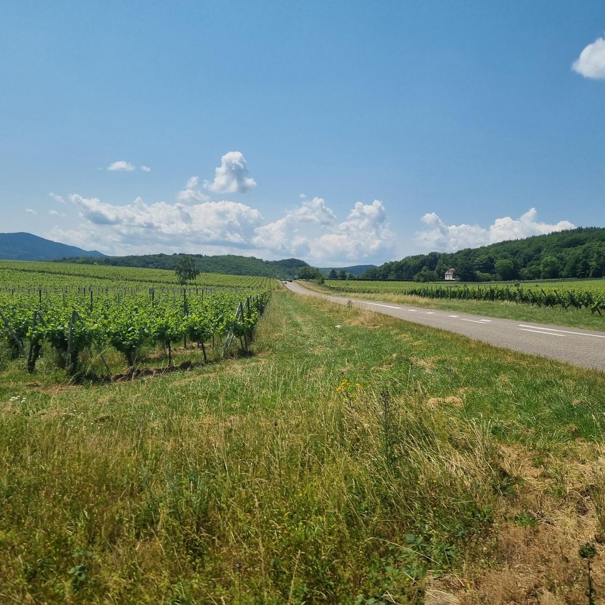
View over the vineyards to Ortenberg Castle, situated on the hill above.
7
0
Ramstein Castle was built in 1293 by Otto von Ochsenstein to support the siege of the neighboring Ortenberg Castle. After being owned by the Zorn von Bulach family, it was destroyed by the Strasbourg family in the 15th century. Initially consisting of a simple tower, the castle was later expanded into a proper castle, which was destroyed by the Swedes during the Thirty Years' War. Today, only the outer wall and two gun towers remain, built in 1793 to defend the entrance to the Vosges Mountains.
8
0
At the end of the ridge, at an altitude of 443 meters, lies Ortenbourg Castle, built between 1260 and 1265 by Rudolf Habsburg and one of the most beautiful ruins in the Rhine Valley. A masterpiece of military architecture, with its high gorge surrounding a 32-meter-long dungeon, it is visible from afar and blends perfectly into the landscape. This dungeon offered six levels of defensive fire, and its pentagonal design allowed for better deflection of attackers' projectiles. The recently founded association "Les sentinelles de l'Ortenbourg" (Ortenbourg Sentinels) aims to preserve, expand, and revitalize the castle.
8
0
Frequently Asked Questions
How many mountaineering routes are available around Eichhofen?
The Eichhofen area features a selection of mountaineering routes, with at least 2 documented tours. These routes offer varied terrain through forested hills and historic sites, catering to different ability levels.
Are there any easy or family-friendly mountaineering routes in Eichhofen?
Yes, for those seeking an easier experience, the Château d'Ortenbourg – Château de Ramstein loop from Dieffenthal is an excellent choice. This 2.7-mile (4.4 km) trail is rated as easy and leads through historic castle grounds and woodlands, making it suitable for families.
What are some more challenging mountaineering routes in the Eichhofen area?
For a more challenging experience, consider the Mont Sainte-Odile Abbey – Mount Sainte-Odile loop from Ottrott. This moderate 8.3-mile (13.4 km) route involves sustained elevation gain and explores a significant historical abbey. Another moderate option is the Elsberg – Hohenbourg loop from Ottrott, which navigates through forested areas to historic castle ruins.
Are there any circular mountaineering routes around Eichhofen?
Yes, all the featured mountaineering routes around Eichhofen are circular. For example, the Mont Sainte-Odile Abbey – Mount Sainte-Odile loop from Ottrott and the Elsberg – Hohenbourg loop from Ottrott both offer rewarding circular journeys through the region's diverse landscapes.
What kind of landmarks or attractions can I expect to see along the mountaineering routes?
The routes often feature historic sites and natural viewpoints. You can expect to see significant landmarks like the Mount Sainte-Odile and its abbey, as well as historic castle ruins such as Bernstein Castle and Andlau Castle. The region is also known for its forested hills and views of surrounding valleys.
What is the best time of year for mountaineering in Eichhofen?
The region's forested hills and varied terrain are generally enjoyable throughout the warmer months, from spring to autumn. While specific data on winter mountaineering is not available, conditions can be more challenging with snow and ice, so it's best to check local weather forecasts if planning a winter trip.
Are there any cafes or places to eat near the mountaineering trails in Eichhofen?
While specific cafes directly on the trails are not detailed, the routes often start or pass near villages like Ottrott and Dieffenthal, where you are likely to find local establishments for refreshments. The town of Obernai is also a notable nearby settlement that offers dining options.
What do other mountaineers enjoy the most about mountaineering in Eichhofen?
The area is highly rated by the komoot community, with an average score of 5.0 stars. Reviewers often praise the varied terrain, the combination of natural beauty with historic sites like abbeys and castle ruins, and the well-maintained paths through woodlands.
Are there any specific peaks or viewpoints to look out for?
Yes, the region offers several notable peaks and viewpoints. Mount Sainte-Odile is a prominent feature, and you can also find viewpoints like the Hering Tower on Ungersberg and the Great Bellevue, offering panoramic views of the surrounding landscape.
Is there parking available for the mountaineering trails?
While specific parking locations are not detailed for each route, trails often begin in or near villages such as Ottrott and Dieffenthal. It is generally advisable to look for designated parking areas within these villages when planning your trip.
Are there any hidden gems or less-known routes for mountaineering in Eichhofen?
While the guide highlights popular routes, the region's extensive network of trails through forested hills means there are always opportunities to explore less-trafficked paths. Focusing on areas slightly off the main routes, especially around the numerous smaller peaks and valleys, might reveal some quieter, hidden gems.
Most popular routes around Eichhofen
Most popular attractions around Eichhofen

Get inspired with the komoot mobile app


Explore more
Browse the best Mountain Hikes & Routes in other regions.
