The best running trails around Trevico
3.0
(1)
20
runners
2
runs
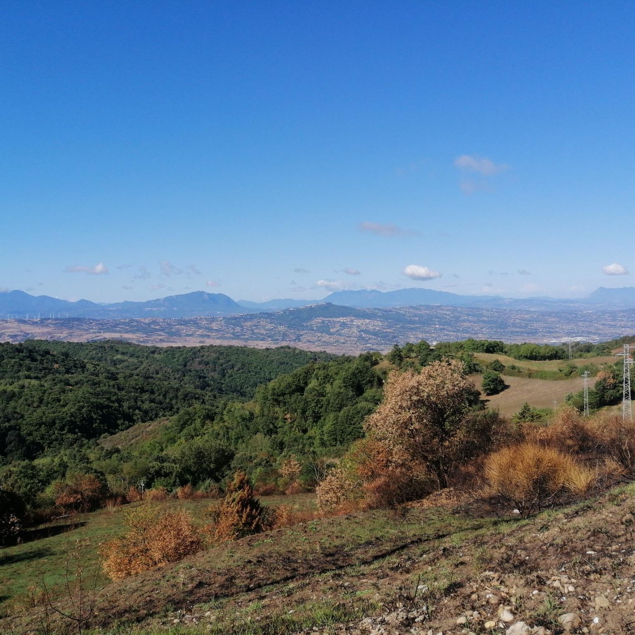
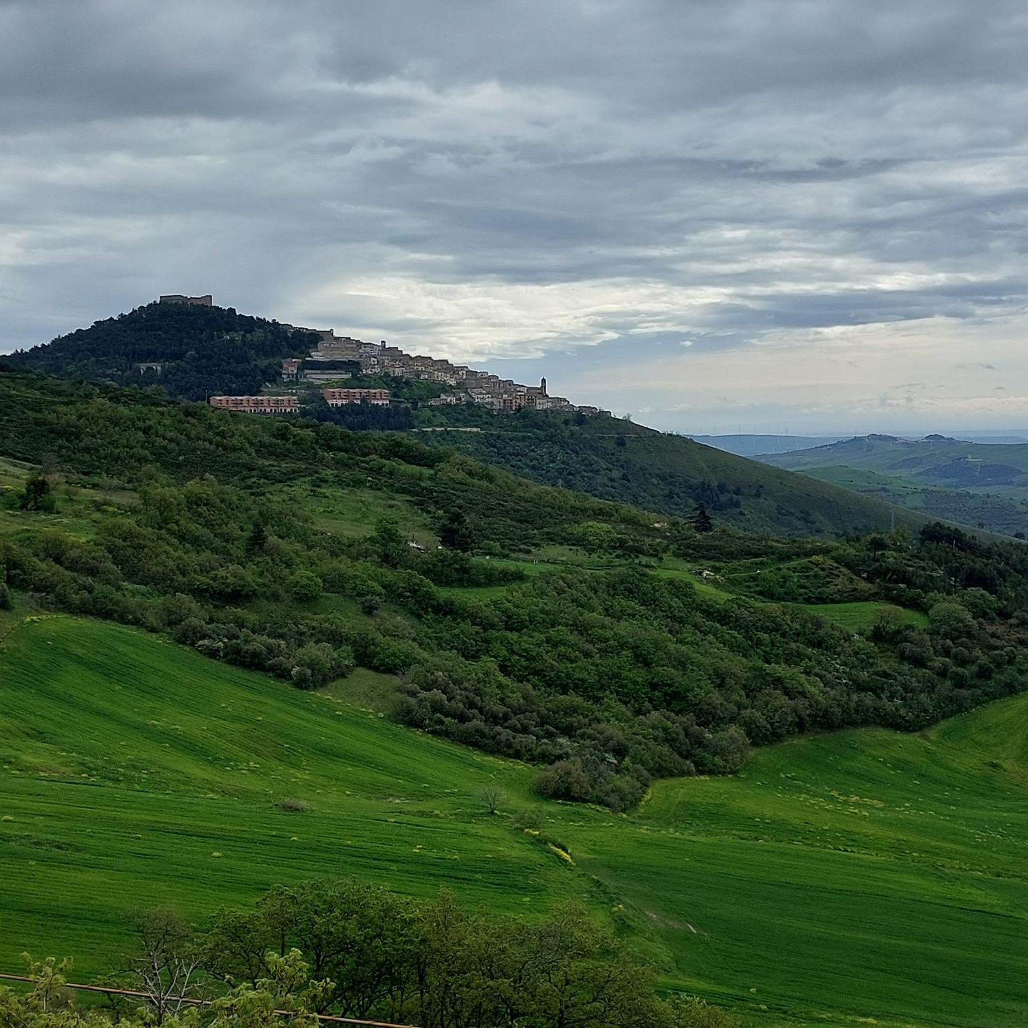
Jogging around Trevico offers an invigorating experience in the "Roof of Irpinia," situated at 1,094 meters (3,580 feet) above sea level. This high-altitude location provides expansive panoramic views of the surrounding valleys and distant landscapes. The region is characterized by green forests, open countryside, and varied terrain within the Apennine foothills, creating diverse running environments. These natural settings offer both challenging uphill sections and rewarding downhill stretches for runners.
Best jogging routes around Trevico
- The most popular jogging route is…
Last updated: June 28, 2026
3
runners
6.85km
00:44
60m
60m
Moderate run. Good fitness required. Mostly paved surfaces. Suitable for all skill levels.
4
runners
6.31km
00:39
30m
30m
Moderate run. Good fitness required. Mostly paved surfaces. Suitable for all skill levels.

Sign up for free
5
runners
7.35km
00:49
190m
190m
Moderate run. Good fitness required. Mostly paved surfaces. Suitable for all skill levels.
4
runners
6.55km
00:41
30m
30m
Moderate run. Good fitness required. Mostly paved surfaces. Suitable for all skill levels.
2
runners
9.79km
01:04
190m
190m
Moderate run. Good fitness required. Mostly paved surfaces. Suitable for all skill levels.
Our route recommendations are based on thousands of hikes, rides, and runs completed by other people on komoot.
Start today with a free account
Your next adventure awaits.
Login or Signup
Popular around Trevico

Frequently Asked Questions
What kind of terrain can I expect on the running trails around Trevico?
The running trails around Trevico offer a diverse experience, characterized by the region's position in the Apennine foothills. You'll encounter varied terrain, from paths winding through green forests and open countryside to sections with noticeable elevation changes, providing both rewarding uphill and downhill stretches. The high altitude of Trevico, known as the "Roof of Irpinia," also means you'll often enjoy expansive panoramic views.
How many running routes are available in the Trevico area?
Our guide features four distinct running routes around Trevico, each offering a unique way to experience the region's natural beauty. These routes are popular among local runners and provide a good overview of the varied landscapes.
Are there any circular running routes in Trevico?
Yes, all the routes highlighted in our guide are circular, allowing you to start and finish at the same point. For example, you can explore the Running loop from Kira Finestre or the Running loop from Industria italiana Autobus - Menarinibus, both designed for a continuous run back to your starting location.
What is the best time of year for jogging in Trevico?
Trevico's high altitude at 1,094 meters (3,580 feet) means it often benefits from cooler air, making it an appealing destination for jogging, especially during warmer months. The "green forests and countryside" are particularly inviting in spring and autumn, but the panoramic views are stunning year-round, weather permitting.
Are the running routes in Trevico suitable for beginners?
The routes around Trevico are generally classified as moderate. While they do feature varied terrain and some elevation changes due to the Apennine foothills, they are manageable for beginners looking for a bit of a challenge. We recommend starting with a shorter route like the Running loop from Kira Finestre to get a feel for the area.
Can I find longer running routes for more advanced training?
While all routes are rated moderate, some offer greater distances and more significant elevation changes for a more extended workout. The Masseria Di Chiara – La taverna rossa loop from Avellino, for instance, covers nearly 10 kilometers with over 185 meters of ascent, providing a good challenge for experienced runners.
Are there any running routes with particularly good viewpoints?
Trevico, known as the "Roof of Irpinia," is famous for its breathtaking 360-degree views. Many routes will offer glimpses of the surrounding valleys, and on clear days, you might even see as far as the Adriatic Sea near Manfredonia. The elevated position ensures scenic vistas are a common reward on most trails.
What are the typical distances of the running trails in Trevico?
The running trails in Trevico vary in length, catering to different preferences. You'll find routes ranging from approximately 5.5 kilometers (3.4 miles) like the Running loop from Kira Finestre, up to nearly 10 kilometers (6.1 miles) such as the La taverna rossa – Masseria Di Chiara loop from Sturno.
What do other runners say about the trails in Trevico?
More than 10 runners have used komoot to explore Trevico's varied terrain. They often praise the invigorating experience of running in the "Roof of Irpinia," highlighting the expansive panoramic views, the refreshing high-altitude air, and the beautiful green forests and countryside that make for an ideal natural setting.
Is it possible to access the running routes by public transport?
While Trevico is a high-altitude town, specific public transport connections directly to the start points of all running routes may be limited. It's advisable to check local bus schedules or consider driving to the area, as many routes are easily accessible by car.
Are there options for parking near the running trails?
Given Trevico's setting, parking is generally available in or near the town center and at various points where routes might begin. For routes like the Running loop from Industria italiana Autobus - Menarinibus, you can often find convenient parking nearby, making access straightforward.
Most popular routes around Trevico

Get inspired with the komoot mobile app


Explore more
Browse the best Running Trails & Routes in other regions.
