Easy hikes and walks around Sayago
4.6
(131)
795
hikers
84
hikes
Easy hiking trails around Sayago traverse a landscape shaped by the Duero River, featuring dramatic canyons and valleys within the Arribes del Duero Natural Park. The region offers a network of paths that provide views of the river's meanders and historical elements like old mills. This terrain is characterized by its rugged beauty and varied natural features, making it suitable for accessible outdoor exploration.
Best easy hiking trails around Sayago
- The most popular easy hiking route is Abelón's Waterfalls and…
Last updated: July 7, 2026
4.3
(9)
35
hikers
Easy hike. Great for any fitness level. Easily-accessible paths. Suitable for all skill levels.
4.7
(9)
27
hikers
6.33km
01:42
80m
80m
Easy hike. Great for any fitness level. Easily-accessible paths. Suitable for all skill levels.

Sign up for free
3.8
(4)
24
hikers
6.42km
01:42
60m
60m
Easy hike. Great for any fitness level. Easily-accessible paths. Suitable for all skill levels.
2
hikers
5.43km
01:39
180m
180m
Easy hike. Great for any fitness level. Easily-accessible paths. Suitable for all skill levels.
4.0
(1)
1
hikers
3.43km
00:56
50m
50m
Easy hike. Great for any fitness level. Easily-accessible paths. Suitable for all skill levels.
4.5
(4)
20
hikers
5.99km
01:45
150m
150m
Easy hike. Great for any fitness level. Easily-accessible paths. Suitable for all skill levels.
4.4
(5)
17
hikers
Easy hike. Great for any fitness level. Easily-accessible paths. Suitable for all skill levels.
5.0
(1)
11
hikers
7.17km
01:54
70m
70m
Easy hike. Great for any fitness level. Easily-accessible paths. Suitable for all skill levels.
5.0
(1)
8
hikers
3.50km
01:00
80m
80m
Easy hike. Great for any fitness level. Easily-accessible paths. Suitable for all skill levels.
4.0
(1)
5
hikers
6.45km
01:50
140m
150m
Easy hike. Great for any fitness level. Easily-accessible paths. Suitable for all skill levels.
Get access to more routes and recommendations from other explorers.
Sign up for free
Already have an account?
Our route recommendations are based on thousands of hikes, rides, and runs completed by other people on komoot.
Start today with a free account
Your next adventure awaits.
Login or Signup


Tips from the Community

Mirador do Penedo Amarelo. It is located on Rua do Penedo Amarelo, in the urban area of Miranda do Douro. It offers wide panoramic views of the Douro River surrounded by green hills, the dam, the historic center and the co-cathedral of Miranda do Douro. It is one of the most outstanding urban viewpoints in the area.
3
0

At number 4 you have a truly magnificent view of the reservoir.
0
0
Douro Camping in Miranda do Douro is a highly rated option for those seeking a peaceful, natural experience in northern Portugal. It offers functional chalets and bungalows, some with fully equipped kitchens, private bathrooms, and satellite TV.
4
0
The Pisón Stream Bridge in Fariza is part of one of the most iconic hiking trails in the Arribes del Duero Natural Park: the Mills Route. It is a medieval bridge, possibly with a Roman base, that crosses the Pisón Stream, a tributary that fed numerous flour mills in the area.
1
0
The Hermitage of the Virgen del Castillo in Fariza, Zamora, is a place of great historical, spiritual, and scenic value, nestled in the heart of the Arribes del Duero Natural Park. It sits atop a hill, offering spectacular views of the Duero canyon, right on the natural border between Spain and Portugal. Nearby is the Mirador de la Virgen del Castillo, considered one of the most beautiful in the Arribes.
1
0
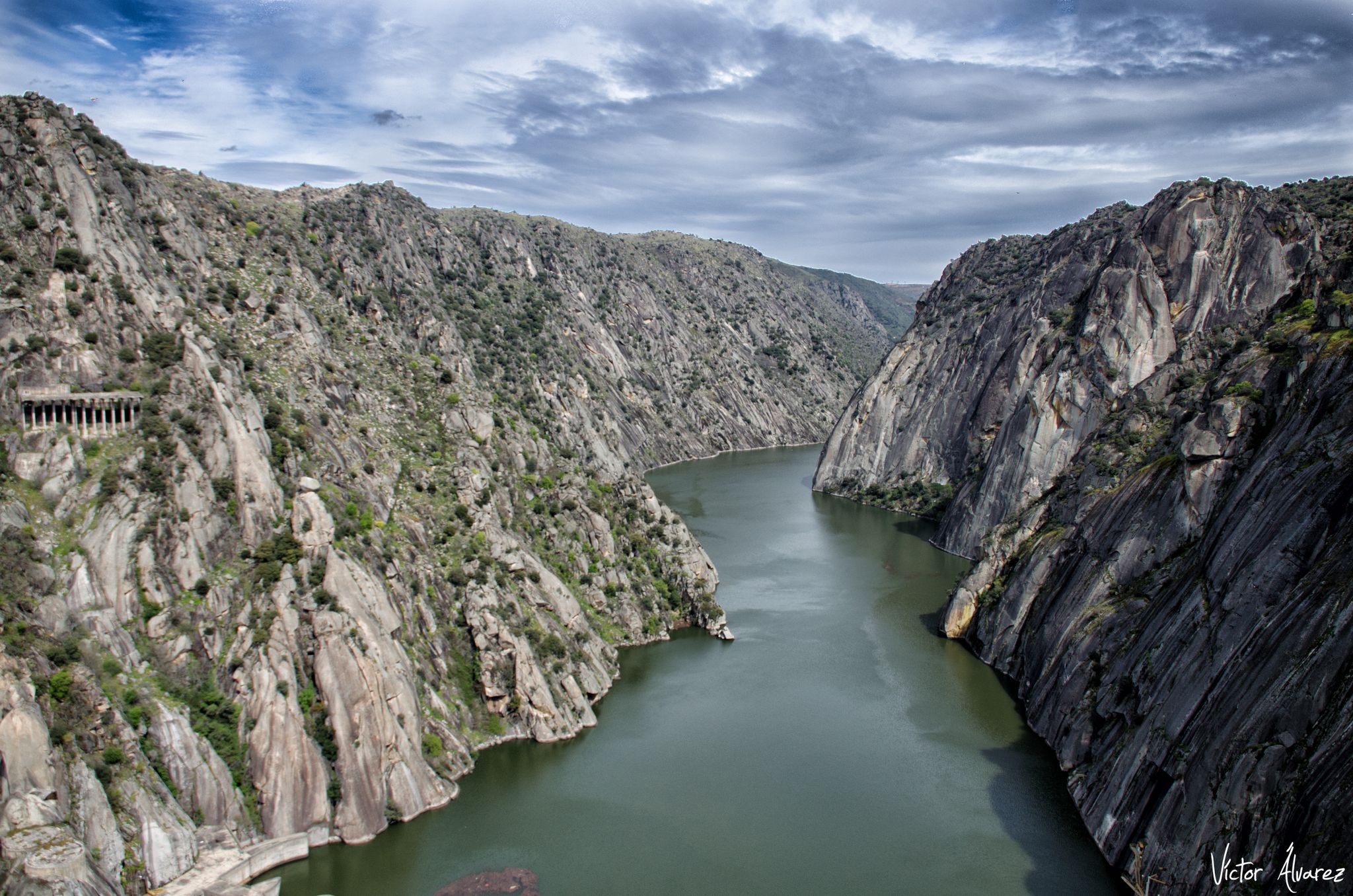
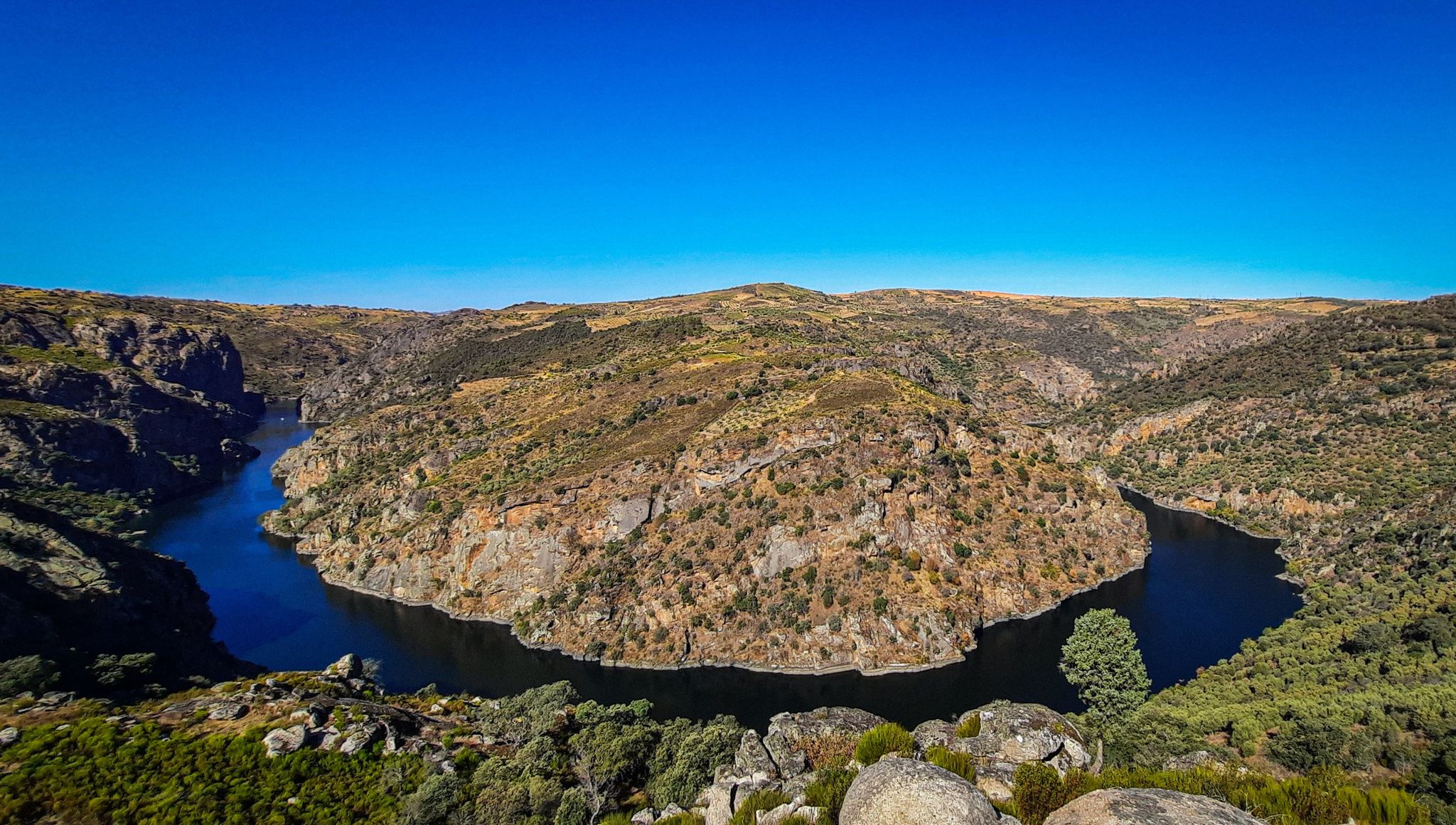
The Mirador de las Barrancas, located in Fariza, in the province of Zamora, is one of the most spectacular spots in the Arribes del Duero Natural Park. It offers stunning views of the Duero River canyon, which marks the natural border between Spain and Portugal. A granite landscape with unique rock formations and a microclimate that favors Mediterranean crops such as olive trees, vineyards, and almond trees. Spot birds of prey, such as the griffon vulture and the golden eagle, which are very common in the area.
1
0

The first bishops of Miranda had to live in the Castle. It was only in 1601 that construction began on the Episcopal Palace and the Seminary. When it was completed, more than a century later, its opulence was no less than that of the Cathedral, whose Renaissance style it imitated. The Palace was built around a central courtyard, surrounded by a cloister with lowered arcades, on monolithic columns. And, although badly damaged by successive fires during the 17th and 18th centuries, it was the definitive transfer of the seat of the Diocese to Bragança, in 1780, that caused it to fall into rapid ruin. The shadow of its monumentality can still be seen today in the cloister and on the portico of the Seminary. However, despite its state of ruin, its symbolic power remains because the bishops always continued to engrave their names on the respective memorial, at the entrance to the Renaissance portico of the first Episcopal Palace of the Diocese.
2
1
The castle of Miranda do Douro was built during a second period of settlement and ordering in Trás-os-Montes, which occurred during the reign of King Dinis. The first kings had provided this vast region with administrative units protected by Romanesque castles, called Terras, whose mission was to establish royal authority in an area of the kingdom that was notoriously peripheral. Over time, this power structure proved to be inadequate and King Afonso III initiated a different policy, the most visible of which was the founding of new urban towns. In the territory of Miranda do Douro, the new town was founded by King Dinis in 1286, thus culminating in the transfer of power from the old castle of Algoso, which had been the capital of the land until that date.
1
1
Frequently Asked Questions
How many easy hiking trails are available in Sayago?
Sayago offers a good selection of easy hiking trails, with over 35 routes specifically categorized as easy. These trails are designed to be accessible and enjoyable for a wide range of hikers.
What kind of landscape can I expect on easy hikes in Sayago?
Easy hikes in Sayago primarily feature landscapes shaped by the Duero River, including dramatic canyons and valleys within the Arribes del Duero Natural Park. You'll find paths offering panoramic views of the river's meanders and rugged natural beauty.
Are there any easy circular routes in Sayago?
Yes, many easy trails in Sayago are circular, making them convenient for day trips. For example, the Abelón's Waterfalls and San Vicente Hermitage Viewpoint - circular from Abelón is a popular 3.5-mile loop. Another option is the Río Duero desde Pino del Oro — circular, offering scenic views along the river.
Can I find easy trails with waterfalls in Sayago?
Yes, you can. The Abelón's Waterfalls and San Vicente Hermitage Viewpoint - circular from Abelón route specifically features waterfalls. You can also visit the Abelón Waterfall as a highlight.
Are there easy family-friendly hiking options in Sayago?
Many of the easy trails in Sayago are suitable for families, given their manageable distances and gentle elevation changes. Routes like the GR 14: Moral de Sayago Mills Route, which is just over 2 miles, are great for shorter outings with children.
What are some notable viewpoints along easy trails in Sayago?
Sayago is known for its stunning viewpoints. The Mirador de las Escaleras Trail leads to the Staircase Viewpoint, offering panoramic views of the Duero River. Another excellent option is the Mirador de las Barrancas, which can be accessed via an easy loop from Fariza de Sayago.
Can I explore historical sites or old mills on easy hikes?
Absolutely. The region has a rich history, and several easy trails incorporate historical elements. The Ribera de los Molinos Trail, for instance, explores riverbanks and highlights historical mills. The GR 14: Moral de Sayago Mills Route also focuses on the area's milling heritage.
What do other hikers enjoy most about the easy trails in Sayago?
The easy trails in Sayago are highly rated by the komoot community, with an average score of 4.5 stars from over 80 reviews. Hikers often praise the dramatic river-carved landscapes, the well-maintained paths, and the stunning natural viewpoints within the Arribes del Duero Natural Park.
Are there any easy trails near the Almendra Reservoir?
Yes, you can find an easy trail near the Almendra Reservoir. The Almendra Reservoir loop from Camping Los Arribes is a 4.5-mile circular hike that allows you to explore the area around this significant body of water. You can also visit the Almendra Reservoir itself.
What is the best time of year for easy hikes in Sayago?
While Sayago offers hiking opportunities year-round, spring and autumn are generally considered the best times for easy hikes. The weather is milder, and the natural scenery, whether blooming or displaying autumn colors, is particularly vibrant. Summers can be hot, so early mornings or late afternoons are preferable then.
Are there any easy trails that lead to religious buildings or hermitages?
Yes, some easy trails in Sayago offer glimpses of local religious heritage. The Abelón's Waterfalls and San Vicente Hermitage Viewpoint - circular from Abelón includes a viewpoint over a hermitage. Additionally, the Staircase Viewpoint – Hermitage of Santa Cruz loop from Fermoselle passes by the Hermitage of Santa Cruz.
What should I wear for an easy hike in Sayago?
For easy hikes in Sayago, comfortable walking shoes or light hiking boots are recommended. Dress in layers to adapt to changing temperatures, and consider sun protection like a hat and sunscreen, especially during warmer months. Always bring enough water, regardless of the trail's difficulty.
Most popular routes around Sayago
Most popular attractions around Sayago

Get inspired with the komoot mobile app


Explore more
Browse the best Hikes in other regions.
