Easy hikes and walks around El Andévalo
4.4
(1153)
5,211
hikers
53
hikes
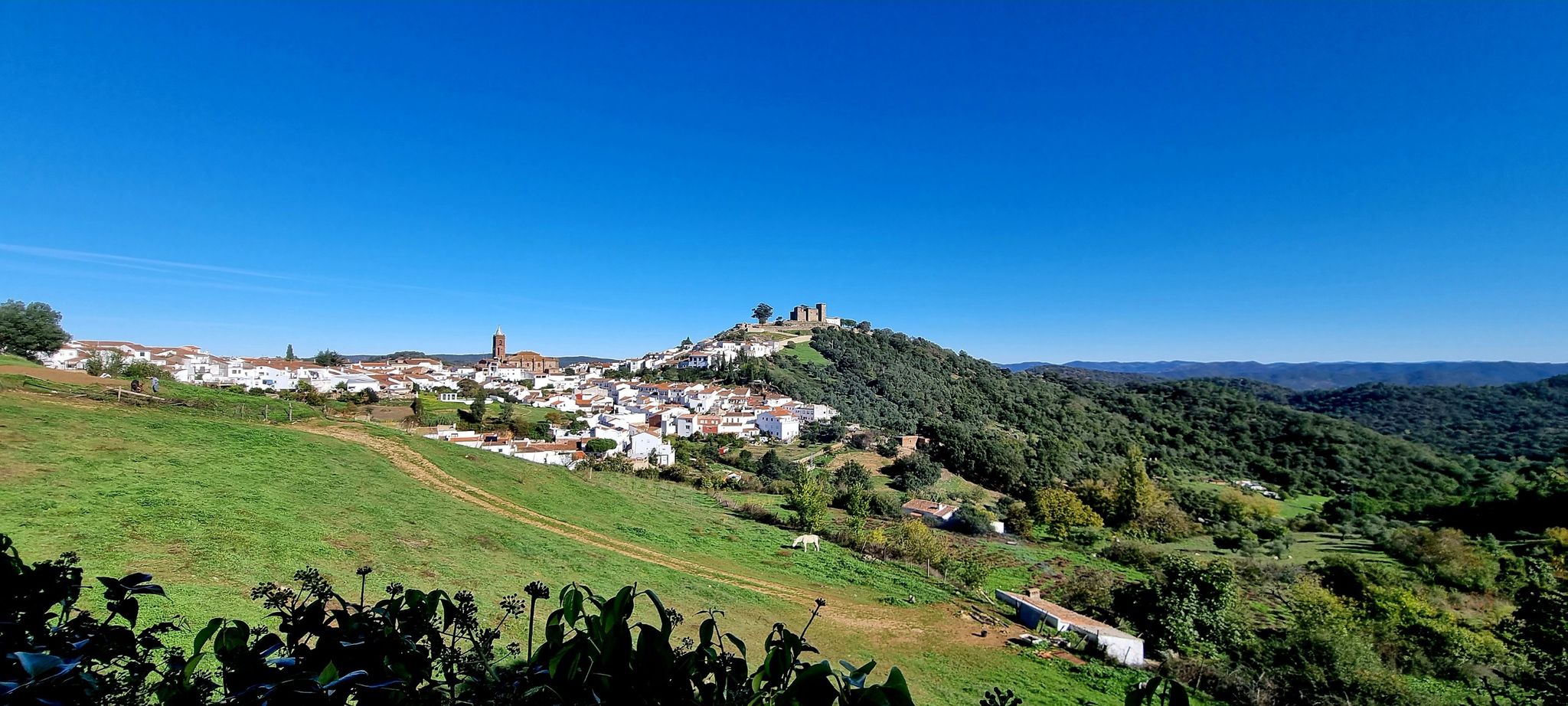
Easy hiking trails around El Andévalo traverse a diverse landscape characterized by Mediterranean meadows known as "dehesas," dotted with holm and cork oaks. The region features pine forests and numerous reservoirs, creating varied natural environments. Situated between the Sierra de Aracena and the Portuguese border, El Andévalo also showcases unique "mining landscapes" with ochre, orange, and black hues from its industrial past. The Guadiana River forms part of the border, offering scenic riverside paths.
Best easy hiking trails around El…
Last updated: July 7, 2026
5.0
(2)
67
hikers
Easy hike. Great for any fitness level. Easily-accessible paths. Suitable for all skill levels.
4.4
(8)
42
hikers
6.88km
01:52
100m
100m
Easy hike. Great for any fitness level. Easily-accessible paths. Suitable for all skill levels.

Sign up for free
4.0
(3)
49
hikers
4.47km
01:08
10m
10m
Easy hike. Great for any fitness level. Easily-accessible paths. Suitable for all skill levels.
4.0
(3)
23
hikers
Easy hike. Great for any fitness level. Easily-accessible paths. Suitable for all skill levels.
4.0
(2)
28
hikers
Easy hike. Great for any fitness level. Easily-accessible paths. Suitable for all skill levels.
20
hikers
4.06km
01:02
10m
10m
Easy hike. Great for any fitness level. Easily-accessible paths. Suitable for all skill levels.
4.0
(1)
22
hikers
Easy hike. Great for any fitness level. Easily-accessible paths. Suitable for all skill levels.
22
hikers
Easy hike. Great for any fitness level. Easily-accessible paths. Suitable for all skill levels.
1.0
(1)
8
hikers
Easy hike. Great for any fitness level. Easily-accessible paths. Suitable for all skill levels.
13
hikers
Easy hike. Great for any fitness level. Easily-accessible paths. Suitable for all skill levels.
Get access to more routes and recommendations from other explorers.
Sign up for free
Already have an account?
Our route recommendations are based on thousands of hikes, rides, and runs completed by other people on komoot.
Start today with a free account
Your next adventure awaits.
Login or Signup



Other adventures around El Andévalo

Tips from the Community

Good way to get from Portugal to Spain or vice versa!
0
0

I think this sculpture is so true to life, you wouldn't be surprised if it spoke to you!
0
0
Vila Real de Santo António is located on the Gulf of Cádiz, which is part of the Atlantic Ocean, and on the right bank of the Guadiana River, whose lower reaches form the border between Portugal and Spain. The town offers several attractions, charming restaurants, bars, and cafés! A ferry ⛴️ provides convenient hourly service to the Spanish town of Ayamonte.
2
0
…there is a very good selection of fresh produce, meat, fruit and vegetables here.
3
0
…there are hourly flights between Portugal and Spain ⛴️😃
2
0
Ayamonte is a Spanish town in the province of Huelva, in the autonomous region of Andalusia, with a population of 21,622. It lies at the mouth of the Guadiana River where it flows into the Atlantic Ocean, bordering Portugal, from where it can be reached hourly by ferry ⛴️. The town boasts many attractions, fantastic cafes, restaurants, and bars, and offers a wide variety of shops and boutiques in addition to its market hall.
3
0
Ayamonte is a Spanish town in the province of Huelva, in the autonomous region of Andalusia, with a population of 21,622. It lies at the mouth of the Guadiana River where it flows into the Atlantic Ocean, bordering Portugal, from where it can be reached hourly by ferry ⛴️. The town boasts many attractions, fantastic cafes, restaurants, and bars, and offers a wide variety of shops and boutiques in addition to its market hall.
3
0

The beginning of my route is incredible
0
0
Frequently Asked Questions
How many easy hiking trails can I find in El Andévalo?
El Andévalo offers a good selection of easy hiking trails, with 24 routes specifically categorized as easy. In total, there are 48 hiking routes available in the region, providing diverse options for all skill levels.
What kind of landscapes will I encounter on easy hikes in El Andévalo?
Easy hikes in El Andévalo showcase a diverse range of landscapes. You'll traverse Mediterranean meadows known as "dehesas" with holm and cork oaks, pine forests, and numerous reservoirs. The region also features unique "mining landscapes" with ochre, orange, and black hues from its industrial past, particularly along the Odiel Marshes – Water tank at the old railway track loop from Isla Cristina. The Guadiana River, forming part of the border with Portugal, offers scenic riverside paths.
Are there any easy circular routes in El Andévalo?
Yes, many of the easy trails in El Andévalo are circular, allowing you to start and end at the same point. Examples include the Viewpoint over the Guadiana River loop from Sanlúcar de Guadiana, which offers panoramic views, and the Endless Beach – Nice view loop from Caño de la Mojarra, which explores coastal areas.
What do other hikers enjoy most about the easy trails in El Andévalo?
The easy trails in El Andévalo are highly rated by the komoot community, with an average score of 4.4 stars from over 300 reviews. Hikers frequently praise the varied terrain, from coastal paths and river views to the unique mining landscapes, and the accessibility of routes suitable for various fitness levels.
Are there any family-friendly easy hikes in El Andévalo?
Many of the easy trails in El Andévalo are suitable for families, offering gentle terrain and manageable distances. Routes like the Nice view – Playa de Punta del Moral loop from Isla del Moral provide pleasant coastal walks. The Vía Verde del Río Tinto, mentioned in regional research, also has sections accessible for various abilities, making it a good option for families.
Can I bring my dog on the easy hiking trails?
Generally, dogs are welcome on many of the natural trails in El Andévalo, especially on less crowded paths. However, it's always advisable to keep them on a leash and check for any specific local regulations or protected areas where restrictions might apply. Ensure you carry water for your dog, especially during warmer months.
What are some interesting landmarks or natural features to see along the easy trails?
Along the easy trails, you can discover several interesting points. You might encounter the unique "mining landscapes" with their distinctive colors, especially in areas influenced by the Iberian Pyrite Belt. Coastal routes offer views of the Marshes and Saltworks of Isla Cristina. Other highlights include the Isla Canela Tower and The Pasodoble of Ayamonte, which can be seen on routes like The Pasodoble of Ayamonte – Paseo de la Ribera loop from Ayamonte.
What is the typical duration and distance for easy hikes in El Andévalo?
Easy hikes in El Andévalo typically range from 2.8 miles (4.5 km) to around 4.3 miles (6.9 km). Most of these routes can be completed in about 1 to 2 hours, depending on your pace and how often you stop to enjoy the scenery. For example, the Concrete Pier – Damaged Bridge loop from Isla del Moral is about 3.2 miles (5.1 km) and takes approximately 1 hour 18 minutes.
Are there any trails suitable for wheelchairs or strollers?
While most natural trails may present challenges, the Vía Verde del Río Tinto, a former railway line, is noted in regional research for having sections accessible to people with physical disabilities. For other routes, it's best to check specific trail conditions, as many easy paths might still involve uneven surfaces or soft sand, especially near coastal areas.
What is the best time of year to go hiking in El Andévalo?
The best time for hiking in El Andévalo is typically during the spring (March to May) and autumn (September to November). During these seasons, the weather is milder and more pleasant, avoiding the intense heat of summer and the cooler, potentially wetter days of winter. Spring brings blooming wildflowers, while autumn offers comfortable temperatures for exploration.
Is parking available near the easy hiking trails?
Yes, parking is generally available near the starting points of many popular easy hiking trails, especially in towns and villages like Isla del Moral, Sanlúcar de Guadiana, and Ayamonte. It's advisable to check local signage for any parking restrictions or fees, particularly in more urbanized coastal areas.
Are there any cafes or places to eat near the easy hiking routes?
Many of the easy hiking routes start or pass through towns and villages where you can find cafes, restaurants, and bars. Coastal areas like Isla del Moral and Ayamonte offer numerous options for refreshments and meals after your hike. For routes in more rural dehesa or mining landscapes, it's recommended to bring your own snacks and drinks.
Most popular routes around El Andévalo
Most popular attractions around El Andévalo

Get inspired with the komoot mobile app


Didn’t find what you were looking for?
Check out more Hikes throughout El Andévalo below and find the perfect route in your destination.
Explore more
Browse the best Hikes in other regions.
