Routes

Planner

Features

Updates

App

Login or Signup

Get the App

Login or Signup

Routes
Hikes
United States
Washington

Skamania County

Easy hikes and walks in Skamania County

4.7

(356)

6,825

hikers

138

hikes

Easy hiking trails in Skamania County traverse a landscape shaped by volcanic activity and the Columbia River Gorge. The region features dense old-growth forests, numerous waterfalls, and dramatic elevation changes. Much of the county is covered by national forests, providing a vast network of trails. This area offers diverse terrain, from lush river valleys to exposed ridgelines.

Best easy hiking trails in Skamania County

  • The most popular easy hiking route is Cape Horn Trail, a 2.8 miles (4.5 km) trail that takes 1 hour 28 minutes to complete. This route offers views of the Columbia River Gorge.
  • Another top favourite among local hikers is Lower Falls Creek Trail, an easy 1.6 miles (2.6 km) path. This trail leads through forest to a multi-tiered waterfall.
  • Local hikers also love the Skamania Lodge Lake Loop Trail, a 2.3 miles (3.7 km) trail leading through forested areas around a lake, often completed in about 1 hour 2 minutes.
  • Hiking in Skamania County is defined by the Columbia River Gorge, old-growth forests, and volcanic formations. The network offers options for various ability levels, including many easy hiking trails.
  • The routes in Skamania County are highly rated by the komoot community with an average score of 4.8 stars from over 130 reviews. More than 2,900 hikers have used komoot to explore Skamania County's varied terrain.

Last updated: July 8, 2026

5.0

(1)

33

hikers

#1.

Cape Horn Trail

4.51km

01:28

220m

220m

Start your hike on the Cape Horn Trail, an easy 2.8 miles (4.5 km) route that takes about 1 hour and 28 minutes to complete. You will gain 713 feet (217 metres) in elevation as you explore varied terrain, moving from forested paths to more rocky sections. Along the way, you can expect wide views of the Columbia River Gorge, including distant glimpses of landmarks like Angel's Rest. Make sure to pause at Pioneer Point for expansive vistas across the landscape. In spring, the trail bursts with wildflowers such as trillium, while autumn transforms the big leaf maples into a display of rich colors.

When planning your visit to the Cape Horn Trail, be aware of seasonal closures that affect the lower section. From February 1st to July 15th each year, this part of the route is closed to protect nesting peregrine falcons. During these months, you can still hike the upper portion of the trail. This allows you to experience a significant part of the route as an out-and-back journey.

This trail is located within the Columbia River Gorge National Scenic Area, offering a quick yet rewarding outdoor experience. It provides a chance to see diverse plant life and impressive geological features. The route is known for its varied landscape, making it a good choice if you are looking for a short hike with changing scenery.

Navigate with device

Send to Phone

Save

Easy

5.0

(1)

12

hikers

Embark on an easy hike along the Lower Falls Creek Trail, a 1.6-mile (2.6 km) route that guides you through a vibrant green forest. You will experience a gentle uphill climb, gaining 659 feet (201 metres) in elevation, which takes about 51 minutes to complete. As you follow Falls Creek, you will notice mossy rocks and fallen trees, adding to the natural charm. The path eventually leads you to a cable suspension bridge, offering striking views of the gorge below. The main attraction is the impressive Falls Creek Falls, a triple-tiered waterfall that creates a cool, misty atmosphere, perfect for a refreshing stop.

This trail is an excellent choice for active families looking for an accessible outdoor adventure. You can typically find parking available directly at the trailhead, making access straightforward. Be aware that a creek crossing just before the falls can become challenging, especially during early season melts when water levels are higher. Planning your visit during drier periods might offer a more comfortable experience.

The Lower Falls Creek Trail is nestled within the expansive Gifford Pinchot National Forest, a region known for its lush, verdant landscapes. The constant presence of Falls Creek alongside the path contributes to the rich, mossy environment you will encounter. This area is a prime example of the Pacific Northwest's temperate rainforest ecosystem, characterized by its dense canopy and abundant undergrowth. The trail provides a wonderful opportunity to immerse yourself in this unique natural setting.

Easy
guide_signup
Let us show you the way with the komoot mobile app
With a free komoot account, you can easily find, customize, and navigate endless outdoor adventures.

Sign up for free

Embark on an easy hike along the Gillette Lake via Pacific Crest Trail, a route that winds through the Columbia River Gorge National Scenic Area. This pleasant journey covers 3.3 miles (5.3 km) with a gentle elevation gain of 614 feet (187 metres), typically taking about 1 hour and 32 minutes to complete. As you go, you will experience varied scenery, from shaded "Green Tunnel" sections to open areas that provide expansive views of peaks like Table Mountain and Hamilton Mountain. The highlight is Gillette Lake, a charming body of water known for its arresting greenish-blue hue and surrounding flowers. You will also encounter smaller ponds and cross picturesque creeks, with occasional glimpses of the Bonneville Dam.

Before you set out, be aware that a Northwest Forest Pass is required for parking at the trailhead. Restrooms are conveniently available right at the start of the trail. This route is a great option for those who enjoy hiking with their canine companions, as leashed dogs are welcome to join you. Plan your visit to make the most of this accessible and scenic outdoor experience.

This section of the Pacific Crest Trail offers a unique blend of natural beauty and historical context within the Columbia River Gorge. The trail's path through both dense forest and clear-cut areas showcases the diverse ecosystems of the region. Keep an eye out for the smaller ponds and creeks that add to the tranquil atmosphere before reaching the distinctive greenish-blue waters of Gillette Lake. It is a notable segment for its easy accessibility and rewarding views.

Easy

2

hikers

3.77km

01:04

10m

210m

Embark on an easy hike along the East Crater Trail #48, a gentle route spanning 2.3 miles (3.8 km) with a minimal elevation gain of just 26 feet (8 metres). You can expect to complete this pleasant journey in about 1 hour and 3 minutes. As you walk, you will find yourself surrounded by thick mountain hemlock forests, which gradually give way to alpine firs, especially as you approach Junction Lake. The trail offers a diverse landscape, featuring small lakes, ponds, and open meadows, where wildflowers bloom in season and huckleberry bushes display vibrant colors in autumn. You will also pass through an area affected by a 2017 wildfire, which presents a unique, stark beauty.

Before you head out, be aware that while the trail is generally well-maintained, you might encounter muddy or water-logged sections, particularly in early summer or after heavy rain. Recent restoration efforts have aimed to improve these areas for a better hiking experience. Mosquitoes can also be quite active during certain times of the year, especially in early summer, so come prepared with appropriate repellent. Always check local conditions before your visit to ensure a smooth and enjoyable trip.

This trail serves as an excellent introduction to the Indian Heaven Wilderness, allowing you to explore its heart without a strenuous climb. It is known for its varied natural beauty, from lush forests to open meadows and serene water bodies. The unique landscape, including sections recovering from the wildfire, highlights the dynamic nature of this wilderness area. If you are looking for a tranquil and accessible way to experience the region's diverse ecosystems, the East Crater Trail #48 offers a rewarding outing.

Easy

2

hikers

2.67km

00:53

190m

40m

Embark on the Cape Horn Trail for an easy hike through lush, old-growth forests, offering expansive views of the Columbia River Gorge. This route, spanning 1.7 miles (2.7 km), guides you past picturesque waterfalls, including the notable Cape Horn Waterfall overlook. You will gain 610 feet (186 metres) in elevation, a journey that typically takes around 53 minutes. Keep an eye out for Tipping Tree Point, a scenic viewpoint providing vistas of the river and Beacon Rock, enhancing your experience in this natural setting.

Before you head out, be aware of an important seasonal closure affecting the lower section of the Cape Horn Trail. From February 1st through July 15th each year, this part of the route is closed to protect nesting peregrine falcons. During these months, you can still enjoy the upper trail, which is typically hiked as an out-and-back. Plan your visit accordingly to ensure access to your preferred sections of the path.

The Cape Horn Trail is a highlight within the Columbia River Gorge National Scenic Area, known for its dramatic landscapes and rich biodiversity. This particular trail stands out for its combination of forest immersion and sweeping river views. It offers a quick yet rewarding outdoor experience, making it a popular choice for those seeking a taste of the Gorge's natural beauty without committing to a full-day excursion. Its accessibility and scenic points make it a notable option in the region.

Easy

2

hikers

3.09km

01:08

270m

40m

Embark on an easy hike along the Grassy Knoll Trail, a 1.9-mile (3.1 km) route that climbs 891 feet (272 metres) and typically takes about 1 hour and 7 minutes to complete. The path guides you from dense forest into open, rocky sections and expansive grassy meadows. You will find abundant wildflowers, particularly in late spring and early summer. From the Grassy Knoll summit, you can enjoy wide views of Mt. Adams and Mt. Hood, with glimpses of Mt. Rainier and Mt. St. Helens on clear days.

Before you go, know that the forest roads leading to the trailhead can be rough and have potholes, which might be tricky for vehicles with low clearance. The ground near the summit can be a bit loose with rocks, so make sure you wear suitable footwear for your hike. Plan your visit during the warmer months to best experience the trail's natural beauty.

This trail is located within the Gifford Pinchot National Forest, offering a classic Pacific Northwest hiking experience. It is well-known for its vibrant wildflower displays and the impressive panoramic vistas from its peak. The route provides a rewarding outdoor escape, allowing you to connect with nature and enjoy the region's volcanic scenery.

Easy

1.05km

00:18

0m

70m

The Lava Canyon Trail offers an easy hike through a landscape dramatically shaped by ancient lava flows and the 1980 eruption of Mount St. Helens. You will follow a short 0.7-mile (1.0 km) route, taking about 17 minutes to complete with no elevation gain. As you walk, you will encounter deep canyons carved by mudflows and dramatic basalt cliffs. Keep an eye out for the rushing Muddy River, known for its surprisingly blue-tinged waters. The impressive Lava Canyon Falls, cascading down a narrow gorge, is a highlight of this unique volcanic area.

Plan your visit to the Lava Canyon Trail between May and November, when the snow has typically melted, offering the best conditions for hiking. It is always a good idea to check current conditions before you head out, especially regarding trail access. Be aware that the main suspension bridge, which is part of a longer 1.4-mile upper loop, can sometimes be closed. If the bridge is closed, you might not be able to complete the full loop as intended. This short route is perfect for a quick outdoor experience when you are in the Mount St. Helens area.

This trail is situated within the Mount St. Helens National Volcanic Monument, a region dedicated to preserving the unique geological and ecological impacts of the 1980 eruption. The area's geology is a testament to powerful natural forces, showcasing how ancient lava flows and more recent volcanic activity have sculpted the terrain. You will see evidence of these events throughout your hike, from the basalt formations to the river's path. It is a great way to experience the raw power of nature in a relatively short timeframe.

Easy

1

hikers

Embark on the Skamania Lodge Lake Loop Trail for a refreshing outdoor experience that winds through serene forested areas and offers tranquil lakeside views. This easy hiking route covers 2.3 miles (3.7 km) and involves a gentle elevation gain of 207 feet (63 metres), making it accessible for most. You can expect to complete the loop in about 1 hour and 1 minute, enjoying the peaceful atmosphere as you pass by Wy'East Lake and Lilly Pad Lake. The path provides a pleasant escape into nature, perfect for a leisurely stroll or a quick stretch of the legs.

Accessing the trail is straightforward, as it begins directly on the Skamania Lodge property. If you are staying at the lodge, you can walk right to the trailhead, or if you are visiting for the day, parking is generally available on-site. This convenient location means you can easily fit this hike into your schedule, whether you are looking for an early morning walk or an afternoon outing. The trail is well-maintained and suitable for year-round enjoyment, though conditions may vary with the seasons.

Beyond the immediate beauty of the lakes, the trail is part of a larger network of over four miles of hiking paths available at the lodge, offering options for extended exploration if you wish. As you hike, keep an eye out for local wildlife; many visitors have reported sightings of birds, frogs, turtles, and even deer, particularly around Lilly Pad Lake. You might also catch glimpses of the distant Red Bluff Mountains, adding to the scenic backdrop of the Columbia River Gorge and enhancing your connection to the natural surroundings.

Easy

1

hikers

Embark on an easy 2.2-mile (3.5 km) hike along the Norway Pass via Boundary Trail, where you will gain 848 feet (258 metres) in about 1 hour and 9 minutes. This route takes you through the striking blast zone of Mount St. Helens, revealing a landscape where ash-covered slopes contrast with vibrant new growth. You will witness the dramatic sight of Spirit Lake, still scattered with trees felled by the eruption, and on clear days, enjoy distant views of Mount Rainier and Mount Adams. The trail offers a unique perspective on nature's powerful recovery, showcasing both 'ghost forests' of bleached trees and flourishing new firs and alders.

Before you set out, be aware that the trail's terrain can be dusty and rocky in certain sections, with some narrow and eroded paths. Wearing appropriate footwear is highly recommended for your comfort and safety. The route also features exposed areas with minimal shade, so plan your hike for cooler parts of the day or bring sun protection, especially during warmer months. Always check local conditions and any specific access requirements for the Mount St. Helens National Volcanic Monument before your visit.

This trail provides a compelling opportunity to explore the aftermath of the 1980 eruption of Mount St. Helens. You can observe the stark contrast between the areas devastated by the blast and the remarkable resilience of nature as new life reclaims the landscape. The views extend to the mountain's gaping crater and the pumice plain below, offering a powerful sense of the geological forces at play in this unique region.

Easy

1

hikers

6.04km

01:48

270m

30m

Embark on the Lower Falls Creek Trail, an easy hiking route that guides you through a lush, young forest. You will follow the rushing Falls Creek, encountering moss-covered rocks and fallen trees along the way. This 3.8-mile (6.0 km) hike involves an elevation gain of 884 feet (269 metres) and typically takes about 1 hour and 48 minutes to complete, offering a pleasant experience for most hikers.

When planning your visit, be aware that the road leading to the trailhead can have potholes, so drive carefully. During early spring melts, you might encounter a tricky creek crossing before reaching the main falls, so prepare for potentially wet feet. The trail is especially beautiful in spring when the water flow is strong, and also in the fall as the foliage changes color, making these seasons ideal for your adventure.

Located within Washington's Gifford Pinchot National Forest, this family-friendly trail is renowned for its impressive triple waterfalls. A highlight of the route is the cable suspension bridge, which provides excellent views of the whitewater below and the multi-tiered Falls Creek Falls. The area has a magical atmosphere, particularly in spring, and offers perfect spots for a picnic.

Easy
Sign up for free to see 129 more hikes in Skamania County.

Get access to more routes and recommendations from other explorers.

Sign up for free

Already have an account?

Our route recommendations are based on thousands of hikes, rides, and runs completed by other people on komoot.

Start today with a free account

Your next adventure awaits.

Login or Signup

Popular around Skamania County

Easy hikes around North Bonneville

Easy hikes around Stevenson

Easy hikes around Carson

Easy hikes in Mount Adams Wilderness

Easy hikes in Trapper Creek Wilderness

Pacific Crest Trail from Mexico to Canada – 4,200 kilometres of wilderness

The tour of your life – music trails on the Pacific coast
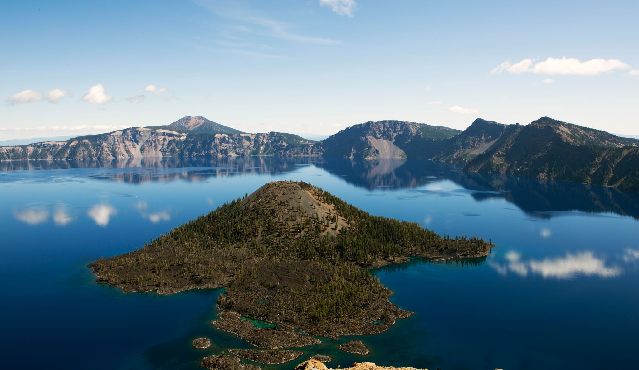
Volcanic peaks and glistening shores – discover Oregon and Washington

Other adventures in Skamania County

Pacific Crest Trail from Mexico to Canada – 4,200 kilometres of wilderness

Hiking Collection by

Caro "Bandit"

Tips from the Community

Emily
July 15, 2026, Gillette Lake

Beautiful lake. Good campsite.

1

0

This is a great spot to take in one of the Muddy River's powerful cascades as it pours through Lava Canyon — the water-carved remains of an old lava flow.

0

0

oliviakellis
November 15, 2023, Pioneer Point

Pioneer Point is one of the most visited viewpoints in Cape Horn, offering scenic views of the Columbia River as well as Oregon, on the other side of the river.

0

0

Teri S
June 14, 2022, Gillette Lake

Offering one of the first good campsites on the Pacific Crest Trail heading north into Washington from Oregon, Gillette Lake is a beautiful little lake fed by Gillette Creek. Watch out for poison oak in the area as it is quite thick through this section.

0

0

Fall Creek Falls is a 220-foot, three tiered waterfall. It is stunning!

1

0

Frequently Asked Questions

How many easy hiking trails are available in Skamania County?

Skamania County offers a wide selection of easy hiking trails. There are 37 easy routes specifically designed for a relaxed outdoor experience, out of a total of 141 hiking trails in the region.

Are there any family-friendly easy hikes in Skamania County?

Yes, Skamania County has several family-friendly options. The Lower Falls Creek Trail is an easy 1.6-mile path leading to a beautiful multi-tiered waterfall, perfect for families. The Skamania Lodge Lake Loop Trail is another great choice, offering a 2.3-mile walk through forested areas around a lake.

Can I bring my dog on easy hiking trails in Skamania County?

Many trails in Skamania County are dog-friendly, but it's always best to check specific trail regulations before you go. Generally, trails within the Gifford Pinchot National Forest and the Columbia River Gorge National Scenic Area allow dogs on leash. Always ensure your dog is under control and pack out any waste.

Which easy trails feature waterfalls?

Skamania County is known for its abundant waterfalls. The Lower Falls Creek Trail is an excellent easy option that takes you directly to the impressive Falls Creek Falls. While not a specific route in this guide, the Hamilton Mountain Trail (a more moderate option) also features Rodney and Hardy Falls, and Panther Creek Falls is easily accessible via a short trail.

Are there any easy loop hikes in Skamania County?

Yes, for those who prefer circular routes, the Skamania Lodge Lake Loop Trail is a pleasant 2.3-mile loop through forested areas. Another popular option is the Cape Horn Trail, which offers a 2.8-mile loop with views of the Columbia River Gorge.

What kind of terrain can I expect on easy hikes in Skamania County?

Easy hikes in Skamania County offer diverse terrain. You'll find paths winding through dense old-growth forests, trails along the dramatic Columbia River Gorge, and routes exploring areas shaped by volcanic activity. Expect a mix of relatively flat sections and gentle inclines, often with well-maintained surfaces.

What are some interesting landmarks or natural features to see along easy trails?

Skamania County's easy trails often lead to fascinating natural features. You can explore the unique geological formations of the Columbia River Gorge. While not directly on an easy trail listed here, the Ape Cave Interpretive Site offers a unique experience in a lava tube. Many trails also offer views of the surrounding Cascade Mountains and the Columbia River.

What is the best time of year to go on easy hikes in Skamania County?

The best time for easy hikes in Skamania County is generally from spring through fall. Spring brings vibrant wildflower displays, especially on trails with open areas. Summer offers warm, sunny weather ideal for exploring. Fall provides cooler temperatures and beautiful autumn foliage. Some lower elevation trails may be accessible in winter, but always check conditions for snow and ice.

Are permits required for easy hikes in Skamania County?

For most easy hikes in Skamania County, especially those within the Columbia River Gorge National Scenic Area or Gifford Pinchot National Forest, a Northwest Forest Pass or America the Beautiful Pass may be required for parking at trailheads. Specific permits are generally not needed for easy day hikes, but always check the latest regulations for your chosen trail, particularly for popular areas or during peak seasons.

What do other hikers say about the easy trails in Skamania County?

The easy trails in Skamania County are highly regarded by the komoot community, with an average rating of 4.8 stars from over 130 reviews. Hikers frequently praise the stunning natural beauty, the well-maintained paths, and the accessibility of these routes for all skill levels. Many highlight the scenic views of the Columbia River Gorge and the tranquility of the old-growth forests.

Are there any easy trails that offer views of Mount St. Helens?

While many trails offer distant views of Mount St. Helens, the Norway Pass via Boundary Trail provides an easy 2.1-mile section that can offer glimpses of the volcano's dramatic landscape, especially as you gain a little elevation. The region around Mount St. Helens National Volcanic Monument itself has easy trails like the June Lake Trail, which leads to a serene lake and waterfall at the base of the mountain.

Where can I find parking for easy hiking trails in Skamania County?

Most trailheads for easy hikes in Skamania County, particularly those within state parks or national forests, have designated parking areas. Some popular spots like Beacon Rock State Park or trailheads along the Columbia River Gorge will have clear signage. Be aware that some parking areas may require a pass, such as a Discover Pass for state parks or a Northwest Forest Pass for national forest lands.

Most popular routes in Skamania County

Hiking in Skamania County

Most popular attractions in Skamania County

Natural Monuments

Store rating

Get inspired with the komoot mobile app

With a free komoot account, you can easily find, customize, and navigate endless outdoor adventures.

or

Join komoot Now

Store rating

Didn’t find what you were looking for?

Check out more Hikes throughout Skamania County below and find the perfect route in your destination.

StevensonMount Adams WildernessTrapper Creek WildernessCarsonNorth Bonneville

Nearby adventure guides

Things to Do in Indian Heaven Wilderness

background

Get ready to conquer new peaks

Sign up for Free

Explore
RoutesRoute plannerFeaturesHikesMTB TrailsRoad cycling routesBikepackingSitemap
Download the app
Follow Us on Socials

© komoot GmbH

Privacy Policy



