Easy hikes and walks around Mooserboden
4.6
(2187)
12,474
hikers
106
hikes
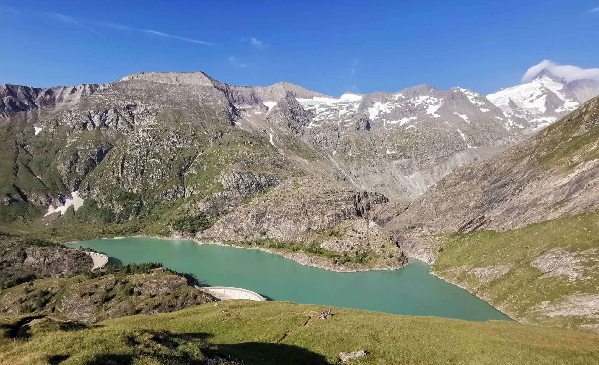
Easy hiking trails around Mooserboden offer access to high alpine landscapes within the Hohe Tauern National Park. The region is characterized by majestic mountain scenery, including views of three-thousand-meter peaks, and striking turquoise reservoirs like Mooserboden and Wasserfallboden. Hikers can explore diverse alpine flora and discover unique natural features along well-maintained paths.
Best easy hiking trails around Mooserboden
- The most popular easy hiking route is Kitzsteinhorn Summit Cable Car – Kitzsteinhorn Ski Resort loop from Gletschermühle, a 1.5 miles…
Last updated: June 30, 2026
1
hikers
Easy hike. Great for any fitness level. Easily-accessible paths. Suitable for all skill levels.
5.0
(1)
11
hikers
2.29km
00:47
120m
120m
Easy hike. Great for any fitness level. Easily-accessible paths. Suitable for all skill levels.

Sign up for free
4.4
(19)
191
hikers
Easy hike. Great for any fitness level. Easily-accessible paths. Suitable for all skill levels.
4.8
(11)
119
hikers
Easy hike. Great for any fitness level. Easily-accessible paths. Suitable for all skill levels.
3.0
(1)
25
hikers
2.96km
00:57
140m
140m
Easy hike. Great for any fitness level. Easily-accessible paths. Suitable for all skill levels.
Get access to more routes and recommendations from other explorers.
Sign up for free
Already have an account?
Our route recommendations are based on thousands of hikes, rides, and runs completed by other people on komoot.
Start today with a free account
Your next adventure awaits.
Login or Signup
Popular around Mooserboden
Other adventures around Mooserboden

Tips from the Community


Death
0
0

Simple food, rustic hut, lovely spot, highly recommended!
0
0

The trip to the summit is worth it
0
0


Located right next to the wildlife park. More like an oversized playground. But very nicely done. Something for everyone.
4
0
Small but beautiful wildlife park. Impressive panorama of the Grossglockner and the neighboring peaks. The park can be visited free of charge with the National Park Summer Card.
6
0
Frequently Asked Questions
How many easy hiking trails are there around Mooserboden?
Mooserboden offers a selection of 13 easy hiking trails, providing accessible routes to explore the high alpine landscapes of the Hohe Tauern National Park.
What kind of terrain can I expect on easy hikes around Mooserboden?
Easy hikes around Mooserboden typically feature well-maintained paths with gentle elevation changes. You'll traverse alpine meadows, enjoy views of rugged mountain backdrops, and walk alongside the stunning turquoise reservoirs. Some paths, like the Herb Trail, are designed for relaxed exploration.
Are there any family-friendly easy hikes in Mooserboden?
Yes, Mooserboden is well-suited for families. The Herb Trail, leading from the Mooserboden reservoir to the Fürthermoar Alm, is a relaxed option with breathtaking views and opportunities to learn about local flora. The Electricity Trail is also suitable for families and strollers, offering interactive stations about hydropower.
Can I bring my dog on easy trails in Mooserboden?
Generally, dogs are welcome on trails in the Mooserboden area, but it's crucial to keep them on a leash, especially within the Hohe Tauern National Park, to protect wildlife and livestock. Always carry water for your dog and clean up after them.
Are there circular easy routes available?
Yes, many easy routes around Mooserboden are designed as loops. For example, the Kitzsteinhorn Summit Cable Car – Kitzsteinhorn Ski Resort loop from Gletschermühle is a popular easy circular trail offering alpine views.
What are some notable landmarks or attractions I can see on easy hikes?
Along easy hikes, you can encounter impressive engineering marvels like the Mooserboden Dam itself, offering insights into hydropower. The Heathen Church Memorial at Mooserboden is another point of interest. You'll also enjoy panoramic views of the surrounding three-thousand-meter peaks and the turquoise reservoirs.
What is the best time of year for easy hikes in Mooserboden?
The best time for easy hikes in Mooserboden is typically from late spring to early autumn (June to September) when the trails are clear of snow, and the alpine flora is in bloom. The weather is generally mild, offering ideal conditions for enjoying the mountain scenery.
Are there any easy trails that offer views of the Kitzsteinhorn?
Yes, the View of the Kitzsteinhorn – Krefelder Hut loop from Alpincenter is an easy path that provides panoramic vistas of the majestic Kitzsteinhorn and the high mountains.
What do other hikers enjoy most about easy hiking in Mooserboden?
The area is highly rated by the komoot community, with an average score of 4.6 stars from over 2,200 reviews. Reviewers often praise the spectacular mountain scenery, the striking turquoise reservoirs, and the accessibility of the well-maintained paths, even for beginners.
Are there any easy routes that lead to an alpine hut or alm?
Yes, the Herb Trail leads to the cozy Fürthermoar Alm, where you can enjoy local delicacies and visit a small mountain pasture museum. Another option is the Salzburger Hut loop from Häuslalm, which takes you through alpine meadows.
How long do easy hikes around Mooserboden typically take?
Easy hikes in Mooserboden vary in length, but many can be completed within 1 to 2 hours. For instance, the Kitzsteinhorn Summit Cable Car – Kitzsteinhorn Ski Resort loop from Gletschermühle takes about 45 minutes, while others like the Trauneralm loop from Käfertalbach might take closer to an hour.
Is there public transport access to the starting points of easy hikes?
Access to Mooserboden is typically via the Kaprun high mountain reservoirs, which are reached by a combination of bus and inclined lift. This transport system makes many trailheads accessible, but it's advisable to check the operating times for the specific season.
Are there less crowded easy hikes in Mooserboden?
While popular spots can attract visitors, exploring trails slightly off the main reservoir paths or visiting during off-peak hours (early morning or late afternoon) can offer a more tranquil experience. The region has 13 easy trails, providing options to find quieter routes.
Most popular routes around Mooserboden
Most popular attractions around Mooserboden

Get inspired with the komoot mobile app


Explore more
Browse the best Hikes in other regions.
