Easy hikes and walks around Dam Zeulenroda
4.6
(4310)
14,989
hikers
648
hikes
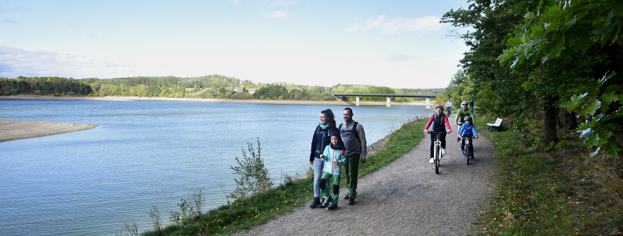
Easy hiking trails around Dam Zeulenroda are situated in the Vogtland region, characterized by rolling hills, dense forests, and the tranquil waters of the Zeulenroda Reservoir. The area offers a diverse landscape of woodlands reflecting in the water, providing a serene environment for outdoor activities. This region, part of the Thuringian Slate Mountains, features gentle elevations and extensive natural areas.
Best easy hiking trails around Dam Zeulenroda
- The most popular easy hiking route is Hiking car park at the Vorsperre – Kesselmühle Läßwitz loop from Langenwolschendorf, a 2.2 miles (3.6 km) trail that takes about 1 hour to complete, following the reservoir's edge through woodlands.
- Another top favourite among local hikers is Marble runs at the lakeside hotel – View of Zeulenrodaer Meer loop from Quingenberg, an easy 1.8 miles (2.9 km) path. This route offers views of the Zeulenrodaer Meer and surrounding gentle hills.
- Local hikers also love the Brückentelefon Bridge – View of Zeulenrodaer Meer loop from Weißendorf, a 3.0 miles (4.9 km) trail leading along the reservoir's shore, often completed in about 1 hour 15 minutes.
- Hiking around Dam Zeulenroda is defined by rolling hills, dense forests, and the expansive Zeulenroda Reservoir. The network offers numerous well-marked easy hiking trails suitable for various ability levels.
- The routes in Dam Zeulenroda are highly rated by the komoot community with an average score of 4.6 stars from over 2,800 reviews. More than 10,000 hikers have used komoot to explore Dam Zeulenroda's varied terrain.
Last updated: July 14, 2026
4.9
(76)
252
hikers
Easy hike. Great for any fitness level. Easily-accessible paths. Suitable for all skill levels.
4.6
(22)
202
hikers
4.06km
01:04
30m
30m
Easy hike. Great for any fitness level. Easily-accessible paths. Suitable for all skill levels.

Sign up for free
4.8
(23)
171
hikers
3.92km
01:02
30m
30m
Easy hike. Great for any fitness level. Easily-accessible paths. Suitable for all skill levels.
4.8
(13)
37
hikers
7.00km
01:55
110m
110m
Easy hike. Great for any fitness level. Easily-accessible paths. Suitable for all skill levels.
4.6
(10)
42
hikers
Easy hike. Great for any fitness level. Easily-accessible paths. Suitable for all skill levels.
Get access to more routes and recommendations from other explorers.
Sign up for free
Already have an account?
Our route recommendations are based on thousands of hikes, rides, and runs completed by other people on komoot.
Start today with a free account
Your next adventure awaits.
Login or Signup




Tips from the Community

There are some beautiful things to actively discover along the panoramic trail at Zeulenrodaer Meer 😊.
17
0
Great idea for 📚 swapping.
17
0

Always a nice place to relax.
0
0

The lovely rest and relaxation huts, which are located at regular intervals along the path (the dam circular path), are a wonderful sight to behold.
0
0

A bit steep, but the view makes up for it
0
0
For the first overview / impression
1
0

Currently difficult to reach due to fallen trees lying across the road
0
0
Decision point...do you want to go to the Weida Dam or the Zeulenroda Dam?😉
0
0
Frequently Asked Questions
How many easy hiking trails are available around Dam Zeulenroda?
There are over 360 easy hiking trails around Dam Zeulenroda, offering a wide variety of options for all skill levels. The region's gentle hills and extensive forests provide a serene backdrop for outdoor activities.
What do other hikers say about the easy trails around Dam Zeulenroda?
The easy trails around Dam Zeulenroda are highly rated by the komoot community, with an average score of 4.6 stars from over 2,800 reviews. Hikers often praise the well-marked paths, the tranquil waters of the reservoir, and the scenic woodlands.
Are there short, easy hikes suitable for a quick outing?
Yes, many easy trails are perfect for shorter excursions. For example, the Marble runs at the lakeside hotel – View of Zeulenrodaer Meer loop from Quingenberg is an easy 1.8-mile (2.9 km) path offering views of the Zeulenrodaer Meer, typically completed in under an hour.
Can I find easy circular routes around Dam Zeulenroda?
Absolutely. Many easy trails are designed as circular routes, allowing you to start and end at the same point. The Weida River and Wooden Bridge – Pisselmühle Forebay loop from Weißendorf is a great example, offering a 4.3-mile (6.9 km) loop through varied scenery.
Are the easy hiking trails around Dam Zeulenroda suitable for families with children?
Yes, the easy hiking trails are generally very family-friendly. The region's gentle elevations and well-maintained paths make them suitable for children. Many routes follow the reservoir's edge, providing pleasant views and opportunities for breaks.
Are dogs allowed on the easy hiking trails around Dam Zeulenroda?
Yes, dogs are generally welcome on the easy hiking trails around Dam Zeulenroda. It's always recommended to keep them on a leash, especially in nature protection areas or near wildlife, and to clean up after them.
What kind of scenic viewpoints can I expect on these easy trails?
The easy trails often lead to picturesque viewpoints offering panoramic views of the Zeulenroda Reservoir and the surrounding forests. Lookout points above the dam provide unique perspectives of the water and the Thuringian Slate Mountains landscape.
Are there any interesting landmarks or attractions along the easy hiking trails?
Yes, you can discover several interesting spots. Along some routes, you might encounter charming huts like the Angler's Dream Shelter at Zeulenroda Reservoir or the Der Fischer un sine Fru Shelter. The Brückentelefon Bridge is also a notable feature on one of the popular easy loops.
Are there any easy trails that pass by the Zeulenroda-Triebes Wildlife Park?
Yes, there is an easy route that allows you to explore the area near the wildlife park. The Zeulenroda-Triebes Wildlife Park – View of Zeulenrodaer Meer loop from Quingenberg is a 3.4-mile (5.4 km) trail that offers views of the Zeulenrodaer Meer and passes by the wildlife park area.
What is the best time of year for easy hiking around Dam Zeulenroda?
The Dam Zeulenroda region is beautiful year-round. Spring brings blooming nature, summer offers pleasant temperatures for lakeside walks, autumn showcases vibrant foliage, and even winter can be charming with snow-covered landscapes, provided trails are clear.
Are there places to eat or rest along the easy hiking trails?
While the trails themselves might not have continuous cafes, the region offers charming huts and shelters like the Flowers by the wayside rest area, which are perfect for a picnic or a short break. The nearby towns and lakeside areas also provide dining options.
Most popular routes around Dam Zeulenroda
Most popular attractions around Dam Zeulenroda

Get inspired with the komoot mobile app


Explore more
Browse the best Hikes in other regions.
