Easy hikes and walks around Parco naturale di Montevecchia e della Valle di Curone
4.4
(6182)
32,022
hikers
97
hikes
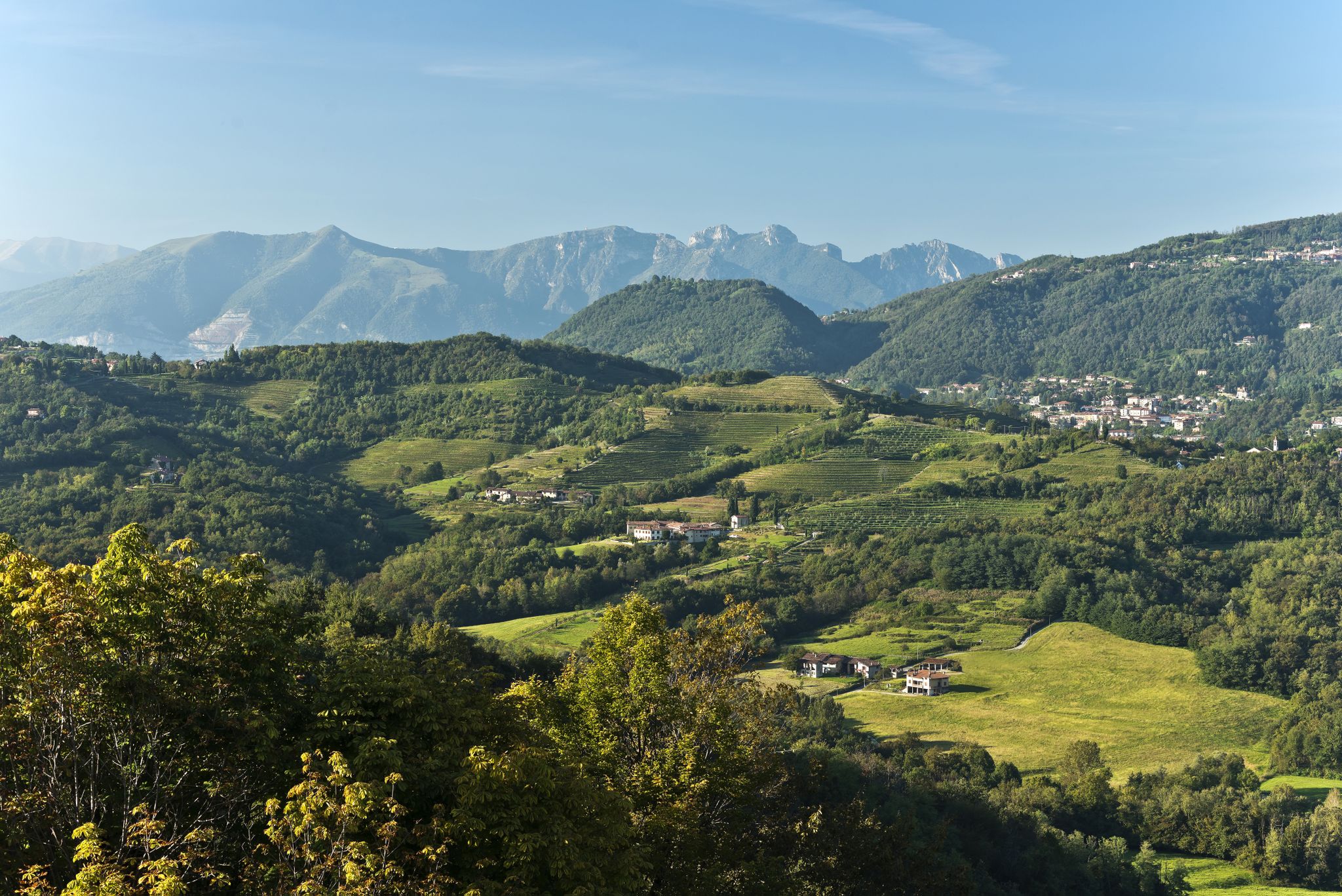
Easy hiking trails around Parco naturale di Montevecchia e della Valle di Curone traverse a diverse landscape, encompassing the Curone Valley, the Montevecchia relief, and areas shaped by the Molgora stream. The central part features terraced hillsides with small vineyards, alongside extensive woods, meadows, and wetlands. This region offers a harmonious blend of natural beauty and agricultural influence, with the Montevecchia hill providing a notable elevation.
Best easy hiking trails around Parco naturale di Montevecchia e della Valle di Curone
…Last updated: October 10, 2026
4.7
(105)
319
hikers
4.89km
01:22
90m
90m
Easy hike. Great for any fitness level. Easily-accessible paths. Suitable for all skill levels.
4.5
(20)
69
hikers
4.22km
01:18
160m
160m
Easy hike. Great for any fitness level. Easily-accessible paths. Suitable for all skill levels.

4.5
(23)
58
hikers
4.72km
01:27
160m
150m
Easy hike. Great for any fitness level. Easily-accessible paths. Suitable for all skill levels.
4.8
(13)
39
hikers
Easy hike. Great for any fitness level. Easily-accessible paths. Suitable for all skill levels.
4.8
(4)
40
hikers
6.28km
01:58
240m
240m
Easy hike. Great for any fitness level. Easily-accessible paths. Suitable for all skill levels.
Get access to more routes and recommendations from other explorers.
Already have an account?
Our route recommendations are based on thousands of hikes, rides, and runs completed by other people on komoot.
Start today with a free account
Your next adventure awaits.
Popular around Parco naturale di Montevecchia e della Valle di Curone
Other adventures around Parco naturale di Montevecchia e della Valle di Curone

Tips from the Community

Excellent view of the Curone Valley in Montevecchia Park!
0
0
Ca Soldato is located within the Parco di Montevecchia la Valle del Curone!
0
0

Ca' del Soldato - Park Center and picnic area
0
0

The Sanctuary of the Blessed Virgin of Mount Carmel is the symbolic monument of Montevecchia, located on top of a hill overlooking the Brianza lecchese and the Curone Park. Known for its spectacular panoramic position, it offers a view that on the clearest days ranges from the profiles of the Prealps (like the Resegone) to the skyline of Milan.
0
0
The Cypress Path is one of the most iconic itineraries in the Montevecchia and Curone Valley Regional Park. About 4.5 km long, it offers breathtaking panoramic views reminiscent of Tuscan landscapes. It develops between 350 and 440 meters above sea level, offering a walk suitable for everyone.
0
0

breathtaking view, a bit difficult to climb.
0
0

Frequently Asked Questions
How many easy hiking trails are available in Parco naturale di Montevecchia e della Valle di Curone?
The park offers a good selection of easy hiking trails, with over 40 routes specifically categorized as easy. These paths are designed to be accessible and enjoyable for a wide range of visitors.
What is the best time of year for easy hikes in Parco naturale di Montevecchia e della Valle di Curone?
The park's unique microclimate, especially around the terraced hillsides, makes it pleasant for hiking for much of the year. Spring and autumn are particularly ideal, offering mild temperatures and vibrant natural colors. Even winter can be enjoyable for easy walks, provided conditions are dry.
What do other hikers enjoy most about the easy trails in Parco naturale di Montevecchia e della Valle di Curone?
The easy trails in Parco naturale di Montevecchia e della Valle di Curone are highly rated by the komoot community, with an average score of 4.5 stars from over 850 reviews. Hikers frequently praise the harmonious blend of natural beauty, agricultural landscapes, and well-maintained paths that make for a relaxing outdoor experience.
Are there any easy circular routes in Parco naturale di Montevecchia e della Valle di Curone?
Yes, the park features several easy circular routes. For example, the Station Route Loop and the Stazione and Sentierone Loop are popular choices, offering varied scenery and convenient starting and ending points.
Are the easy trails in Parco naturale di Montevecchia e della Valle di Curone suitable for families with children?
Many of the easy trails are well-suited for families. Paths like the Lean Meadows Trail offer gentle gradients through open meadows and woodlands, making them perfect for walks with children. The diverse landscapes also provide plenty of opportunities for exploration and discovery.
Can I bring my dog on the easy hiking trails?
Yes, dogs are generally welcome on the trails within Parco naturale di Montevecchia e della Valle di Curone. However, it's always recommended to keep them on a leash, especially in areas with wildlife or near agricultural land, to ensure their safety and respect for other visitors and the environment.
Are there any viewpoints or scenic spots on the easy trails?
Absolutely. The Montevecchia relief itself offers panoramic views, and the View of the hills from Montevecchia is a notable highlight. You can also find scenic spots like Cypress Peak and The Hill of the Cypresses, providing beautiful vistas over the valley and surrounding landscapes.
Is there parking available for easy hiking trails in Parco naturale di Montevecchia e della Valle di Curone?
Yes, parking is generally available at various access points and trailheads around the park. Specific parking areas can often be found near villages or popular starting points for the trails, though it's advisable to check local signage.
How can I reach the easy hiking trails in Parco naturale di Montevecchia e della Valle di Curone by public transport?
The park is located less than an hour from Milan, and while public transport options exist, they might require some planning. Buses serve some of the towns surrounding the park, which can provide access to certain trailheads. Checking local bus schedules for routes connecting to towns like Montevecchia or Cernusco Lombardone is recommended.
Are there cafes or places to eat near the easy hiking trails?
Yes, the park is dotted with small villages and rural settlements, including Montevecchia itself, which offer cafes, trattorias, and agriturismos where you can enjoy local cuisine and refreshments. These spots are perfect for a break before or after your hike.
What natural attractions can I see along the easy hiking trails?
Beyond the diverse landscapes of woods, meadows, and riparian thickets, you can encounter unique natural features. Keep an eye out for interesting petrifying springs along the small streams. The Oasis of Galbusera Bianca is another significant natural monument within the park.
Are there any historical or cultural landmarks to explore on easy hikes?
The park is rich in history. You can visit the Sanctuary of Montevecchia, a significant religious and cultural landmark offering panoramic views. The park also preserves ancient rural settlements like Galbusera Nera and Galbusera Bianca, and traces of older civilizations.
Are there any trails that pass through the terraced vineyards mentioned in the guide?
Yes, some easy trails wind through the central area of the park, where you'll find the distinctive terraced hillsides adorned with small vineyards and aromatic herbs. These paths offer a unique opportunity to experience the blend of natural beauty and traditional agriculture that defines the region.
Most popular routes around Parco naturale di Montevecchia e della Valle di Curone
Most popular attractions around Parco naturale di Montevecchia e della Valle di Curone

Get inspired with the komoot mobile app


Explore more
Browse the best Hikes in other regions.
