The best cycling routes around Fjellsjøkampen
3.5
(2)
30
riders
4
rides
Touring cycling routes around Fjellsjøkampen traverse a landscape characterized by ancient coniferous forests, varied terrain, and scenic lakes. The region, situated in Akershus county, Norway, features forest roads and paths that can accommodate mixed-terrain cycling. While primarily known for hiking, the surrounding area offers opportunities for cycling through protected nature reserves and rural environments. Elevations vary, with the highest point, Fjellsjøkampen, reaching 812 meters, though cycling routes typically navigate lower, undulating terrain.
Best touring cycling routes around Fjellsjøkampen
- The most…
Last updated: July 10, 2026
1
riders
18.4km
01:18
300m
310m
Moderate bike ride. Good fitness required. Mostly paved surfaces. Suitable for all skill levels.
4
riders
33.6km
02:23
570m
570m
Hard bike ride. Very good fitness required. Mostly paved surfaces. Suitable for all skill levels.

Sign up for free
5.0
(1)
20
riders
53.9km
03:16
380m
380m
Moderate bike ride. Good fitness required. Mostly paved surfaces. Suitable for all skill levels.
2.0
(1)
5
riders
48.1km
03:06
580m
580m
Hard bike ride. Very good fitness required. Mostly paved surfaces. Suitable for all skill levels.
Our route recommendations are based on thousands of hikes, rides, and runs completed by other people on komoot.
Start today with a free account
Your next adventure awaits.
Login or Signup
Popular around Fjellsjøkampen

Tips from the Community

A 7.5 km forest trail through rolling terrain above Hurdalssjøen, passing old crofter sites, stone ruins and quiet woodland sections. The route combines natural scenery with traces of local history, including viewpoints and remnants of former forest settlements.
0
0
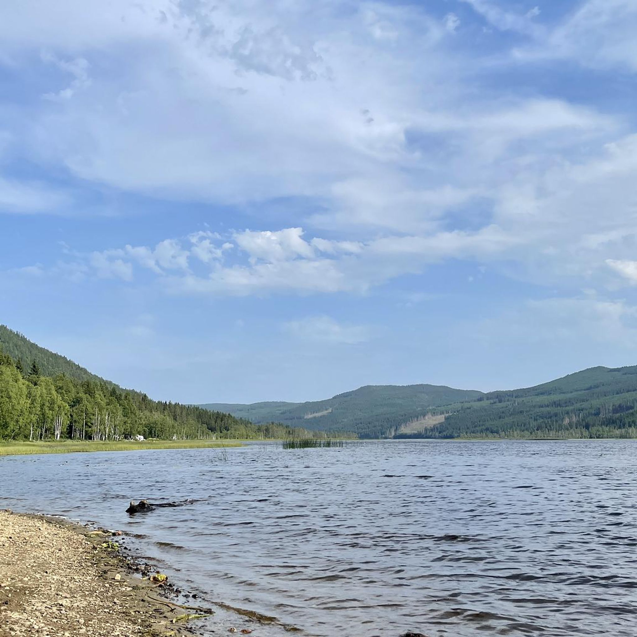
A small beach with a picnic area on the shores of Hurdalssjøen, surrounded by forest and calm waters.
0
0


Very cozy, nice staff. Pilgrims can help themselves to free coffee.
1
0
Birthplace of the Norwegian Constitution (Constitution Building).
1
0
Frequently Asked Questions
How many touring cycling routes are available around Fjellsjøkampen?
There are 4 touring cycling routes available around Fjellsjøkampen, offering a variety of experiences for different skill levels.
What kind of terrain can I expect on touring cycling routes near Fjellsjøkampen?
The touring cycling routes around Fjellsjøkampen traverse a landscape characterized by ancient coniferous forests and varied terrain. You can expect a mix of surfaces, including paved sections and unpaved forest roads, making it suitable for mixed-terrain or gravel bikes. Elevations vary, with routes navigating undulating terrain rather than directly ascending the highest peak.
Are there any family-friendly touring cycling routes in the Fjellsjøkampen area?
While the region is known for its varied terrain, including some difficult sections, there are moderate routes that could be suitable for families with some cycling experience. For example, the Olaberget – Vesleelvfossen loop from Svartungsvegen is an 18.4 km moderate route through forested areas.
Can I bring my dog on touring cycling routes around Fjellsjøkampen?
The Fjellsjøkampen Nature Reserve is a protected area with rich wildlife. While specific regulations for dogs on cycling routes are not detailed, it's generally advisable to keep dogs on a leash, especially within nature reserves, to protect wildlife and ensure a pleasant experience for all users. Always check local signage for specific rules.
What are the best times of year for touring cycling near Fjellsjøkampen?
The best time for touring cycling around Fjellsjøkampen is typically during the warmer months, from late spring to early autumn. This period offers more stable weather conditions, clear paths, and the full beauty of the ancient coniferous forests and lakes. Winter cycling would require specialized equipment due to snow and ice.
Are there any notable landmarks or viewpoints along the cycling routes?
While the touring cycling routes themselves focus on the forest and rural landscapes, the broader Fjellsjøkampen region is known for its natural beauty. The summit of Fjellsjøkampen, accessible via hiking trails, offers panoramic views extending to Jotunheimen and the Oslofjord. The area also features scenic lakes like Fjellsjøen and Hurdalsjøen, which add to the picturesque environment.
Where can I park my car when cycling around Fjellsjøkampen?
Access to the Fjellsjøkampen area, particularly for hiking trails, often involves forest roads leading to parking areas. For specific cycling routes, starting points like Svartungsvegen or Hurdal skisenter, as mentioned in the route descriptions, would typically have designated parking facilities. It's always recommended to check the specific route details on komoot for parking information.
Is public transport an option for reaching the cycling routes with my bike?
Public transport options directly to the starting points of these specific touring cycling routes with bike carriage facilities may be limited. The region is more rural, and while buses might serve Hurdal, transporting a bicycle might require prior arrangement or specific services. Planning your journey by car to a suitable starting point is often the most straightforward option.
Are there any cafes or accommodation options near the cycling routes?
The Fjellsjøkampen area is primarily natural and rural. While there might not be cafes directly on every route, the Eidsvollbygningen Café loop from Strømmen skole suggests that cafes can be found in nearby towns or along longer routes. For accommodation, you would likely find options in Hurdal or surrounding communities, offering a place to stay after your ride.
Are there specific rules for cycling within the Fjellsjøkampen nature reserve?
The Fjellsjøkampen Nature Reserve protects ancient coniferous forests and diverse wildlife. While cycling is generally permitted on designated roads and trails, it's crucial to respect the natural environment. This includes staying on marked paths, not disturbing wildlife, and adhering to any posted regulations regarding access or activities. Always check local signage for specific rules within the reserve.
Are there any circular touring cycling routes available?
Yes, several of the touring cycling routes around Fjellsjøkampen are designed as loops. For instance, the Olaberget – Vesleelvfossen loop from Svartungsvegen, the Melbylia – Rundberget loop from Hurdal skisenter, and the Eidsvollbygningen Café loop from Strømmen skole are all circular routes, allowing you to start and end at the same point.
What do other cyclists say about touring cycling in Fjellsjøkampen?
The touring cycling routes in Fjellsjøkampen are highly rated by the komoot community, with an average score of 3.5 stars from over 2 reviews. Cyclists often appreciate the varied terrain and the journey through forested areas, offering a natural and engaging experience.
What are some longer touring cycling routes for experienced cyclists?
For experienced touring cyclists seeking a challenge, routes like the Melbylia – Rundberget loop from Hurdal skisenter stand out. This difficult 33.6 km path features significant elevation changes. Another longer option is the Svarthølshaugen loop from Hurdal verk, a difficult 47.3 km route with substantial elevation gain.
Most popular routes around Fjellsjøkampen

Get inspired with the komoot mobile app


Explore more
Browse the best Cycling routes in other regions.
