The best running trails around Skulstadvatnet
5.0
(1)
43
runners
3
runs
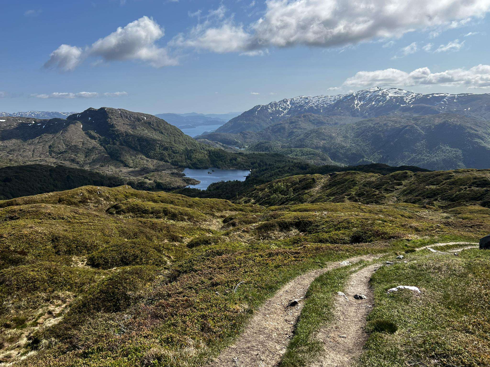
Jogging routes around Skulstadvatnet offer diverse terrain within a picturesque fjord region, characterized by dramatic natural beauty. The area features numerous running trails that wind through mountains, past lakes, and along scenic approaches to the water. Joggers can experience varied surfaces, from more accessible paths to challenging routes with significant elevation gain, all set amidst an environment of endless greenery and rugged landscapes.
Best jogging routes around Skulstadvatnet
- The most popular jogging route is Skulstadvatnet – Hananipa loop from Trengereid…
Last updated: June 27, 2026
7
runners
6.34km
01:10
360m
360m
Hard run. Very good fitness required. Sure-footedness, sturdy shoes and alpine experience required.
10
runners
8.76km
01:22
470m
470m
Hard run. Very good fitness required. Mostly paved surfaces. Suitable for all skill levels.

Sign up for free
5
runners
4.29km
00:47
320m
320m
Hard run. Very good fitness required. Mostly paved surfaces. Suitable for all skill levels.
2
runners
6.12km
01:07
390m
390m
Hard run. Very good fitness required. Sure-footedness, sturdy shoes and alpine experience required.
2
runners
8.28km
01:25
420m
420m
Hard run. Very good fitness required. Sure-footedness, sturdy shoes and alpine experience required.
Our route recommendations are based on thousands of hikes, rides, and runs completed by other people on komoot.
Start today with a free account
Your next adventure awaits.
Login or Signup
Popular around Skulstadvatnet
Frequently Asked Questions
What kind of terrain can I expect on the running routes around Skulstadvatnet?
The region offers a diverse range of terrain, from mostly paved surfaces suitable for all skill levels to more challenging paths. You'll encounter varied natural elements including farmland, small lakes, streams, and dramatic mountain landscapes. The area is characterized by endless greenery, tall evergreen trees, and rugged natural beauty, typical of Western Norway.
Are there any easy or beginner-friendly jogging paths near Skulstadvatnet?
While many of the listed routes are considered difficult, the area does offer paths suitable for varying fitness levels. The approximately 3.5-kilometer walk or run from Trengereid train station along Skulstadvegen to Skulstadvatnet provides a scenic and more accessible approach with views of the Sørfjorden.
How many running routes are available in the Skulstadvatnet area?
There are currently 5 jogging routes detailed for the Skulstadvatnet area, all offering challenging experiences through the region's diverse landscapes.
What are the best viewpoints or natural features to see while jogging around Skulstadvatnet?
A significant highlight is the ascent to Hananipa Summit, which offers spectacular 360-degree panoramic views of the Norwegian fjord landscape, including the Sørfjorden, Osterøy island, and surrounding mountain tops. The route Skulstadvatnet – Hananipa loop from Trengereid leads to this peak. The journey to Skulstadvatnet itself also provides scenic views of the Sørfjorden.
Are there any circular running loops available?
Yes, several routes are designed as loops. For example, the Skulstadvatnet – Hananipa loop from Trengereid is a 7.1-mile circular trail, and the Varmavatnet – Brøknipa loop from Bruvik is another popular option.
What do other runners enjoy most about jogging in Skulstadvatnet?
The area is highly rated by the komoot community, with an average score of 5.0 stars. Runners often praise the dramatic natural beauty, the challenging mountain trails, and the rewarding panoramic views from peaks like Hananipa.
Is there public transport access to the running paths around Skulstadvatnet?
Yes, the scenic approach to Skulstadvatnet can begin from Trengereid train station. From there, you can run or walk approximately 3.5 kilometers along Skulstadvegen to reach the lake and its surrounding trails.
Are there any family-friendly running routes in the Skulstadvatnet area?
While many of the listed routes are challenging with significant elevation gain, the more accessible paths and the scenic walk from Trengereid train station to Skulstadvatnet could be suitable for families looking for a less strenuous outdoor experience. Always consider the fitness level of all participants.
Can I bring my dog on the jogging trails around Skulstadvatnet?
The natural environment around Skulstadvatnet, with its varied terrain and serene atmosphere, is generally welcoming for dogs. However, it's always advisable to keep dogs on a leash, especially in areas where you might encounter sheep or other wildlife, and to check local regulations for specific trails.
What is the best time of year to go running in Skulstadvatnet?
The region's 'endless greenery' suggests that spring, summer, and early autumn offer beautiful conditions for running. During these seasons, you can enjoy the full vibrancy of the natural landscape. Winter conditions would likely involve snow and ice, requiring appropriate gear and caution.
Are there any advanced or particularly challenging running trails in the region?
Absolutely. All the routes listed for Skulstadvatnet are classified as difficult. For instance, the Stongfjellet loop from Gjerstad kyrkje covers 6.1 km with over 380 meters of elevation gain, and the Litlavatnet – Storavatnet loop from Gjerstad kyrkje is 8.2 km with over 410 meters of ascent, providing strenuous runs for experienced joggers.
What kind of natural environment will I experience on the trails?
You'll be immersed in a dramatic and rugged natural environment typical of Western Norway, featuring 'endless greenery, tall evergreen trees, so much water, and lots of mountains.' The trails wind through varied landscapes, including farmland, small lakes, and streams, offering a serene and picturesque experience.
Most popular routes around Skulstadvatnet

Get inspired with the komoot mobile app


Explore more
Browse the best Running Trails & Routes in other regions.
