The best cycling routes in Pacific Rim National Park Reserve - Long Beach Unit
4.6
(5)
156
riders
3
rides
Touring cycling in Pacific Rim National Park Reserve - Long Beach Unit offers routes through a diverse coastal landscape. The region features extensive sandy beaches, temperate rainforests, and rugged shorelines. Terrain generally includes gentle gradients suitable for cycling, with some routes traversing boardwalks and paved multi-use paths.
Best touring cycling routes in Pacific Rim National Park Reserve - Long Beach Unit
- The most popular touring cycling route is Long Beach loop from Shorepine Bog, a 15.2 miles (24.5 km)…
Last updated: October 8, 2026
5
riders
22.7km
01:18
110m
110m
Easy bike ride. Great for any fitness level. Mostly paved surfaces. Suitable for all skill levels.
4.6
(5)
125
riders
41.1km
02:23
190m
190m
Moderate bike ride. Good fitness required. Mostly paved surfaces. Suitable for all skill levels.

26
riders
10.1km
00:35
40m
40m
Easy bike ride. Great for any fitness level. Mostly paved surfaces. Suitable for all skill levels.
Our route recommendations are based on thousands of hikes, rides, and runs completed by other people on komoot.
Start today with a free account
Your next adventure awaits.
Popular around Pacific Rim National Park Reserve - Long Beach Unit

Tips from the Community

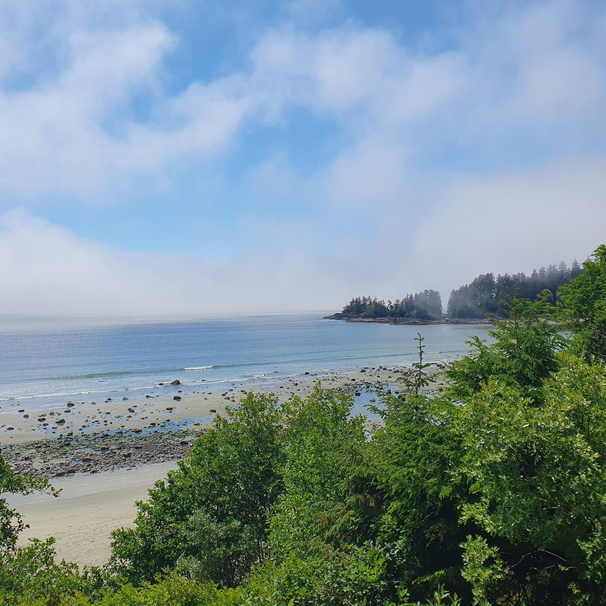
Ponsford Beach borders MacKenzie Beach to the south. The beach is protected by Mushroom Island, a wooded rock formation offshore that is separated from the mainland at high tide, and the smaller Ponsford Island, which lies further away from the mainland.
2
0
The long and wide MacKenzie Beach offers numerous accommodations, resorts, and two campgrounds, as well as a restaurant. Access is via MacKenzie Beach Road or Tin WIS Road. Parking is limited. The beach is ideal for watching the sunset.
2
0

Green Point campground provides one of the most amazing camping experiences you'll find anywhere. The walk-in campsites, in particular, are special: you feel truly intimate with nature because you are so close to the trees and the ocean. Bathroom facilities are in excellent condition. Reservations are often filled months in advance, but you may be able to take advantage of others' cancellations.
0
0

Long Beach is an almost ideal beach for surfing: wide, shallow water, nice waves and a parking lot directly behind a row of trees. You only have to carry your surfboard very far at low tide 😄
0
0

It is part of the Pacific Rim National Park and is known for its stunning landscapes, fine sand and waves perfect for surfing. The beach extends for 16 kilometers and offers various activities such as hiking, wildlife observation, and nature walks. It is also a popular spot for surfers.
1
0

Beautiful beach, ideal for spending time with the family. Very quiet place a few meters from the town where you can find everything you need.
1
0
Frequently Asked Questions
What kind of terrain can I expect on touring cycling routes in Pacific Rim National Park Reserve - Long Beach Unit?
The routes in Pacific Rim National Park Reserve - Long Beach Unit offer a diverse coastal landscape, including extensive sandy beaches, temperate rainforests, and rugged shorelines. You'll find gentle gradients, with some paths traversing boardwalks and paved multi-use trails.
Are there family-friendly touring cycling routes in Pacific Rim National Park Reserve - Long Beach Unit?
Yes, the region offers several easy routes suitable for families. For instance, the Chesterman Beach loop from Tofino is a shorter, easy trail leading through coastal areas and near beaches, perfect for a family outing.
Where can I find parking for touring cycling trails in the Long Beach Unit?
Parking is available at various access points throughout the park. For routes like the Long Beach loop from Shorepine Bog, you can typically find parking near the Shorepine Bog Trailhead or other designated park facilities.
What are some notable landmarks or attractions I can see along the cycling routes?
Many routes offer access to significant natural and cultural highlights. You might pass by the Rainforest Trail, the Shorepine Bog Trail, or the Kwisitis Visitor Centre. The Amphitrite Point Lighthouse – Ucluelet Lighthouse loop from Ucluelet specifically takes you past the iconic lighthouse.
Are there any circular touring cycling routes in the Pacific Rim National Park Reserve - Long Beach Unit?
Yes, many of the touring cycling routes are designed as loops. Examples include the popular Long Beach loop from Shorepine Bog and the Ucluelet visitor centre loop from Ucluelet, offering convenient starting and ending points.
What is the best season for touring cycling in Pacific Rim National Park Reserve - Long Beach Unit?
The temperate rainforest climate means cycling is possible year-round, but the summer months (June to September) offer drier weather and longer daylight hours. Spring and fall provide lush scenery and fewer crowds, though you should be prepared for rain.
What should I wear when touring cycling in the Long Beach Unit?
Given the coastal and rainforest environment, it's advisable to dress in layers. Waterproof and windproof outer layers are recommended, especially outside of peak summer. Comfortable cycling attire and sturdy shoes are essential.
Are there any cafes or places to eat near the touring cycling trails?
Yes, both Tofino and Ucluelet, which serve as starting points or pass-throughs for several routes, offer a variety of cafes, restaurants, and amenities. The Long Beach loop from Tofino, for example, starts and ends in Tofino, providing easy access to dining options.
What do other touring cyclists enjoy the most about touring cycling in Pacific Rim National Park Reserve - Long Beach Unit?
The area is highly rated by the komoot community, with an average score of 4.7 stars. Reviewers often praise the stunning coastal views, the well-maintained multi-use paths, and the immersive experience of cycling through the temperate rainforest.
What kind of wildlife might I encounter on the Pacific Rim bike paths?
The park is home to diverse wildlife. Cyclists might spot various bird species, including eagles, and potentially deer. Keep an eye out for marine life if cycling near the beaches, such as sea lions or even whales during migration seasons. Always maintain a respectful distance from all wildlife.
How many touring cycling routes are available in Pacific Rim National Park Reserve - Long Beach Unit?
There are 6 touring cycling routes listed in this guide, with 5 rated as easy and 1 as moderate, catering to various skill levels.
Are there any longer touring cycling routes for more experienced riders?
For those seeking a longer ride, the Long Beach loop from Tofino is a moderate 39.9 km (24.8 miles) path that provides a more extensive exploration of the coastal environment and forested sections.
Most popular routes in Pacific Rim National Park Reserve - Long Beach Unit
Most popular attractions in Pacific Rim National Park Reserve - Long Beach Unit

Get inspired with the komoot mobile app


Explore more
Browse the best Cycling routes in other regions.
