The best walks and hikes around Harrison Lake
4.5
(37)
260
hikers
23
hikes
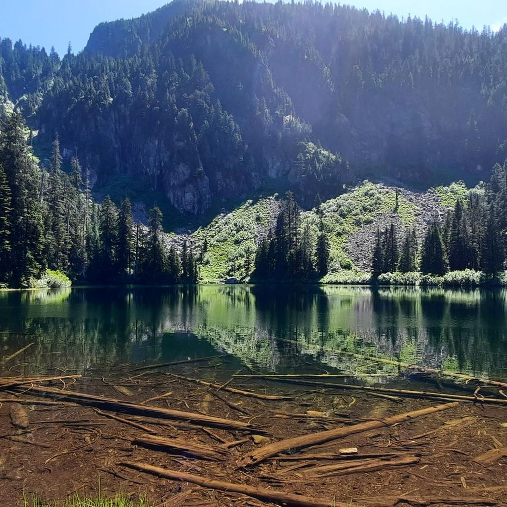
Hiking around Harrison Lake offers access to a diverse landscape characterized by a large glacial-fed lake, surrounded by the Lillooet and Douglas Ranges. The region features dramatic mountainous terrain with peaks rising significantly from the lake's shores, alongside lush forests, coves, and rock cliffs. This varied environment provides a range of hiking opportunities, from lakeside paths to challenging mountain ascents.
Best hiking trails around Harrison Lake
- The most popular hiking route is View of the Lake – Sandy Cove Beach loop from Harrison Hot Springs, a 3.3 miles (5.3 km) trail that takes 1 hour 39 minutes to complete, offering views of the lake and access to a secluded beach.
- Another top favourite among local hikers is Bear Mountain — Harrison Hot Springs, a difficult 11.4 miles (18.4 km) path. This route features significant elevation gain through forested slopes, rewarding hikers with expansive mountain vistas.
- Local hikers also love the Miami Creek loop from Harrison Hot Springs, a 1.8 miles (2.9 km) trail leading through forested areas, often completed in about 43 minutes.
- Hiking around Harrison Lake is defined by its glacial-fed lake, mountainous surroundings, and lush forests. The network offers options for different ability levels, from easy strolls to difficult climbs.
- The routes in Harrison Lake are highly rated by the komoot community with an average score of 4.4 stars from over 30 reviews. More than 200 hikers have used komoot to explore Harrison Lake's varied terrain.
Last updated: June 26, 2026
13
hikers
18.4km
06:22
990m
990m
Hard hike. Very good fitness required. Sure-footedness, sturdy shoes and alpine experience required.
27.6km
07:44
540m
540m
Hard hike. Very good fitness required. Easily-accessible paths. Suitable for all skill levels.

Sign up for free
15.3km
04:35
480m
480m
Moderate hike. Good fitness required. Easily-accessible paths. Suitable for all skill levels.
4.3
(8)
34
hikers
5.30km
01:39
100m
100m
Moderate hike. Great for any fitness level. Mostly accessible paths. Sure-footedness required.
18
hikers
3.61km
00:57
30m
30m
Easy hike. Great for any fitness level. Easily-accessible paths. Suitable for all skill levels.
Get access to more routes and recommendations from other explorers.
Sign up for free
Already have an account?
Our route recommendations are based on thousands of hikes, rides, and runs completed by other people on komoot.
Start today with a free account
Your next adventure awaits.
Login or Signup
Popular around Harrison Lake

Tips from the Community

Harrison Lake is the largest lake in southwestern BC, and is a glacier-fed body of water stretching about 60 kilometres long and up to 9 kilometres wide, flanked by the Lillooet and Douglas Mountain Ranges. The lake played a significant role in the early history of British Columbia as one of the main water routes during the Fraser Canyon Gold Rush of 1858–1860. Today, it’s a popular destination for boating, kayaking, and fishing, especially near the resort community of Harrison Hot Springs at its southern end.
0
0
Cascade Peninsula trail is a relatively challenging route with fantastic views of Harrison Lake, but be prepared for a few steep, uneven sections along the way. It's a quiet, off-the-beaten-path trek that sees little traffic, making it a great option if you're looking for some solitude and beautiful scenery. The trail is open seasonally from April to October, making it an ideal place to spend some time outdoors on a warm day.
0
0
Cascade Peninsula Recreation Site is a medium-sized forested campsite nestled on the shores of Harrison Lake, tucked into a sheltered bay that protects it from the strong inflow winds that pick up during the hotter parts of the day. It’s a popular spot for boaters, anglers, and hikers, with sites available on a first-come, first-served basis (cash only). It’s important to note that though improvements have been made, a 4WD vehicle is best for accessing this area.
0
0
Long Island Bay Recreation Site is a small, protected, boat-access-only site on the west side of Long Island on Harrison Lake, making this dock your gateway to the island’s trail network. There are three docks configured in a “U” shape that can accommodate any size of vessel. If you don’t have your own boat, you can arrange drop-off and pick-up through Shoreline Tours in Harrison Hot Springs, which offers water taxi service to Long Island at $325 per hour. You can contact them directly to confirm availability and scheduling before your trip here: https://shoreline-tours.squarespace.com/harrison-hot-springs-speedboattour.
0
0
This beach at the north end of Long Island Bay Recreation Site is a quiet, natural shoreline spot where the bay opens up to the more expansive lake. It’s a mix of coarse sand and small stones, with clear, cold water and fantastic views up the rugged, forested slopes that surround Harrison Lake. Less developed than the main campground area, this secluded spot is ideal for landing small boats, relaxing, or taking in the beautiful, remote setting.
0
0
This trail is a remote, challenging out-and-back route on the west side of Long Island along Harrison Lake. Accessible only by boat, this trail sees very few visitors, making it a great escape into nature. It runs through lush, forested terrain and connects to several side trails that lead to picturesque freshwater lakes and elevated viewpoints overlooking Long Island Bay, with plenty of opportunities for camping and paddling. Covering approximately 27 kilometres with considerable elevation gain, this trail is best suited for experienced hikers ready for a long, backcountry-style day.
0
0
Long Island Bay campground includes a communal fire pit, a small picnic shelter, and outhouses and is a simple but functional base for exploring the island on foot. From here, there are several trails that lead to a lookout towering over Long Island Bay, freshwater lakes, and various other parts of the island. The site is maintained in partnership with the BC Forest Service by Harrison Yacht Club volunteers, and there are no camping fees; just be sure to pack out what you pack in.
0
0

Bear Lake is a small fishing lake off Bear Lake FSR. You will need to take a wooden boardwalk to get to the lake; however, it is in rough shape, so please use caution.
0
0
Frequently Asked Questions
How many hiking trails are available around Harrison Lake?
Harrison Lake offers a diverse selection of over 20 hiking trails. These routes cater to various skill levels, from leisurely strolls to more challenging mountain ascents, providing ample opportunities to explore the region's unique landscapes.
What types of hiking trails can I find around Harrison Lake?
The trails around Harrison Lake range in difficulty. You'll find 7 easy routes, 8 moderate paths, and 5 more challenging trails. This variety ensures options for hikers of all experience levels, from casual walkers to those seeking a strenuous climb.
Are there family-friendly hiking options near Harrison Lake?
Yes, several trails are suitable for families. Sasquatch Provincial Park, located north of Harrison Hot Springs, offers easy hiking trails, including a short interpretive trail. The Hicks Lake Loop within the park is another easy and scenic option, featuring viewpoints and stream crossings perfect for a family outing.
Can I bring my dog on the hiking trails around Harrison Lake?
Many trails in the Harrison Lake area are dog-friendly, but it's always best to check specific park or trail regulations before heading out. Generally, dogs should be kept on a leash to protect wildlife and ensure a pleasant experience for all hikers.
Are there any loop hikes around Harrison Lake?
Yes, there are several loop hikes available. A popular option is the View of the Lake – Sandy Cove Beach loop from Harrison Hot Springs, which is a moderate 5.3 km trail offering lake views and access to a secluded beach. Another easy loop is the Miami Creek loop from Harrison Hot Springs, a shorter 2.9 km path through forested areas.
What are some trails with great viewpoints of Harrison Lake?
For stunning vistas, consider the Bear Mountain — Harrison Hot Springs trail. This challenging route features significant elevation gain, rewarding hikers with expansive mountain and lake views. The Harrison Grind is another steep trail known for excellent views of Harrison Lake.
What unique natural features can I explore while hiking in the region?
The Harrison Lake area is rich in natural wonders. You can explore the dramatic glacial-fed lake, lush forests, and rock cliffs. The region is also famous for its therapeutic hot springs at Harrison Hot Springs. For a unique experience, visit Echo Island, known for its sensational echo, or the Spirit Trail, where local artists have adorned cedar trees with masks.
What is the best time of year to hike around Harrison Lake?
The best time for hiking around Harrison Lake is typically from spring through fall, when the weather is mild and trails are clear of snow. Summer offers warm conditions for combining hikes with water activities, while spring and fall provide cooler temperatures and vibrant foliage. Some lower elevation trails may be accessible in winter, but higher routes can be snow-covered.
Are there any trails that lead to secluded beaches or coves?
Yes, the View of the Lake – Sandy Cove Beach loop from Harrison Hot Springs specifically leads to Sandy Cove Beach, offering a chance to enjoy a secluded lakeside spot. The Whippoorwill Point Trail also leads to Sandy Cove and passes by the Harrison River.
What do other hikers enjoy most about hiking in Harrison Lake?
The Harrison Lake area is highly rated by the komoot community, with an average score of 4.4 stars from over 30 reviews. Reviewers often praise the diverse landscape, from the dramatic mountainous terrain to the lush forests and stunning lake views. The variety of trails, catering to different abilities, is also frequently highlighted as a positive aspect.
Where can I find parking for trailheads around Harrison Lake?
Parking is generally available at popular trailheads and within provincial parks like Sasquatch Provincial Park. For trails originating near Harrison Hot Springs, designated parking areas are usually provided. It's advisable to check specific trail information or local signage for the most accurate parking details before your hike.
Are there any challenging hikes for experienced hikers?
Yes, experienced hikers can tackle routes like Bear Mountain — Harrison Hot Springs, an 18.4 km path with significant elevation gain, offering a strenuous workout and rewarding views. The Harrison Lake Trail (#217) also provides access to a beautiful mountain lake, and hikers can continue to Harrison's summit for a more challenging climb.

Get inspired with the komoot mobile app


Explore more
Browse the best Hikes in other regions.
