The best walks and hikes around Columbia
5.0
(4)
51
hikers
4
hikes
Hiking around Columbia offers a network of trails primarily characterized by easy, accessible paths suitable for various activity levels. The region features routes that traverse local parks and natural areas, providing opportunities for outdoor activity within a developed setting. These trails often include gentle elevation changes and are well-suited for casual walks and fitness activities.
Best hiking trails around Columbia
- The most popular hiking route is Carson Creek Trail Loop, a 4.2 miles (6.8 km) trail that takes 1 hour 53 minutes to complete, offering a longer option for an easy hike.
- Another top favourite among local hikers is Columbia College Fitness Trail, an easy 1.9 miles (3.1 km) path. This route provides a straightforward walk with minimal elevation gain, ideal for a quick fitness outing.
- Local hikers also love the Heron Point Loop, a 1.3 miles (2.1 km) trail leading through local parkland, often completed in about 33 minutes.
- Hiking around Columbia is defined by accessible park trails and fitness paths, with options for different ability levels, all categorized as easy. The network provides opportunities for short walks and longer, gentle excursions.
- The routes in Columbia are highly rated by the komoot community with an average score of 5.0 stars from over 4 reviews. More than 50 hikers have used komoot to explore Columbia's varied terrain.
Last updated: July 7, 2026
4
hikers
2.14km
00:34
20m
20m
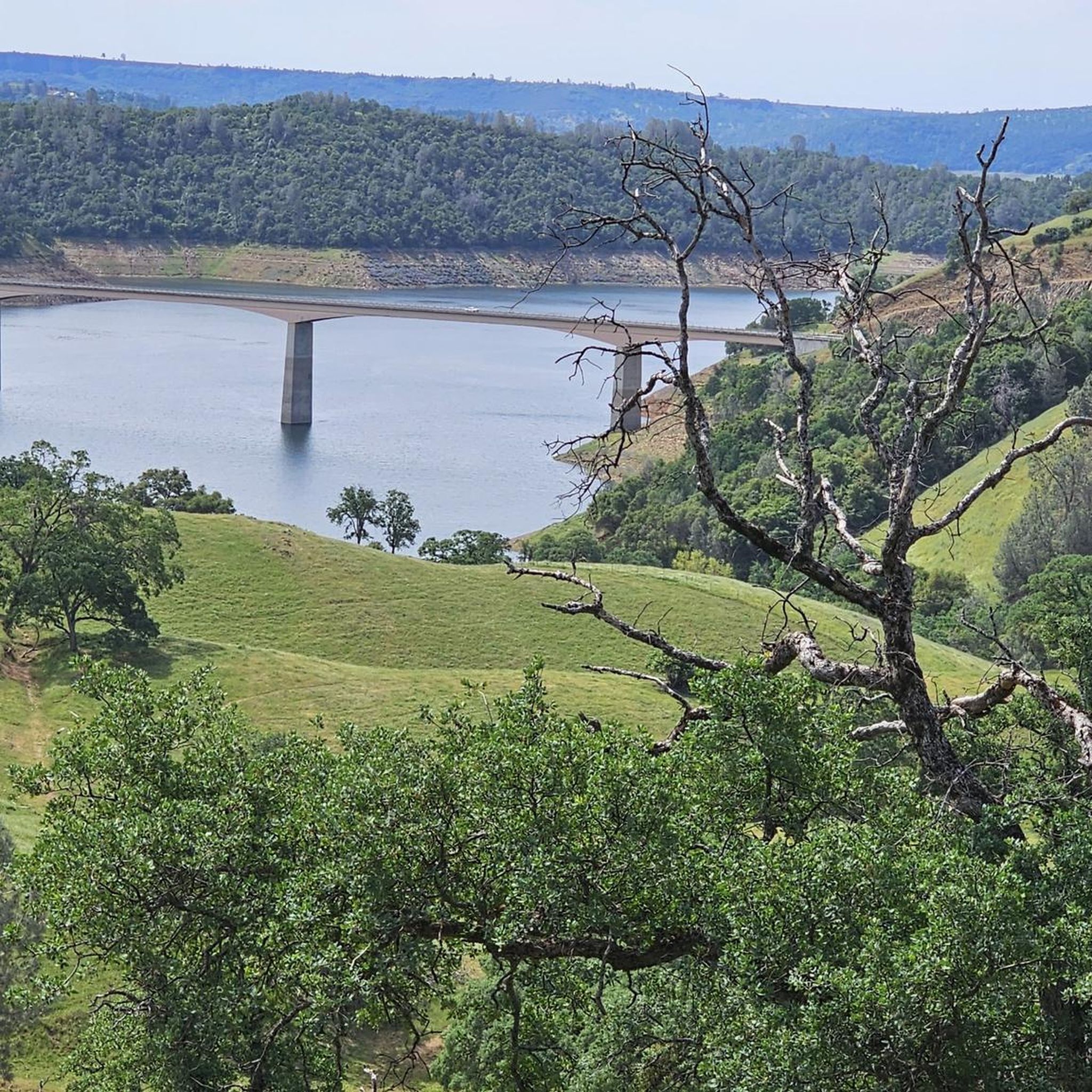
Embark on the Heron Point Loop, an easy hike that offers scenic views of New Melones Reservoir. This 1.3-mile (2.1 km) route, with a gentle 54 feet (17 metres) of elevation gain, takes about 33 minutes to complete. As you hike, you'll pass through varied landscapes, from open grasslands to shaded tree groves. Look for vibrant wildflowers and distinctive manzanita bushes with their deep red bark. The trail occasionally brings you close to the water's edge, providing refreshing perspectives.
You can easily access the Heron Point Loop from either the Acorn Campground or the Heron Point Day Use Area. For the most comfortable hiking experience, plan your visit during the fall or spring months. Summers in this region can be very hot, making midday hikes less enjoyable. Conversely, winters often bring rain, so be prepared for potentially wet conditions.
This family-friendly trail is situated within the Tuttletown Recreation Area, offering a pleasant outdoor escape. The route is generally well-maintained, making it suitable for a wide range of hikers. Keep an eye out for different oak trees that dot the landscape, adding to the natural beauty of the area. It's a great option for a quick, accessible outing.
3
hikers
3.09km
00:50
40m
30m
The Columbia College Fitness Trail offers a refreshing 1.9-mile (3.1 km) loop through the scenic forestland surrounding the campus, providing a tranquil escape with views of a pond or the San Diego Reservoir. This easy route, with only 118 feet (36 metres) of elevation gain, takes approximately 49 minutes to complete, making it ideal for a quick, invigorating walk. You'll find the path generally well-maintained, and the natural setting often allows for glimpses of local wildlife like deer and rabbits.
Planning your visit to this beginner hiking trail is straightforward, as it's located directly on the Columbia College campus. Parking is typically readily available, and there are no permits or fees required to access the trail. For the most comfortable experience, consider hiking in the morning or late afternoon, especially during warmer months, to enjoy cooler temperatures.
What makes the Columbia College Fitness Trail truly unique are its integrated workout stations dotted along the path. These par course facilities transform a simple walk into a full-body fitness challenge, offering instructions for various exercises. It's a fantastic option if you're looking for a loop hike that combines gentle exercise with the beauty of California's historic Mother Lode region.

Sign up for free
2.06km
00:37
80m
10m
An easy 1.3-mile hike on Tuolumne Table Mountain near New Melones Lake, offering unique geology and seasonal wildflowers.
5.0
(4)
11
hikers
6.76km
01:53
130m
130m
The Carson Creek Trail Loop offers a delightful and easy hiking experience near Angels Camp, perfect for a relaxed day outdoors. You'll follow a gentle singletrack path through oak-covered hillsides, enjoying intermittent views of New Melones Lake. The trail is known for its seasonal wildflowers and opportunities for birdwatching, making it a pleasant journey through nature.
This easy 4.2-mile (6.8 km) loop has a modest 425 feet (130 metres) of elevation gain and typically takes around 1 hour and 53 minutes to complete. It's an ideal choice for families, beginners, or anyone seeking a low-impact hike. Dogs are permitted on a leash, and the trail is generally well-maintained and accessible, though some sections can be exposed to the sun.
Historically, this area is part of the Indigenous territory of the Me-Wuk (Central Sierra Miwok) people. The trail's gentle nature and scenic beauty make it a popular spot for a quick escape, often serving as a refreshing cool-down section if you're exploring longer routes in the Glory Hole Recreation Area. It's a great way to experience the natural beauty of Calaveras County.
1.70km
00:31
60m
60m
The Natural Bridges Trail in Calaveras County offers a delightful, easy hike through oak-shaded ravines and open canyon views, following the winding path of Coyote Creek. Your journey culminates at the spectacular Natural Bridge, a series of limestone formations carved by the creek, which in spring is surrounded by wildflowers. The trail itself is generally wide but can be rocky, so wear appropriate footwear to enjoy the scenery comfortably.
This 1.1-mile (1.7 km) hike, with an easy difficulty rating and just 196 feet (60 metres) of elevation gain, typically takes around 31 minutes. It's a fantastic option if you're looking for a family-friendly outing, but be aware that parking can be limited and fills up quickly, especially on weekends. Remember that dogs and bikes are not permitted on the trail to help preserve this unique natural environment.
The highlight of this route is undoubtedly the opportunity to experience the Natural Bridge up close, with the creek offering a refreshing spot for wading or swimming during warmer months. This geological feature, formed by Coyote Creek, showcases the power of water over limestone. The trail provides a wonderful, accessible way to connect with nature and explore a distinctive natural monument in California.
Our route recommendations are based on thousands of hikes, rides, and runs completed by other people on komoot.
Start today with a free account
Your next adventure awaits.
Login or Signup
Popular around Columbia
Tips from the Community

This is a great trail in terms of bang for your buck. The caves that it leads to are amazing, and the cool water in the creek is great on a hot day. Just keep in mind that you will be going uphill on the way back, so conserve some energy and drinking water for the return trip.
0
0
New Melones Lake straddles the border of Calaveras and Tuolumne counties. In addition to providing electric power, irrigation water, and flood control to the area the lake is also open for recreation. Visitors can enjoy hiking, biking, swimming, boating, fishing, and camping.
0
0
This is a relatively easy and well maintained trail. You'll have a good chance at spotting wildlife as there is quite a range out here from deer to snakes, and even mountain lions (though very rare). Much of the trail is exposed so bring plenty of water, sunscreen, and wear a wide brimmed hat.
0
0

Coyote river flows through 2 active limestone caves building natural bridges near Vallecito, CA, that can be reached by a trail. See the other highlights for directions to find the trail: https://www.komoot.de/tour/7889577 There is a Lower Natural Bridge about half a mile downstream from the Upper Natural Bridge, requiring scrambling along the overgrown river rocks but amazing. Ferns hang down over the arched limestone walls to create an exotic landscape. Coyote Creek spills down a smooth-rock channel and disappears in the darkness of the limestone cave tunnels. Water drips down, growing beautiful deposit formations. http://hikespeak.com/trails/upper-natural-bridge-hike-calaveras-county
1
0
Frequently Asked Questions
How many hiking trails are available around Columbia?
Currently, there are 4 hiking trails listed around Columbia. These routes offer a variety of experiences for outdoor enthusiasts.
What is the difficulty level of hiking trails in Columbia?
All the hiking trails currently listed for Columbia are rated as easy. This makes them suitable for a wide range of hikers, including beginners and families.
Are there any loop trails in Columbia?
Yes, there are several loop trails available. You can enjoy a full circular walk on routes like the Heron Point Loop or the Carson Creek Trail Loop, which are perfect for a straightforward outing.
What do other hikers enjoy most about hiking in Columbia?
The trails in Columbia are highly rated by the komoot community, with an average score of 5.0 stars from 4 ratings. Hikers often appreciate the accessibility and ease of these routes, making them great for a relaxing outdoor experience.
Are there family-friendly hiking options in Columbia?
Absolutely. Given that all listed routes are rated as easy and are relatively short, they are generally very suitable for families. Trails like the Columbia College Fitness Trail offer gentle terrain for all ages.
Are there dog-friendly hiking trails in Columbia?
While the guide doesn't specify dog-friendliness for individual routes, many easy trails in natural areas are welcoming to dogs on a leash. It's always best to check local park regulations or signage at the trailhead before heading out with your furry friend.
What kind of natural attractions can I see along the hiking trails in Columbia?
Around Columbia, you can explore various natural features. For example, the Natural Bridge is a notable natural monument. Additionally, you might encounter serene water bodies like New Melones Lake, offering picturesque views.
Are there any historical sites or landmarks near the hiking trails?
Yes, Columbia is rich in history. You can combine your hike with a visit to historical sites such as the Columbia State Historic Park Gold Mining Town or the Masonic Hall. The nearby Angels Camp is another historic gold mining town worth exploring.
What is the longest easy hike available in Columbia?
The longest easy hike currently listed is the Carson Creek Trail Loop, which spans approximately 6.7 kilometers (4.2 miles).
Are there any trails that offer significant elevation gain for a workout?
While all routes are rated easy, the Tuolumne Table Mountain trail offers the most elevation gain among the listed routes, with an ascent of about 79 meters (259 feet), providing a bit more of a climb within an easy difficulty rating.
Most popular routes around Columbia
Most popular attractions around Columbia

Get inspired with the komoot mobile app


Explore more
Browse the best Hikes in other regions.
